- Bewbush
-
Coordinates: 51°06′18″N 0°13′15″W / 51.1051°N 0.2207°W
Bewbush 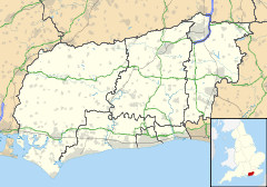
 Bewbush
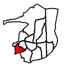
Bewbush shown within West SussexPopulation 9,081 OS grid reference TQ245355 District Crawley Shire county West Sussex Region South East Country England Sovereign state United Kingdom Post town CRAWLEY Postcode district RH11 Dialling code 01293 Police Sussex Fire West Sussex Ambulance South East Coast EU Parliament South East England UK Parliament Crawley List of places: UK • England • West Sussex Bewbush is a neighbourhood of Crawley in West Sussex, England and is one of the town's 13 designated neighbourhoods. Bewbush is located in south west Crawley and is bordered by Broadfield to the south, Ifield to the north and Gossops Green to the north east. The neighbourhood has a population of approximately 9,000.
Contents
History
A park was recorded at Bewbush as early as 1295. It was a manor which later became known as the Holmbush Estate. The manor belonged for most of the twentieth century to the Clifton Brown family. In 1973, some 300 acres (1.2 km2) were purchased by Crawley Borough Council.[1]
The manor house was first mentioned in the early 14th Century, although this no longer remains. A building with some 17th Century elements remains, although it was clad in brick in the 19th Century.[1] The building now stands amid modern developments in the neighbourhood.
The borough council began development of the new neighbourhood of Bewbush in 1974, with a leisure centre opening in 1984, and a shopping parade the following year. Additional land was brought into the borough of Crawley from Lower Beeding in 1983 to see the extension of the neighbourhood to reach its capacity population of 9000.[2] Development of the neighbourhood continued into the 1990s.
Governance
Bewbush neighbourhood is a co-terminus with the local government ward of Bewbush in the Borough of Crawley. It is also a ward of the upper-tier authority of West Sussex County Council. The neighbourhood forms part of the parliamentary constituency of Crawley.
Demography

As at the 2001 census, the ward had a population of 9081. The neighbourhood has a yougner population than the national average, with some 77% of residents being aged under 45, compared to 60% nationally. This is also reflected in the average age of the residents at 29, compared to 37 nationally.[3]
Around 90% of the properties in the neighbourhood are terraced properties or flats.[3] The vast majority of the properties were originally council-owned, with over one-third remaining owned by the local authority of other social landlords.
There is an ethnically diverse population in the neighbourhood, with a large proportion (17.3%) of black and ethnic minority groups represented.[3] This is reflected in the areas large Hindu and Muslim populations which are both well above the national averages at 9% and 5% respectively.[4]
In terms of social classification, the neighbourhood is made up of approximately 45% in the ABC1 grouping, compared to the national figures of around 51%.[5]
Education
See also: Schools in Crawley, West SussexBewbush is served by two Primary schools. The first school to open in the neighbourhood was Bewbush First School in 1978. This was shortly followed by Bewbush Middle School in 1982, with Waterfield First School opening officially in 1985.[6] Bewbush first and middle schools were closed in 2004 when the three-tier education model was amended, and a new school - Bewbush Community Primary School opened in the middle school buildings in September of that year. At the same time, Waterfield First School was extended to become Waterfield Primary School.[7]
Other Facilities
There is a Church of England church named for Saint Mary Magdalene in the west of the neighbourhood. At the neighbourhood centre, alongside the primary school is a Sure Start Children and Family Centre and a doctor's surgery. However, in March 2007, the local authority announced its intention to redevelop the area of central Bewbush. In 2009 the closure and demolition of the Bewbush Leisure Centre and The Dorsten public house took place, with the creation of a smaller pavilion style community building next to where the leisure centre had been.[8] The new pavilion opened for use on 14 May the same year.[9] A new park opened on 27 July 2009 on land that was previously part of Bewbush Primary School, which serves as a replacement for the old Bewbush Leisure Park. It holds various new playground equipment and England's first training area for Parkour[10] Public transport is provided by the Metrobus bus routes, which include the 24-hour Crawley Fastway guided bus route to the Crawley Town centre and Gatwick Airport
References
- ^ a b Hudson, T.P. (Ed) (1987). "Lower Beeding: Manors and other estates". A History of the County of Sussex: Volume 6 Part 3: Bramber Rape (North-Eastern Part) including Crawley New Town: 16–21. http://www.british-history.ac.uk/report.aspx?compid=18381.
- ^ Hudson, T.P. (Ed) (1987). "Crawley New Town: Growth of the new town". A History of the County of Sussex: Volume 6 Part 3: Bramber Rape (North-Eastern Part) including Crawley New Town: 75–81. http://www.british-history.ac.uk/report.aspx?compid=18415.
- ^ a b c West Sussex County Council & West Sussex Public Health Observatory (2007). "Bewbush Ward Profile" (PDF). West Sussex Ward Profiles 2007. West Sussex County Council. Archived from the original on 2008-06-27. http://web.archive.org/web/20080627171253/http://www2.westsussex.gov.uk/business/economic_info/Ward+Profiles/Crawley/Bewbush_Ward_Profile.pdf. Retrieved 2008-02-17.
- ^ "Religion (KS07)". Neighbourhood Statistics website. Office of National Statistics. 2001. http://neighbourhood.statistics.gov.uk/dissemination/LeadTableView.do?a=3&b=5942661&c=bewbush&d=14&e=14&g=495901&i=1001x1003x1004&m=0&r=1&s=1203277263534&enc=1&dsFamilyId=17. Retrieved 2008-02-17.
- ^ "Approximated Social Grade". Neighbourhood Statistics website. Office of National Statistics. 2001. http://neighbourhood.statistics.gov.uk/dissemination/LeadTableView.do?a=3&b=5942661&c=bewbush&d=14&e=16&g=495901&i=1001x1003x1004&m=0&r=1&s=1203277456578&enc=1&dsFamilyId=141. Retrieved 2008-02-17.
- ^ Hudson, T.P. (Ed) (1987). "Crawley New Town: Education". A History of the County of Sussex: Volume 6 Part 3: Bramber Rape (North-Eastern Part) including Crawley New Town: 75–81. http://www.british-history.ac.uk/report.aspx?compid=18425.
- ^ Director of Education and the Arts (2002). "Crawley School Age of Transfer Report" (PDF). West Sussex County Council. http://www.westsussex.gov.uk/cs/mis/070502eda21.pdf. Retrieved 2007-07-25.
- ^ "Langley Green and Bewbush regeneration given go ahead". CBC Press Releases. Crawley Borough Council. 2007. http://www.crawley.gov.uk/stellent/idcplg?IdcService=SS_GET_PAGE&ssDocName=PR1942&ssTargetNodeId=99. Retrieved 2008-02-17.
- ^ "Breezehurst Community Pavilion opens its doors". CBC. Crawley Borough Council. 2009. http://www.crawley.gov.uk/stellent/idcplg?IdcService=SS_GET_PAGE&ssDocName=PR2470&ssTargetNodeId=99. Retrieved 2009-07-27.
- ^ "Heart of Bewbush Neighbourhood Regeneration Project". CBC. Crawley Borough Council. 2009. http://www.crawley.gov.uk/stellent/groups/public/documents/adviceguidance/int168378.pdf. Retrieved 2009-07-27.
it also had a pub called the Dorsten which was actually pulled down due to fighting and anti social behaviour
External links
Administration Constituency · Local Elections · MP: Henry Smith
Leisure Transport Crawley Station · Gatwick Airport Station · Ifield Station · Three Bridges Station · M23 motorway · A23 road · Metrobus · Fastway · Gatwick Airport
Education Buildings Listed buildings · Places of worship · Friary Church of St Francis and St Anthony · St John the Baptist's Church · St Margaret's Church · St Michael and All Angels Church · St Nicholas' Church · Ifield Friends Meeting House · Ancient Priors · Brewery Shades · Broadfield House · Charlwood House · City Place Gatwick · Crawley Hospital · George Hotel · Ifield Water Mill · Old Punch Bowl · The Beehive · Tree House · White Hart Inn
Geography Gatwick Stream · River Mole
Neighbourhoods
and other areasBewbush · Broadfield · Furnace Green · Gossops Green · Ifield · Langley Green · Lowfield Heath · Maidenbower · Manor Royal Industrial · Northgate · Pound Hill · Southgate · Three Bridges · Tilgate · Tinsley Green · West Green · Worth
Categories:


Wikimedia Foundation. 2010.