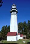
- Dofflemyer Point Light
-
Dofflemyer Point Light
 Dofflemyer Point Light, ca. 1988
Nearest city: Olympia, Washington Built: 1934 Architect: Kindle,Rufus Architectural style: Other Governing body: COAST GUARD MPS: Maritime Related Resources of Budd Inlet MPS NRHP Reference#: 93001339
[1]Added to NRHP: May 1, 1995 Dofflemyer Point Light Location Budd Inlet, Washington Coordinates 47°08′25″N 122°54′25″W / 47.1404°N 122.907°WCoordinates: 47°08′25″N 122°54′25″W / 47.1404°N 122.907°W Year first lit 1934 Automated 1987 Foundation Surface Construction Concrete Tower shape Pyramidal Height 30 ft The Dofflemyer Point Lighthouse is a U.S. lighthouse in Boston Harbor, Washington. It was one of the first in the state to be automated, and is listed on the National Register of Historic Places.
History
A lens lantern atop a twelve-foot stake was established at the Dofflemeyer Point in 1887. The Point defines the eastern side of the entrance to Budd Inlet, which leads south to Olympia, the state capital. In 1934, the light was upgraded to the present 30 foot, pyramidal concrete tower. In the early 1960s, the United States Coast Guard automated the Dofflemyer Point Lighthouse, using photoelectric cells to turn the light on and off. However, a contract keeper was still required to maintain the light and tower, and to activate the fog signal when needed. The lighthouse was fully automated in 1987 and a radio-beacon, which transmitted a radio signal used in locating a mariner’s position, was installed.
On May 1, 1995, the Dofflemyer Point Lighthouse was officially designated by the Washington State Advisory Council on Historic Preservation as an historic place and listed on the Washington Heritage Register.
See also
References
- ^ "National Register Information System". National Register of Historic Places. National Park Service. 2008-04-15. http://nrhp.focus.nps.gov/natreg/docs/All_Data.html.
U.S. National Register of Historic Places Topics Lists by states Alabama • Alaska • Arizona • Arkansas • California • Colorado • Connecticut • Delaware • Florida • Georgia • Hawaii • Idaho • Illinois • Indiana • Iowa • Kansas • Kentucky • Louisiana • Maine • Maryland • Massachusetts • Michigan • Minnesota • Mississippi • Missouri • Montana • Nebraska • Nevada • New Hampshire • New Jersey • New Mexico • New York • North Carolina • North Dakota • Ohio • Oklahoma • Oregon • Pennsylvania • Rhode Island • South Carolina • South Dakota • Tennessee • Texas • Utah • Vermont • Virginia • Washington • West Virginia • Wisconsin • WyomingLists by territories Lists by associated states Other Categories:- Lighthouses on the National Register of Historic Places in Washington (state)
- Buildings and structures in Thurston County, Washington
- History of Olympia, Washington
- Transportation in Thurston County, Washington
- Washington Registered Historic Place stubs
- United States lighthouse stubs
- Washington (state) building and structure stubs
Wikimedia Foundation. 2010.

