- Constantine, Algeria
-
Constantine
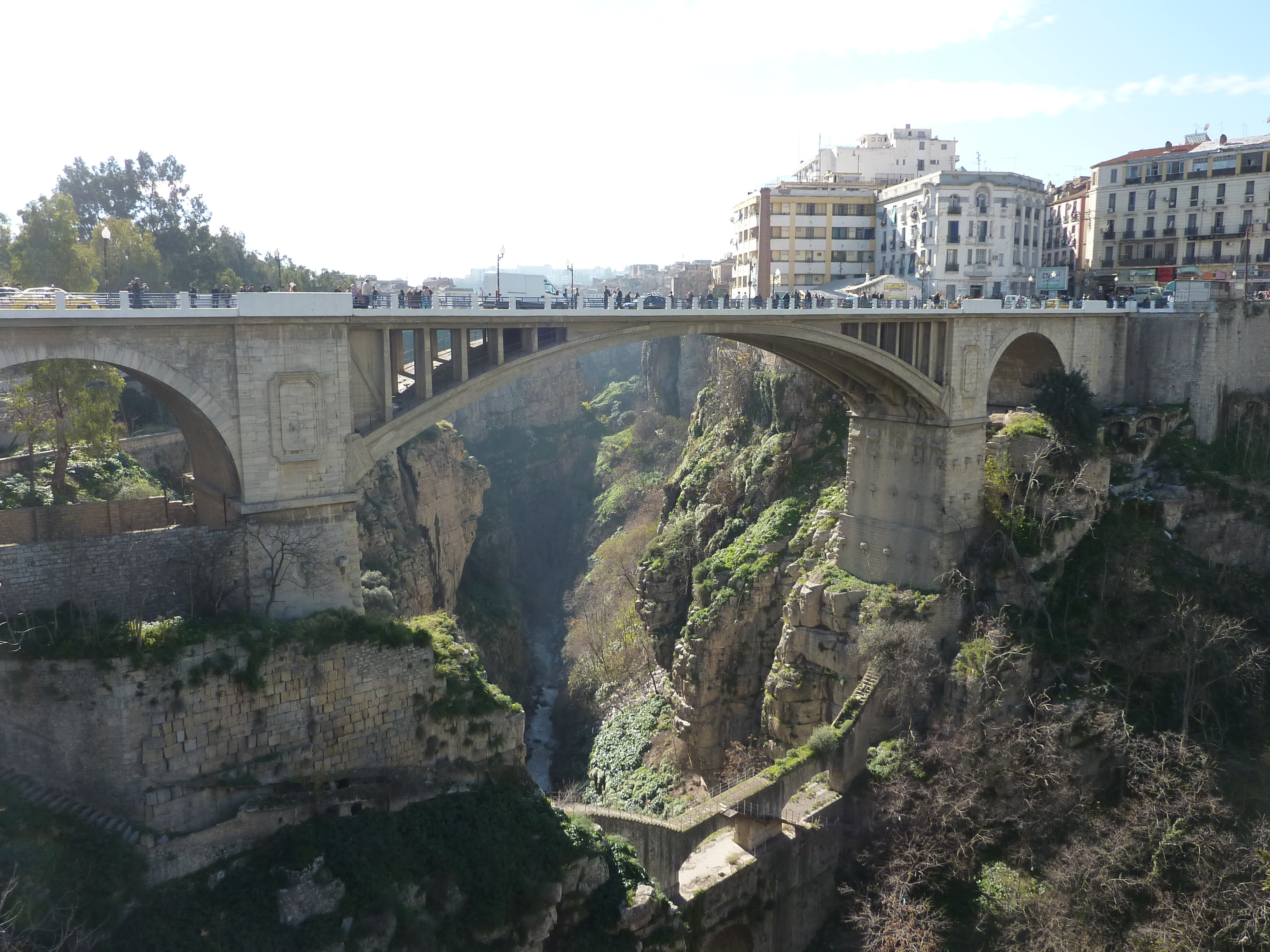
قسنطينة, Qusanṭīnah also known as Kasantina— Commune and city — A bridge in Constantine

Coat of armsNickname(s): city of bridges 
 Constantine
Coordinates: 36°21′N 6°36′E / 36.35°N 6.6°ECoordinates: 36°21′N 6°36′E / 36.35°N 6.6°E Country  Algeria
Province Constantine Province District Constantine District Government – President A. Chibane (2007-2012) Area – Total 2,288 km2 (883.4 sq mi) Population (2008)2008 census [1] – Total 448,374 – Density 196/km2 (507.6/sq mi) Time zone CET (UTC+1) Constantine (Arabic: قسنطينة, Qusanṭīnah, also spelled Qasentina also spelled as Kasantina) is the capital of Constantine Province in north-eastern Algeria. It was the capital of the same-named French département until 1962. Slightly inland, it is about 80 kilometres from the Mediterranean coast, on the banks of Rhumel river. Regarded as the capital of eastern Algeria and the centre of its region, Constantine has a population of 448,374 (1,000,000 with the agglomeration), making it the third largest city in the country after Algiers and Oran. There are museums and important historical sites around the city (one of the most beautiful one is the Palais du Bey, in the casbah)
Contents
History
The city was originally created by the Phoenicians, who called it Sarim Batim (royal city). Later it was named Cirta, which in Phoenician means a city carved into the rock. The city was taken over by Numidia, the country of the Berber people, after the Phoenicians were defeated by Rome in the Third Punic War. In 112 BC the city was occupied by Jugurtha who defeated his half-brother Adherbal. The city later served as the base for Roman generals Quintus Caecilius Metellus Numidicus and Gaius Marius in their war against Jugurtha. Later, with the removal of King Juba I and the remaining supporters of Pompey in Africa (c. 46), Julius Caesar gave special rights to the citizens of Cirta, now known as Colonia Sittlanorum.
In 311, during the civil war between emperor Maxentius and usurper Domitius Alexander (a former governor of Africa), the city was destroyed. Rebuilt in 313, it was subsequently named after emperor Constantine the Great, who had defeated Maxentius. Conquered by the Vandals in 432, Constantine returned to the Byzantine Exarchate of Africa (i.e. North Africa) from 534 to 697. It was conquered by the Arabs in the 7th century, receiving the name of Qusantina.
The city recovered and in 12th century was again a prosperous market, with connection to Pisa, Genoa and Venice. Since 1529 it was intermittently part of Ottoman Empire, ruled by a Turkish bey (governor) subordinate to the dey of Algiers. Salah Bey, who ruled the city in 1770–1792, greatly embellished it and built much of the Muslim architecture still visible today.
In 1826 the last Bey, Ahmed Bey ben Mohamed Chérif, became the new head of state. He led a fierce resistance against French forces, which invaded Algeria four years later. By 13 October 1837, the territory was reconquered by France, and from 1848 on until 1962 it was an integral part of the French motherland and centre of the Constantine Département.
In World War II, during the campaign in North Africa (1942–43), Constantine and the nearby city of Sétif were used by the Allied forces as operational bases.
Geography
Constantine is situated on a plateau at 640 metres (2,100 ft) above sea level. The city is framed by a deep ravine and has a dramatic appearance. The city is very picturesque with a number of bridges over Rhumel river and a viaduct crossing the ravine. The ravine is crossed by four bridges, including Pont Sidi M'Cid. Constantine is the railhead of a prosperous and diverse agricultural area. It also a centre of the grain trade and has flour mills, a tractor factory, and industries producing textiles, wool, linen and leather goods.[citation needed] Algeria and Tunisia serve as its markets.
Climate
Climate data for Constantine Month Jan Feb Mar Apr May Jun Jul Aug Sep Oct Nov Dec Year Record high °F (°C) 78.8
(26.0)77.9
(25.5)82.8
(28.2)88.9
(31.6)94.1
(34.5)101.7
(38.7)112.1
(44.5)110.8
(43.8)102.2
(39.0)93.6
(34.2)84.4
(29.1)78.4
(25.8)112.1
(44.5)Average high °F (°C) 56.1
(13.4)56.7
(13.7)60.4
(15.8)65.5
(18.6)73.2
(22.9)79.3
(26.3)86.9
(30.5)87.8
(31.0)77.4
(25.2)69.3
(20.7)61.0
(16.1)55.4
(13.0)69.08
(20.60)Average low °F (°C) 38.3
(3.5)38.8
(3.8)40.5
(4.7)44.6
(7.0)52.7
(11.5)56.5
(13.6)61.2
(16.2)61.2
(16.2)56.7
(13.7)50.9
(10.5)45.3
(7.4)38.1
(3.4)48.73
(9.29)Record low °F (°C) 14.5
(−9.7)17.1
(−8.3)23.4
(−4.8)32.5
(0.3)39.6
(4.2)40.8
(4.9)43.0
(6.1)42.8
(6.0)39.6
(4.2)31.8
(−0.1)26.8
(−2.9)14.9
(−9.5)14.5
(−9.7)Precipitation inches (mm) 2.457
(62.4)2.476
(62.9)1.803
(45.8)1.831
(46.5)1.138
(28.9)0.685
(17.4)0.634
(16.1)0.602
(15.3)0.85
(21.6)1.346
(34.2)2.051
(52.1)2.657
(67.5)18.48
(469.4)Source: [1] People
Main page: People from Constantine, AlgeriaConstantine is the native city of the Islamic reformer Ben Badis. It is also the hometown of many noteworthy people in Algeria and France.
 Capture of Constantine by French troops, 13 October 1837. Horace Vernet.
- Ben Badis, Islamic reformer and philosopher
- Malek Bennabi, philosopher
- Masinissa, the first King of Numidia
- Princess Charlotte, Duchess of Valentinois, the daughter of Louis II, Prince of Monaco, and the mother of Prince Rainier III
- Claude Cohen-Tannoudji, Nobel Prize winner in Physics
- Charles-Michel Marle, mathematician
- Hassiba Boulmerka, athlete, World and Olympic Champion; she is the first Algerian to win an Olympic title
- Ahlam Mosteghanemi, writer
- Ahmed Bey, the last Bey of Constantine
- Rabah Bitat, the third President of Algeria
- Sidi Nemdil, Algerian Turk, Islamic and nationalist from Nemdil family
- Enrico Macias, French singer
- Cheb i Sabbah, DJ, musician and composer
- Jean-Michel Atlan, artist
- Alphonse Halimi, world champion boxer
- Fatiha Bourbia, architect
- Rachid Khalef, architect
- Kateb Yacine, writer
- Maurice Boitel, artist
- Samir Nasri, French football star who currently plays in England
- Ali Saïdi-Sief, sub-champion in the 5000 m run at the 2000 Summer Olympics
- Sandra Laoura, Olympic medallist
Main sights
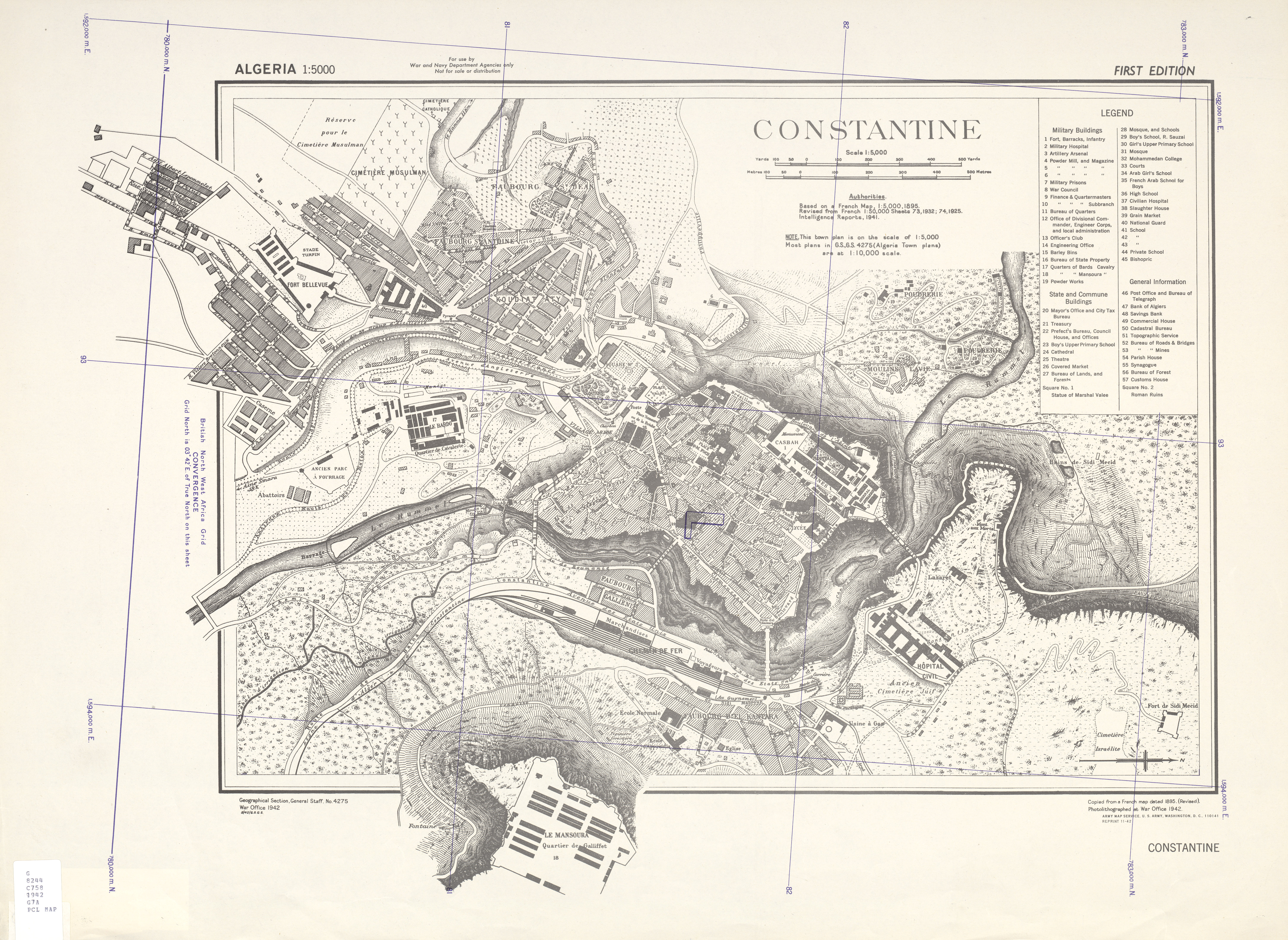
 US Army map of Constantine during ww2
The city is framed by a deep ravine and has a dramatic appearance. The city is very picturesque with a number of bridges and a viaduct crossing the ravine.
- Gustave Mercier Museum (displays of ancient and modern art).
- Abd al Hamid Ben Badis Mosque.
- The Constantine Casbah.
- Emir Abd al-Qadir University and Mosque.
- Soumma Mausoleum
- Massinissa's Mausoleum
- The Palace of Ahmed Bey.
- Ruins of the Antonian Roman aqueduct.
- Ben Abdelmalek Stadium
Nearby is the Roman city of Tiddis and the megalithic monuments and burial grounds at Djebel Mazala Salluste.
The city of bridges
 Bridge of the Falls (Arabic: جسر الشلالات)
The topography of the city is unique and it determines the need for bridges. At the end of the XIX century, Guy de Maupassant wrote: "Eight bridges used to cross this ravine. Six of these bridges are in ruins today." Today the most important bridges are:
- the suspension bridge also named Sidi-M'Cid (1912) (168m long),
- the El-Kantara bridge which leads toward north,
- the Sidi Rached bridge (1912), a long viaduct of 447ms and 27 arches, built by Paul Séjourné,
- the Devil's bridge,
- the Falls bridge,
- the Perregaux bridge.
- the new cable-stayed bridge of Constantine, designed by Dissing+Weitling architecture
- the city des chasseurs bridge, which connect the city( cite des chasseurs) to the university site
Education
Constantine has multiple universities: Mentouri, designed by the Brazilian architect Oscar Niemeyer, and Algerian architect Rashid Hassaine, Zerzara, and the Islamic University of El amir Abdelkader, Constantine will have another university town under construction in the nouvelle ville
International relations
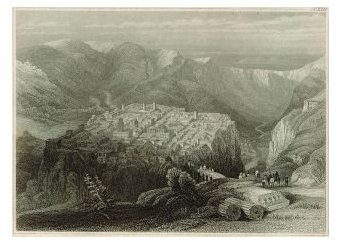
 Constantine, Algeria 1840Main article: List of twin towns and sister cities in Algeria
Twin towns — Sister cities
Constantine is twinned with:
References
- ^ "meteo-constantine". meteo-algerie.org. http://meteo-algerie.org/meteo-constantine. Retrieved June 28, 2011.
- ^ Jérôme Steffenino, Marguerite Masson. "Ville de Grenoble - Coopérations et villes jumelles". Grenoble.fr. http://www.grenoble.fr/jsp/site/Portal.jsp?page_id=92. Retrieved 2009-10-29.[dead link]
External links
- Constantine Official website
- WorldStatesmen- Algeria
- Catholic Encyclopedia article
- Future cable-stayed bridge in Constantine
 Constantine Province
Constantine District Constantine
Aïn Abid District Aïn Abid · Ben BadisEl Khroub District Hamma Bouziane District Hamma Bouziane · Didouche MouradIbn Ziad District Ibn Ziad · Messaoud BoudjeriouZighoud Youcef District Zighoud Youcef · Béni HamidaneCategories:- Constantine Province
- Populated places in Constantine Province
- Communes of Algeria
- 203 BC establishments
- Phoenician colonies
- Constantine, Algeria


Wikimedia Foundation. 2010.