- Cranmore, Isle of Wight
-
Coordinates: 50°43′14″N 1°26′46″W / 50.72067°N 1.44623°W
Cranmore 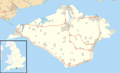
 Cranmore
Cranmore shown within the Isle of WightOS grid reference SZ391913 Unitary authority Isle of Wight Ceremonial county Isle of Wight Region South East Country England Sovereign state United Kingdom Post town YARMOUTH Postcode district PO41 Dialling code 01983 Police Hampshire Fire Isle of Wight Ambulance Isle of Wight EU Parliament South East England UK Parliament Isle of Wight List of places: UK • England • Isle of Wight Cranmore is a village on the Isle of Wight. It is located about three miles east of Yarmouth, in the northwest of the island.
Transport is provided by Southern Vectis bus route 7, serving Freshwater, Yarmouth and Newport including intermediate towns.[1]
Three areas of grassland, scrub and woodland situated around the village are designated as a Site of Special Scientific Interest. Together the three areas cover 12.4 hectares (30.7 acres) and were notified in 2002. The sites are home to the Dormouse (Muscardinus avellanarius), red squirrel (Sciurus vulgaris) and the nationally scarce Small Pearl-bordered Fritillary (Boloria selene) and Kent black arches (Meganola albula). Other species include the adder (Vipera berus) and the common lizard (Lacerta vivipara), and nightingale (Luscinia megarhynchos).[2]
References
- ^ "Southern Vectis - bus route 7". www.islandbuses.info. 2008. http://www.islandbuses.info/r7.shtml. Retrieved 2008-05-04.
- ^ "Cranmore citation sheet". Natural England. http://www.english-nature.org.uk/citation/citation_photo/2000456.pdf. Retrieved 2008-01-31.
Ceremonial county of Isle of Wight Isle of Wight Portal Unitary authorities Major settlements Rivers Topics Sites of Special Scientific Interest on the Isle of Wight Alverstone Marshes • America Wood • Arreton Down • Bembridge Down • Bembridge School And Cliffs • Bonchurch Landslips • Bouldnor And Hamstead Cliffs • Brading Marshes To St. Helen's Ledges • Briddlesford Copses • Calbourne Down • Colwell Bay • Compton Chine to Steephill Cove • Compton Down • Cranmore • Cridmore Bog • Eaglehead and Bloodstone Copses • Freshwater Marshes • Garston's Down • Greatwood And Cliff Copses • Headon Warren And West High Down • King's Quay Shore • Lacey's Farm Quarry • Lake Allotments • Locks Farm Meadow • Medina Estuary • Mottistone Down • Newtown Harbour • Northpark Copse • Parkhurst Forest • Priory Woods • Prospect Quarry • Rew Down • Rowridge Valley • Ryde Sands and Wootton Creek • Shide Quarry • St Lawrence Bank • The Wilderness • Thorness Bay • Ventnor Downs • Whitecliff Bay And Bembridge Ledges • Yar EstuaryCategories:- Villages on the Isle of Wight
- Sites of Special Scientific Interest on the Isle of Wight
- Isle of Wight geography stubs

Wikimedia Foundation. 2010.