- Oakfield, Isle of Wight
-
Coordinates: 50°43′13″N 1°09′21″W / 50.7204°N 1.1558°W
Oakfield 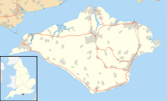
 Oakfield
Oakfield shown within the Isle of WightOS grid reference SZ5991 Shire county Isle of Wight Region South East Country England Sovereign state United Kingdom Police Hampshire Fire Isle of Wight Ambulance Isle of Wight EU Parliament South East England List of places: UK • England • Isle of Wight Oakfield is a suburb of the town of Ryde on the Isle of Wight, England. Historically part of the St Helens parish, it was absorbed into Ryde Borough in 1933 and in turn into Medina Borough in 1974. Oakfield largely consists of light industrial units and various developments of social housing.
The area bounded by High Street, School Street and Reed Street was re-developed in the late 1960s and early 1970s, with Victorian stone-built cottages demolished to make way for local authority flats and houses. Also demolished was the Oakfield Junior School, in High Park Square, built to a design by Thomas Hellyer. Earlier local authority housing (pre and post war) exists in Harding Road, and later council-built properties can be found in Slade Road. The most recent development is Oak Vale, whose metal-clad walls dominate views from many other parts of Ryde. Victorian properties remain in parts of High Street, St John's Hill, Wood Street and Meaders Road as well as in Upper and Lower Highland Roads.
In the 1960s Oakfield had its own butcher, a barbers shop, several pubs and the well-patronised Renown Fish Bar. June's greengrocer shop on the corner of Meaders Road and St Johns Hill was used as a location in the 1973 film That'll be the Day, featuring Ringo Starr and Rosemary Leach. Few of these businesses remain, although the chip shop survives under a different name.
The church of St John, also designed by Hellyer, whilst described as being in Oakfield, would generally be considered to be outside the area, understood as being bounded by Alexandra Road to the east, St Johns Hill to the north, the Ryde to Shanklin Railway to the west, and open countryside to the south.
See also
- St. John's Church, Oakfield, Ryde
Categories:- Villages on the Isle of Wight
- Isle of Wight geography stubs

Wikimedia Foundation. 2010.