- Newport, Isle of Wight
-
Coordinates: 50°42′04″N 1°17′18″W / 50.7010°N 1.2883°W
Newport 
Newport High Street showing some of the shops.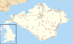
 Newport
Newport shown within the Isle of WightPopulation 23,957 OS grid reference SZ502893 - London 90.26 miles Unitary authority Isle of Wight Ceremonial county Isle of Wight Region South East Country England Sovereign state United Kingdom Post town NEWPORT Postcode district PO30 Dialling code 01983 Police Hampshire Fire Isle of Wight Ambulance Isle of Wight EU Parliament South East England UK Parliament Isle of Wight List of places: UK • England • Isle of Wight Newport is a civil parish and a county town of the Isle of Wight, an island off the south coast of England. Newport has a population of 23,957 according to the 2001 census. The town is situated slightly to the north of the centre of the Island, at the head of the navigable section of the River Medina, which flows northward to the Solent, and on which the town has a quay.
Contents
History
 Newport High Street, circa 1910
 New Redevelopment of the old bus station.
There are signs of Roman settlement in the area, which was probably known as Medina, including two known Roman villas one of which, Newport Roman Villa, is excavated and open to the public.[1]
There was little later use until after the Norman conquest with the first charter being granted late in the twelfth century. In 1377 an invading French force burnt down much of the town while attempting to take Carisbrooke Castle, then under the command of Sir Hugh Tyrill. A group of French were captured and killed, then buried in a tumulus later nicknamed Noddies Hill, a "noddy" being medieval slang for a body. This was later corrupted to Nodehill, the present-day name for a part of central Newport - a name confusing to many as the area is flat.[2]
In 1648 Charles I and a group of Parliamentary Commissioners concluded the Treaty of Newport, an attempt at reaching a compromise in the Civil War, undermined by Charles's negotiations with the French and Scots to intervene on his behalf. The Treaty was repudiated by Oliver Cromwell upon returning from defeating the Scots at The Battle of Preston leading to Charles's execution.
The town was incorporated as a borough in 1608. The town's position as an area of trade accessible to the sea meant it rapidly took over from Carisbrooke as the main central settlement, eventually absorbing the latter as a suburb. The borough ceased to exist in 1974 after the incorporation of the larger Borough of Medina, which was itself superseded in 1995 by a single unitary authority covering the whole of the Isle of Wight.
In recent times, Newport has undergone an influx of changes, with two shopping centres and all new road directions to show for the town's recent development efforts. Newport Quay has also been re-developed, with art galleries such as the Quay Arts Centre, and new flats converted from old warehouses.
The Queen Victoria Memorial was designed by local architect, Percy Stone (1856–1934).[3]
Geography
 A map showing Newport.
 An aerial photograph, showing Newport (bottom left).
Geographically located in the centre of the island at co-ordinates 50.701, -1.2883, Newport is the principal town of the Isle of Wight. Transportation connections link all major towns to Newport, making it the main shopping centre and location for public services on the island. The main A3020 and A3054 roads meet at the busy Coppins Bridge Roundabout east of the town centre.
Newport railway station was the hub of the island's rail network until the mid-20th Century, but it closed in 1966 and the site is now occupied by the A3054 Medina Way dual carriageway.
The nearest city to the town is Portsmouth, located approximately 13 miles north-east on the mainland. More locally, Ryde, the island's largest town is located to the north-east, with other towns Sandown and Shanklin located to the east, and Cowes to the north.
The River Medina runs through Newport, at which point it becomes a navigable tidal estuary.
Distance from surrounding settlements
- Cowes - 4.55 miles, 7.3 km
- East Cowes - 5.01 miles, 8.1 km
- Ryde - 6.73 miles, 10.8 km
- Shanklin - 9.47 miles, 15.2 km
- Sandown - 10.05 miles, 16.2 km
- Ventnor - 11.32 miles, 18.2 km
- Yarmouth - 9.76 miles, 15.7 km
Prisons
The town's suburb of Parkhurst is home to three prison sites: the notorious Parkhurst Prison itself, Camp Hill, and Albany, all of which make up HMP Isle of Wight, the largest prison in the UK. Parkhurst and Albany were once amongst the few top-security prisons in the United Kingdom.
Amenities
Seaclose Park in Newport, located on the east bank of the River Medina, has since 2002 become the location for the revived Isle of Wight Music Festival, which is held annually.
St. George's Park is the home of Newport Football Club, the most successful of the Island's football teams, currently playing in the English Southern League. It has a capacity of 3,000. The Isle of Wight County Cricket Ground is located at Newclose, on the outskirts of the town.
Newport is home to the Postal Museum, possibly the largest private collection of vintage postal equipment and post boxes in the world.[4][5]
Newport bus station is the town's central bus terminus, with all routes in the town serving it. Newport is the hub of the Southern Vectis network, with routes from across the Island terminating there to connect with other services. Wightbus also operate services.
Governance
Parliamentary representation
 Isle of Wight Crown Court in Newport.
 County Hall in Newport.
 Newport, High Street.Main article: Newport (Isle of Wight) (UK Parliament constituency)
From the Middle Ages the Parliamentary Borough of Newport had two seats in the House of Commons, and between 1807 and 1811 they were held by two future Prime Ministers: Arthur Wellesley, later to become the Duke of Wellington (who also found himself elected to two other seats at the same time), and Henry John Temple, 3rd Viscount Palmerston who would go on to become one of the United Kingdom's most notable Prime Ministers. The failure of Palmerston's late father to convert his Irish title into a United Kingdom peerage made entering the House of Commons possible for the young politician. The local patron arranging the deal was Sir Leonard Holmes, who made it a condition that they never visited the borough.
The borough was also represented by two other future Prime Ministers in the 1820s. George Canning was MP for Newport when appointed Prime Minister in 1827; however, under the law as it then stood a minister accepting office automatically vacated his seat and had to stand for re-election to the Commons, and Canning chose to stand at Seaford, a government pocket borough in Sussex, rather than fight Newport again. But in the by-election that followed at Newport, the vacancy was filled by the election of the Honourable William Lamb, later 2nd Viscount Melbourne, whose father had also represented the borough in the 1790s. However, Lamb remained MP for Newport for only two weeks before also being elected for Bletchingley, which he preferred to represent.
Newport's representation in Parliament was cut to one seat in 1867, and it was abolished altogether as a separate constituency in 1885. It now forms a part of the Isle of Wight constituency.
Local Council
Newport has been under a variety of administrations.
- Until 1974 Newport had its own Newport Borough Council.[6]
- From 1974-1995 Newport was part of Medina Borough Council.[6]
- In 1995 this was abolished and the Isle of Wight Council took over responsibility. Newport until 2008 remained unparished when the Isle of Wight Council Unitary Authority was created.[6]
- Newport Town Management Committee was established in April 2006 by the Isle of Wight Council to be the interim body for the town until the Government gave approval for a parish or town council.
- The first election for Newport Parish Council occurred on 1 May 2008.[7]
The Management Committee had no formal powers and was technically no more than an advisory committee to the Isle of Wight Council. However it was treated as a transition authority which in many ways did act as a town or parish council.
In August 2006 the voters of Newport petitioned for a Parish Council to be created in all eight electoral wards of Newport. In addition the voters of the Carisbrooke West electoral ward had already petitioned for a separate parish council. The Government later decided to approve the eight ward petition for Newport, but not the petition for Carisbrooke. As a result of this the first election for Newport Parish Council occurred on 1 May 2008. The eight electoral wards are Carisbrooke East, Carisbrooke West, Fairlee, Mount Joy, Newport North, Newport South, Pan and Parkhurst.[7]
Notable people
- Princess Elizabeth of England, daughter of Charles I and Henrietta Maria, is buried at St. Thomas's Church
- Maxwell Gray (Mary Gleed Tuttiett), writer
- Kelly Sotherton, heptathlete
- Darren Mew, breaststroke swimmer
- Phill Jupitus, comedian
- Gary Silk, footballer
- Craig Douglas, pop singer with hits in the late 1950s and early 1960s
- Danny Briggs, cricketer
- David Griffiths, cricketer
- Anthony Minghella, film director
- Chris Russell, cricketer
See also
- Church of St. John the Baptist, Newport
- St. Paul's Church, Newport
Notes
- ^ The villa on public display was found in 1926. Excavations at the site demonstrate that the villa was built around 280 CE. The villa featured underfloor heating, and elaborate hot and cold baths, sauna and massage rooms and a large kitchen.
- ^ BRANNON'S PICTURE OF THE ISLE OF WIGHT; Or The Expeditious Traveller's Index to Its Prominent Beauties & Objects of Interest. Compiled Especially with Reference to Those Numerous Visitors Who Can Spare but Two or Three Days to Make the Tour of the Island, Printed and Published by George Brannon, Wootton, Isle of Wight, 1843 (various sources give dates of 1844, 1848, 1849, etc, possibly of other editions)
- ^ "Queen Victoria memorial". Memorials & Monuments on the Isle of Wight. 24 July 2009. http://www.isle-of-wight-memorials.org.uk/others/newportvictoria.htm. Retrieved 20 November 2009.
- ^ Postal Museum official website.
- ^ Isle of Wight Postal Museum, WightCAM - photographically illustrated walks on the Isle of Wight.
- ^ a b c IW County Record Office local government records
- ^ a b "Newport Parish Council Homepage". www.iwight.gov.uk. http://www.iwight.com/parishcouncils/parishcouncilsdetail.aspx?id=31. Retrieved 2008-08-25.
External links
Ceremonial county of Isle of Wight Unitary authorities Major settlements Rivers Topics Categories:- Towns on the Isle of Wight
- County towns in England
- Ports and harbours of the Isle of Wight


Wikimedia Foundation. 2010.