- Anston
-
For the unincorporated community in Wisconsin, see Anston, Wisconsin.
Coordinates: 53°21′15″N 1°13′06″W / 53.3542°N 1.2182°W
Anston 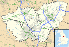
 Anston
Anston shown within South YorkshirePopulation 9,559 OS grid reference SK5386 Parish North and South Anston Metropolitan borough Rotherham Metropolitan county South Yorkshire Region Yorkshire and the Humber Country England Sovereign state United Kingdom Post town Rotherham Postcode district S25 Dialling code 01909 Police South Yorkshire Fire South Yorkshire Ambulance Yorkshire EU Parliament Yorkshire and the Humber UK Parliament Rother Valley List of places: UK • England • Yorkshire The villages of North Anston and South Anston are the principal constituents of the civil parish of North and South Anston, in the Metropolitan Borough of Rotherham in South Yorkshire, England. The area is generally known simply as Anston, although the Post Office now officially recognises South Anston in its own right (this change occurred due to postal confusion with nearby Aston and also because of petitions of local residents). Anston is located on the A57, midway between Sheffield and Worksop. It has a population of 9,559.[1]
Anston was already established as a settlement by the time of the Domesday Book (1086), when North and South Anston (Anestan and Litelanstan) were under the ownership of Roger de Busli. The name Anston is thought to derive from "an stan" (a stone) as opposed to anything based on the suffix -ton, and there is much evidence of quarrying in the area. Anston, and neighbouring Dinnington make up a 3.5 km strip of urban development stranded amidst a sea of agricultural land, and its presence and growth owe much to quarrying. The original interest for the area (beyond Anston's agricultural uses) was the sandy "Anstone" magnesian limestone, but the real growth in Anston's population was more due to the sinking of the Dinnington Main Colliery in the early 20th century. Anston is Part of Rotherham Borough Council for the Anston and Woodsetts Ward. It is represented by the three Labour Councillors, Darren J L Hughes, Judy Dalton and Jo Burton.
Anston railway station opened on 20 May 1912 and closed on 2 December 1929.
Contents
North Anston
North Anston is located at about 53° 21' 20" N, 1° 13' W and merges seamlessly into the town of Dinnington to the north. Today, it is largely a commuter base for Sheffield, Worksop and Rotherham, and is mainly made up of sub—urban housing estates. The picturesque "old village" at the south-east however retains its green, and the village wells. The surrounding landscape contains several disused quarries: the plantations to the east, and Greenlands Park to the west being prime examples.
There are currently two pubs in North Anston: the Little Mester on Nursery Road and the Cutler on Woodsetts Road.
North Anston is home to the Tropical Butterfly House, Wildlife and Falconry Centre (http://www.butterflyhouse.co.uk), a popular attraction seeing around 80,000 visitors every year. It is also home to the limestone gorge of Anston Stones Wood, a Site of Special Scientific Interest.Anston stones wood stretches across the border of South Yorkshire and Nottinghamshire. The wood is believed to be part of a mediaeval smuggling route. Evidence of this has been found in the valley an example of this is Dead Man's Cave, a large cave carved out of the limestone used for hiding goods.
South Anston
South Anston is located at about 53°21′50″N 1°13′20″W / 53.36389°N 1.22222°W, and is separated from North Anston by the Anston Brook, the A57 and a freight railway-line. It is more rural than its northern partner, though it still has its fair share of suburban sprawl. South Anston contains the parish church of St. James, and two Methodist chapels (dating from 1871 and 1935). It also contains Anston's working quarries which continue to mine stone for the building industry.
There are two pubs of note in South Anston: the Loyal Trooper and the Leeds Arms.
To the south of the village lies the Chesterfield Canal. It was from a dock just to the south of Dog Kennel Lane that stone taken from quarries in North Anston was transported to London for the rebuilding of the Houses of Parliament following the fire in the 1830s. The blocks of stone were taken by horse-drawn sled to the canal, then taken down to West Stockwith where they were transferred to sailing barges for the journey to London.[2]
References
- ^ Office for National Statistics : Census 2001 : Parish Headcounts : Rotherham Retrieved 2009-08-28
- ^ Yorkshire Stone to London by Christine Richardson, ISBN 978-0-9552609-2-6, 36 pages, Published by Richlow, in 2007, The story of the transportation of stone to Westminster for the rebuilding of the Houses of Parliament.
External links
 Media related to Anston at Wikimedia CommonsCategories:
- Dinnington
- Villages in South Yorkshire
- Geography of Rotherham

Wikimedia Foundation. 2010.