- Newmarket, Ontario
-
Newmarket — Town — Newmarket's Old Town Hall – The belltower is the result of restoration work in the 1980s
Motto: "Prudence" Country  Canada
Province  Ontario
Regional municipality York Region Settled 1801 Incorporated 1857 (village) Incorporated 1880 (town) Government - Type Seat of York Region - Mayor Tony Van Bynen - Regional Councillor John Taylor Area - Total 38.07 km2 (14.7 sq mi) Elevation 239 m (784 ft) Population (2006)[1] - Total 74,295 - Density 1,951/km2 (5,053.1/sq mi) Time zone EST (UTC−5) Forward Sortation Area L3X, L3Y Area code(s) 905 and 289 Website www.newmarket.ca Newmarket is a town in Southern Ontario located approximately 25 km north of Toronto, Ontario, Canada. It is part of the Greater Toronto Area and is connected to Toronto by freeway, and is served by two interchanges along Highway 404. It is also connected to Highway 400 via Highway 9. Some of Newmarket's most noticeable landmarks are Upper Canada Mall, Southlake Regional Health Centre, and its many parks and recreation areas. Newmarket is the regional seat of York Region.
Contents
Geography
Newmarket's geographical coordinates are 44.05°N, 79.46°W, and its elevation above sea level is 239 m.[2] It has an area of 38.07 km². The town is bounded on the north by East Gwillimbury, on the east by Whitchurch-Stouffville, to the south by Aurora, and on the west by King.
Newmarket lies north of the Oak Ridges Moraine; hence, all drainage from the town flows northwards into Lake Simcoe. The main river in Newmarket is the East Holland River (known locally simply as "The Holland River"), and all other streams in the town are tributaries thereto. These include; Bogart Creek, a brook that weaves its way into town from the moraine by way of Bogarttown, emptying into the Holland in north-central Newmarket; Western creek, another brook rising just west of the town, and reaching the Holland in the town's north end; Tannery Creek, a stream that joins the Holland in south Newmarket after flowing through Aurora; and a number of other small watercourses.
There are two reservoirs in Newmarket; Fairy Lake (which is managed by the Lake Simcoe Region Conservation Authority), a favourite recreational area in the centre of town, is a former mill pond on the East Holland River; and Bogart Pond, also a former mill pond, is fed and drained by Bogart Creek in Bogarttown. Furthermore, the water level in the reach of the East Holland north of Davis Drive is controlled from an unfinished Newmarket Canal lock, now used as a weir.
Newmarket also lies south of and above the Algonquin Shoreline, where elevations suddenly drop off from the gently rolling hills that characterize much of Newmarket to the much flatter, lower land down below in the Holland Marsh.
The land itself is characterized mainly by glacial deposits from the last ice age, known as "Newmarket Till". The town is underlain mainly by sand and gravel, ground by the icesheets that covered the area until about 10,000 years ago. No outcrops are to be found anywhere in Newmarket, so deep are the glacial deposits.
History
Newmarket's location on the Holland River long ago made the area a natural route of travel between Lake Ontario and Lake Simcoe. A major portage route, the Toronto Carrying-Place Trail ran one of its two routes down the Holland, through the Newmarket area, and over the Oak Ridges Moraine to the Rouge River and into Lake Ontario. A more used route ran down the western branch of the Holland, over the moraine, and down the Humber River. In 1793, John Graves Simcoe travelled the trail, northward along the main route to the west, and south to York (now Toronto) along the lesser used eastern route though Newmarket. Selecting the eastern route as the better of the two, Simcoe started construction of Yonge Street along the former trail in late 1795, starting in York in Toronto Bay, and ending at the newly named St. Albans (Holland Landing) just to the north of Newmarket.
In June, 1800, Timothy Rogers, a Quaker from Vermont, explored the area around the Holland River and down to Lake Simcoe to find a suitable location for a new Quaker settlement. Some of the US Quakers were interested in moving northward, disturbed by the violence they were expected to take part in during the American Revolution. In 1801 Rogers returned along with several Quaker families who had left their homes in Vermont and Pennsylvania.
By the Christmas of 1801, Joseph Hill had constructed a mill on the Holland River, damming it to produce a mill pond that is now known as Fairy Lake. The town of "Upper Yonge Street" sprouted up around the mill, which explains why its primary downtown area was centred on the Holland River, and not on the nearby Yonge Street. Hill also built a tannery just to the north of the mill, and the first store and house, as well as additional mills. By 1802, Elisha Beman had begun to establish businesses and buy land in Newmarket. A mill was first and other businesses (including a distillery) soon followed. The town continued to grow through the early 19th century, along with the formation of Aurora and Holland Landing, and a market held in the current downtown location gave rise to the name "Newmarket".
Newmarket was incorporated as a village in 1857 with a population of 700. In 1880, with a population of 2,000, Newmarket became a town and William Cane was elected as its first mayor. In later years Cane's sash and door factory became the first in Canada to manufacture lead pencils. In 1858, Robert Simpson co-opened "Simpson & Trent Groceries, Boots, Shoes and Dry Goods" in the downtown area, the first store in what would become the Simpsons department store chain .
In June 1853 the first train pulled into Newmarket on the Toronto, Simcoe & Lake Huron Union Railroad, the first railway in Upper Canada. It eventually linked Toronto to Collingwood on Georgian Bay, a major shipbuilding centre.[3] Today, this line is the "Newmarket Subdivision" of the Canadian National Railway system, running north out of town towards Bradford, and south towards Toronto.
In 1899 the Toronto and York Radial Railway arrived in Newmarket. This operated along Yonge Street south of Newmarket, but turned east to run through the downtown area; it would later be extended north. At the time, it brought significant numbers of day trippers to Newmarket to shop at the market. Automobile traffic on Yonge, and the already existing mainline railway, had a significant effect on ridership, and the Radial stopped running north of Richmond Hill in the early 1930s. In 1947 the remaining tracks between North Toronto and Richmond Hill were torn up.[4]
North of Davis Drive, the East Holland River was straightened to prepare it for use as a commercial waterway to bypass the railway, whose prices were skyrocketing around the turn of the 20th century. Sir William Mulock, the local Member of Parliament, proposed a canal system running down the Holland River through Holland Landing and into Lake Simcoe. This would allow boats to connect from there to the Trent-Severn Waterway for eventual shipment south. The canal was almost complete by the summer of 1912, when it was cancelled by the incoming government of Robert Borden. Today, the locks are still visible, mostly silted up, although the turning basin in downtown Newmarket was filled in and now forms the parking lot of The Tannery Mall, on the site of the former Hill tannery.[5]
For much of the 20th century, Newmarket developed along the east-west Davis Drive axis, limited to the area between Yonge Street on the west and between Bayview and Leslie Street in the east, and running from just north of Davis on the north to the Fairy Lake area on the south. By the 1950s, Newmarket was experiencing a suburban building boom due to its proximity to Toronto. The population increased from 5,000 to 11,000 between 1950 and 1970. The construction of Upper Canada Mall at the corner of Yonge Street and Davis Drive in 1974 started pulling the focal point of the town westward.
By the 1980s the original downtown area was run down. Most businesses had built up in the area around Upper Canada Mall, with additional strip malls developing directly across the intersections to the south and southeast. A concerted effort to save the historic downtown area during the late 1980s was successful, and it is once again a major focal point of the town.
The arrival of Highway 404 reversed the westward movement, pulling development eastward again, and surrounding the formerly separate hamlet of Bogarttown at the intersection of Mulock Drive and Leslie Street. Since then, Newmarket has grown considerably, filling out in all directions. The town limits now run from Bathurst Street in the west to Highway 404 in the east, and from just south of Green Lane to just north of St. John's Sideroad, taking over the former hamlet of Armitage at Yonge Street south of Mulock Drive. The outer limits of the town are less than a kilometer from Sharon to the north, and continuous with Aurora to the south.
Population
Census Population 1841 600 1871 1,760 1881 2,006 1891 2,143 1901 2,125 1911 2,966 1921 3,626 1931 3,748 1941 4,026 1951 5,356 1961 8,932 1971 18,941 1981 29,753 1991 45,474 2001 65,788 2006 74,295 Est. 2010 85,000 According to the 2006 census, the town's population was 74,295 (as of March 31, 2006, the York Region Planning Department put the total at 77,518[6]). According to the same source, the population projection for 2011 is 87,000 and for 2026 it is 98,000.
Given its area, the latest population figure puts Newmarket's population density at just over 2000 inhabitants per square kilometer.
The median income for all families was $88,514 in 2005, well above the Ontario average.[1] For households, it was $81,640.[1] The median income of all men over the age of 15 was $42,755 and for women over the age of 15 it was $25,606.[1] 9.8% of residents were classified as "low income" by Statistics Canada.[1] The 2001 Census revealed Newmarket to be the 35th wealthiest municipality in Canada based on median family income.[7]
Arms
 Newmarket's coat of arms
Newmarket's coat of arms is actually taken from the town's old corporate seal. The town flag is a navy blue field with this same design in the middle. The beehive and bees are said to represent industry. There are nine bees, representing the town's first nine businesses. The latest form of the seal was introduced in 1938 with the arms somewhat altered from – but very similar in concept to – one that was earlier used. The arms' origin is something of a mystery, however. It is unknown what artist created the current version – or indeed the earlier version – and the town has no official record as to the purchase or redesign of the arms.[8]
Transportation
Newmarket is serviced by two exits of Highway 404, which currently connects Newmarket to Toronto, although construction is underway to extend it north to Keswick. Highway 400 is accessible from the west side of Newmarket for access to Toronto and north to Barrie and Muskoka.
Public transit is provided by York Region Transit, which operates the Viva Blue bus rapid transit route from the Newmarket Bus Terminal to the Finch Bus Terminal in Toronto, as well as local and community bus routes. Commuter rail and bus service is provided by GO Transit through the Newmarket GO Station with service south to Toronto and north to Barrie.
Education
Public elementary and secondary education in Newmarket is overseen by York Region's two school boards: the York Region District School Board (YRDSB), and the York Catholic District School Board (YCDSB). Newmarket is also the home of Pickering College, a private day and boarding school, and a handful of other independent schools.
The YRDSB operates four secondary schools in Newmarket: Dr. John M. Denison Secondary School, Huron Heights Secondary School, Newmarket High School, and Sir William Mulock Secondary School, in addition to 15 elementary schools.
The YCDSB operates one secondary school in the town: Sacred Heart Catholic High School, and six elementary schools.
The town also houses a satellite campus of Seneca College.
Government
Tony Van Bynen became mayor in December 2006, and will serve in the office until 2014. He succeeds Tom Taylor, who was the mayor from 1997 to 2006. (See list of previous mayors)
The town's Council includes the Mayor, seven Councillors elected on the basis of one per ward, and a Regional Councillor who is elected to join the mayor at meetings of York Region Council. The members of council elected in 2010[9] are:
- Regional Councillor: John Taylor
- Ward 1: Tom Vegh
- Ward 2: David Kerwin
- Ward 3: Jane Twinney
- Ward 4: Tom Hempen
- Ward 5: Joe Sponga
- Ward 6: Maddie Di Muccio
- Ward 7: Chris Emanuel
The town is part of the federal riding of Newmarket—Aurora. As of 2008, the riding is represented in the Canadian House of Commons by Lois Brown, a member of the Conservative Party of Canada.
Provincially, Newmarket became part of the riding of Newmarket-Aurora in the Ontario Provincial Legislature. The province realigned its riding to match those of the federal government in 2004. Progressive Conservative MPP Frank Klees was elected to represent Newmarket-Aurora in the 2007 provincial general election.
Government offices in Newmarket:
- Municipal Offices (Town Hall)
- York Region Council
- York Regional Police
- Ontario Provincial Courthouse
Urban planning
Based within the limits placed on low-density urban forms, a small portion of Newmarket is subject to the Ontario Government's Greenbelt Legislation.
Newmarket's 2006 Official Plan seeks to balance the desire to maintain the present low-density urban form characterized by the segregation of residential, retail and employment uses and the need to comply with Ontario's Places to Grow legislation, which identified the Yonge Street & Davis Drive intersection of Newmarket as one of 25 sites of future intensification to be found throughout the Golden Horseshoe area.[10]
Four areas of Newmarket have been selected to absorb the majority of planned population growth and accommodate mixed usages on sites well served by transit. These are the Yonge-Davis Provincial Urban Growth Centre, the Yonge Street Regional Centre (south of Green Lane), the Regional Healthcare Centre (Southlake Regional Health Centre) and Historic Downtown Centre (surrounding Main Street South). Further construction of big box retail stores in the Yonge Street corridor will not be permitted and the long-term objective of the town is redevelopment or the addition of new buildings to these areas.
Newmarket Public Library
Located downtown, the Newmarket Public Library provides residents with free access to 175,000 items, including books, audio books, magazines, multilingual materials, DVDs, CDs, video games, e-books and online databases. The library also runs the York Info service, which provides information about local organizations, groups and services, and helps develop a stronger volunteer presence in the community by connecting people who want to volunteer with non-profit agencies looking for help. The library also produces a quarterly newsletter called "Off the Shelf" to inform patrons of its programs, services and events. The Library is a founding member of the Shared Digital Infrastructure (SDI) project, an initiative to plan for an Intelligent Community in Newmarket.
Sports and recreation
Soccer
Newmarket soccer is represented by the Newmarket Soccer Club which is located in the Magna Centre. The club is host to a house league, rep league, senior league, and special needs league. The Newmarket rep teams are known as Newmarket United (formerly York United), and have been very successful representing the town with some teams making it to the provincial and national levels. Toronto FC former captain Jim Brennan played in Newmarket in his youth.
Hockey
Newmarket is represented in the Ontario Provincial Junior A Hockey League by the Newmarket Hurricanes (originally called the "87's"), whose home rink is currently the Ray Twinney Complex. The "'Canes" have an ongoing rivalry with the nearby Aurora Tigers.
Newmarket was previously home to the following teams:
- Newmarket Saints from 1986 to 1991, an American Hockey League franchise and farm team of the Toronto Maple Leafs who moved from St. Catharines. The franchise was later moved to St.John's, Newfoundland and became the St. John's Maple Leafs. Currently the Toronto Maple Leafs' farm team is the Toronto Marlies playing out of the recently renovated Ricoh Coliseum on the CNE grounds.
- Newmarket Royals from 1992 to 1994. This was a franchise of the Ontario Hockey League who were previously the Cornwall Royals and in 1994 moved again to become the Sarnia Sting.
- Newmarket Flyers from 1975 to 1986, OPJHL Jr. A (formerly The Seneca Flyers)
- Newmarket Redmen from late 1920s to 1972 Jr. B
Golf
Two golf courses exist within Newmarket's town limits:
- St. Andrew's Valley (public), straddles the Aurora/Newmarket border
- Glenway Country Club (public)
There are also several courses in the surrounding communities and countryside.
Swimming
Four public swimming places exist throughout Newmarket: Ray Twinney Complex, Gorman Pool, which is open only in the summer, The Main Pool, and the Magna Centre. Newmarket also has two swim teams: Team Aquadome, and the Newmarket Stingrays.
Ringette
Newmarket is home to the Newmarket and District Ringette Association. The Newmarket Ray's have Regional and Provincial teams. Home games are at the Magna Centre. Ringette is a truly Canadian sport that promotes fun, fitness and friendship for players of all ages.
Media
- The Era-Banner
Famous residents (past and present)
- Erin Ambrose, women's ice hockey player, won a gold medal at the 2010 IIHF World Women’s Under-18 Championship in Chicago
- Hannah Armstrong, women's ice hockey player, won a gold medal at the 2010 IIHF World Women’s Under-18 Championship in Chicago
- Jim Brennan, Canada men's national soccer team member, first player signed to Toronto FC soccer club
- Jim Carrey, actor [11]
- John Candy, comedian
- Herb Cain, former NHL hockey player, 1944 NHL scoring champion
- Munro Chambers, Actor
- Dit Clapper, Hall of Fame hockey player
- Clarknova, alternative rock band
- Nicole Connery, women's ice hockey player, will represent Canada at the 2012 IIHF World Women’s Under-18 Championships[12]
- Steve Downie, NHL Hockey player, Tampa Bay Lightning, previously the Philadelphia Flyers
- Brian Elliott, goaltender for the Colorado Avalanche of the NHL[13]
- Glass Tiger, rock band
- Scott Goodyear, Indycar racing driver
- Wes Jarvis, AHL and NHL hockey player (Washington Capitals, Minnesota North Stars, Los Angeles Kings, and Toronto Maple Leafs). Jarvis was also head coach of the Newmarket Hurricanes of the OPJHL and an assistant coach with the Barrie Colts.
- Marcel de Jong, a Dutch-Canadian soccer player for Roda JC
- Mike Kitchen, former head coach for the St. Louis Blues
- Corey Locke, AHL hockey player and NHL draft pick
- Lorne Lofsky, jazz guitarist
- Chuck Luksa, former WHA hockey player with Cincinnati Stingers
- Robin Mackin, member of Canada's Olympic Softball team, 2008
- H.R. MacMillan, CBE, C.C., forestry specialist and industrialist, wartime administrator, philanthropist
- Jamie Macoun, former NHL hockey player
- Teresa McDonnell Orr, three-time Olympian competing in the ’68, ’72 and ’76 Olympic Games on Canada’s Gymnastics team. Technical Program Coordinator for Rhythmic Gymnastics & Dance and a Rhythmic Coach at Seneca College
- William Mulock, former Cabinet Minister and Chief Justice of the Supreme Court of Ontario
- Joe Murphy, member of the 1990 Stanley Cup champion Edmonton Oilers
- Carlos Newton, Former UFC Welterweight Champion, Trainer/Teacher at Warrior Martial Arts
- Steven Lee Olsen, country musician
- Peter Orr, Olympic baseball player and Washington Nationals infielder
- Mazo de la Roche, author of the Jalna series
- The Salads, punk rock band
- Lindsay Seemann, Swimmer - 200m Backstroke, 2008 Olympics - Beijing, China
- Serial Joe, rock band
- Shayne Stevenson, former NHL player Boston Bruins and Tampa Bay Lightning
- Tyler Stewart, drummer for Barenaked Ladies
- Bill Thoms, former NHL star for the Toronto Maple Leafs, Chicago Black Hawks and Boston Bruins
- Tokyo Police Club, rock band
- The Elwins, rock band
References
- ^ a b c d e "Newmarket Ontario (Town)". 2006 Community profiles. Statistics Canada. http://www12.statcan.ca/english/census06/data/profiles/community/Details/Page.cfm?Lang=E&Geo1=CSD&Code1=3519048&Geo2=PR&Code2=35&Data=Count&SearchText=newmarket&SearchType=Begins&SearchPR=01&B1=All&Custom=. Retrieved 27 May 2009.
- ^ http://www.fallingrain.com/world/CA/8/Newmarket.html
- ^ Historic Newmarket, The first railroad in Upper Canada
- ^ Historic Newmarket, Streetcar to Toronto
- ^ Carter, Terry. "The Ghost Canal". newmarket.ca. Town of Newmarket. http://www.newmarket.ca/en/lifestyle/theghostcanal.asp. Retrieved 22 August 2011.
- ^ Town of Newmarket - Population
- ^ Income of Individuals, Families, Households
- ^ http://www.newmarket.ca/userfiles/HTML/nts_1_477_1.html
- ^ "Contact Information Mayor and Town Council". Town of Newmarket. http://www.newmarket.ca/en/townhall/contactinformationmayorandtowncouncil.asp. Retrieved 201-02-25.
- ^ "Town of Newmarket 2-2006 Official Plan" (PDF). Town of Newmarket. 10 October 2006. http://www.newmarket.ca/userfiles/page_attachments/Library/1/3107712_Newmarket_OP___Consolidated_Modifications___2008_04___Regional_Approval.pdf. Retrieved 25 August 2008.[dead link]
- ^ Jim Carrey Online: Biography
- ^ http://www.hockeycanada.ca/index.php/ci_id/172868/la_id/1.htm
- ^ http://avalanche.nhl.com/club/player.htm?id=8470880 Accessed Feb 22 2011
External links
- Town of Newmarket
- Newmarket Public Library
- 2001 Community Profile
- Ontario Plaques - Dutch Settlement of Holland Marsh
- Ontario Plaques - Founding of Newmarket
- Ontario Plaques - Mazo de la Roche
- Ontario Plaques - Meeting House of the Religious Society of Friends (Quakers)
- Ontario Plaques - Newmarket Radial Railway Arch
- VivaNext - Davis Drive expansion project
Coordinates: 44°04′N 79°27′W / 44.06°N 79.45°W

East Gwillimbury King 
Whitchurch-Stouffville  Newmarket

Aurora Town of Markham • Town of Newmarket • Town of Richmond Hill • City of Vaughan • Town of Whitchurch-StouffvilleGreater Toronto Area Largest city: TorontoRegions 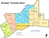
Cities Towns Ajax • Aurora • Caledon • East Gwillimbury • Georgina • Halton Hills • Markham • Milton • Newmarket • Oakville • Richmond Hill • WhitbyTownships and municipalities Categories:


Wikimedia Foundation. 2010.