- National Register of Historic Places listings in Southeast Fairbanks Census Area, Alaska
-
 Location of the Southeast Fairbanks Census Area in Alaska
This is a list of the National Register of Historic Places listings in Southeast Fairbanks Census Area, Alaska.
This is intended to be a complete list of the properties and districts on the National Register of Historic Places in Southeast Fairbanks Census Area, Alaska, United States. The locations of National Register properties and districts for which the latitude and longitude coordinates are included below, may be seen in a Google map.[1]
There are 12 properties and districts listed on the National Register in the census area, including one National Historic Landmark.
-
- This National Park Service list is complete through NPS recent listings posted November 10, 2011.[2]
[3] Landmark name[4] Image Date listed Location Community Summary 1 Big Delta Historic District 
March 20, 1991 Mile 274.5 on the Richardson Highway at the junction of the Delta and Tanana Rivers
64°9′19″N 145°50′4″W / 64.15528°N 145.83444°WBig Delta 2 Chicken Historic District 
September 30, 2001 Mile 66.5 on the Taylor Highway
64°4′34″N 141°55′53″W / 64.07611°N 141.93139°WChicken 3 Chisana Historic Mining Landscape 
May 14, 1998 Vicinity of Chisana and Gold Hill
62°6′10″N 141°53′58″W / 62.10278°N 141.89944°W[5][6]Northway 4 Eagle Historic District 
October 27, 1970 Mile 0 on the Taylor Highway
64°47′7″N 141°12′47″W / 64.78528°N 141.21306°WEagle 5 F.E. Company Dredge No. 4 
May 18, 2006 0.25 miles along Chicken Airport Rd., mile 66.4 on the Taylor Highway
64°4′24″N 141°56′15″W / 64.07333°N 141.9375°WChicken 6 The Kink November 20, 1975 East of Fairbanks, part of the northern fork of the Fortymile River
64°23′12″N 142°2′17″W / 64.38667°N 142.03806°WFairbanks 7 Rapids Roadhouse 
February 2, 2001 Mile 227.4 on the Richardson Highway
63°31′48″N 145°51′24″W / 63.53°N 145.85667°WDelta 8 Rika's Landing Roadhouse 
September 1, 1976 Mile 274.5 on the Richardson Highway near the junction of the Delta and Tanana Rivers
64°9′21″N 145°50′18″W / 64.15583°N 145.83833°W[7]Big Delta 9 Slana Roadhouse February 2, 2005 Mile 1 on Nebesna Rd.
62°42′19″N 143°57′39″W / 62.70528°N 143.96083°WSlana 10 Steele Creek Roadhouse April 29, 1980 Fortymile River
64°16′15″N 141°17′3″W / 64.27083°N 141.28417°WEagle 11 Sullivan Roadhouse August 10, 1979 Mile 266 on the Richardson Highway
64°2′7″N 145°43′43″W / 64.03528°N 145.72861°WDelta Junction 12 Swan Point Archaeological Site September 26, 2008 Northern edge of the Shaw Creek Flats, 90 kilometres (56 mi) southeast of Fairbanks
63°18′N 146°2′W / 63.3°N 146.033°W[8]Big Delta See also
- List of National Historic Landmarks in Alaska
- National Register of Historic Places listings in Alaska
References
- ^ The latitude and longitude information provided in this table was derived originally from the National Register Information System, which has been found to be fairly accurate for about 99% of listings. For about 1% of NRIS original coordinates, experience has shown that one or both coordinates are typos or otherwise extremely far off; some corrections may have been made. A more subtle problem causes many locations to be off by up to 150 yards, depending on location in the country: most NRIS coordinates were derived from tracing out latitude and longitudes off of USGS topographical quadrant maps created under North American Datum of 1927, which differs from the current, highly accurate GPS system used by Google maps. Chicago is about right, but NRIS longitudes in Washington are higher by about 4.5 seconds, and are lower by about 2.0 seconds in Maine. Latitudes differ by about 1.0 second in Florida. Some locations in this table may have been corrected to current GPS standards.
- ^ "National Register of Historic Places: Weekly List Actions". National Park Service, United States Department of the Interior. Retrieved on November 10, 2011.
- ^ Numbers represent an ordering by significant words. Various colorings, defined here, differentiate National Historic Landmark sites and National Register of Historic Places Districts from other NRHP buildings, structures, sites or objects.
- ^ "National Register Information System". National Register of Historic Places. National Park Service. 2008-04-24. http://nrhp.focus.nps.gov/natreg/docs/All_Data.html.
- ^ Location derived from Fensterman, Greg. Hiking Alaska's Wrangell-St. Elias National Park and Preserve: From Day Hikes to Backcountry Treks. Guilford: Falcon, 2008, 5. The NRIS lists the site as "Address Restricted".
- ^ Coordinates derived from the GNIS feature record for Gold Hill
- ^ Address derived from this state webpage; the NRIS lists it at Mile 252
- ^ Location derived from Holmes, Charles, et al. "Swan Point" in American Beginnings: The Prehistory and Palaeoecology of Beringia, Frank Hadleigh West, ed. Chicago: U of Chicago P, 1996, 319. The NRIS lists the site as "Address Restricted".
U.S. National Register of Historic Places Topics Lists by states Alabama • Alaska • Arizona • Arkansas • California • Colorado • Connecticut • Delaware • Florida • Georgia • Hawaii • Idaho • Illinois • Indiana • Iowa • Kansas • Kentucky • Louisiana • Maine • Maryland • Massachusetts • Michigan • Minnesota • Mississippi • Missouri • Montana • Nebraska • Nevada • New Hampshire • New Jersey • New Mexico • New York • North Carolina • North Dakota • Ohio • Oklahoma • Oregon • Pennsylvania • Rhode Island • South Carolina • South Dakota • Tennessee • Texas • Utah • Vermont • Virginia • Washington • West Virginia • Wisconsin • WyomingLists by territories Lists by associated states Other  Category:National Register of Historic Places •
  Portal:National Register of Historic Places
Properties on the National Register of Historic Places in Alaska  Boroughs
 Census areasAleutians West • Bethel • Dillingham • Hoonah-Angoon • Nome • Petersburg • Prince of Wales-Hyder • Southeast Fairbanks • Valdez-Cordova • Yukon-KoyukukThere are no sites listed on the National Register of Historic Places in Wade Hampton Census Area
Municipalities and communities of Southeast Fairbanks Census Area, Alaska Cities 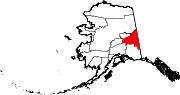
CDPs Alcan Border | Big Delta | Chicken | Deltana | Dot Lake | Dot Lake Village | Dry Creek | Eagle Village | Fort Greely | Healy Lake | Northway | Northway Junction | Northway Village | Tanacross | Tetlin | Tok
Unincorporated
communitiesCategories:- National Register of Historic Places in Alaska by borough and census area
- Southeast Fairbanks Census Area, Alaska
-


Wikimedia Foundation. 2010.