- National Register of Historic Places listings in Carroll County, Indiana
-
 Location of Carroll County in Indiana
This is a list of the National Register of Historic Places listings in Carroll County, Indiana.
This is intended to be a complete list of the properties and districts on the National Register of Historic Places in Carroll County, Indiana, United States. Latitude and longitude coordinates are provided for many National Register properties and districts; these locations may be seen together in a Google map.[1]
There are 22 properties and districts listed on the National Register in the county.
-
- This National Park Service list is complete through NPS recent listings posted November 10, 2011.[2]
Current listings
[3] Landmark name [4] Image Date listed Location City or town Summary 1 Adams Mill 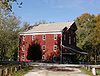
November 23, 1984 Off County Road 50E
40°28′50″N 86°30′29″W / 40.480556°N 86.508056°WCutler 2 Adams Mill Covered Bridge 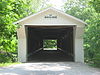
January 11, 1996 County Road 50E over Wildcat Creek
40°29′01″N 86°30′42″W / 40.483611°N 86.511667°WCutler 3 Barnett-Seawright-Wilson House 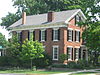
September 17, 1980 203 E. Monroe St.
40°35′18″N 86°40′25″W / 40.588333°N 86.673611°WDelphi 4 Baum-Shaeffer Farm 
August 28, 1998 6678 W 200N
40°34′28″N 86°39′11″W / 40.574444°N 86.653056°WDelphi 5 Burris House and Potawatomi Spring 
September 15, 1977 Towpath Rd.
40°41′54″N 86°34′28″W / 40.698333°N 86.574444°WLockport 6 Camden Masonic Temple 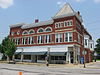
December 23, 2003 213 W. Main St.
40°36′31″N 86°32′26″W / 40.608611°N 86.540556°WCamden 7 Carroll County Courthouse 
December 23, 2003 101 W. Main St.
40°35′10″N 86°40′29″W / 40.586111°N 86.674722°WDelphi 8 Carrollton Bridge 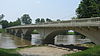
June 22, 2003 Carrollton Rd. across the Wabash River
40°38′54″N 86°39′24″W / 40.648333°N 86.656667°WDelphi 9 Deer Creek Valley Rural Historic District 
December 19, 2002 Southeastern corner of Sec. 21, most of Sec. 22, and areas north of Deer Creek
40°35′35″N 86°37′49″W / 40.593056°N 86.630278°WDelphi 10 Delphi City Hall 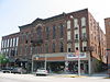
December 17, 1998 105-109 Washington St.
40°35′12″N 86°40′26″W / 40.586667°N 86.673889°WDelphi 11 Delphi Courthouse Square Historic District 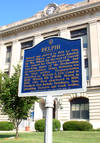
March 31, 2010 Roughly bounded by Monroe, the southern side of Main, and the western sides of Market and Indiana Sts.
40°35′11″N 86°40′29″W / 40.586358°N 86.674819°WDelphi 12 Delphi Lime Kilns 
June 27, 2002 North-northwest of Delphi
40°35′45″N 86°40′43″W / 40.595833°N 86.678611°WDelphi 13 District School No. 3 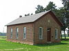
March 31, 1988 Southeastern corner of the junction of County Roads 750N and 100W
40°39′21″N 86°32′38″W / 40.655833°N 86.543889°WRockfield 14 Foreman-Case House 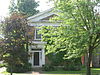
May 24, 1990 312 E. Main St.
40°35′12″N 86°40′15″W / 40.586667°N 86.670833°WDelphi 15 Lock No. 33 Lock Keeper's House, and Wabash and Erie Canal Lock No. 33 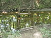
June 24, 2002 Along the Wabash and Erie Canal south of Bicycle Bridge Rd.
40°34′52″N 86°41′0″W / 40.58111°N 86.683333°W[5]Delphi 16 Niewerth Building 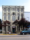
May 24, 1984 124 E. Main St.
40°35′10″N 86°40′22″W / 40.586111°N 86.672778°WDelphi 17 Pulaski County Bridge No. 31 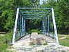
June 22, 2003 Spans the Wabash and Erie Canal, southwest of downtown Delphi
40°34′59″N 86°41′0″W / 40.58306°N 86.683333°W[6]Delphi Formerly located on County Road 1175W near Medaryville;[4] moved to Delphi in 2006[7] 18 Fred and Minnie Raber Farm 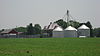
September 16, 1992 State Road 218 east of County Road 425W
40°36′21″N 86°36′11″W / 40.605833°N 86.603056°WCamden 19 Sunset Point 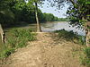
June 24, 2002 Confluence of Deer Creek and the Wabash River
40°34′19.6″N 86°41′18″W / 40.572111°N 86.68833°W[5]Delphi 20 Andrew Thomas House 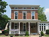
December 27, 1984 W. Main St.
40°36′31″N 86°32′26″W / 40.608611°N 86.540556°WCamden 21 Wabash and Erie Canal Culvert No. 100 
March 20, 2002 Towpath Rd. over Burnett's Creek
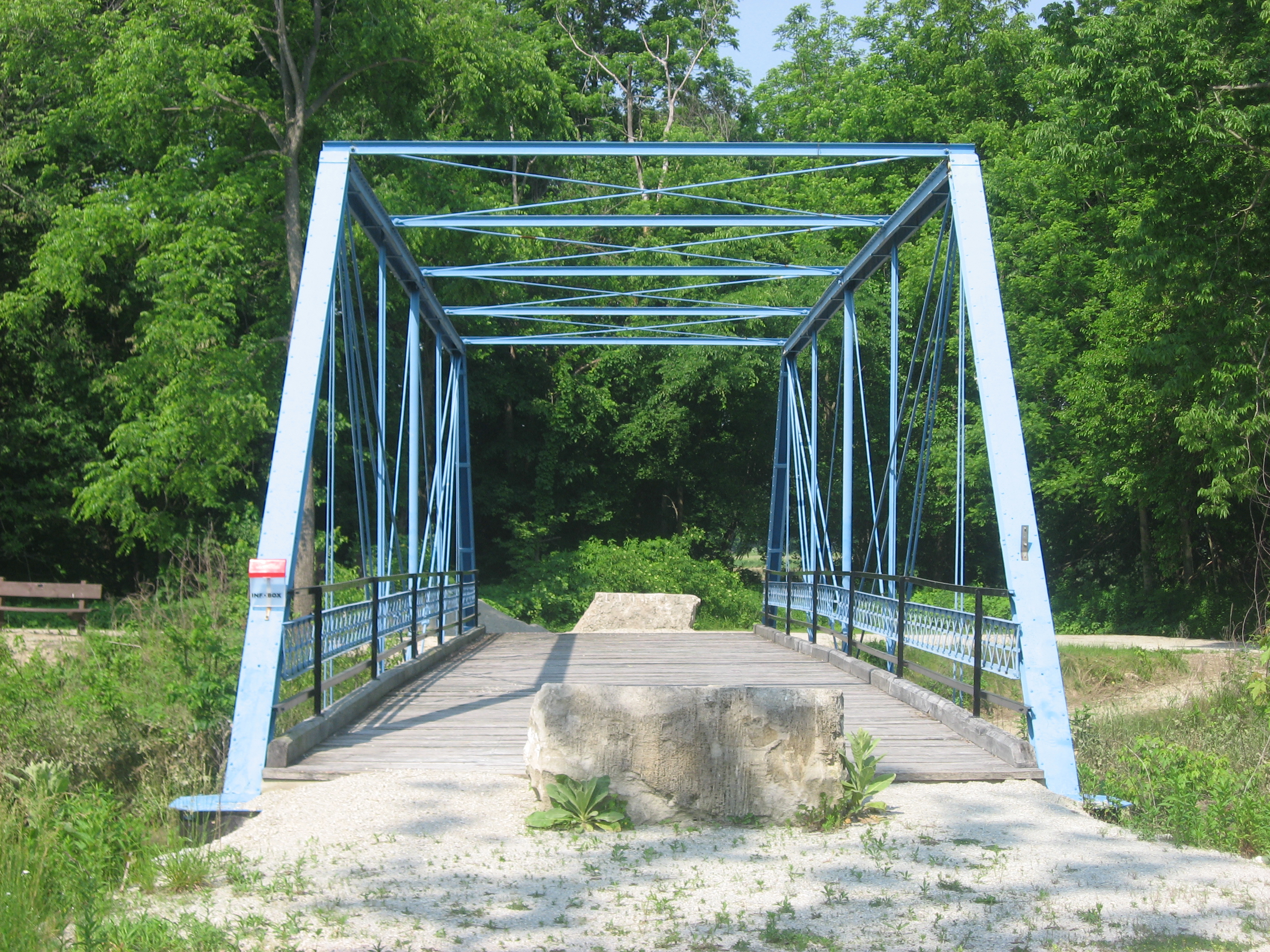
40°42′11″N 86°34′02″W / 40.703056°N 86.567222°WLockport 22 Wilson Bridge 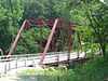
June 6, 2001 0.6 miles west of County Road 450W on County Road 300N over Deer Creek
40°35′27″N 86°37′16″W / 40.590833°N 86.621111°WDelphi See also
- List of National Historic Landmarks in Indiana
- National Register of Historic Places listings in Indiana
References
- ^ The latitude and longitude information provided in this table was derived originally from the National Register Information System, which has been found to be fairly accurate for about 99% of listings. For about 1% of NRIS original coordinates, experience has shown that one or both coordinates are typos or otherwise extremely far off; some corrections may have been made. A more subtle problem causes many locations to be off by up to 150 yards, depending on location in the country: most NRIS coordinates were derived from tracing out latitude and longitudes off of USGS topographical quadrant maps created under North American Datum of 1927, which differs from the current, highly accurate GPS system used by Google maps. Chicago is about right, but NRIS longitudes in Washington are higher by about 4.5 seconds, and are lower by about 2.0 seconds in Maine. Latitudes differ by about 1.0 second in Florida. Some locations in this table may have been corrected to current GPS standards.
- ^ "National Register of Historic Places: Weekly List Actions". National Park Service, United States Department of the Interior. Retrieved on November 10, 2011.
- ^ Numbers represent an ordering by significant words. Various colorings, defined here, differentiate National Historic Landmark sites and National Register of Historic Places Districts from other NRHP buildings, structures, sites or objects.
- ^ a b "National Register Information System". National Register of Historic Places. National Park Service. . http://nrhp.focus.nps.gov/natreg/docs/All_Data.html.
- ^ a b Location derived from "Delphi, Indiana Trails Map". Wabash and Erie Canal Association, n.d. Accessed 2011-06-04. The NRIS lists the site as "Address Restricted".
- ^ Location derived from "Delphi, Indiana Trails Map". Wabash and Erie Canal Association, n.d. Accessed 2011-10-07.
- ^ Knapp, Carla (November 11, 2007). "Bridge offers unique look into history: Fully restored Stearns Truss bridge will be rededicated today". Pharos-Tribune (Logansport, Indiana). http://www.pharostribune.com/local/local_story_314232207.html. Retrieved 2011-10-07.
U.S. National Register of Historic Places Topics Lists by states Alabama • Alaska • Arizona • Arkansas • California • Colorado • Connecticut • Delaware • Florida • Georgia • Hawaii • Idaho • Illinois • Indiana • Iowa • Kansas • Kentucky • Louisiana • Maine • Maryland • Massachusetts • Michigan • Minnesota • Mississippi • Missouri • Montana • Nebraska • Nevada • New Hampshire • New Jersey • New Mexico • New York • North Carolina • North Dakota • Ohio • Oklahoma • Oregon • Pennsylvania • Rhode Island • South Carolina • South Dakota • Tennessee • Texas • Utah • Vermont • Virginia • Washington • West Virginia • Wisconsin • WyomingLists by territories Lists by associated states Other  Category:National Register of Historic Places •
  Portal:National Register of Historic Places
Municipalities and communities of Carroll County, Indiana County seat: Delphi City 
Towns Burlington | Camden | Flora | Yeoman
Townships Adams | Burlington | Carrollton | Clay | Deer Creek | Democrat | Jackson | Jefferson | Liberty | Madison | Monroe | Rock Creek | Tippecanoe | Washington
Unincorporated
communitiesAdams Mill | Breezy Point | Bringhurst | Burrows | C and C Beach | Carrollton | Cutler | Deer Creek | Gingrich Addition | Lakewood | Lexington | Lockport | Lower Sunset Park | Ockley | Owasco | Patton | Pittsburg | Prince William | Pyrmont | Radnor | Rockfield | Roth Park | Sandy Beach | Scarlet Oaks | Sharon | Sleeth | Terrace Bay | Upper Sunset Park | Walnut Gardens | Wheeling
Categories:- National Register of Historic Places in Indiana by county
- Carroll County, Indiana
-


Wikimedia Foundation. 2010.