- May 2009 Southern Midwest derecho
-
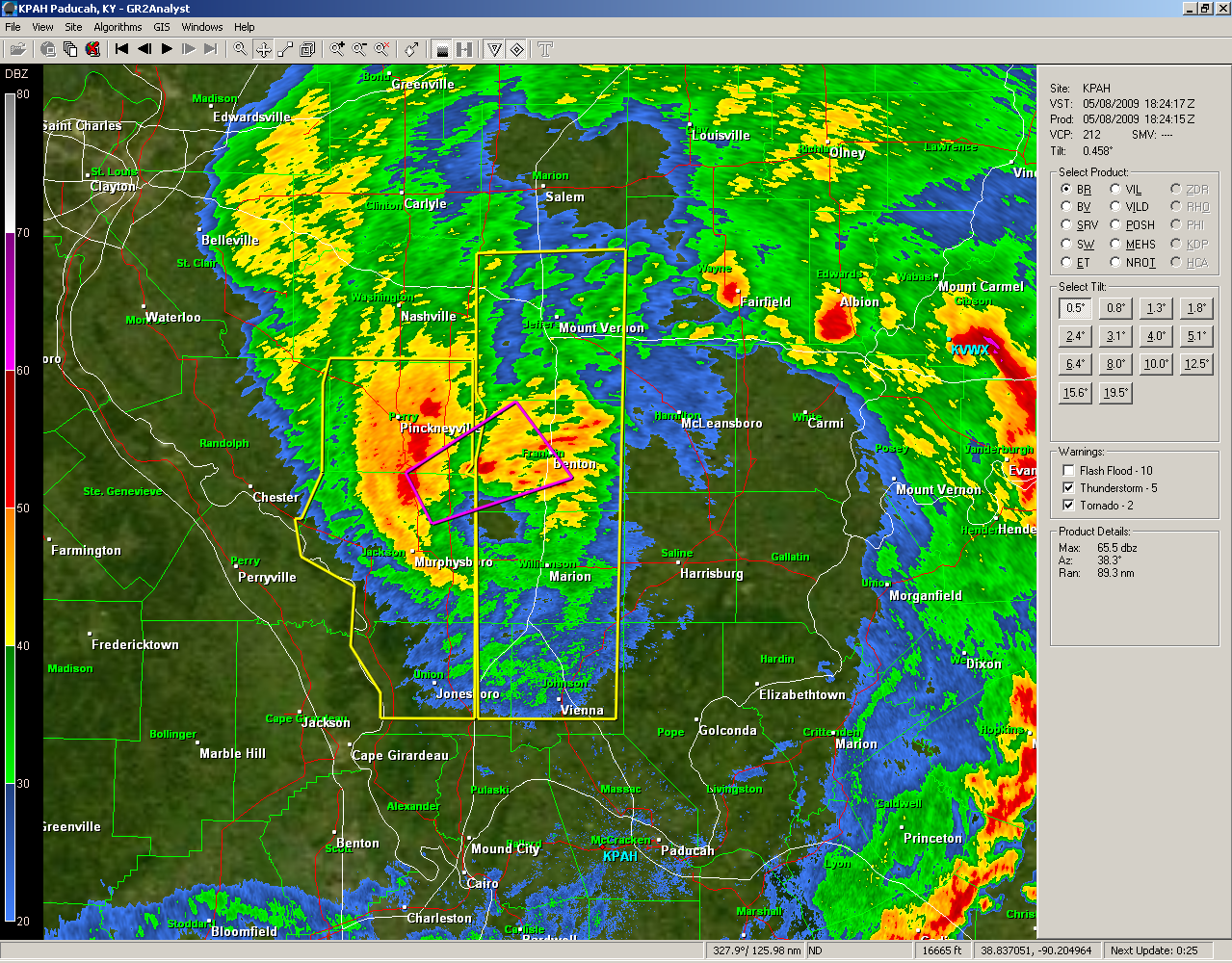
May 2009 derecho A screenshot from the Paducah, KY radar of the mesoscale convective vortex portion of the derecho near Carbondale, Illinois. This screenshot is from the approximate time the 106 mph (171 km/h) wind gust was recorded at the Carbondale airport.
Date of tornado outbreak: May 8, 2009 Duration1: 15 hours, 28 minutes Maximum rated tornado2: EF3 tornado Tornadoes caused: 39 confirmed[1][2][3] Damages: ~$500 million[4] Fatalities: Four direct, two indirect[5][6][7][8] Areas affected: Southeastern Kansas, Southern Missouri, Southwestern Illinois, Central and Eastern Kentucky, Eastern Tennessee, Southwestern Virginia, and Northwestern North Carolina 1Time from first tornado to last tornado
2Most severe tornado damage; see Enhanced Fujita ScaleThe May 2009 Southern Midwest Derecho was an extreme progressive derecho and mesoscale convective vortex event that struck Southeastern Kansas, Southern Missouri, and Southwestern Illinois on May 8, 2009.[9] Thirty-nine tornadoes, including two of EF3 strength on the Enhanced Fujita Scale, were reported in addition to high non-tornadic winds associated with the derecho and MCV.[9] Due to the abnormal shape of the storm on radar and the extremely strong winds, many called this an "inland hurricane."[10] A new class of storm, the Super Derecho, has been used to describe this event after analysis in 2010.[11] Embedded supercells produced hail up to baseball size in Southern Missouri, a rare event in a derecho.[2] A wind gust to 106 mph (171 km/h) was recorded by a backup anemometer at the Carbondale, Illinois airport after official National Weather Service equipment failed.[1]
Contents
Meteorological synopsis
Radar animation spanning the lifetime of the storm
 Radar image of the derecho as it moves through Southwestern Missouri; the bookend vortex is beginning to form on the northern end at the time of this radar image.
A complex of thunderstorms formed over Northwestern Kansas overnight May 7 and into the early morning hours of May 8, before moving into in South Central Kansas, where better moisture and stronger upper level winds were present.[12] The cluster of storms began to evolve into a more organized derecho near Hutchinson, Kansas, where National Weather Service damage surveys found winds greater than 100 mph (160 km/h) started, then continued through southern Missouri.[3][12] While in Southwestern Missouri, the derecho began to change; supercells began to embed within the line and a wake low began to form in conjunction with a bookend vortex on the northern end of the derecho.[1][3] As the derecho entered Southeastern Missouri, the initial line associated began to weaken, but the mesoscale convective vortex (MCV) became increasingly pronounced on the northern end.[2] Many experts and NWS meteorologists considered this to be one of the worst derechos and MCVs in the past decade.[1][13] The Storm Prediction Center issued two "particularly dangerous situation" severe thunderstorm watches[14][15] and a vividly worded tornado watch, mentioning the possibility of winds in excess of 105 mph (169 km/h).[16] Local National Weather Service offices in Springfield, Missouri and Paducah, Kentucky also issued strongly worded severe thunderstorm warnings, with precautionary statements similar to those used in tornado warnings.[17][18] As both the initial squall line and MCV weakened, very little severe weather was reported between Southern Illinois and Central Kentucky.[19] However, as the weakening squall line encountered higher instability and more favorable upper-level winds, the line split into several supercells in a process still not fully understood;[20] these storms produced several tornadoes in Central Kentucky, Eastern Tennessee, Southwestern Virginia, and Northwestern North Carolina.[21][22] While no longer producing severe weather itself, the MCV continued to enhance thunderstorms early the next morning across southeastern Virginia.[23]
Other similar events
See also: LandphoonDespite at first seeming extremely rare, further research has found that similar storms have occurred previously.[1] One case, which occurred in North Carolina on April 15, 1999, produced a killer tornado and an 165 mph (266 km/h) wind gust, although this may have been associated with a tornado.[24] Another heavily studied event in Northern Pennsylvania on July 21, 2003 also resulted in several tornadoes.[25] However, these events lasted for a much shorter period of time and were significantly smaller; numerical modeling has shown that an average bookend vortex is only 12 nmi (22 km) across, while the May 2009 storm reached up to 40 nmi (74 km) in diameter.[1]
Confirmed tornadoes
Confirmed
TotalConfirmed
EF0Confirmed
EF1Confirmed
EF2Confirmed
EF3Confirmed
EF4Confirmed
EF540 9 18 11 2 0 0 List of reported tornadoes - Friday, May 8, 2009 EF# Location County Coord. Time (UTC) Path length Summary Missouri EF1 E of Pilgrim Dade 37°22′N 93°45′W / 37.367°N 93.75°W 1253 2 miles (3.2 km) Brief tornado damaged several trees and outbuildings along an intermittent path.[26] EF1 Republic area Greene 37°06′N 93°30′W / 37.1°N 93.5°W 1305 4 miles (6.4 km) Short-lived tornado tracked through downtown Republic, damaging about 50 structures. Losses from the storm reached $1 million.[27] EF1 NW of Springfield-Branson National Airport Greene 37°15′N 93°23′W / 37.25°N 93.383°W 1314 2 miles (3.2 km) A brief tornado touched down near Springfield Airport, destroying a few outbuildings and heavily damaging a home. Losses from the storm reached $200,000.[28] EF1 NW of Brighton Polk 37°28′N 93°22′W / 37.467°N 93.367°W 1316 9 miles (14 km) An EF1 tornado damaged or destroyed several barns and outbuildings and caused moderate to severe damage to frame homes. Losses from the storm reached $2 million.[29] EF0 Ebenezer area Greene 37°19′N 93°19′W / 37.317°N 93.317°W 1321 4 miles (6.4 km) Several trees and outbuildings were damaged.[30] EF1 SE of Swan to SW of Merritt Taney, Christian, Douglas 36°46′N 93°01′W / 36.767°N 93.017°W 1325 12 miles (19 km) A 0.5 mi (0.80 km) wide, relatively long-tracked tornado tracked for 12 miles (19 km) through three counties. The most severe damage took place in Christian County where two homes were damaged and several outbuildings were destroyed. Losses from the tornado reached $2.6 million.[31][32][33] EF1 E of Fordland Webster 37°09′N 92°55′W / 37.15°N 92.917°W 1338 4 miles (6.4 km) A dairy farm lost its roof, a truck was lofted over a fence, and an outbuilding was destroyed.[34] EF2 W of Goodhope Douglas 36°54′N 92°49′W / 36.9°N 92.817°W 1339 2.5 miles (4.0 km) A short-lived tornado tore the roof off a home and damaged numerous trees.[35] EF2 N of Merritt Douglas 36°55′N 92°52′W / 36.917°N 92.867°W 1339 2.5 miles (4.0 km) A short-lived but very large 0.75 mi (1.21 km) tornado damaged two homes and several outbuildings. Losses from the storm reached $200,000.[36] EF2 ESE of March Dallas 37°31′N 93°03′W / 37.517°N 93.05°W 1341 4 miles (6.4 km) A 400 yd (0.37 km) wide tornado made several touchdowns along a 4 mi (6.4 km) path. Peaking at EF2 intensity with estimated winds of 130 mph (210 km/h), the tornado destroyed three framed houses and numerous outbuildings. Two people were injured and transported to a local hospital; however, one died of a heart attack while en-route.[37] EF1 N of Ava Douglas 37°00′N 92°40′W / 37.00°N 92.67°W 1400 1 mile (1.6 km) A barn was destroyed and a few homes suffered minor damage. EF1 NW of Hartville Wright 37°18′N 92°33′W / 37.30°N 92.55°W 1402 3.5 miles (5.6 km) Several outbuildings were destroyed, and numerous trees were uprooted. EF1 SW of Wasola Ozark 36°46′N 92°37′W / 36.76°N 92.61°W 1411 2 miles (3.2 km) Seven outbuildings were destroyed and three homes were damaged; intense tree damage was also noted. EF0 ESE of Mountain Grove Texas 37°07′N 92°11′W / 37.12°N 92.19°W 1422 3.5 miles (5.6 km) Several buildings were damaged and numerous trees were uprooted. EF1 WNW of Peace Valley Howell 36°53′N 91°47′W / 36.89°N 91.79°W 1435 9 miles (14 km) A few homes and numerous trees were damaged. EF2 W of Mountain View to SE of Summersville Howell, Texas, Shannon 37°00′N 91°51′W / 37.00°N 91.85°W 1435 21 miles (34 km) A farm house was lifted and moved injuring two people. Two auto shops and several homes and outbuildings were damaged or destroyed. Numerous trees were snapped or uprooted. EF2 SE of Lebanon Laclede 37°37′N 92°35′W / 37.62°N 92.59°W 1440 2.2 miles (3.5 km) Four homes and several outbuildings were damaged EF1 ESE of Hazelton Texas 37°30′N 91°57′W / 37.50°N 91.95°W 1444 3.5 miles (5.6 km) One barn was destroyed and one mobile home lost its roof. EF2 SW of Alley Spring Shannon 1445 12 miles (19 km) Several buildings and a cabin at a sawmill were destroyed. Trees suffered extensive damage. EF3 NW of Pomona Howell 36°53′N 91°56′W / 36.88°N 91.93°W 1500 2.2 miles (3.5 km) One house, one mobile home, one travel trailer, two outbuildings, and an auto shop were destroyed. Cars were tossed 40 to 50 yards (37 to 46 m) away and two school buses were blown over. EF0 McBride area Perry 1620 2.2 miles (3.5 km) Damage limited to trees; the tornado was caught on tape. EF1 SE of Fredericktown Madison unknown 0.5 miles (0.80 km) EF1 N of Ellington Reynolds unknown 2 miles (3.2 km) Two homes had roof damage; trees suffered significant damage. Illinois EF1 WSW of Du Quoin Jackson 37°57′N 89°24′W / 37.95°N 89.40°W 1630 3 miles (4.8 km) Structural damage to two barns, shingle damage to homes, power poles blown over, and dozens of trees were snapped or uprooted. EF1 N of Thompsonville to NE of Crab Orchard Franklin, Williamson 1945 5 miles (8.0 km) Trees were damaged in a rural area. EF0 N of Royalton Franklin unknown unknown A brief tornado touchdown was photographed. Kentucky EF1 E of Hiseville Barren, Metcalfe 37°07′N 85°48′W / 37.11°N 85.80°W 1904 4 miles (6.4 km) Three outbuildings were destroyed, and one home and a pole barn were damaged. EF3 S of Richmond Garrard, Madison, Estill 37°41′N 84°22′W / 37.68°N 84.37°W 2055 at least 22 miles (35 km) 2 deaths - Homes suffered severe damage. Several cars were flipped over. Five people were injured. EF0 NW of Irvine Estill 2123 less than 0.25 miles (0.40 km) Two structures had metal roofing torn off. Several trees were knocked down including one that damaged the porch of a home. Tennessee EF2 SE of Huntsville Scott 2254 4.5 miles (7.2 km) Seven homes were damaged and a free standing cellphone tower collapsed. EF2 SW of Tazewell Claiborne unknown 2.2 miles (3.5 km) Two large barns were destroyed and one home lost its roof. EF1 NE of Thorn Hill Grainger, Hancock 36°24′N 83°20′W / 36.40°N 83.34°W 2336 3.5 miles (5.6 km) Barns and outbuildings were damaged heavily, and several homes suffered roof damage. EF0 S of Gray Washington 36°24′N 82°29′W / 36.40°N 82.48°W 0045 unknown Tornado touchdown was reported by law enforcement, but no damage reported. EF0 NW of Etowah McMinn unknown 0.1 miles (0.16 km) A tornado briefly touched down causing damage to several trees. Virginia EF0 N of Clintwood Dickenson 37°11′N 82°28′W / 37.183°N 82.467°W 0100 0.75 miles (1.21 km) Numerous trees were uprooted, one of which fell on a mobile home. Two homes suffered minor roof damage.[38] EF2 SE of Pound Wise 37°04′N 82°33′W / 37.067°N 82.55°W 0145 1.7 miles (2.7 km) Two trailers and several outbuildings were destroyed, and a third trailer was damaged.[39] EF0 NW of Lebanon Russell 36°54′N 82°05′W / 36.9°N 82.083°W 0225 0.1 miles (0.16 km) A tornado briefly touched down without any known impact.[40] EF2 NE of Lebanon Russell 36°56′N 81°57′W / 36.933°N 81.95°W 0230 1.1 miles (1.8 km) One barn was destroyed, one home had moderate damage, and 100 trees were snapped or uprooted.[41] North Carolina EF2 NW of Ennice Alleghany 36°33′N 81°01′W / 36.55°N 81.017°W 0344 5 miles (8.0 km) A mobile home was destroyed, injuring four people. Five homes and several outbuildings were damaged, and cement silos were toppled, causing two additional injuries. Damages from the tornado amounted to $200,000.[42] EF1 SW of Ennice Alleghany 36°33′N 81°00′W / 36.55°N 81°W 0346 0.25 miles (0.40 km) Three outbuildings were destroyed and one home and a pole barn were damaged.[43] Sources:National Weather Service Springfield, MO, National Weather Service St. Louis, MO, National Weather Service Paducah, KY, National Weather Service Louisville, KY, National Weather Service Jackson, KY, National Weather Service Morristown, TN Effects
Kansas and Southwestern Missouri
 Damage to a business in downtown Doniphan, Missouri on May 8, 2009
The initial squall line formed in Central Kansas, to the northwest of Hutchinson.[12] In Hutchinson, several airplanes were flipped at a local airport, and 21,000 people were left without power. A woman was killed in New Albany, Kansas when her mobile home was blown forty feet off of its foundation.[8] National Weather Service survey teams found that winds reached 120 mph (190 km/h) in the area, which also resulted in the destruction of a church and the town's post office, in addition to damaging several homes.[8][12] 130 buildings were damaged in Cherokee, Kansas, including a high school gymnasium. Schools in several counties closed for the day, and a twenty mile strech Kansas Turnpike was closed for an hour due to flooding.[8] The derecho continued to intensify as it reached Southwestern Missouri, where the storm forced several television stations in Joplin, Missouri off-the-air after their transmission towers were downed; one station's tower landed on its studios.[44] Numerous schools were damaged throughout the Springfield, Missouri area including a roof collapse at the Fair Grove High School resulting in three injuries to students. There were numerous reports of tree and roof damage throughout Springfield, prompting some business to close, and caused Drury University to cancel some morning classes.[44] 346 buildings were damaged in some way in Greene County, Missouri , and four people were injured, but none required hospitalization.[45]
Southeastern Missouri and Southwestern Illinois
 Picture of an EF-0 tornado north of Royalton, Illinois on May 8, 2009
As the initial line weakened, the mesoscale convective vortex on the northern end began to strengthen and separate from the squall line.[1] A long-lived supercell formed within the MCV in Madison County, Missouri, producing hail up to baseball size and a few tornadoes in addition to the more widespread straight-line wind damage throughout the area.[2] As the MCV crossed the Mississippi River and entered into more populated areas, it strengthened greatly while it nearly separated from the initial line.[1][2] Numerous buildings were severely damaged or destroyed throughout Southern Illinois; immediately after the MCV struck, Carbondale was reported to be virtually impassable due to the amount of debris on roadways. Marion, Murphysboro, Grand Tower, Johnston City Herrin, Energy, and Carterville, Illinois declared curfews and states of emergency due to power outages and the massive amounts of damage caused by the storms, some of these cities were even left without water due to the power outages.[1][46][47] In the city of Carbondale, damage was estimated at $3,000,000 USD, excluding damage at Southern Illinois University. Officials deemed 34 buildings total losses, and reported that 3,000 trees were felled throughout the city.[48] Preliminary estimates placed damages at Southern Illinois University in excess of $5,000,000 USD, numerous buildings on campus sustained some kind of roof damage, and nearly 100 windows were blown out residence halls. Due to infrastructre damage from the storm, most communication by land line and mobile phone was reported to be impossible.[48] In Carterville, Illinois, officials found 17 buildings to be total losses. The city's public works garage was shifted off its foundation and the police station sustained damage.[48] In Franklin County, Illinois, 13 buildings were deemed to be beyond repair; damage assessments found that 184 buildings received some kind of damage from the storm. Winds were estimated between 80 and 90 mph (130 and 140 km/h) in the county.[48] At one point, 68,000 people were left without power in Southern Illinois alone, prompting unusual methods to restore power, such as using helicopters to clear debris and position power poles.[49]
Elsewhere
 Damage to home in a subdivision in Madison County, Kentucky from an EF-3 tornado on May 8, 2009.
As the squall line continued east, it began to break apart into separate supercells, several of these supercells produced tornadoes.[21][50] An EF-3 tornado touched down in eastern Garrard County before tracking into southern Madison County, Kentucky; two people were killed in this tornado, five others were injured, and 150 homes were damaged. All of the injuries and deaths occurred in one mobile home near the intersection of Kentucky Route 1295 and Kentucky Route 52 in southern Madison County.[7][21] Most of the damaged homes were in a subdivision in the Waco area, just north of the Blue Grass Army Depot. One mobile phone bill from a damaged house was carried 35 miles (56 km) before coming to rest on the property of a National Weather Service employee.[21]
Flooding
The squall line and associated convection resulted in significant flooding south of St. Louis, Missouri and in Eastern Kentucky.[2][51]
Prior to becoming a mesocyclone, the system produced upwards of 4 in (100 mm) of rain over parts of Kansas during the morning hours.[52] In Rice County, high waters washed out several small bridges and low water crossings and damaged concrete structures, leaving roughly $340,000 in losses.[53] In some places, rainfall reached 4 in (100 mm) within a 30-minute span, leading to widespread street flooding. Up to ten drivers required rescue after their cars stalled in the flood waters.[54] Flowing water over the Kansas Turnpike forced officials to shut down a 20 mi (32 km) stretch of the highway for over an hour.[55] One person needed to be rescued in Lyon County after driving into a flooded street. Barricades were set up in some areas of the county due to rising waters.[56] In Reno County, four bridges sustained severe flood damage and another was destroyed. Damages to the bridges amounted to $500,000.[57] In some places, the rainfall was heavy enough to cancel schools.[58]
In parts of Missouri, up to 4 in (100 mm) of rain fell in a short period of time, triggering flash flooding. Along Missouri Route 89, flood waters reached a depth of roughly 2 ft (0.61 m).[59] Numerous side roads were closed due to flooding throughout several counties.[60] In Washington County, the Big River overflowed its banks and inundated a nearby highway.[61] More significant flooding took place in St. Francois County where some homes had up to 8 ft (2.4 m) of water in their basements and railroads were partially washed out.[62] A water rescue took place near the town of Bloomsdale.[63] Some of the most severe flooding took place in the town of Doniphan in Ripley County where 5.03 in (128 mm) of rain fell in a 24-hour span. Ten people needed to be evacuated from their homes due to rising waters. The county courthouse and local high school sustained major water damage. At the school, all of the classrooms were flooded by up to 18 in (460 mm) of water and a nearby parking lot also buckled under the water. Several other structures in the area were also inundated during the storm and two people needed to be rescued from their vehicle that was trapped in waist-deep water.[64] In Laclede County, severe flooding washed out low-lying roads and drainage culverts.[65]
Aftermath
On July 2, 2009, President Barack Obama declared a major disaster in Franklin, Gallatin, Jackson, Randolph, Saline, and Williamson counties in Illinois; Dolph A. Diemont was named as the Federal Emergency Management Agency coordinating officer for the area. FEMA also stated that further disaster declarations are possible as requested by the state.[66] Missouri Governor Jay Nixon requested federal assistance for 46 counties in Missouri; damage in those counties was estimated to exceed $48,700,000 USD.[67] On November 30, 2009, Senator Claire McCaskill announced the State Emergency Agency of Missouri would receive $2, 623,409.71 in federal grant money to cover the state's cost in managing the Public Assistant Award Grants. In addition, it was announced the Citizens Electric Corporation is receiving a $1,395,201.46 grant to offset costs incurred repairing infrastructure in Perry, Sainte Genevieve, and Cape Girardeau counties.[68]
See also
- Tornadoes of 2009
- List of North American tornadoes and tornado outbreaks
- May 2009 derecho series
- List of derecho events
References
- ^ a b c d e f g h i "Updated: What was it that caused the May 8 windstorm?". National Weather Service Paducah, KY. May 19, 2009. http://www.crh.noaa.gov/pah/?n=southildamage. Retrieved June 29, 2009.
- ^ a b c d e f "May 8, 2009 Derecho". National Weather Service Saint Louis, MO. May 12, 2009. http://www.crh.noaa.gov/lsx/?n=05_08_2009. Retrieved June 29, 2009.
- ^ a b c "Severe storms move through the Ozarks - May 8, 2009". National Weather Service Springfield, MO. June 10, 2009. http://www.crh.noaa.gov/news/display_cmsstory.php?wfo=sgf&storyid=27308&source=2. Retrieved June 29, 2009.
- ^ Stuart Hinson (2009). "NCDC Storm Events Database". National Climatic Data Center. http://www4.ncdc.noaa.gov/cgi-win/wwcgi.dll?wwevent~storms. Retrieved September 5, 2009.
- ^ Novara, Chuck (May 9, 2009). "Friday's Storms Claim One". Marion, Illinois: The Southern Illinoisan. http://thesouthern.com/news/local/image_8076a1b8-1fb1-518b-85be-d4f3b38e6581.html. Retrieved April 10, 2010.
- ^ "One storm related death reported in the four states". Wilson County, Kansas: KOAM. May 11, 2009. http://www.koamtv.com/Global/story.asp?S=10327538. Retrieved June 29, 2009.
- ^ a b "Deadly tornado kills two, several others injured". WKYT. May 11, 2009. http://www.wkyt.com/home/headlines/44722082.html. Retrieved June 29, 2009.
- ^ a b c d "Storm shakes southeast, soaks Reno". The Hutchinson News. May 8, 2009. http://www.hutchnews.com/Todaystop/stormsfri. Retrieved July 2, 2009.
- ^ Skilling, Tom (May 11, 2009). "Today's Ask Tom Why". WGN-TV. http://weblogs.wgntv.com/chicago-weather/tom-skilling-blog/2009/05/todays-ask-tom-why-1.html. Retrieved April 7, 2010.
- ^ Israel, Brett. "Huge Windstorm Spawns New Classification: 'Super Derecho'". Imaginova Corporation. LiveScience. http://www.livescience.com/environment/super-derecho-storm-100907.html. Retrieved 19 September 2010.
- ^ a b c d Billings, Jerilyn (May 9, 2009). "Derecho causes significant wind damage across Southern Kansas !!". National Weather Service Wichita, KS. http://www.crh.noaa.gov/ict/scripts/viewstory.php?STORY_NUMBER=2009050914. Retrieved June 29, 2009.
- ^ Skilling, Tom (May 8, 2009). "Derecho called one of the worst of the past decade". WGN-TV. http://weblogs.wgntv.com/chicago-weather/tom-skilling-blog/2009/05/derecho-called-one-of-the-wors.html. Retrieved June 29, 2009.
- ^ Corfidi (May 8, 2009). "Storm Prediction Center PDS Severe Thunderstorm Watch 264". Storm Prediction Center. http://www.spc.noaa.gov/products/watch/2009/ww0264.html. Retrieved June 29, 2009.
- ^ Hart (May 8, 2009). "Storm Prediction Center PDS Severe Thunderstorm Watch 266". Storm Prediction Center. http://www.spc.noaa.gov/products/watch/2009/ww0266.html. Retrieved June 29, 2009.
- ^ Hales (May 8, 2009). "Storm Prediction Center Tornado Watch 267". Storm Prediction Center. http://www.spc.noaa.gov/products/watch/2009/ww0267.html. Retrieved June 29, 2009.
- ^ "IEM Valid time extent code (VTEC) app". Iowa Environmental Mesonet. May 8, 2009. http://mesonet.agron.iastate.edu/vtec/#2009-O-NEW-KSGF-SV-W-0128. Retrieved June 29, 2009.
- ^ "IEM Valid time extent code (VTEC) app". Iowa Environmental Mesonet. May 8, 2009. http://mesonet.agron.iastate.edu/vtec/#2009-O-NEW-KPAH-SV-W-0103. Retrieved June 29, 2009.
- ^ "SPC storm reports for May 8, 2009". Storm Prediction Center. May 18, 2009. http://www.spc.noaa.gov/climo/reports/090508_rpts.html. Retrieved July 4, 2009.
- ^ Spoden, Patrick; R. Przybylinski, C. Wielgos, R. Shanklin (November 10, 2006). "Sampling Issues Associated with the Evansville Tornado and other nearby Supercells on the Early Morning of 6 November 2005: Challenges to Operational Forecasters". St. Louis, Missouri: American Meteorological Society. http://ams.confex.com/ams/23SLS/techprogram/paper_115287.htm. Retrieved July 4, 2009.
- ^ a b c d "EF-3 Tornado in Garrard County and Madison County on May 8, 2009". National Weather Service Louisville, KY. May 14, 2009. http://www.crh.noaa.gov/lmk/?n=may_8_2009_garrard_madison_tornado. Retrieved July 4, 2009.
- ^ "Long-lived supercell thunderstorms on May 8, 2009". National Weather Service Morristown, TN. May 9, 2009. http://www.srh.noaa.gov/mrx/svrevnts/may09tornadoes/may09tornado.php. Retrieved July 4, 2009.
- ^ Corfidi (May 9, 2009). "Storm Prediction Center Tornado Watch 279". Storm Prediction Center. http://www.spc.noaa.gov/products/watch/2009/ww0279.html. Retrieved April 10, 2010.
- ^ "The North Carolina Tornadocane (SPC Cool Image)". Storm Prediction Center. April 11, 2006. http://www.spc.noaa.gov/coolimg/nc_storm/index.html. Retrieved April 10, 2010.
- ^ "MCS with Eye - July 21, 2003". Hydrometeorological Prediction Center. March 1, 2007. http://www.hpc.ncep.noaa.gov/research/roth/landcane.html. Retrieved April 10, 2010.
- ^ "Missouri Event Report: EF1 Tornado". National Climatic Data Center. 2009. http://www4.ncdc.noaa.gov/cgi-win/wwcgi.dll?wwevent~ShowEvent~761897. Retrieved July 4, 2011.
- ^ "Missouri Event Report: EF1 Tornado". National Climatic Data Center. 2009. http://www4.ncdc.noaa.gov/cgi-win/wwcgi.dll?wwevent~ShowEvent~762390. Retrieved July 4, 2011.
- ^ "Missouri Event Report: EF1 Tornado". National Climatic Data Center. 2009. http://www4.ncdc.noaa.gov/cgi-win/wwcgi.dll?wwevent~ShowEvent~762391. Retrieved July 4, 2011.
- ^ "Missouri Event Report: EF1 Tornado". National Climatic Data Center. 2009. http://www4.ncdc.noaa.gov/cgi-win/wwcgi.dll?wwevent~ShowEvent~762393. Retrieved July 4, 2011.
- ^ "Missouri Event Report: EF0 Tornado". National Climatic Data Center. 2009. http://www4.ncdc.noaa.gov/cgi-win/wwcgi.dll?wwevent~ShowEvent~762392. Retrieved July 4, 2011.
- ^ "Missouri Event Report: EF1 Tornado". National Climatic Data Center. 2009. http://www4.ncdc.noaa.gov/cgi-win/wwcgi.dll?wwevent~ShowEvent~762072. Retrieved July 4, 2011.
- ^ "Missouri Event Report: EF1 Tornado". National Climatic Data Center. 2009. http://www4.ncdc.noaa.gov/cgi-win/wwcgi.dll?wwevent~ShowEvent~762394. Retrieved July 4, 2011.
- ^ "Missouri Event Report: EF1 Tornado". National Climatic Data Center. 2009. http://www4.ncdc.noaa.gov/cgi-win/wwcgi.dll?wwevent~ShowEvent~762395. Retrieved July 4, 2011.
- ^ "Missouri Event Report: EF1 Tornado". National Climatic Data Center. 2009. http://www4.ncdc.noaa.gov/cgi-win/wwcgi.dll?wwevent~ShowEvent~762292. Retrieved July 4, 2011.
- ^ "Missouri Event Report: EF2 Tornado". National Climatic Data Center. 2009. http://www4.ncdc.noaa.gov/cgi-win/wwcgi.dll?wwevent~ShowEvent~762291. Retrieved July 4, 2011.
- ^ "Missouri Event Report: EF2 Tornado". National Climatic Data Center. 2009. http://www4.ncdc.noaa.gov/cgi-win/wwcgi.dll?wwevent~ShowEvent~761988. Retrieved July 4, 2011.
- ^ "Missouri Event Report: EF2 Tornado". National Climatic Data Center. 2009. http://www4.ncdc.noaa.gov/cgi-win/wwcgi.dll?wwevent~ShowEvent~762421. Retrieved July 4, 2011.
- ^ Stuart Hinson (2009). "Virginia Event Report: EF0 Tornado". National Climatic Data Center. http://www4.ncdc.noaa.gov/cgi-win/wwcgi.dll?wwevent~ShowEvent~760645. Retrieved September 6, 2009.
- ^ Stuart Hinson (2009). "Virginia Event Report: EF2 Tornado". National Climatic Data Center. http://www4.ncdc.noaa.gov/cgi-win/wwcgi.dll?wwevent~ShowEvent~759137. Retrieved September 6, 2009.
- ^ Stuart Hinson (2009). "Virginia Event Report: EF0 Tornado". National Climatic Data Center. http://www4.ncdc.noaa.gov/cgi-win/wwcgi.dll?wwevent~ShowEvent~759138. Retrieved September 6, 2009.
- ^ Stuart Hinson (2009). "Virginia Event Report: EF0 Tornado". National Climatic Data Center. http://www4.ncdc.noaa.gov/cgi-win/wwcgi.dll?wwevent~ShowEvent~759139. Retrieved September 6, 2009.
- ^ Stuart Hinson (2009). "North Carolina Event Report: EF2 Tornado". National Climatic Data Center. http://www4.ncdc.noaa.gov/cgi-win/wwcgi.dll?wwevent~ShowEvent~762123. Retrieved September 6, 2009.
- ^ Stuart Hinson (2009). "North Carolina Event Report: EF1 Tornado". National Climatic Data Center. http://www4.ncdc.noaa.gov/cgi-win/wwcgi.dll?wwevent~ShowEvent~762122. Retrieved September 6, 2009.
- ^ a b "Damage reports pour in from across the Ozarks". Springfield, Missouri: KYTV. May 11, 2009. http://www.ky3.com/news/local/44588752.html. Retrieved July 3, 2009.
- ^ "Green County storm damage summary" (Press release). Springfield-Greene County Office of Emergency Management. May 8, 2009. http://www.greenecountymo.org/info/file/05-14-09.pdf. Retrieved July 4, 2009.
- ^ "Storm damage reports from around the Heartland". KFVS-TV. May 11, 2009. http://www.kfvs12.com/Global/story.asp?s=10328982. Retrieved July 4, 2009.
- ^ "Breaking news: Storm damage". WSIL-TV. May 8, 2009. http://www.wsiltv.com/p/news_details.php?newsID=7431&type=top. Retrieved July 4, 2009.
- ^ a b c d "Storm Data and Unusual Weather Phenomena - May 2009". National Weather Service Paducah, KY. July 24, 2009. http://www.crh.noaa.gov/images/pah/pdf/pahmay09.pdf. Retrieved July 26, 2009.
- ^ "May 12th: Williamson Co 10:00am News Update". Williamson County, Illinois: WSIL-TV. May 12, 2009. http://www.wsiltv.com/p/news_details.php?newsID=7452&type=top. Retrieved July 4, 2009.
- ^ "Brief EF-0 Tornado in Estill County on Friday, May 8". National Weather Service Jackson, KY. May 12, 2009. http://www.crh.noaa.gov/news/display_cmsstory.php?wfo=jkl&storyid=27505&source=2. Retrieved July 4, 2009.
- ^ "Pictures from the May 8–9 flash flooding". National Weather Service Jackson, Kentucky. May 10, 2009. http://www.crh.noaa.gov/news/display_cmsstory.php?wfo=jkl&storyid=27871&source=2. Retrieved July 4, 2009.
- ^ Stuart Hinson (2009). "Kansas Event Report: Flood". National Climatic Data Center. http://www4.ncdc.noaa.gov/cgi-win/wwcgi.dll?wwevent~ShowEvent~759422. Retrieved September 5, 2009.
- ^ Stuart Hinson (2009). "Kansas Event Report: Flood". National Climatic Data Center. http://www4.ncdc.noaa.gov/cgi-win/wwcgi.dll?wwevent~ShowEvent~759425. Retrieved September 5, 2009.
- ^ Stuart Hinson (2009). "Kansas Event Report: Flood". National Climatic Data Center. http://www4.ncdc.noaa.gov/cgi-win/wwcgi.dll?wwevent~ShowEvent~759458. Retrieved September 5, 2009.
- ^ Stuart Hinson (2009). "Kansas Event Report: Flash Flood". National Climatic Data Center. http://www4.ncdc.noaa.gov/cgi-win/wwcgi.dll?wwevent~ShowEvent~761064. Retrieved September 5, 2009.
- ^ Stuart Hinson (2009). "Kansas Event Report: Flash Flood". National Climatic Data Center. http://www4.ncdc.noaa.gov/cgi-win/wwcgi.dll?wwevent~ShowEvent~761067. Retrieved September 5, 2009.
- ^ Stuart Hinson (2009). "Missouri Event Report: Flood". National Climatic Data Center. http://www4.ncdc.noaa.gov/cgi-win/wwcgi.dll?wwevent~ShowEvent~761444. Retrieved September 5, 2009.
- ^ Stuart Hinson (2009). "Missouri Event Report: Flash Flood". National Climatic Data Center. http://www4.ncdc.noaa.gov/cgi-win/wwcgi.dll?wwevent~ShowEvent~761594. Retrieved September 6, 2009.
- ^ Stuart Hinson (2009). "Missouri Event Report: Flash Flood". National Climatic Data Center. http://www4.ncdc.noaa.gov/cgi-win/wwcgi.dll?wwevent~ShowEvent~758564. Retrieved September 5, 2009.
- ^ Stuart Hinson (2009). "Missouri Event Report: Flash Flood". National Climatic Data Center. http://www4.ncdc.noaa.gov/cgi-win/wwcgi.dll?wwevent~ShowEvent~758565. Retrieved September 5, 2009.
- ^ Stuart Hinson (2009). "Missouri Event Report: Flash Flood". National Climatic Data Center. http://www4.ncdc.noaa.gov/cgi-win/wwcgi.dll?wwevent~ShowEvent~758568. Retrieved September 5, 2009.
- ^ Stuart Hinson (2009). "Missouri Event Report: Flash Flood". National Climatic Data Center. http://www4.ncdc.noaa.gov/cgi-win/wwcgi.dll?wwevent~ShowEvent~758569. Retrieved September 5, 2009.
- ^ Stuart Hinson (2009). "Missouri Event Report: Flash Flood". National Climatic Data Center. http://www4.ncdc.noaa.gov/cgi-win/wwcgi.dll?wwevent~ShowEvent~758570. Retrieved September 5, 2009.
- ^ Stuart Hinson (2009). "Missouri Event Report: Flash Flood". National Climatic Data Center. http://www4.ncdc.noaa.gov/cgi-win/wwcgi.dll?wwevent~ShowEvent~760210. Retrieved September 5, 2009.
- ^ Stuart Hinson (2009). "Missouri Event Report: Flash Flood". National Climatic Data Center. http://www4.ncdc.noaa.gov/cgi-win/wwcgi.dll?wwevent~ShowEvent~762774. Retrieved September 5, 2009.
- ^ Politico Staff (July 2, 2009). "W.H. reacts to Illinois storms". The Politico. http://www.politico.com/politico44/perm/0709/disaster_declaration_be865427-72d8-4cfe-a6cb-f6f8a1d5c637.html. Retrieved July 2, 2009.
- ^ "Governor seeks help for 46 Missouri counties". Jefferson City, Missouri: Associated Press via KYTV. May 28, 2009. http://www.ky3.com/news/local/46406072.html. Retrieved July 3, 2009.
- ^ "Missouri Awarded $2.6 Million for Storm Damage Repair". KFVS-TV. November 30, 2009. http://www.kfvs12.com/Global/story.asp?S=11593727. Retrieved November 30, 2009.
External links
- National Weather Service Paducah, KY summary
- National Weather Service Springfield, MO summary
- National Weather Service Saint Louis, MO summary
- National Weather Service Wichita, KS summary
- National Weather Service Louisville, KY summary
- National Weather Service Blacksburg, VA summary
- National Weather Service Morristown, TN summary
- NBC Chicago slideshow of damage in Carbondale
Categories:- F3 tornadoes
- Tornadoes in Missouri
- Tornadoes in Illinois
- Tornadoes in Kentucky
- Tornadoes in Tennessee
- Tornadoes in Virginia
- Tornadoes in North Carolina
- Tornadoes of 2009
- 2009 natural disasters in the United States
- Derechos in the United States


Wikimedia Foundation. 2010.