- Jackson County, Illinois
-
Jackson County, Illinois 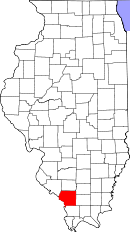
Location in the state of Illinois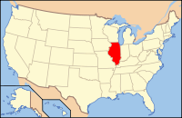
Illinois's location in the U.S.Founded 1816 Seat Murphysboro Largest city Carbondale Area
- Total
- Land
- Water
602.38 sq mi (1,560 km²)
584.08 sq mi (1,513 km²)
18.30 sq mi (47 km²), 3.04%Population
- (2010)
- Density
60,218
101/sq mi (39/km²)Time zone Central: UTC-6/-5 Website www.co.jackson.il.us Jackson County, incorporated January 10, 1816, is a county located in the U.S. state of Illinois. According to the 2010 census, it has a population of 60,218, which is an increase of 1.0% from 59,612 in 2000.[1] Its county seat is Murphysboro[2]; its most populous city is Carbondale, home to the main campus of Southern Illinois University.
The Carbondale Micropolitan Statistical Area includes all of Jackson County.
Contents
History
Human occupation of Jackson County began about 11,500 years ago. Extensive documentation of the areas indigenous peoples has been conducted and is ongoing. Exploration from the European explorers began with the Joliet-Marquette exploration along the Mississippi River. It was not until the 18th and 19th century when pioneer farmers began to settle in the area's inexpensive land along the Mississippi River and in the forested Shawnee hills with its one-hundred-foot trees.
As early as 1813, Conrad Will (namesake of Will County) conducted a large salt extraction operation, using slave labor, on the banks of the Big Muddy River, south of Murphysboro. As this area was in the "free" Northwest Territory, Will had to have legal exemptions to possess slaves.
Jackson County was organized in 1816, having been carved out of Randolph County. It was named for Andrew Jackson, who had just defeated the British at the Battle of New Orleans.
Shortly after the American Civil War, General John A. Logan led a parade of veterans from Murphysboro to Carbondale, Illinois. General Logan, a Union veteran, invited the Confederate veterans, of which there were many in Jackson County, to march with him. Thus, what might have been another celebration of the Union victory became a memorial to the war dead on both sides. This is one version of the origin of the Memorial Day holiday.
In 1925 the great Tri-State Tornado ripped through Jackson County on March 18, leaving devastation in its path. The villages of Gorham and DeSoto and the city of Murphysboro were especially hit hard.
The county courthouse is located in downtown Murphysboro. The current reinforced concrete courthouse replaced earlier wooden structures and was built during 1927-28. The original county seat and courthouse were located along the Big Muddy River at Brownsville. To afford a more strategic location after the courthouse in Brownsville was destroyed by fire, County government was moved upstream a few miles to Murphysboro. There are few traces of Brownsville still visible. On February 27, 1843, the Illinois General Assembly created a commission to designate a new county seat for Jackson County.
-
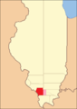
Jackson County at the time of its creation to 1818, including unorganized territory (formerly part of Johnson County) temporarily attached to it.[3]
-
Jackson County between 1818 and 1827
-
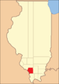
Jackson County in 1827, when it was reduced slightly to its current size
Geography
According to the 2010 census, the county has a total area of 602.38 square miles (1,560.2 km2), of which 584.08 square miles (1,512.8 km2) (or 96.96%) is land and 18.30 square miles (47.4 km2) (or 3.04%) is water.[4] The average elevation is around 400 feet (120 m), except near the Mississippi River.
The first coal mine in Illinois was opened on the south bank of the Big Muddy River near the present-day Route 127 Bridge.
Major highways
 U.S. Highway 51
 Illinois Route 3
 Illinois Route 4
 Illinois Route 13
 Illinois Route 127
 Illinois Route 149
 Illinois Route 151
Adjacent counties
- Perry County - north
- Franklin County - northeast
- Williamson County - east
- Union County - southeast
- Perry County, Missouri - west
- Randolph County - northwest
National protected areas
- Crab Orchard National Wildlife Refuge (part)
- Shawnee National Forest (part)
Economic Development
Much of the county's economic situation is dependent upon Southern Illinois University Carbondale and the city of Carbondale. A rapidly developing city, it is part of the Metro Lakeland area consisting mainly of the major communities of Carbondale, Marion, Herrin, and Carterville. The outer regions of the Metro are include Murphysboro, the rest of Jackson County, the rest of Williamson County, Perry County, and Saline County. Jackson County is also located near the Shawnee Hills Wine Trail. Once a small business, the wine trail has evolved into a booming tourist attraction.
Several major roadways run through the county:
Illinois Routes 3, 149, 13, 127
U.S. Route 51Illinois Route 3 runs from St. Louis to Cairo, connecting to Interstate 57 and Cape Girardeau, Missouri in between.
Illinois Route 149 runs East-West through the county connecting Illinois Route 3 and Interstate 57 in West Frankfort.
Illinois Route 13 connects to Interstate 57 fourteen miles (21 km) East of the county line, in Marion.
Illinois Route 127 connects to Interstate 64 thirty miles North of the county line, in Nashville, Illinois.
U.S. Route 51 runs North-South through the county and the heart of Carbondale. It connects to Interstate 57 south of Jackson County, in Union County, and to Interstate 64 north of Jackson County, in Washington County.Demographics
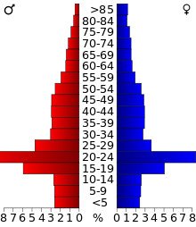 2000 census age pyramid for Jackson County, skewed by Southern Illinois University.
Historical populations Census Pop. %± 1900 33,871 — 1910 35,143 3.8% 1920 37,091 5.5% 1930 35,680 −3.8% 1940 37,920 6.3% 1950 38,124 0.5% 1960 42,151 10.6% 1970 55,008 30.5% 1980 61,522 11.8% 1990 61,067 −0.7% 2000 59,612 −2.4% 2010 60,218 1.0% IL Counties 1900-1990 2010
Whereas according to the 2010 U.S. Census Bureau:
- 77.8% White
- 14.3% Black
- 0.4% Native American
- 3.2% Asian
- 0.1% Native Hawaiian or Pacific Islander
- 2.6% Two or more races
- 1.6% Other races
- 4.0% Hispanic or Latino (of any race)
2000
As of the census[5] of 2000, there were 59,612 people, 24,215 households, and 12,664 families residing in the county. The population density was 101 people per square mile (39/km²). There were 26,844 housing units at an average density of 46 per square mile (18/km²). The racial makeup of the county was 80.79% White, 13.02% Black or African American, 0.31% Native American, 3.03% Asian, 0.06% Pacific Islander, 1.00% from other races, and 1.80% from two or more races. 2.42% of the population were Hispanic or Latino of any race. 22.0% were of German, 10.0% Irish, 9.4% American and 8.6% English ancestry according to Census 2000. 92.6% spoke English and 2.7% Spanish as their first language.
There were 24,215 households out of which 24.40% had children under the age of 18 living with them, 39.30% were married couples living together, 9.70% had a female householder with no husband present, and 47.70% were non-families. 34.90% of all households were made up of individuals and 9.30% had someone living alone who was 65 years of age or older. The average household size was 2.21 and the average family size was 2.89.
In the county the population was spread out with 19.30% under the age of 18, 26.00% from 18 to 24, 25.90% from 25 to 44, 17.90% from 45 to 64, and 11.00% who were 65 years of age or older. The median age was 28 years. For every 100 females there were 104.30 males. For every 100 females age 18 and over, there were 102.90 males.
The median income for a household in the county was $24,946, and the median income for a family was $40,950. Males had a median income of $31,910 versus $22,396 for females. The per capita income for the county was $15,755. About 14.70% of families and 25.20% of the population were below the poverty line, including 23.00% of those under age 18 and 10.50% of those age 65 or over.
Cities and towns
- Ava
- Campbell Hill
- Carbondale
- De Soto
- Dowell
- Elkville
- Gorham
- Grand Tower
- Makanda
- Murphysboro
- Vergennes
Townships
Jackson County is divided into sixteen townships:
Climate and weather
Murphysboro, Illinois Climate chart (explanation) J F M A M J J A S O N D 2.93921345244.355334.566424.876524.884613.488663.987633.180552.969434.655353.74426Average max. and min. temperatures in °F Precipitation totals in inches Source: The Weather Channel[6] Metric conversion J F M A M J J A S O N D 744-6767-410813111319612124111212916853119100311780271374216117132947-3Average max. and min. temperatures in °C Precipitation totals in mm In recent years, average temperatures in the county seat of Murphysboro have ranged from a low of 21 °F (−6 °C) in January to a high of 88 °F (31 °C) in July, although a record low of −25 °F (−32 °C) was recorded in January 1977 and a record high of 113 °F (45 °C) was recorded in August 1930. Average monthly precipitation ranged from 2.91 inches (74 mm) in January to 4.78 inches (121 mm) in May.[6]
See also
References
- ^ "Jackson County QuickFacts". United States Census Bureau. http://quickfacts.census.gov/qfd/states/17/17077.html. Retrieved 2011-11-05.
- ^ "Find a County". National Association of Counties. http://www.naco.org/Counties/Pages/FindACounty.aspx. Retrieved 2011-06-07.
- ^ White, Jesse. Origin and Evolution of Illinois Counties. State of Illinois, March 2010. [1]
- ^ "Census 2010 U.S. Gazetteer Files: Counties". United States Census. http://www.census.gov/geo/www/gazetteer/files/Gaz_counties_national.txt. Retrieved 2011-11-05.
- ^ "American FactFinder". United States Census Bureau. http://factfinder.census.gov. Retrieved 2008-01-31.
- ^ a b "Monthly Averages for Murphysboro, Illinois". The Weather Channel. http://www.weather.com/weather/wxclimatology/monthly/graph/USIL0825. Retrieved 2011-01-27.
External links

Randolph County Perry County Franklin County Perry County, Missouri 
Williamson County  Jackson County, Illinois

Union County Municipalities and communities of Jackson County, Illinois Cities Ava | Carbondale | Grand Tower | Murphysboro

Villages Townships Bradley | Carbondale | Degognia | DeSoto | Elk | Fountain Bluff | Grand Tower | Kinkaid | Levan | Makanda | Murphysboro | Ora | Pomona | Sand Ridge | Somerset | Vergennes
Unincorporated
communitiesBoskydell | Cora | Crain | Degognia | Dry Hill | Etherton | Glenn | Grimsby | Hallidayboro | Harrison | Howardton | Jacob | Jones Ridge | Matthews Junction‡ | Mount Carbon | Neunert | Oraville | Pomona | Poplar Ridge | Raddle | Reeds Station | Sand Ridge | Sato | Stone Fort | Ward
Footnotes ‡This populated place also has portions in an adjacent county or counties
Categories:- Illinois counties
- 1816 establishments in the United States
- Populated places established in 1816
- Jackson County, Illinois
- Little Egypt
- Metro Lakeland
- Illinois counties on the Mississippi River
-


Wikimedia Foundation. 2010.