- Daulatabad, Maharashtra
-
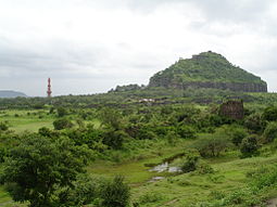
Daulatabad(Devgiri) (Marathi दौलताबाद; Urdu: دولتآباد ؛ meaning “City of Prosperity”), is a 14th century fort city in Maharashtra, India, about 16 kilometers northwest of Aurangabad. The place, was once as known as Deogiri, (circa the sixth century AD, when it was an important uplands city along caravan routes and is now but a village, based around the former city of the same name.
Starting 1327, it famously remained the capital of Tughlaq dynasty, under Muhammad bin Tughluq (r. 1325-1351), who also changed its name, and forcibily moved the entire population of Delhi here, for two years, before it was abandoned due to lack of water.
Contents
Fort of Devagiri
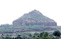
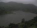
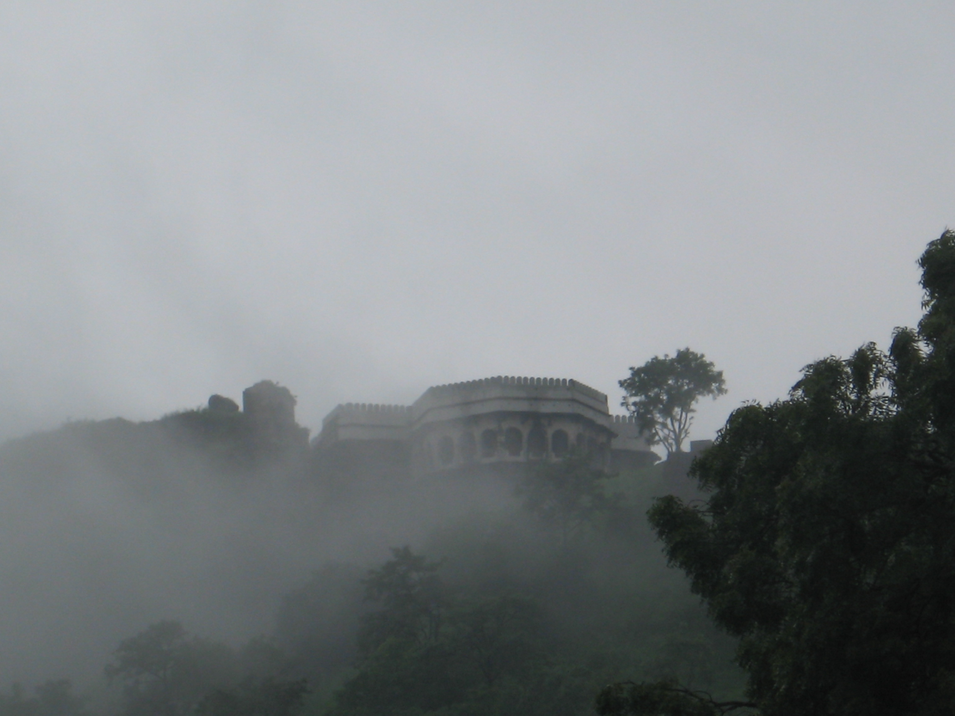
Once known as 'Devgiri', this magnificent 11th century fortress stands on a hill just 17 km. from Aurangabad. It was given the name Daulatabad, the 'city of fortune', by Muhammad Tughlaq, Sultan of Delhi. Initially a Yadav stronghold, it passed through the hands of several dynasties in the Deccan. One of the world's best preserved fort of medieval times, surviving virtually unaltered, Daulatabad yet displays the character that made it invincible.
Arguably amongst the best constructed forts all over the world, this fort never in its lifetime witnessed a battle. Only once was the power transferred on this fort, and that too was by treachery!
It has 7 lines of defence all the way up to the Baradari (palatial building on the top) and each line is constructed in such a way, that even if that line is captured, it is impossible to use it to attack the fort by directing the fire inwards.
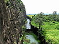
A series of secret, quizzical, subterranean passages lie coiled like a python amidst the fort. Here flaring torches were thrust upon an unwary enemy. Or hot oil poured down his path, as he deliberated in the labyrinth. Also the heat from a brazier was blown into the passage by a process of suction suffocating the entire garrison within. The Fort itself lies in the body of an isolated hill; the steep hill - sides at the base falling so sharply to the moat that no hostile troops could scale the height.
The moat, 40 ft. deep and carved into solid rock with mechanical drawbridges teemed with crocodiles. A 5-kilometer sturdy wall, artificial scarping and a complicated series of defenses made Daulatabad impregnable.
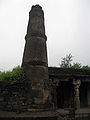
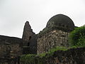
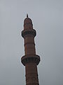
The 30-meter high Chand Minar (Tower) built much later with 3 circular galleries had a defensive and religious role in the fortress.
The area of the city includes the hill-fortress of Devagiri (Marathi देवगिरी) (sometimes Latinised to Deogiri). It stands on a conical hill, about 200 meters high. Much of the lower slopes of the hill has been cut away by Yadava dynasty rulers to leave 50 meter vertical sides to improve defenses. The fort is a place of extraordinary strength. The only means of access to the summit is by a narrow bridge, with passage for not more than two people abreast, and a long gallery, excavated in the rock, which has for the most part a very gradual upward slope.
About midway along this gallery, the access gallery has steep stairs, the top of which is covered by a grating destined in time of war to form the hearth of a huge fire kept burning by the garrison above. At the summit, and at intervals on the slope, are specimens of massive old cannon facing out over the surrounding countryside. Also at the mid way, there is a cave entrance meant to confuse the Enemies.
The City
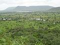
The original widespread capital city is now mostly unoccupied and has been reduced to a village. Much of its survival depends on the tourists to the old city and the adjacent fort.
History
 The siege of Daulatabad (April-June 1633)
The site had been occupied since at least 100 BCE, and now has remains of Buddhist caves similar to those at Ajanta and Ellora.
 Daulatabad Fort -- Devagiri (Deogiri).
The city is said to have been founded c. 1187 by Bhillama V, a prince who renounced his allegiance to the Chalukyas and established the power of the Yadava dynasty in the west.
There is a tradition that Deoghur or Doulatabad was built in 1203 AD by a Dhangar or herdsman who acquiring by some unusual good fortune vast wealth was named by his brother shepherds Rajah Ram and soon after assumed the rank of a Rajah.[1]
In 1294 the fort was captured by Ala-ud-din Khilji, and the rajas, so powerful that they were held by the Sultans of Delhi to be the rulers of all the Deccan, were reduced to pay tribute. The tribute falling into arrear, Devagiri was again occupied by the Muslims under Malik Kafur, in 1307 and 1310, and in 1318 the last raja, Harpal, was flayed alive.
Devagiri now became an important base for the operations of the Delhi Sultanate's conquering expeditions southwards. In 1327 Muhammad bin Tughluq determined to make it his capital, changed its name to Daulatabad, and tried to march the whole population of Delhi to it.
The project was interrupted by troubles which summoned him to the north; during his absence the Muslim governors of the Deccan revolted; and Daulatabad itself fell into the hands of Zafar Khan, the governor of Gulbarga. It remained in the hands of the Bahmanis till 1526, when it was taken by the Nizam Shahis. It was captured by the Mughal emperor Akbar, but in 1595 it again surrendered to Ahmad Nizam Shah of Ahmednagar, on the fall of whose dynasty in 1607 it passed into the hands of the usurper, the Nizam Shahi minister Malik Amber, originally an Abyssinian slave, who was the founder of Kharki (the present Aurangabad).
His successors held it until they were overthrown by Shah Jahan, the Mughal emperor, in 1633; after which it remained in the possession of the Delhi emperors until, after the death of Aurangzeb, it fell to the first Nizam of Hyderabad. Its glory, however, had already decayed owing to the removal of the seat of government by the emperors to Aurangabad.
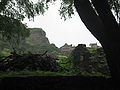
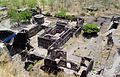
Fortification walls of the fort
The Fort which according to Indian ancient texts falls under the classification of Misra durg or mixed fort as it combines the qualities of Giridurg (mountain fort), Dev durg (God's fort) and Bhumi durg (land fort). The fortification walls were built at different periods by different dynasites like the Yadavas, Khilji, Tughlaq, Bahamani, Nizam Shahi and Malik Amber bears a marked resemblance to medieval European forts in the disposition of projecting towers, covered passages and bastions. The walls consist of labyrinth like arrangements of the underground secret passage with safety arrangements, in the style of buildings which give the bastions, despite their grim appearances, a touch of beauty by insertions of carved stones and dainty architectural details at various places.
The strengths of Daulatabad Fort
The fort has been considered as the most powerful, puissant fort that offered robust resistance to the enemies. An invincible fort, one of the best preserved in comparison to other forts in the vicinity of the same period. Its sound and sturdy quality exists due to the powerful wall about three miles in perimeter and defended by a moat and gacis that runs round the hill at its foot and between this outer curtain and the citadel, also known as Dharagir and Duwagir. These details have been extracted from Professor Dulari Qureshi's book Fort of Daulatabad. "[2]
Monuments
The outer wall, 2.75 miles (4.43 km) in circumference, once enclosed the ancient city of Deogiri (Devagiri), and between this and the base of the upper fort are three lines of defences.
Besides the fortifications Daulatabad contains several notable monuments, of which the chief are the Chand Minar and the Chini Mahal. The Chand Minar is a tower 210 ft (64 m). high and 70 ft (21 m). in circumference at the base, and was originally covered with beautiful Persian glazed tiles. It was erected in 1445 by Ala-ud-din Bahmani to commemorate his capture of the fort. The Chini Mahal, or China Palace, is the ruin of a building once of great beauty. In it Abul Hasan Tana Shah, the last of the Qutb Shahi kings of Golconda, was imprisoned by Aurangzeb in 1687.[3]
 This article incorporates text from a publication now in the public domain: Chisholm, Hugh, ed (1911). Encyclopædia Britannica (11th ed.). Cambridge University Press.
Rail transport
DAULATABAD (Station Code:DLB) is a station located on the Kachiguda-Manmad section of Hyderabad(HYB) Division of South Central Railway(SCR). After Divisional adjustments in 2003, Daulatabad now comes under Nanded(NED) Division of SCR. Aurangabad(AWB) is a major station near to Daulatabad. So not many trains stop at Daulatabad. The trains that halt at Daulatabad are: Dharmabad-manmad Marathwada Express/Passenger, the prestigious Kachiguda-Manmad Passenger, Daund-Nanded Passenger, Nizamabad-Pune Passenger, Nagarsol-Nanded Passenger(erstwhile Manmad-nanded Passenger) and Nanded-Manmad Passenger.
Underground tunnel
Daulatabad fort has many underground tunnels. Most of them have been closed or sealed. It is believed[who?] that one such tunnel stretches from inside the fort to Rajur town where famous Ganapati temple is built. The tunnel's length is approximately 70 km. It is said[who?] that Daulatabad Fort's 'deep-mala' (lights tower) can be seen from Rajur temple.
Gallery
-

-
-
-
-
-
-
-
-
-
-
-

-

-
-
-
-
View from Mughal Pavilion
-

Canon pointing into distance from Mughal Pavilion
-

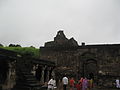
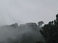
Mughal Pavilion, high up the fort
-

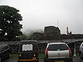
Track within Daulatabad Fort
-
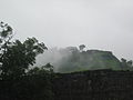
A view from the top of the Devagiri fort. Note the tunnel entrance, cannon post, and narrow access bridge
See also
- Yadav
- Aurangabad Tourism Capital of Maharashtra
References
- ^ The Asiatic journal and monthly register for British and foreign India, pg 355. Published in 1827.
- ^ Qureshi Dulari," Fort of Daulatabad," Chapter II p.18, 19
- ^ Qureshi, Dulari (2004). Fort of Daulatabad. New Delhi: Bharatiya Kala Prakashan. ISBN 818090072X. http://www.indiaclub.com/Shop/searchresults.asp?ProdStock=17637. Retrieved March 7, 2010.
External links
- Daulatabad at the Islamic Monuments of India Photographic Database
- http://www.tribuneindia.com/2003/20030817/spectrum/travel.htm
- History of the Mughal Pavilion and information regarding the fort
Aurangabad district, Maharashtra topics History Satavahana · Rashtrakuta Empire · Kalachuri · Chalukyas · Malik Ambar · Ahmednagar Sultanate · Daulatabad · Deccan sultanates · Yadavas of Devagiri · Shahaji · Aurangzeb · Muhammad bin Tughluq · Asaf Jah I · Nasir Jang · Asaf Jah II · Abul Hasan Qutb Shah · History of Aurangabad Sufi Saiints
Geography Jayakwadi dam · Salim Ali LakeCities and towns Monuments Bibi Ka Maqbara · Grishneshwar temple · Gates in Aurangabad · Panchakki · Himayat Bagh · Aurangabad Water System · Ajanta Caves · Ellora Caves · Aurangabad Caves · Daulatabad · Naukhanda palaceTransport Aurangabad Airport · Aurangabad Jan Shatabdi · Devagiri Express · Hyderabad-Godavari Valley Railways · Ajanta Express · Marathwada Express · Nagpur–Aurangabad–Mumbai express highwayEducation Dr. Babasaheb Ambedkar Marathwada University · Jawaharlal Nehru Engineering College · The Maulana Azad Education Trust · Hi-Tech Institute Of Technology · Government College of Engineering · MIT AurangabadPolitics Aurangabad Lok Sabha constituency · Gangapur Vidhan Sabha constituency · Kannad Vidhan Sabha constituency · Vaijapur Vidhan Sabha constituency · Rajendra Darda · Chandrakant KhaireCulture Urdu in Aurangabad · Himroo · Paithani · Naan Qalia · Wali Mohammed Wali · Siraj Aurangabadi · Azad Bilgrami · Zar Zari Zar Baksh · Sayyid Burhan-ud-din · Khwaja Zainuddin Shirazi · Ganj Rawan Ganj Baksh · Sufi Saints · Waheed Akhtar · Sikandar Ali Wajd · Rafiq ZakariaNeighbourhoods Neighborhoods of Aurangabad City · Aurangabad cantonment · Aurangabad CIDCOIndustrial Estates Waluj MIDC · Shendra MIDC · Shendra - Bidkin Industrial ParkOther topics Forts in Maharashtra Akola district Akola Fort · Narnala · BalapurSatara district Mumbai suburban district Mumbai city district Bombay Castle · Dongri Fort · Fort George · Mahim Fort · Mazagon Fort · Riwa Fort · Sewri Fort · Sion Hillock Fort · Worli FortRaigad district Karnala · Korlai · Kothaligad · Kolaba Fort · Lingana · Manikgad · Murud-Janjira · Padmadurg · Raigad · Sudhagad · Malanggad · Khanderi · Underi · Prabalgad · IrshalgadAurangabad District DaulatabadAmravati district Ahmednagar district Ratnagiri district Pune district Nashik district Kolhapur district Sindhudurg district Sindhudurg · VijaydurgNagpur district SitabuldiDhule district Laling · ThalnerThane district Bassein Fort · Belapur Fort · Arnala · Ghodbunder Fort · Mahuli
Coordinates: 19°56′34″N 75°12′47″E / 19.942724°N 75.213164°E
Categories:- Forts in Maharashtra
- Aurangabad, Maharashtra
- Former Indian capital cities
-


Wikimedia Foundation. 2010.