- Narka, Kansas
-
Narka, Kansas — City — Location of Narka, Kansas
Coordinates: 39°57′37″N 97°25′38″W / 39.96028°N 97.42722°WCoordinates: 39°57′37″N 97°25′38″W / 39.96028°N 97.42722°W Country United States State Kansas County Republic Area – Total 0.2 sq mi (0.5 km2) – Land 0.2 sq mi (0.5 km2) – Water 0.0 sq mi (0.0 km2) Elevation 1,585 ft (483 m) Population (2010)[1] – Total 94 – Density 470/sq mi (181.5/km2) Time zone Central (CST) (UTC-6) – Summer (DST) CDT (UTC-5) ZIP code 66960 Area code(s) 785 FIPS code 20-49350[2] GNIS feature ID 0472612[3] Narka is a city in Republic County, Kansas, United States. As of the 2010 census, the city population was 94.[1]
Contents
Geography
Narka is located at 39°57′37″N 97°25′38″W / 39.960229°N 97.427351°W (39.960229, -97.427351).[4] According to the United States Census Bureau, the city has a total area of 0.2 square miles (0.52 km2), all of it land.
Demographics
Historical populations Census Pop. %± 1990 113 — 2000 93 −17.7% 2010 94 1.1% U.S. Decennial Census As of the census[2] of 2000, there were 93 people, 47 households, and 24 families residing in the city. The population density was 521.0 people per square mile (199.5/km2). There were 55 housing units at an average density of 308.1 per square mile (118.0/km2). The racial makeup of the city was 100.00% White.
There were 47 households out of which 25.5% had children under the age of 18 living with them, 40.4% were married couples living together, 2.1% had a female householder with no husband present, and 48.9% were non-families. 44.7% of all households were made up of individuals and 27.7% had someone living alone who was 65 years of age or older. The average household size was 1.98 and the average family size was 2.83.
In the city the population was spread out with 22.6% under the age of 18, 8.6% from 18 to 24, 22.6% from 25 to 44, 23.7% from 45 to 64, and 22.6% who were 65 years of age or older. The median age was 42 years. For every 100 females there were 121.4 males. For every 100 females age 18 and over, there were 100.0 males.
The median income for a household in the city was $16,250, and the median income for a family was $21,250. Males had a median income of $28,750 versus $16,250 for females. The per capita income for the city was $11,693. There were 22.2% of families and 23.8% of the population living below the poverty line, including 15.8% of under eighteens and 37.5% of those over 64.
References
- ^ a b "2010 City Population and Housing Occupancy Status". U.S. Census Bureau. http://factfinder2.census.gov/faces/tableservices/jsf/pages/productview.xhtml?pid=DEC_10_PL_GCTPL2.ST13&prodType=table. Retrieved October 18, 2011.
- ^ a b "American FactFinder". United States Census Bureau. http://factfinder.census.gov. Retrieved 2008-01-31.
- ^ "US Board on Geographic Names". United States Geological Survey. 2007-10-25. http://geonames.usgs.gov. Retrieved 2008-01-31.
- ^ "US Gazetteer files: 2010, 2000, and 1990". United States Census Bureau. 2011-02-12. http://www.census.gov/geo/www/gazetteer/gazette.html. Retrieved 2011-04-23.
External links
- City
- Schools
- USD 109, local school district
- Maps
- Narka City Map, KDOT
- Republic County Map, KDOT
Municipalities and communities of Republic County, Kansas Cities 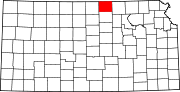
Unincorporated
communitiesCategories:- Cities in Kansas
- Populated places in Republic County, Kansas


Wikimedia Foundation. 2010.