- Benton County, Washington
-
Benton County, Washington 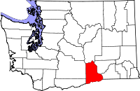
Location in the state of Washington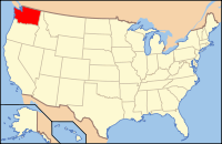
Washington's location in the U.S.Founded March 8, 1905 Seat Prosser Area
- Total
- Land
- Water
1,760 sq mi (4,558 km²)
1,703 sq mi (4,411 km²)
57 sq mi (148 km²), 3.24%Population
- (2010)
- Density
175,177
103/sq mi (39.7/km²)Website www.co.benton.wa.us Benton County is a county located in the south-central portion of the U.S. state of Washington. The Columbia River makes up the north, south, and east boundaries of the county. In 2010, its population was 175,177.[1] The county seat is Prosser, and its largest city is Kennewick. It was named after Missouri Senator Thomas Hart Benton.
Benton County was created out of Klickitat County on March 8, 1905.[2]
Contents
Geography
According to the U.S. Census Bureau, the county has a total area of 1,760 square miles (4,558.4 km2), of which 1,703 square miles (4,410.7 km2) is land and 57 square miles (147.6 km2) (3.24%) is water.
Adjacent counties
- Grant County, Washington - north
- Franklin County, Washington - northeast
- Walla Walla County, Washington - east
- Umatilla County, Oregon - south/southeast
- Morrow County, Oregon - south/southwest
- Klickitat County, Washington - west/southwest
- Yakima County, Washington - west
National protected area
- Hanford Reach National Monument (part)
- Saddle Mountain National Wildlife Refuge (part)
- Umatilla National Wildlife Refuge (part)
Wineries
The area of south-central Washington occupied by Benton County has been known primarily as an agricultural hub since its settlement by white Americans. The rise of viticulture has had a profound impact on the agricultural and tourism industries over the past two decades, and has in many ways reshaped the reputation of the region. Prominent wineries and tasting rooms located in the area include but are not limited to:
Tri-Cities tasting rooms
- Badger Mountain (organic) Vineyard, Kennewick
- Bernard Griffin Winery, Richland
- Bookwalter Winery, Richland
- Goose Ridge Vineyards, Richland
- Powers Winery, Kennewick
- Tagaris Winery and Taverna, Richland
Red Mountain and other Benton City tasting rooms
- Buckmaster Cellers, Benton City
- Hedges Cellars, Benton City
- Kiona Vineyards Winery, Benton City
- Oakwood Cellars, Benton City
- Terra Blanca, Benton City
- Seth Ryan Winery, Benton City
- Tapteil Vineyard Winery, Benton City
- Cañon de Sol, Benton City
- Chandler Ranch Vineyards Estate Winery, Benton City
- Sandhill Winery, Benton City
Prosser and other tasting rooms
- Alexandria Nicole Cellars, Prosser
- C R Sandidge Wines, winery in Chelan, tasting room in Prosser
- Chateau Champoux, Prosser
- Chinook Wines, Prosser
- Columbia Crest Winery, Paterson
- Cowan Vineyards, Prosser
- Coyote Canyon Winery, Prosser
- Desert Wind Vineyard, Prosser
- Eaton Hill Winery
- Fox Estate Winery, Mattawa
- Frenchman Hills Vineyard
- Hinzerling Winery and Vintner's Inn, Prosser
- Hogue Cellars Winery, Prosser
- Kestrel Winery, Prosser
- Sleeping Dog Wines, Benton City
- Snipes Gap Vineyards, Prosser
- Snoqualmie Vineyards, Prosser
- Thurston Wolfe Winery, Prosser
Geographic features
Sites of interest
- Hanford Nuclear Reservation
- Toyota Center
- Columbia Center Mall
- Columbia Park, Kennewick
Major highways
 Interstate 82
 Interstate 182
 U.S. Route 12
 U.S. Route 395
 Washington State Route 14
 Washington State Route 240
Demographics
Historical populations Census Pop. %± 1910 7,937 — 1920 10,903 37.4% 1930 10,952 0.4% 1940 12,053 10.1% 1950 51,370 326.2% 1960 62,070 20.8% 1970 67,540 8.8% 1980 109,444 62.0% 1990 112,560 2.8% 2000 142,475 26.6% 2010 175,177 23.0% As of the census[3] of 2000, there were 142,475 people, 52,866 households, and 38,063 families residing in the county. The population density was 84 people per square mile (32/km²). There were 55,963 housing units at an average density of 33 per square mile (13/km²). The racial makeup of the county was 86.25% White, 0.93% Black or African American, 0.82% Native American, 2.20% Asian, 0.11% Pacific Islander, 7.01% from other races, and 2.69% from two or more races. 12.50% of the population were Hispanic or Latino of any race. 18.1% were of German, 11.0% English, 9.1% United States or American and 8.4% Irish ancestry according to Census 2000. 86.4% spoke English and 10.3% Spanish as their first language.
There were 52,866 households out of which 38.20% had children under the age of 18 living with them, 57.60% were married couples living together, 10.20% had a female householder with no husband present, and 28.00% were non-families. 23.20% of all households were made up of individuals and 7.70% had someone living alone who was 65 years of age or older. The average household size was 2.68 and the average family size was 3.17.
In the county, the population was spread out with 29.70% under the age of 18, 8.60% from 18 to 24, 28.50% from 25 to 44, 22.90% from 45 to 64, and 10.30% who were 65 years of age or older. The median age was 34 years. For every 100 females there were 98.70 males. For every 100 females age 18 and over, there were 96.30 males.
The median income for a household in the county was $47,044, and the median income for a family was $54,146. Males had a median income of $45,556 versus $27,232 for females. The per capita income for the county was $21,301. About 7.80% of families and 10.30% of the population were below the poverty line, including 14.30% of those under age 18 and 6.90% of those age 65 or over.
Census-recognized communities
Benton County 
- Benton City (3,145)
- Finley (6,012)
- Highland (3,388)
- Kennewick (74,665)
- Prosser (5,780)
- Richland (49,090)
- West Richland (12,200)
Other communities
Ghost Towns
- Hanford (ghost town)
- White Bluffs (ghost town)
See also
References
- ^ "U.S. Census Bureau Delivers Washington's 2010 Census Population Totals, Including First Look at Race and Hispanic Origin Data for Legislative Redistricting" (.xls). U.S. Census Bureau. 2011-02-23. http://www.census.gov/newsroom/releases/archives/2010_census/cb11-cn45.html. Retrieved 2011-03-27.
- ^ "Milestones for Washington State History — Part 3: 1901 to 1950". HistoryLink.org. 2003-03-06. http://www.historylink.org/essays/output.cfm?file_id=5381.
- ^ "American FactFinder". United States Census Bureau. http://factfinder.census.gov. Retrieved 2008-01-31.
Further reading
- Lyman, William Denison (1919). History of the Yakima Valley, Washington : comprising Yakima, Kittitas, and Benton counties. S.J. Clarke.Available online through the Washington State Library's Classics in Washington History collection
External links

Grant County Franklin County Yakima County 
Walla Walla County  Benton County, Washington

Klickitat County Morrow County, Oregon Umatilla County, Oregon Municipalities and communities of Benton County, Washington Cities Benton City | Kennewick | Prosser | Richland | West Richland

CDPs Unincorporated
communitiesKiona | Hanford | Paterson | Plymouth | White Bluffs | Whitstran
Categories:- Washington (state) counties
- Benton County, Washington
- States and territories established in 1905
- Tri-Cities, Washington


Wikimedia Foundation. 2010.