- Klausen, South Tyrol
-
For Klausen in Rhineland- Palatinate, see Klausen, Germany.
Klausen — Comune — Gemeinde Klausen
Comune di Chiusa
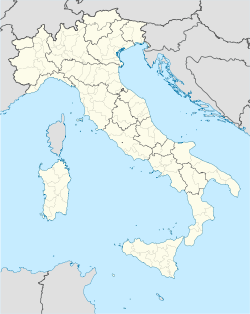
Coat of armsLocation of Klausen in Italy Coordinates: 46°38′N 11°34′E / 46.633°N 11.567°ECoordinates: 46°38′N 11°34′E / 46.633°N 11.567°E Country Italy Region Trentino-Alto Adige/Südtirol Province South Tyrol (BZ) Frazioni Gufidaun (Gudon), Latzfons (Lazfons), Verdings (Verdignes) Government - Mayor Maria-Anna Gasser Fink Area - Total 51.4 km2 (19.8 sq mi) Elevation 523 m (1,716 ft) Population (Nov. 2010) - Total 5,144 - Density 100.1/km2 (259.2/sq mi) Demonym German:Klausner
Italian: chiusaniTime zone CET (UTC+1) - Summer (DST) CEST (UTC+2) Postal code 39043 Dialing code 0472 Website Official website Klausen (Italian: Chiusa; Ladin: Tluses or Tlüses) is a comune (municipality) in South Tyrol in the Italian region Trentino-Alto Adige/Südtirol, located about 70 km northeast of the city of Trento and about 20 km northeast of the city of Bolzano.
As of 30 November 2010, it had a population of 5,144 and an area of 51.4 km².[1]
The municipality of Klausen contains the frazioni (subdivisions, mainly villages and hamlets) Gufidaun (Gudon), Latzfons (Lazfons), and Verdings (Verdignes).
Klausen borders the following municipalities: Feldthurns, Lajen, Sarntal, Vahrn, Villanders and Villnöß.
Contents
History
Coat-of-arms
The emblem represents an argent dexter key on gules. The emblem was used as a seal from 1448, known from 1397 and granted in 1540 by Cardinal Bernhard von Cles Bishop of Brixen.[2]
Society
Linguistic distribution
According to the 2001 census, 91.11% of the population speak German, 8.29% Italian and 0.60% Ladin as first language.[3]
Demographic evolution

References
- ^ All demographics and other statistics: Italian statistical institute Istat.
- ^ Heraldry of the World: Klausen
- ^ Oscar Benvenuto (ed.): "South Tyrol in Figures 2008", Provincial Statistics Institute of the Autonomous Province of South Tyrol, Bozen/Bolzano 2007, p. 16, table 10
External links
- (German) (Italian) Homepage of the municipality
Categories:
Wikimedia Foundation. 2010.


