- Tiers, South Tyrol
-
Tiers — Comune — Gemeinde Tiers
Comune di TiresLocation of Tiers in Italy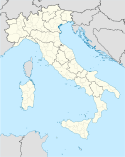
 Tiers
TiersCoordinates: 46°28′N 11°32′E / 46.467°N 11.533°ECoordinates: 46°28′N 11°32′E / 46.467°N 11.533°E Country Italy Region Trentino-Alto Adige/Südtirol Province South Tyrol (BZ) Frazioni St. Zyprian, St. Georg Government - Mayor Karl Markus Villgrattner Area - Total 42.1 km2 (16.3 sq mi) Elevation 1,028 m (3,373 ft) Population (Nov. 2010) - Total 979 - Density 23.3/km2 (60.2/sq mi) Demonym German: Tierser
Italian: tiresaniTime zone CET (UTC+1) - Summer (DST) CEST (UTC+2) Postal code 39050 Dialing code 0471 Website Official website Tiers (Italian: Tires) is a comune (municipality) in the province of South Tyrol in the Italian region Trentino-Alto Adige/Südtirol, located in the Tiersertal about about 15 km east of the city of Bolzano (Bozen).
Contents
Geography
As of November 30, 2010, it had a population of 979 and an area of 42.1 km².[1]
Tiers borders the following municipalities: Kastelruth, Karneid, Völs am Schlern, Welschnofen, Campitello di Fassa, Mazzin, and Pozza di Fassa.
History
Coat-of-arms
The emblem is formed by a bend, helmet shaped, of argent and azure on gules background. It is the insignia of Lords of Velseck who ruled the village from 1200 until 1470 for the Bishops of Brixen. The emblem was granted in 1968. [2]
Society
Linguistic distribution
According to the 2001 census, 97.40% of the population speak German, 2.35% Italian and 0.25% Ladin as first language.[3]
Demographic evolution

References
- ^ All demographics and other statistics: Italian statistical institute Istat.
- ^ Heraldry of the World: Tiers
- ^ Oscar Benvenuto (ed.): "South Tyrol in Figures 2008", Provincial Statistics Institute of the Autonomous Province of South Tyrol, Bozen/Bolzano 2007, p. 18, table 10
External links
- (German) (Italian) Homepage of the municipality
- (English) Tiers am Rosengarten
- (English) Rosengarten Latemar
Categories:


Wikimedia Foundation. 2010.