- Nasugbu, Batangas
-
Nasugbu — Municipality — Map of Batangas showing the location of Nasugbu. Location in the Philippines
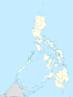
 Nasugbu
Coordinates: 14°04′N 120°38′E / 14.067°N 120.633°ECoordinates: 14°04′N 120°38′E / 14.067°N 120.633°E Country  Philippines
Region CALABARZON (Region IV) Province Batangas District 1st District Founded January 31, 1947 Barangays 43 Government - Mayor Hon. Antonio Barcelon (LAKAS-CMD) Area - Total 278.51 km2 (107.5 sq mi) Population (2007) - Total 113,926 - Density 409.1/km2 (1,059.4/sq mi) Time zone PST (UTC+8) ZIP code 4231 Income class 1st class Website Official website N
120°35'56 (120.5988) EPopulation Census of Nasugbu Census Pop. Rate 1995 83,874 — 2000 96,113 2.97% 2007 113,926 2.37% Nasugbu is a 1st class municipality in the province of Batangas, Philippines. According to the latest census, it has a population of 113,926 people in 19,615 households.
Several bus services provide transportation to and from Nasugbu. Jeepneys from Tagaytay City also enter and leave the town at a scheduled time. Within the town, tricycles are the main mode of transport.
The local government is pushing for the cityhood of the town, which would pave the way to make it more industrialised and developed.
Contents
Name
According to legend, a group of Spanish soldiers was allowed by their commander to go on a sightseeing tour of the friendlier villages on the western coast of Batangas. The group came upon a native couple cooking rice in a palayok (clay pot), the lid of which rattled over the steaming rice. In Spanish, the group leader asked the woman: "¿Cómo se llama este pueblo?" ("What is this place called?") The woman, who knew no Spanish, thought that the stranger was asking about her pot of rice. "Nasubo na po iyan, eh, kaya ganyan" ("The rice is boiling; that is why it is like that,") she replied. The Spaniard repeated the word "nasubo" and nodding his head towards his companions, introduced the word to them. The village henceforth began to be called by that name. Although no historical documents can support this legend, it is the most common story one hears when asking how the town got its name.
Demographics

Most of the people in Nasugbu are Tagalogs. In recent years, there's been a noticeable increase of Visayans in Barangay Wawa and other barangays. The main language spoken is Tagalog, and a significant number now speaks Cebuano. Due to the historic relevance of the town, a small number of families speak Spanish. Many among the educated class speak English.
A great majority of Nasugbugueños are Catholics. Although there is a legislated separation of church and state in the Philippines, the town fiesta on December 3 is a holiday. Nasugbu is also one of the most important centres of the Roman Catholic Church in the Archdiocese of Lipa. Though officially called Vicariate I, it is sometimes called the Vicariate of San Francisco Xavier in honour of the town's patron saint. Some barangays have their own respective patron saints and celebrate a feast day other than that of St. Francis Xavier's. It is to be noted that San Lorenzo Ruiz is now also a patron saint of Nasugbu. The minority belong to other minor religions like the indigenous Iglesia ni Cristo, The Church of Jesus Christ of Latter-day Saints and Born Again denominations.
Geography
Topography
Located at 14:05:51N (14.0975) latitude and 120:35:56E (120.5988) longitude. Nasugbu is bounded on the north by the municipalities of Maragondon, Magallanes and Alfonso in the province of Cavite; on the east by the Batangas municipalities of Laurel, Calaca and Balayan; on the south by the Batangas municipalities of Lian and Tuy; and on the west by the South China Sea. It is the largest town in Western Batangas with a land area of 276.33 km².
Entering the town proper via the national highway, one passes fields of sugar cane, corn and rice fields, hills and mountains. The terrain slopes downwards to the South China Sea. Because of its rolling terrain and coastline location, agriculture (sugarcane, rice, corn, vegetables, coconut, fruits) and aquaculture are Nasugbu's main industries.
Travel distance from Metro Manila is about 102 kilometers via Tagaytay City. From Batangas City (the provincial capitol), its distance covers about 70 kilometers.
Barangays
 The Municipal Hall of Nasugbu, Batangas.
Nasugbu is politically subdivided into 43 barangays. The 12 barangays located in the poblacion are classified as urban, and the rest are classified as rural.
- Aga
- Balaytigui
- Banilad
- Barangay 1 (Pob.)
- Barangay 2 (Pob.)
- Barangay 3 (Pob.)
- Barangay 4 (Pob.)
- Barangay 5 (Pob.)
- Barangay 6 (Pob.)
- Barangay 7 (Pob.)
- Barangay 8 (Pob.)
- Barangay 9 (Pob.)
- Barangay 10 (Pob.)
- Barangay 11 (Pob.)
- Barangay 12 (Pob.)
- Bilaran
- Bucana
- Bulihan
- Bunducan
- Butucan
- Calo
- Calayo
- Catandaan
- Kaylaway
- Kayrilaw
- Cogunan
- Dayap
- Latag
- Looc
- Lumbangan
- Malapad Na Bato
- Mataas Na Pulo
- Maugat
- Munting Indang
- Natipuan
- Pantalan
- Papaya
- Putat
- Reparo
- Talangan
- Tumalim
- Utod
- Wawa
Climate
The climate of Nasugbu falls under the first type of classification, Type I, characterized by two pronounced seasons: Dry season from November to April and wet season for the rest of the year. The annual average temperature in the municipality is 27.3 degrees Celsius. January is the coolest month having an average temperature of 25.8 degrees Celsius, while April is the warmest month registering an average temperature of 29 degrees Celsius.
Economy
 An example of the locomotive used by the Central Azucarera Don Pedro during their early days. CADP is one of the largest sugar mills in the Philippines's
By virtue of Presidential Decree 1520, former dictator Ferdinand Marcos declared some areas of the municipality as a potential tourism area. Thenceforth Nasugbu had a tourism industry known primarily for its beaches. Before Boracay and other places became fashionable, Nasugbu was one of the traditional destinations tourists headed during Holy Week and other holidays. Its proximity to Manila still makes it a popular and practical choice.
Some economic highlights are the development of Nasugbu's agro-industrial industry (feed mills, meat processing and poultry-growing) by building more farm-to-market roads. The loal government is encouraging investors, particularly computer companies, to build a technological park. Aside from the technopark, there are plans to develop the Wawa fishing port as an ecotourism center, which would be patterned after Pier 39 in San Francisco.
While the government wants to turn Nasugbu into a viable investment area, they also wish to preserve the town's natural environment. Hiking in the mountains and virgin forests around Nasugbu is popular. One particular spot, Karakawa, is a series of multi-tiered naturally-formed rock pools hewn out of the mountain. The smallest pool is about the size of a jacuzzi while the biggest measures about 25 square meters. The pools are more than 6 meters deep, and one can catch fish in the pools.
At the moment, because of its rolling terrain and coastline location, agriculture (sugarcane, rice, corn, vegetables, coconut, fruits) and aquaculture are Nasugbu’s main industries. It is home to the Central Azucarera Don Pedro, one of the country's largest sugar producers.
Being home to one of the largest sugar milling companies of the country, the production of sweets is a significant portion of the local economy. Nasugbu is the only town in Luzon which hosts a bibingkahan (rice cake area) in its public market. There are at least 10 kinds of rice cakes that are found only in Nasugbu, in addition to the varieties that could be found elsewhere in the country. Many Nasugbugueños, even those who do not do much cooking, take pride in making a variety of sweets such as sweetened yam, sweetened coconut and similar products.
Education and Culture
The primary place for tertiary higher learning is the Western part of Batangas.
Nasugbu West Central School is the largest elementary school in the Southern Tagalog region. Other elementary schools in the town proper include Lourderette School, Pedagogia, St. Paul's and Creative Dreams School. Most barrios (or barangays, as they are now called) have their own grade schools, and some in recent years also have high schools, as in Bilaran and Kaylaway.
Nasugbu Institute, founded in 1932, is a private high school that has prided itself in producing some of the town's more successful natives. Nasugbu also hosts the high school campus of the|Batangas State University], known locally as the Apolinario R. Apacible School of Fisheries (or simply "Fisheries"). It was formerly a fishery school with courses including Fish Culture, Fish Capture, and Fish Preservation, but was later attached to the Batangas State University. Presently, aside from Fishery courses, the school also offers other courses like Education and Tourism. Other relatively new high schools are Nasugbu Christian Faith Academy and the RB Cordero Academy.
Despite improvements of the town's education system, the proximity to Manila makes well-off families send their children to the metropolis for college.
The town is home to the Nasugbu Auditorium, where many cultural activities regularly are held. It is the town's primary theatre and showcases not only plays but also concerts of popular artists and bands.
Cultural and Historical Significance
 St. Francis Xavier and St. Lorenzo Ruiz, the two patrons of the Town.
Nasugbu has always been a humble town with no historical document recounting its foundation. The earliest written date to the founding by the Jesuits of the Parish of St. Francis Xavier in 1852.
It never became a commercial centre since the town of Balayan was just very near, and the Chinese had long established it as a trade route. Neither did it become a religious centre like Lipa nor a centre of governance like Tanauan. Little was written about the area until the time of the revolution.
The first historical account about this humble town was when a native tribesman, known only as Matienza, led his fellow Nasugbugueños, together with some natives from the nearby Lian, in revolt against a large land grant to the Roxases. However, victory was not on their side. This happened in the end of the 19th century.
Nasugbu was not as much irrigated as the fields of nearby towns, making it one of the towns that suffered much when the town of Lipa was besieged on 18 June 1896. Ten days later the effects for the people of Nasugbu were so dire that the Gobernadorcillo authorised taking P1000 from the treasury of Lipa to provide a rice subsidy for the Nasugbugueños.
When the revolution officially started in Batangas in September 1896, an organised revolt also broke out in the town of Nasugbu, together with the towns of Balayan, Lian, Talisay and Lemery seven weeks later. The Revolt of Nasugbu was led by Luciano San Miguel and was one of the largest revolts in the province. However, on 12 December 1896, San Miguel unknowingly led his men into a trap, and Nasugbu suffered the greatest number of casualties in the revolution.
In September 1898, the town of Cawit (Cavite) officially declared independence from Spanish rule. This made the life of the Caviteños more tumultuous than before. Due to this, the people of the nearby town of Alfonso invaded the Roxas estate and started to harass the tenants there. Although the municipal officials of Nasugbu responded quickly and complained to their counterparts in Cavite, the citizens were already defying authority.
During times of war, Batangas was administered by the Governor General and the right of habeas corpus was suspended, resulting in more casualties.
Archeological Significance
The Nasugbu Cow
The Dark Age of Nasugbu was compensated by a great archaeological discovery. According to the National Museum of the Philippines, a group of scientists found a wooden cow a year before the Second World War. Knowing that it was of great significance to the history of the country, the cow was immediately handed over the National Museum, but it did not survive the destruction of the war. However, a year after the war, a new archaeological artifact was excavated in the nearby town of Calatagan, which in turn became the most important prehistoric artifact of the country.
The San Diego Ship Wreck
Nasugbu's greatest contribution to the archaeological world is the San Diego Ship Wreck, discovered by a group of scientists in 1991 with the cooperation of the governments of France, the United States and the Philippines.
In his book, Los Succesos de las Islas Filipinas, Fr. Antonio de Morga wrote that being the Admiral of the Islands, he tried to defend the country from Dutch soldiers, who was then under the leadership of Admiral Oliver Van Noort. but since de Morga had very little experience in warfare, he led the San Diego to sink somewhere south of Manila Bay. It was the first ever recorded battle between two European powers in Asian waters.
This eventful sinking of the San Diego happened at the dawn of 14 December 1600. Although the fight resulted in a draw, the news of the sinking reached every main city of the Old World. According to the chronicles, the ship contained so much food and battle gear that there was no room for people that would operate them.
De Morga, however, failed to give the exact location of the wreck. The ship remained sunk in Nasugbu waters for almost 500 years until its 1991 discovery. To date, it remains the country's most important submarine archaeological finding. From it, the National Museum of the Filipino People was able to collect about 5000 artifacts representing a time capsule of Asia, Europe and the Americas.
The artifacts include Asian jars and ceramics from Vietnam and China, weaponry from Japan (like sabres) and Portugal (like cannons and gilded articles believed to come from Iberoamerica. According also to the National Museum, the wreckage contained some of the world's best preserved astrolabes.
The artifacts were also exhibited in France in 1995 and Germany in 1996, returning to Manila for the celebration of the centennial of Philippine independence in 1998. Today, the San Diego collection remains the most extensive collection in the National Museum, occupying a large portion of the building's first floor and the whole second floor.
Nasugbu is the site of the first recorded naval battle between European troops in Southeast Asia — at Fortune Island to the west of the town.
The Nasugbu Landing
While the foundation date of the municipality is listed as 31 January, this is mainly a celebration of the foundation of modern Nasugbu, since the town existed long before the Second World War. It is presumed that the town was created by the same Royal Edict that created the province of Batangas and defined its composition and boundaries.
The Municipal Government chose 31 January as the town's foundation date to commemorate the date when the Americans landed on its shores after the famous Leyte Landing. This landing marked the beginning of the liberation of the island of Luzon from the Japanese occupation.
Prelude to the Landing [1]
January 17, 1945 was an auspicious day. That day, three American officers, one a captain and two lieutenants, of the U.S. Eighth Army HQ appeared at the First Battalion Hunters Regiment in Balaytigue. They came by PT boat, known then as the fastest in the world, with Lt. Domingo Angeles, battalion G2, who introduced the Americans to Maj. Calixto Gasilao, the battalion CO.
The American officers had a crucial mission, the end goal of which was first kept secret from Gasilao. One could only guess that it had something to do with the planned landing operations in Southern Luzon, and that there was a need to measure the varying depths of the waters of Nasugbu Bay. Specifically, they wanted to gather information on the enemy forces, especially their radar positioning, searchlight installations and other shore fortifications. The American officers came in person because it was dangerous to convey all this via radio communications.
The captain, John Richmond, told Maj. Gasilao that they had only 24 hours to beat, and must return to Abra de Ilog off the northeastern coast of Mindoro, in twenty-four hours. So he asked the guerrilla major to assign at least two of his officers to do the job. Maj. Gasilao agreed to designate two of what he referred to as the best intelligence officers in his battalion, Lt. Romeo Gatan, assistant S2, and Lt. Domingo Angeles. Gatan was assigned to explore the shore line, and Angeles was sent out to find out the depth and bottom of the ocean including it surface contours.
The Lt. Angeles Mission
Lt. Domingo de Leon Angeles,[2] together with two home guards, set out to the sea at dawn. His flimsy banca was loaded with fishing gear as camouflage to a daring mission of gathering information for the U.S. 8th Army. He had with him several pieces of rattan of similar dimensions for use in measuring the depths of Nasugbu Bay.
But as the sun rose, the morning fog that had been Heaven-sent was swiftly blown away and as the Japanese patrol boat in the area noticed the banca soon gave warning shots. At the sound of the gunshots, Angeles's two companions darted out of the banca and escaped. Angeles was left alone, and also thought of escaping but it was too late.
While about four Japanese patrolmen chase after the two escapees, the rest rounded up Angeles and interrogated him. Insisting that he's just a simple fisherman which the Japanese didn't believe, Angeles was slapped across the mouth and kicked several times, and then brought to the Japanese Naval Commander at San Diego Point.
There he was continuously interrogated and tortured, and was forced to admit that he was doing espionage activity, which he denied until he passed out. Coming to his senses later, he found himself soaked in water. He was grilled again until he almost lost his senses again, but he never wavered and stuck to his original claim that he was a fisherman.
Wanting to prove if he was telling the truth, the Japanese brought him to the barrio of Bucana, where he said he lived at that time. Bucana used to be a marshy area very close to the river flowing onto Nasugbu Bay.
Angeles could speak some Japanese, which he learned being a POW (Bataan Death March). He became a construction foreman for some major installations and infrastructure that the Japanese Occupation Forces wanted to build on Corregidor after its fall (the Japanese used both American and Filipino POWs to build them).
The knowledge of some basic Japanese somehow helped since the Japanese guards accompanying him to Bucana were rather kinder to him. He was so thirsty and asked the guards if he could get a drink up the first house that they reached in the village. They allowed him to do so, and one of the guards left his rifle with the other and went up the house with Angeles.
As Angeles finished his glass of water, he went to the old houseowner and before the old man was able to get hold of the glass, Angeles jumped out of the window and ran as fast as hell through the thicket behind the house on to the marshland and mangroves that fill the area, all the time dodging the salvo of bullets fired by the Japanese guards. After running some distance away, he hid under the marshes breathless until dusk fell. He then cautiously pulled off a miraculous flight back to the battalion command post on the evening of January 18, 1945.
Angeles learned then that in the same breath, Romeo Gatan was also captured and pounded into a pulp by the Japanese but also made it back to the command post.
Oblivious of their pains from torture extracted by the Japanese and from extreme fatigue, Angeles and Gatan immediately engaged in writing up their respective reports composed of sketches and detailed maps. Before midnight of January 18, the American officers boarded their PT boat back to the U.S. Eighth Army HQ.
Lt. Col. Henry J. Muller, G2 of the 11th Airborne Division, declared later on the accuracy of the reports by the Hunters ROTC Guerrilas (where Angeles and Gatan belonged) in the zoning in Nasugbu Bay, and on the firepower of the Japanese enemy on the shore.
The mission of these daring men was to be one of the deciding factors in the ability of the American forces to successfully land in Nasugbu, and start ousting the Japanese Occupation forces from Southern Luzon towards liberating the country from the horrors of WWII.
Special tourism zone
On August 3, 2007, by Executive Order 647, President Gloria Macapagal-Arroyo declared Nasugbu, famous for its white sand beach resorts, a special tourism zone, mandating the formation of a private sector-led "Nasugbu eminent persons group" to oversee development. The Nasugbu Special Tourism Zone will cover areas included in the Nasugbu Tourism Development Plan prepared by the municipal government and validated by the Philippine Tourism Authority (PTA). SM Investments Corp. (SMIC) plans to construct a 59 km² resort, the Hamilo Coast, at the NSTZ. Within the property is Mt. Pico de Loro, a national park. SMIC will also establish a ferry service from the Manila Bay terminal of the SM Central Business Park in the Mall of Asia to Hamilo Coast, due to be operational by 2008.[3]
Current officials as of 2007 elections
- Mayor: Antonio A. Barcelon
- Vice-Mayor: Apolo Villafania
References
- ^ "The Indomitable", Hunters ROTC Association, 1972. Vidal Brigoli Armamento.
- ^ Personal witnessing and accounts of the late Domingo De Leon Angeles of Ternate, Cavite and his adopted town of Nasugbu, who died on April 6, 2009.
- ^ Inquirer.net, Arroyo declares Nasugbu a special tourism zone
External links
- Official Nasugbu web site
- BSU-ARASOF Official Website
- Nasugbu Schools
- Philippine Standard Geographic Code
- 1995 Philippine Census Information
- 2000 Philippine Census Information
- 2007 Philippine Census Information

South China Sea Ternate, Cavite Maragondon, Cavite South China Sea 
Magallanes, Cavite  Nasugbu, Batangas

Lian, Batangas Tuy, Batangas
Balayan, BatangasCalaca, Batangas
Laurel, BatangasMunicipalities Agoncillo • Alitagtag • Balayan • Balete • Bauan • Calaca • Calatagan • Cuenca • Ibaan • Laurel • Lemery • Lian • Lobo • Mabini • Malvar • Mataas na Kahoy • Nasugbu • Padre Garcia • Rosario • San Jose • San Juan • San Luis • San Nicolas • San Pascual • Santa Teresita • Santo Tomas • Taal • Talisay • Taysan • Tingloy • TuyComponent cities Categories:- Municipalities of Batangas


Wikimedia Foundation. 2010.