- Beckley, West Virginia
-
City of Beckley, West Virginia — City — Main Street in downtown Beckley in 2007.
Motto: The Gateway to Southern West Virginia Location of Beckley, West Virginia
Coordinates: 37°46′47″N 81°10′59″W / 37.77972°N 81.18306°WCoordinates: 37°46′47″N 81°10′59″W / 37.77972°N 81.18306°W Country United States State West Virginia County Raleigh Government – Mayor Emmett Pugh (D) Area – Total 9.2 sq mi (23.8 km2) – Land 9.2 sq mi (23.8 km2) – Water 0.0 sq mi (0.0 km2) Elevation 2,421 ft (738 m) Population (2010) – Total 17,614 – Density 1,856.1/sq mi (740.1/km2) Time zone Eastern (EST) (UTC-5) – Summer (DST) EDT (UTC-4) ZIP codes 25801, 25802, 25926 Area code(s) 304 and 681 FIPS code 54-05332[1] GNIS feature ID 1553831[2] Website http://www.beckley.org/ Beckley is a city in Raleigh County, West Virginia, United States, which was founded on April 4, 1838. The 2008 population was estimated to be 16,832 by the U.S. Census Bureau.[3] Early in its history, the town was known as Beckleyville and Raleigh Court House. The city is sometimes called the "Smokeless Coal Capital", "The City of Champions" and the "Gateway To Southern West Virginia." The population of the Beckley area is roughly 77,000 including Raleigh County and parts of Fayette County. It is the county seat of Raleigh County.[4] Beckley was named in honor of John James Beckley, who was the first Clerk of the House of Representatives and the first Librarian of Congress. It was founded by his son Alfred Beckley (US Army general and Confederate militia commander, born in Washington, D.C.). The current mayor (2007) is Emmett S. Pugh, III.
Beckley is well known for two major tourist attractions: The Beckley Exhibition Coal Mine (which reopened to the public April 1, 2008, after being closed for renovation) and Tamarack. The Exhibition Coal Mine is a preserved coal mine that offers daily tours and a history lesson on coal mining in Appalachia. Tamarack, originally built at a cost of $10 Million and dedicated to former Governor Gaston Caperton, is the home to many artisan crafts from around West Virginia and a dining area featuring meals prepared by chefs trained at The Greenbrier, a world famous four-star resort complex located in White Sulphur Springs.
Beckley has been the subject of intense growth along Eisenhower Drive. This growth has led to increasing traffic problems which the city is attempting to alleviate by building the "Z" way, which would bypass major congestion. The amount of growth the city has experienced has also led to Beckley/Raleigh County considering the formation of a Metro Government which could potentially reduce government operation overhead. The city is the regional hub for over 200,000 Southern West Virginia residents. It is the eighth largest city in West Virginia, succeeded by Fairmont and followed by Martinsburg.
Contents
Geography and climate
Beckley is located at 37°46′47″N 81°10′59″W / 37.779764°N 81.183193°W (37.779764, -81.183193).[5]
According to the United States Census Bureau, the city has a total area of 9.2 square miles (23.8 km2), all of it land.
Due to Beckley's geographical location in the higher elevations, the city is dominated by a Humid continental climate, with very warm summers and cold, snowy winters.
Monthly Normal and Record High and Low Temperatures Month Jan Feb Mar Apr May Jun Jul Aug Sep Oct Nov Dec Rec High °F 73 74 81 86 89 90 94 96 92 81 79 73 Norm High °F 38.8 42.8 51.9 62.5 70.6 77 80.2 78.9 72.6 63.1 52.4 43.1 Norm Low °F 22.1 24.9 32.4 40.6 49.2 57 61.1 59.8 53.5 42.4 34.4 26.5 Rec Low °F -22 -16 -5 11 23 32 41 36 30 18 4 -18 Precip (in) 3.23 2.96 3.63 3.43 4.39 3.92 4.78 3.45 3.23 2.64 2.88 3.09 Source: USTravelWeather.com [1] Demographics
Historical populations Census Pop. %± 1950 19,397 — 1960 18,642 −3.9% 1970 19,884 6.7% 1980 20,492 3.1% 1990 18,274 −10.8% 2000 17,254 −5.6% 2010 17,614 2.1%  Location of the Beckley-Oak Hill CSA and its components:
 Beckley Micropolitan Statistical AreaOak Hill Micropolitan Statistical Area
As of the census of 2000, there were 17,254 people, 7,651 households, and 4,590 families residing in the city.[1] The population density was 1,874.9 people per square mile (724.1/km2). There were 8,731 housing units at an average density of 948.8 per square mile (366.4/km2). The racial makeup of the city was 73.64% White, 22.89% African American, 0.14% Native American, 1.89% Asian, 0.02% Pacific Islander, 0.21% from other races, and 1.22% from two or more races. Hispanic or Latino of any race were 0.74% of the population.
There were 7,651 households out of which 25.1% had children under the age of 18 living with them, 40.9% were married couples living together, 16.2% had a female householder with no husband present, and 40.0% were non-families. 35.6% of all households were made up of individuals and 16.5% had someone living alone who was 65 years of age or older. The average household size was 2.18 and the average family size was 2.83.
In the city the population was spread out with 21.8% under the age of 18, 8.3% from 18 to 24, 25.3% from 25 to 44, 24.4% from 45 to 64, and 20.2% who were 65 years of age or older. The median age was 42 years. For every 100 females there were 82.0 males. For every 100 females age 18 and over, there were 77.1 males.
The median income for a household in the city was $28,122, and the median income for a family was $38,110. Males had a median income of $35,780 versus $23,239 for females. The per capita income for the city was $18,912. About 16.4% of families and 20.9% of the population were below the poverty line, including 33.9% of those under age 18 and 9.5% of those age 65 or over.
Education
Two universities are located in Beckley: Mountain State University and a branch campus of Concord University. Also located in Beckley is New River Community and Technical College. The nonprofit, nondenominational Appalachian Bible College[6] is located just outside the city limits, in nearby Bradley.
Transportation
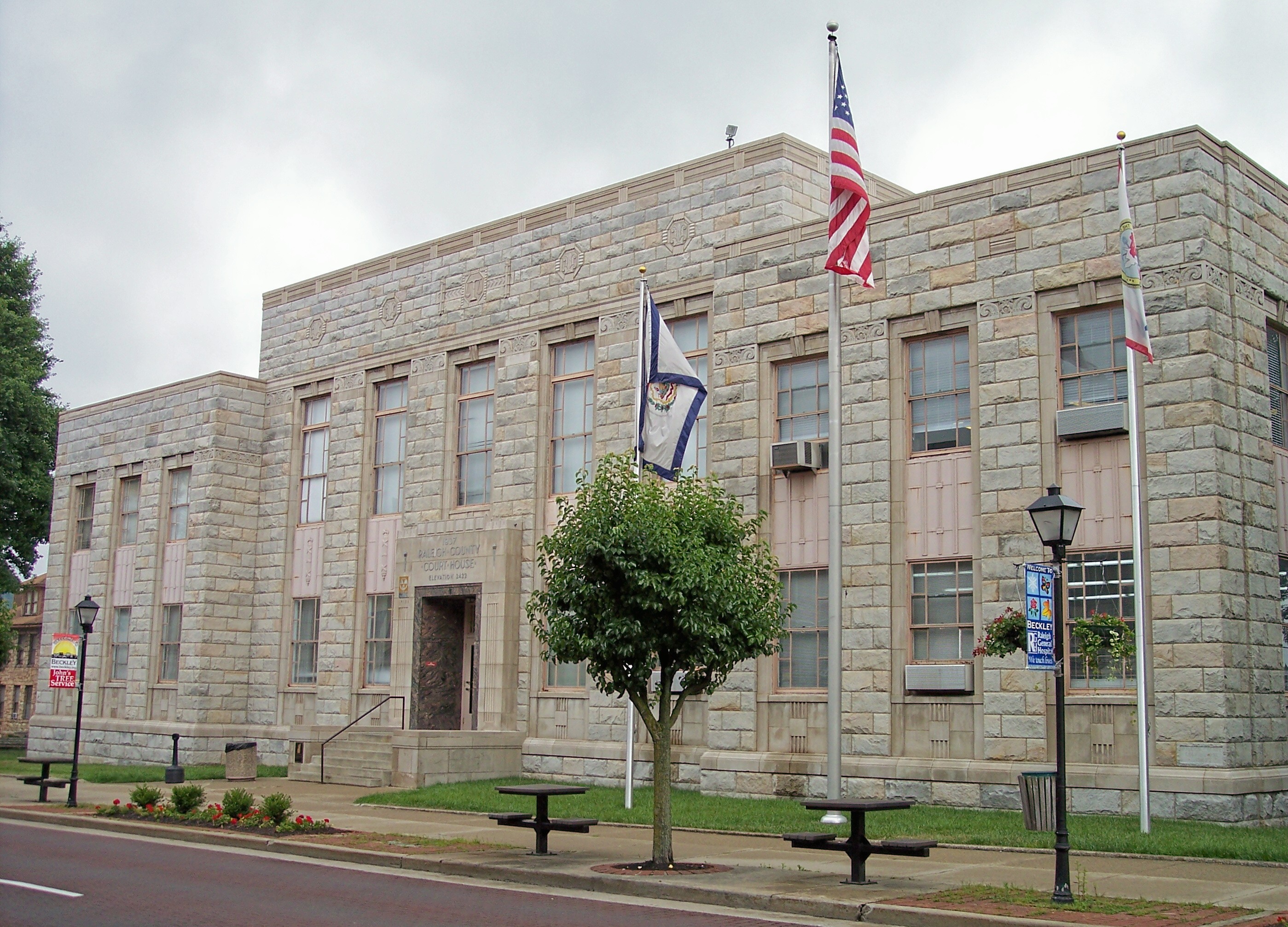
 The Raleigh County Courthouse in Beckley
Highways
Beckley is a major hub in Southern West Virginia. Interstates 64 and 77 form a major crossroads south of Beckley. U.S. Route 19, WV 10, WV 210, WV 3, and WV 16 also serve Beckley.
Air
Greater Beckley's only airport is Beckley Raleigh County Memorial Airport. Raleigh County Airport is served by two airlines: United Airlines with service to Washington-Dulles and Shenandoah Valley. Locair has non-stop flight service to Baltimore, Maryland. Flights to Somerset, Kentucky ended in February 2010, after a contract between the city and the airline ended.
Notable natives and residents
- Rob Ashford, choreographer.
- Tom Carper, U.S. Senator from Delaware.
- Little Jimmy Dickens, singer.
- Steve Harvey, nationally syndicated radio host and comedian
- Jim Justice, weathy businessman and owner of the Greenbrier Resort
- Jon McBride, astronaut.
- Nick Rahall, United States Representative.
- Chris Sarandon, actor.
- Calvin Simon, musician.
- Tamar Slay, professional basketball player.
- Hulett C. Smith, West Virginia governor.
- Morgan Spurlock, filmmaker.
- Bill Withers, singer.
- Joseph Goddard, professional baseball player.
- Doug Legursky, NFL player for the Pittsburgh Steelers
References
- ^ a b "American FactFinder". United States Census Bureau. http://factfinder.census.gov. Retrieved 2008-01-31.
- ^ "US Board on Geographic Names". United States Geological Survey. 2007-10-25. http://geonames.usgs.gov. Retrieved 2008-01-31.
- ^ Table 4: Annual Estimates of the Population for Incorporated Places in West Virginia, Listed Alphabetically: April 1, 2000 to July 1, 2007, U.S. Census Bureau, created 2007, retrieved 28 August 2008
- ^ "Find a County". National Association of Counties. http://www.naco.org/Counties/Pages/FindACounty.aspx. Retrieved 2011-06-07.
- ^ "US Gazetteer files: 2010, 2000, and 1990". United States Census Bureau. 2011-02-12. http://www.census.gov/geo/www/gazetteer/gazette.html. Retrieved 2011-04-23.
- ^ http://www.abc.edu
External links
- City of Beckley Website
- Beckley Local News
- Beckley Calendar of Events
- Beckley-Raleigh County Chamber of Commerce
- Beckley Register-Herald Newspaper
- History of Beckley and Raleigh County
Municipalities and communities of Raleigh County, West Virginia County seat: BeckleyCity Beckley

Towns CDPs Beaver | Bolt | Bradley | Coal City | Crab Orchard | Daniels | Eccles | Ghent | Glen White | Helen | MacArthur | Piney View | Prosperity | Shady Spring | Stanaford
Other
localitiesAbney | Abraham | Affinity | Ameagle | Amigo | Arnett | Artie | Besoco | Big Stick | Blue Jay | Blue Jay 6 | Bragg | Clear Creek | Colcord | Cool Ridge | Cranberry | Crow | Dorothy | Dry Creek | Eastgulf | Egeria‡ | Fireco | Fairdale | Glade Springs | Glen Daniel | Glen Morgan | Hollywood | Hot Coal | Hotchkiss | Jonben | Josephine | Killarney | Lanark | Lego | Lillybrook | Marfork | McVey | Mead | Midway | Montcoal | Mountview‡ | Naoma | Odd | Packsville | Pemberton | Pickshin | Price Hill‡ | Princewick | Raleigh | Rock Creek | Saxon | Shiloh | Skelton | Slab Fork | Soak Creek | Sprague | Stickney | Sullivan | Sundial | Surveyor | Tams | Terry | Ury | Whitby | White Oak | Willibet | Winding Gulf | Woodpeck
Ghost towns Pinepoca | Stotesbury
Footnotes ‡This populated place also has portions in an adjacent county or counties
Categories:- Cities in West Virginia
- Populated places in Raleigh County, West Virginia
- County seats in West Virginia
- Mining communities in West Virginia
- Micropolitan areas of West Virginia
- Populated places established in 1838


Wikimedia Foundation. 2010.