- Monongalia County, West Virginia
-
Monongalia County, West Virginia 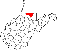
Location in the state of West Virginia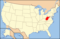
West Virginia's location in the U.S.Founded 1776 Seat Morgantown Area
- Total
- Land
- Water
366 sq mi (948 km²)
361 sq mi (935 km²)
5 sq mi (13 km²), 1.29%Population
- (2000)
- Density
81,866
228/sq mi (88/km²)Website www.co.monongalia.wv.us Monongalia County, known locally as Mon County, is a county located in the U.S. state of West Virginia. As of the 2010 census, the population was 96,189. [1] Its county seat is at Morgantown[1]. The county is included in the Morgantown, West Virginia Metropolitan Statistical Area, and is the largest county in North-Central West Virginia.
Contents
History
 Map of Ohio, Monongalia, & Yohogania Counties circa 1776. Monongalia County is in magenta.
Monongalia County takes its name from the Monongahela River. The name Monongalia may be a misspelling of Monongahela. Alternatively, the conventional Latinate ending "-ia" (designating "land of..." or "country of..." — as in Arabia, Bolivia or Columbia) may have been added to Monongahela (i.e., "Land of the Monongahela").
Monongalia County was formed in 1776 when Virginia's remote District of West Augusta was divided into three counties: Ohio, Yohogania and Monongalia, all named for their most prominent rivers. Ohio County then encompassed most of the western region of the district bordering the Ohio River, including parts of what is now southwestern Pennsylvania. Yohogania County consisted of much of what is now southwestern Pennsylvania and the present counties of Hancock and the northern part of Brooke in West Virginia. Monongalia County encompassed what are now the counties of Tucker, Randolph, Harrison and Barbour in north-central West Virginia, as well as parts of what are now Washington, Greene and Fayette Counties in Pennsylvania. In 1780, in his Notes on the State of Virginia, Thomas Jefferson gave the militia enrollment of what was then the vast Monongalia County at 1,000 troops.
Geography
According to the U.S. Census Bureau, the county has a total area of 366 square miles (948 km²), of which 361 square miles (935 km²) is land and 5 square miles (12 km²) (1.29%) is water.
Major highways
 Interstate 68
 Interstate 79
 U.S. Highway 19
 U.S. Highway 119
 West Virginia Route 7
Adjacent counties
- Greene County, Pennsylvania (north)
- Fayette County, Pennsylvania (northeast)
- Preston County (east)
- Taylor County (southeast)
- Marion County (south)
- Wetzel County (west)
Rivers, Streams, and Lakes
- Monongahela River
- Cheat River
- Decker's Creek
- Cam Harker Spring
- Cheat Lake
- Dunkard Creek
- Aarons Creek
Demographics
Historical populations Census Pop. %± 1790 4,768 — 1800 8,540 79.1% 1810 12,793 49.8% 1820 11,060 −13.5% 1830 14,056 27.1% 1840 17,368 23.6% 1850 12,387 −28.7% 1860 13,048 5.3% 1870 13,547 3.8% 1880 14,985 10.6% 1890 15,705 4.8% 1900 19,049 21.3% 1910 24,334 27.7% 1920 33,618 38.2% 1930 50,083 49.0% 1940 51,252 2.3% 1950 60,797 18.6% 1960 55,617 −8.5% 1970 63,714 14.6% 1980 75,024 17.8% 1990 75,509 0.6% 2000 81,866 8.4% As of the census[2] of 2000, there were 81,866 people, 33,446 households, and 18,495 families residing in the county. The population density was 227 people per square mile (88/km²). There were 36,695 housing units at an average density of 102 per square mile (39/km²). The racial makeup of the county was 92.22% White, 3.38% Black or African American, 0.20% Native American, 2.45% Asian, 0.04% Pacific Islander, 0.32% from other races, and 1.39% from two or more races. 1.01% of the population were Hispanic or Latino of any race.
There were 33,446 households out of which 24.20% had children under the age of 18 living with them, 43.80% were married couples living together, 8.30% had a female householder with no husband present, and 44.70% were non-families. 31.30% of all households were made up of individuals and 8.40% had someone living alone who was 65 years of age or older. The average household size was 2.28 and the average family size was 2.91.
In the county, the population was spread out with 18.20% under the age of 18, 23.40% from 18 to 24, 27.70% from 25 to 44, 20.00% from 45 to 64, and 10.70% who were 65 years of age or older. The median age was 30 years. For every 100 females there were 101.80 males. For every 100 females age 18 and over, there were 101.20 males.
The median income for a household in the county was $28,625, and the median income for a family was $43,628. Males had a median income of $33,113 versus $23,828 for females. The per capita income for the county was $17,106. About 11.30% of families and 22.80% of the population were below the poverty line, including 17.90% of those under age 18 and 8.00% of those age 65 or over.
Localities
Cities
Towns
Census-designated places
Other unincorporated communities
- Arnettsville
- Baker's Ridge
- Behler
- Bertha Hill
- Booth
- Bowlby
- Brewer Hill
- Browns Chapel
- Bula
- Canyon
- Cheat Neck
- Chestnut Ridge
- Clinton Furnace
- Core
- Crown
- Daybrook
- Dellslow
- Delmar
- Easton
- Edna
- Everettsville
- Fieldcrest
- Flaggy Meadow
- Fort Grand
- Fort Martin
- Georgetown
- Greer
- Greystone
- Gum Spring
- Hagans
- Halleck
- Harmony Grove
- Hilderbrand
- Hoard
- Hog Eye
- Holman
- Hunting Hills
- Jaco
- Jakes Run
- Jere
- Kimberly
- Klondike
- Laurel Point
- Little Falls
- Lowsville
- Macdale
- Maidsville
- Maple
- McCurdyville
- McMellin
- Miracle Run
- Mooresville
- Morgan Heights
- National
- New Hill
- Saint Cloud
- Saint Leo
- Sandy
- Smithtown
- Stewartstown
- Suncrest Lake
- Sunset Beach
- Sturgisson
- The Mileground
- Triune
- Tyrone
- Uffington
- Van Voorhis
- Wadestown
- Wana
- West Sabraton
- West Van Voorhis
- Worley
Education
The county's public schools are operated by Monongalia County Schools. The county is also home to West Virginia's largest university, West Virginia University, located in Morgantown.
See also
- National Register of Historic Places listings in Monongalia County, West Virginia
- Snake Hill Wildlife Management Area
- West Virginia University
References
Citations
- ^ "Find a County". National Association of Counties. http://www.naco.org/Counties/Pages/FindACounty.aspx. Retrieved 2011-06-07.
- ^ "American FactFinder". United States Census Bureau. http://factfinder.census.gov. Retrieved 2008-01-31.
Other sources
- Core, Earl Lemley, The Monongalia Story: A Bicentennial History, Vol. I: Prelude (1974), [[Parsons, West Virginia|Co.
- Core, Earl Lemley, The Monongalia Story: A Bicentennial History, Vol. V: Sophistication (1984), Parsons, W.Va.: McClain Printing Co.

Greene County, Pennsylvania Fayette County, Pennsylvania Wetzel County 
Preston County  Monongalia County, West Virginia

Marion County Taylor County External links
Municipalities and communities of Monongalia County, West Virginia Cities 
Towns CDPs Other
localitiesArnettsville | Baker Ridge | Behler | Bertha Hill | Booth | Bowlby | Browns Chapel | Bula | Canyon | Cheat Neck | Chestnut Ridge | Clinton Furnace | Core | Crossroads | Crown | Daybrook | Dellslow | Delmar | Easton | Edna | Everettsville | Fieldcrest | Flaggy Meadow | Fort Grand | Fort Martin | Georgetown | Greer | Greystone | Gum Spring | Hagans | Halleck | Harmony Grove | Hilderbrand | Hoard | Hog Eye | Holman | Hunting Hills | Jaco | Jakes Run | Jere | Kimberly | Klondike | Laurel Point | Little Falls | Lowsville | Macdale | Maidsville | Maple | McCurdyville | McMellin | Miracle Run | Mooresville | Morgan Heights | National | New Hill | Opekiska | Osage | Osgood | Pedlar | Pierpont | Pioneer Rocks | Price | Price Hill | Pursglove | Ragtown | Randall | Richard | Ridgedale | Ringgold | Rock Forge | Rosedale | Sabraton | Saint Cloud | Saint Leo | Sandy | Smithtown | Stewartstown | Suncrest Lake | Sunset Beach | Sturgisson | The Mileground | Triune | Tyrone | Uffington | Van Voorhis | Wadestown | Wana | West Sabraton | West Van Voorhis | Worley
Categories:- West Virginia counties
- Monongalia County, West Virginia
- 1776 establishments in the United States
- Morgantown metropolitan area
- Populated places established in 1776


Wikimedia Foundation. 2010.