- Chandler, Oklahoma
-
Chandler, Oklahoma — City — Location of Chandler, Oklahoma
Coordinates: 35°42′33″N 96°53′23″W / 35.70917°N 96.88972°WCoordinates: 35°42′33″N 96°53′23″W / 35.70917°N 96.88972°W Country United States State Oklahoma County Lincoln Area - Total 8.2 sq mi (21.1 km2) - Land 7.3 sq mi (18.9 km2) - Water 0.9 sq mi (2.2 km2) Elevation 942 ft (287 m) Population (2000) - Total 2,842 - Density 389.3/sq mi (150.3/km2) Time zone Central (CST) (UTC-6) - Summer (DST) CDT (UTC-5) ZIP code 74834 Area code(s) 405 FIPS code 40-13500[1] GNIS feature ID 1091199[2] Website www.chandlerok.com Chandler is a city in Lincoln County, Oklahoma, United States. The population was 2,842 at the 2000 census. It is the county seat of Lincoln County[3] and is part of the Oklahoma City Metropolitan Area.
Chandler is located east of Oklahoma City, Oklahoma on U.S. Route 66 and Interstate 44, and north of Shawnee, Oklahoma on State Highway 18.
Contents
History
Chandler was named after Judge George Chandler, a member of Congress and commissioner of the general land office in Washington, D.C. Chandler was opened by a land run on September 28, 1891. The town had been planned to be opened on September 22, (the date of the Land Run of 1891) but the site survey had not been completed. The Chandler Post Office had opened September 21, the day before the planned run. When Oklahoma county A (Lincoln County) was organized, Chandler became the county seat. On May 30, 1897, a tornado destroyed most of the fledgling town and killed 14 residents.
In 1891 the county government operated out of an office building until the original courthouse was built. The courthouse was destroyed by the tornado of 1897, and a temporary courthouse was erected on the present site. This building was removed in 1907 to make way for a stone courthouse. This third courthouse burned down on December 23, 1967 and the current courthouse was set in its place.[4]
Chandler is one of the many cities along the famous U.S. Route 66 and contains a number of attractions to devotees of "The Mother Road." These include The Route 66 Interpretive Center, The Oklahoma Law Enforcement Museum and Hall of Fame, The Lincoln County Museum of Pioneer History, several Route 66-themed murals, the newly restored old cottage-style Phillips 66 gas station, Papa's BBQ, and one of the last remaining painted barns adverting Meramec Caverns west of town.
U.S. Route 66 brought a significant amount of commercial business to Chandler - due to travelers crossing the state and the country; however when the Turner Turnpike (Interstate 44) was built, much of this business died out.
In 1958, professional baseball player Bo Belcher opened Chandler Baseball Camp.[5] For 42 years, the camp hosted campers from around the world for a bootcamp-like baseball camp during summers. The camp closed in 2000 due to the death of Tom Belcher.[6][7] In 2011 it was added to the National Register of Historic Places.[8][9]
Economy
Today, Chandler's economy is driven mostly by agriculture and livestock, as well as insurance, construction, and manufacturing. Downtown Chandler, which is located on Route 66, is home to many shops and restaurants.
Lincoln County's first Wal-Mart Supercenter opened in 2008 on the east side of Chandler.
Chandler also serves as a commuter town of sorts, with many residents working and shopping in Oklahoma City or Tulsa.
Geography
According to the United States Census Bureau, Chandler has a total area of 8.1 square miles (21 km2), of which, 7.3 square miles (19 km2) of it is land and 0.9 square miles (2.3 km2) of it (10.43%) is water.
Climate
Climate data for Chandler, Oklahoma Month Jan Feb Mar Apr May Jun Jul Aug Sep Oct Nov Dec Year Average high °F (°C) 48.6
(9.2)53.6
(12.0)63.7
(17.6)73.8
(23.2)80.2
(26.8)87.8
(31.0)94.1
(34.5)93.5
(34.2)84.7
(29.3)74.8
(23.8)62.1
(16.7)51.4
(10.8)72.4 Average low °F (°C) 25.7
(−3.5)30.3
(−0.9)39.6
(4.2)50.3
(10.2)58.1
(14.5)66.2
(19.0)70.9
(21.6)69.3
(20.7)61.9
(16.6)50.7
(10.4)39.7
(4.3)29.4
(−1.4)49.3 Precipitation inches (mm) 1.3
(33)1.9
(48)2.9
(74)3.2
(81)5.3
(135)4
(102)2.7
(69)2.6
(66)4.3
(109)3
(76)2.5
(64)1.5
(38)35.2
(894)Source no. 1: weather.com Source no. 2: Weatherbase.com[10] Demographics
As of the census[1] of 2000, there were 2,842 people, 1,146 households, and 747 families residing in the city. The population density was 389.3 people per square mile (150.3/km²). There were 1,290 housing units at an average density of 176.7 per square mile (68.2/km²). The racial makeup of the city was 79.77% White, 9.68% African American, 5.63% Native American, 0.39% Asian, 0.49% from other races, and 4.05% from two or more races. Hispanic or Latino of any race were 1.79% of the population.
There were 1,146 households out of which 31.2% had children under the age of 18 living with them, 47.1% were married couples living together, 14.0% had a female householder with no husband present, and 34.8% were non-families. 32.1% of all households were made up of individuals and 17.3% had someone living alone who was 65 years of age or older. The average household size was 2.36 and the average family size was 2.98.
In the city the population was spread out with 25.7% under the age of 18, 8.7% from 18 to 24, 25.3% from 25 to 44, 20.7% from 45 to 64, and 19.6% who were 65 years of age or older. The median age was 38 years. For every 100 females there were 89.8 males. For every 100 females age 18 and over, there were 84.0 males.
The median income for a household in the city was $26,833, and the median income for a family was $35,744. Males had a median income of $28,125 versus $19,397 for females. The per capita income for the city was $14,676. About 12.1% of families and 16.7% of the population were below the poverty line, including 20.3% of those under age 18 and 15.4% of those age 65 or over.
Recreation
Chandler is home to several city parks, a baseball complex, a municipal swimming pool, and Ripped Health and Fitness. Chandler has two lakes, Bell Cow Lake, and Chandler Lake. Bell Cow Lake, which features camping, boating, fishing, and horse trails, is located north of town, along with Chandler Golf Course. The Lincoln County Raceway, a quarter mile dirt track, is located south of Chandler.[11]
Notable residents
- The composer Roy Harris was born near Chandler
- Tom Belcher - Professional Baseball Player and owner of Chandler Baseball Camp.[12]
Sports
Chandler High School State Championships:
1986, 2005-Football State Champions 1972, 1997- Boys Basketball State Champions
1971- Boy's State Track Champions
1933- Girl's Basketball State ChampionsNational Register of Historic Places
- Boston Store
- Chandler Armory
- Chandler Baseball Camp
- Chandler Bookstore
- Chandler High School
- Clapp-Cunningham Building
- Conklin House
- Crane Motor Company Building
- First Presbyterian Church of Chandler
- Johnson House
- Mascho Building and Public Privy (Murphy Building)
- National Guard Statistical Building
- Oleson-Crane Building
- St. Cloud Hotel
- St. Stephen's Episcopal Church
- Wolcott Building
- Midlothian School
- Seaba's Filling Station
- Spring Dell School
- Marshall William M. Tilghman Homestead
References
- ^ a b "American FactFinder". United States Census Bureau. http://factfinder.census.gov. Retrieved 2008-01-31.
- ^ "US Board on Geographic Names". United States Geological Survey. 2007-10-25. http://geonames.usgs.gov. Retrieved 2008-01-31.
- ^ "Find a County". National Association of Counties. http://www.naco.org/Counties/Pages/FindACounty.aspx. Retrieved 2011-06-07.
- ^ "A Brief History of Lincoln County". http://www.rootsweb.ancestry.com/~oklincol/briefhistory.html. Retrieved 2008-07-04.
- ^ http://digital.library.okstate.edu/encyclopedia/entries/C/CH002.html
- ^ http://www.newsok.com/article/2944186
- ^ http://www.checkswing.com/forum/topics/chandler-baseball-camp-alumni
- ^ http://69.175.53.6/register/2011/May/18/2011-12128.pdf
- ^ "Oklahoma baseball camp added to National Register. The Chandler Baseball Camp is being added to the National Register of Historic Places.", The Oklahoman, October 24, 2011.
- ^ "Historical Weather for Chandler, Oklahoma, United States". http://www.weatherbase.com/weather/weatherall.php3?s=486143&refer=.
- ^ http://web.archive.org/web/20091027030035/http://geocities.com/lcraceway/
- ^ http://www.baseball-reference.com/minors/player.cgi?id=belche001tho
External links
- Chandler, Oklahoma official website
- Biography of George Chandler
- Encyclopedia of Oklahoma History and Culture - Chandler
Municipalities of the Greater Oklahoma City Metropolitan Area Population over 500,000 Population over 100,000 Population over 50,000 Population over 20,000 Population over 10,000 Population over 5,000 Population over 2,000 Bethel Acres • Chandler • Harrah • Jones • Lexington • McLoud • Nichols Hills • Nicoma Park • Prague • Slaughterville • Spencer • StroudPopulation over 1,000 Crescent • Forest Park • Goldsby • Langston • Luther • Maud • Minco • Ninnekah • Okarche • Pink • Rush Springs • Union CityPopulation over 500 Population over 200 Population under 200 Bradley • Bridge Creek • Brooksville • Cimarron City • Etowah • Fallis • Kendrick • Lake Aluma • Macomb • Meridian • Norge • Rosedale • Smith Village • Sparks • Woodlawn ParkUnincorporated areas Regional Government Association of Central Oklahoma GovernmentsMunicipalities and communities of Lincoln County, Oklahoma County seat: Chandler Cities 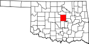
Towns Unincorporated
communitiesArlington | Jacktown | Midlothian | Parkland | Payson | Rossville
Ghost town Avery
Footnotes ‡This populated place also has portions in an adjacent county or counties
County seats in Oklahoma Ada • Altus • Alva • Anadarko • Antlers • Arapaho • Ardmore • Arnett • Atoka • Bartlesville • Beaver • Boise City • Buffalo • Chandler • Chelsea • Cherokee • Cheyenne • Chickasha • Claremore • Coalgate • Duncan • Durant • El Reno • Enid • Eufaula • Fairview • Frederick • Guthrie • Guymon • Hobart • Holdenville • Hollis • Hugo • Idabel • Jay • Kingfisher • Lawton • Madill • Mangum • Marietta • McAlester • Medford • Miami • Muskogee • New Cordell • Newkirk • Nowata • Okemah • Oklahoma City • Okmulgee • Pauls Valley • Pawhuska • Pawnee • Perry • Poteau • Pryor • Purcell • Sallisaw • Sapulpa • Sayre • Shawnee • Stigler • Stillwater • Stilwell • Sulphur • Tahlequah • Taloga • Tishomingo • Tulsa • Vinita • Wagoner • Walters • Watonga • Waurika • Wewoka • Wilberton •
WoodwardCategories:- Oklahoma City Metropolitan Area
- Populated places in Lincoln County, Oklahoma
- Cities in Oklahoma
- Communities on U.S. Route 66
- County seats in Oklahoma


Wikimedia Foundation. 2010.