- Contoocook, New Hampshire
-
Contoocook, New Hampshire — Village — Location within the state of New Hampshire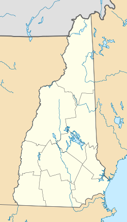
 Contoocook, New Hampshire
Coordinates: 43°13′25″N 71°42′53″W / 43.22361°N 71.71472°WCoordinates: 43°13′25″N 71°42′53″W / 43.22361°N 71.71472°W Country United States State New Hampshire County Merrimack Area - Total 2.4 sq mi (6.1 km2) - Land 2.3 sq mi (5.9 km2) - Water 0.1 sq mi (0.3 km2) Elevation 364 ft (111 m) Population (2010) - Total 1,444 - Density 613.1/sq mi (236.7/km2) Time zone Eastern (EST) (UTC-5) - Summer (DST) EDT (UTC-4) ZIP code 03229 Area code(s) 603 FIPS code 33-14340 GNIS feature ID 0866311 Contoocook is a village [1] and census-designated place (CDP) within the town of Hopkinton in Merrimack County, New Hampshire, United States. The population was 1,444 at the 2010 census.[1]
Contents
History
Contoocook is named after the Contoocook River that runs through it. In previous centuries the area was known as "Contoocookville". It is the birthplace of Civil War naval officer George H. Perkins. His daughter Isabel Weld Perkins and his son-in-law Larz Anderson maintained Perkins Manor as one of several summer homes. In describing the approach to Perkins Manor one commentator writes:
"In passing up the Concord and Claremont Railroad from Concord, the observant traveler has doubtless noticed the substantial and comfortable-looking homestead with large and trim front yard, shaded by thickly planted and generous topped maples, on the right-hand side of the road after crossing the bridge that spans 'Contoocook's bright and brimming river' at the pleasant-looking village of Contoocookville in the northern part of Hopkinton."[2]
Notable inhabitants
Rose Flanders Bascom, who was born in Contoocook in 1880, joined the circus and became a noted female lion tamer before dying of a lion mauling.
Geography
Contoocook is located at 43°13′25″N 71°42′53″W / 43.22361°N 71.71472°W (43.223588, -71.714627).[3]
According to the United States Census Bureau, the CDP of Contoocook has a total area of 2.4 square miles (6.2 km2), of which 2.3 sq mi (6.0 km2) is land and 0.1 sq mi (0.26 km2) (4.24%) is water.
Contoocook is northwest of Concord, the state capital, on Interstate 89.
Demographics
As of the census[4] of 2000, there were 1,444 people, 590 households, and 394 families residing in the CDP. The population density was 637.7 people per square mile (246.7/km²). There were 614 housing units at an average density of 271.2 per square mile (104.9/km²). The racial makeup of the CDP was 98.82% White, 0.28% African American, 0.21% Native American, 0.21% Asian, 0.21% Pacific Islander, 0.07% from other races, and 0.21% from two or more races. Hispanic or Latino of any race were 0.55% of the population.
There were 590 households out of which 32.0% had children under the age of 18 living with them, 55.6% were married couples living together, 7.5% had a female householder with no husband present, and 33.2% were non-families. 27.5% of all households were made up of individuals and 12.5% had someone living alone who was 65 years of age or older. The average household size was 2.45 and the average family size was 3.04.
In the CDP the population was spread out with 25.8% under the age of 18, 4.8% from 18 to 24, 25.4% from 25 to 44, 30.1% from 45 to 64, and 13.9% who were 65 years of age or older. The median age was 42 years. For every 100 females there were 91.5 males. For every 100 females age 18 and over, there were 87.1 males.
The median income for a household in the CDP was $49,038, and the median income for a family was $56,848. Males had a median income of $46,429 versus $29,875 for females. The per capita income for the CDP was $22,124. About 2.8% of families and 3.6% of the population were below the poverty line, including 5.7% of those under age 18 and 6.4% of those age 65 or over.
References
- ^ United States Census Bureau, American FactFinder, 2010 Census figures. Retrieved March 23, 2011.
- ^ The Project Gutenberg EBook of The Bay State Monthly
- ^ "US Gazetteer files: 2010, 2000, and 1990". United States Census Bureau. 2011-02-12. http://www.census.gov/geo/www/gazetteer/gazette.html. Retrieved 2011-04-23.
- ^ "American FactFinder". United States Census Bureau. http://factfinder.census.gov. Retrieved 2008-01-31.
Municipalities and communities of Merrimack County, New Hampshire County seat: Concord Cities 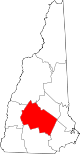
Towns Allenstown | Andover | Boscawen | Bow | Bradford | Canterbury | Chichester | Danbury | Dunbarton | Epsom | Henniker | Hill | Hooksett | Hopkinton | Loudon | New London | Newbury | Northfield | Pembroke | Pittsfield | Salisbury | Sutton | Warner | Webster | Wilmot
Villages Blodgett Landing | Contoocook | East Andover | Elkins | Penacook | South Hooksett | Suncook | Tilton-Northfield‡
Footnotes ‡This populated place also has portions in an adjacent county or counties
Categories:- Populated places in Merrimack County, New Hampshire
- Census-designated places in New Hampshire
- Unincorporated communities in New Hampshire


Wikimedia Foundation. 2010.