- Danbury, New Hampshire
-
Danbury, New Hampshire — Town — George Gamble Library c. 1912 Location in Merrimack County, New Hampshire
Coordinates: 43°31′33″N 71°51′48″W / 43.52583°N 71.86333°WCoordinates: 43°31′33″N 71°51′48″W / 43.52583°N 71.86333°W Country United States State New Hampshire County Merrimack Incorporated 1795 Government – Board of Selectmen Chester Martin, Chair
Bernard Golden
James PhelpsArea – Total 37.7 sq mi (97.7 km2) – Land 37.5 sq mi (97.0 km2) – Water 0.3 sq mi (0.7 km2) 0.74% Elevation 825 ft (251 m) Population (2010) – Total 1,164 – Density 30.9/sq mi (11.9/km2) Time zone Eastern (UTC-5) – Summer (DST) Eastern (UTC-4) ZIP code 03230 Area code(s) 603 FIPS code 33-16980 GNIS feature ID 0873574 Website www.townofdanburynh.com Danbury is a town in Merrimack County, New Hampshire, United States. The population was 1,164 at the 2010 census.[1]
Contents
History
 Inland Farm in 1916
It was first settled about 1771 as a part of Alexandria, but mountainous terrain separated it from the rest of the town. In 1795, it was set off and incorporated, the name suggested by a settler from Danbury, Connecticut. The town later grew by adding land from Wilmot and Hill. Farmers found the surface mostly hilly, but with some good intervales suitable for agriculture. Raising cattle and sheep became the principal occupation. By 1859, when the population was 934, it had seven sawmills, two shingle, lath and clapboard mills, and one tannery.[2]
Geography
According to the United States Census Bureau, the town has a total area of 37.7 square miles (98 km2), of which 37.5 sq mi (97 km2) is land and 0.3 sq mi (0.78 km2) is water, comprising 0.74% of the town.
The town is drained by the Smith River and lies fully within the Merrimack River watershed.[3] Waukeena Lake, School Pond, and Bog Pond are a few of the bodies of water within the town limits.
The highest point in Danbury is the summit of Tinkham Hill, at 2,320 feet (710 m) above sea level, in the northern part of town. Ragged Mountain is a prominent mountain with multiple summits which occupies the southern portion of town and has a ski area of the same name; the elevation of the Danbury summit of Ragged is 2,225 ft (678 m) above sea level. The Sunapee-Ragged-Kearsarge Greenway hiking trail crosses a corner of Danbury along Ragged Mountain's Ridge Trail. Access to the Ridge Trail from the SRK Greenway is on the SRKG 6.1 mile trail section 9, either from trailhead parking on New Canada Road in Wilmot from the northwest or from Proctor Academy's trailhead parking in Andover from the southeast.
Danbury is located approximately 35 miles (56 km) from Concord, the state capital, and 50 miles (80 km) from Manchester, the state's largest city. Danbury is the northernmost town in Merrimack County and lies within the Dartmouth-Lake Sunapee Region. The town is served by U.S. Route 4 and New Hampshire Route 104.
Demographics
Historical populations Census Pop. %± 1800 165 — 1810 345 109.1% 1820 467 35.4% 1830 786 68.3% 1840 800 1.8% 1850 934 16.8% 1860 947 1.4% 1870 796 −15.9% 1880 760 −4.5% 1890 683 −10.1% 1900 654 −4.2% 1910 592 −9.5% 1920 516 −12.8% 1930 498 −3.5% 1940 578 16.1% 1950 496 −14.2% 1960 435 −12.3% 1970 489 12.4% 1980 680 39.1% 1990 884 30.0% 2000 1,071 21.2% 2010 1,164 8.7% In 1800, there were 165 people living in Danbury, according to the first official census.
As of the 2000 census[4], there were 1,071 people, 435 households, and 310 families residing in the town. The population density was 28.6 people per square mile (11.0/km²). There were 596 housing units at an average density of 15.9 per square mile (6.1/km²). The racial makeup of the town was:
- 99.53% White (U.S. average: 75.1%)
- 0.19% African American (U.S. average: 12.3%)
- 0.09% Native American (U.S. average: 0.1%)
- 0.19% from two or more races. (U.S. average: 2.4%)
Hispanic or Latino of any race were 0.47% of the population. (U.S. average: 12.5%)
In 2000, there were 435 households with an average household size of 2.46 and an average family size of 2.84.
- 31.0% had children under the age of 18 living with them. (U.S. average: 32.8%)
- 57.7% were married couples living together. (U.S. average: 51.7%)
- 8.7% had a female householder with no husband present. (U.S. average: 12.2%)
- 28.7% were non-families. (U.S. average: 31.9%)
- 20.9% of all households were made up of individuals. (U.S. average: 25.8%)
- 6.9% had someone living alone who was 65 years of age or older. (U.S. average: 9.2%)
 Danbury Inn in 1916
In 2000, the town's population had a median age of 41 years (U.S. average: 35.3).
- 23.0% under the age of 18
- 6.8% from 18 to 24
- 30.7% from 25 to 44
- 26.7% from 45 to 64
- 12.8% who were 65 years of age or older.
For every 100 females there were 104.0 males. For every 100 females age 18 and over, there were 104.7 males.
The median income for a household in the town was $38,313 (U.S. average: $41,994). The median income for a family was $40,809 (U.S. average: $50,046). Males had a median income of $32,105 versus $26,328 for females. The per capita income for the town was $18,339. About 8.9% of families (U.S. average: 9.2%), and 11.1% of the population (U.S. average: 12.4%) were below the poverty line, including 11.9% of those under age 18 and 9.3% of those age 65 or over.
Places of interest
- Ragged Mountain Resort, ski and golf vacation resort
- Danbury North Road Schoolhouse Museum, run by Danbury Historical Society
- Bog Pond Dam or Danbury Bog, 100-acre (40 ha) recreational reservoir
- Waukeena Lake, 56-acre (23 ha) cold water lake, motorboats restricted
- School Pond, 37-acre (15 ha) warm water pond, motorboats restricted
- Emily & Theodore Hope Forest 375-acre (152 ha) property preserved by the Society for the Protection of New Hampshire Forests (SPNHF)
- Rosemary's Woods, 215-acre (87 ha) SPNHF property
- Independence Park, municipal multi-purpose field
Notable residents
- Donald Hall (1928-), U.S. Poet Laureate in 2006
- Francis Reed (1852–1917), inventor of many lathe and drill machines
- Amos Leavitt Taylor (1877-19__), Secretary of Massachusetts Republican Party (1927–1928); Massachusetts Republican State Chair (1924–1949)
See also
References
- ^ United States Census Bureau, American FactFinder, 2010 Census figures. Retrieved March 23, 2011.
- ^ Coolidge, Austin J.; John B. Mansfield (1859). A History and Description of New England. Boston, Massachusetts. p. 463. http://books.google.com/books?id=OcoMAAAAYAAJ&lpg=PA9&dq=coolidge%20mansfield%20history%20description%20new%20england%201859&pg=PA463#v=onepage&q&f=false.
- ^ Foster, Debra H.; Batorfalvy, Tatianna N.; and Medalie, Laura (1995). Water Use in New Hampshire: An Activities Guide for Teachers. U.S. Department of the Interior and U.S. Geological Survey. http://nh.water.usgs.gov/Publications/nh.intro.html.
- ^ "American FactFinder". United States Census Bureau. http://factfinder.census.gov. Retrieved 2008-01-31.
External links
- Official town website
- George Gamble Library
- New Hampshire Economic and Labor Market Information Bureau Profile
- Sunapee-Ragged-Kearsarge Greenway Coalition
Municipalities and communities of Merrimack County, New Hampshire Cities 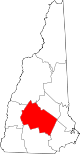
Towns Allenstown | Andover | Boscawen | Bow | Bradford | Canterbury | Chichester | Danbury | Dunbarton | Epsom | Henniker | Hill | Hooksett | Hopkinton | Loudon | New London | Newbury | Northfield | Pembroke | Pittsfield | Salisbury | Sutton | Warner | Webster | Wilmot
Villages Blodgett Landing | Contoocook | East Andover | Elkins | Penacook | South Hooksett | Suncook | Tilton-Northfield‡
Footnotes ‡This populated place also has portions in an adjacent county or counties
Categories:- Towns in Merrimack County, New Hampshire


Wikimedia Foundation. 2010.