- Maryland Route 298
-
Maryland Route 298

Route information Maintained by MDSHA Length: 20.14 mi[1] (32.41 km) Major junctions West end:  MD 20 in Fairlee
 MD 514 in Melitota
 MD 297 in Worton
 MD 561 in Lynch
 MD 292 near Still Pond
 MD 566 near Still Pond
 MD 213 near Kennedyville
East end:  MD 291 near Chesterville
Location Counties: Kent Highway system Maryland highway system
Interstate • US • State • Minor • Former • Turnpikes← MD 297MD 299  →
→Maryland Route 298 (MD 298) is a state highway in the U.S. state of Maryland. The state highway runs 20.14 miles (32.41 km) from MD 20 in Fairlee east to MD 291 near Chesterville. MD 298 is a C-shaped highway that connects Fairlee, MD 213, and Millington with several villages in central Kent County, including Worton, Lynch, and Still Pond. The state highway also provides a bypass of Chestertown between the western and eastern parts of the county. MD 298 was built from Fairlee to MD 292 near Still Pond around 1930. The highway was extended eastward to MD 566 east of Still Pond in the mid 1950s, to MD 213 in the early 1960s, and to MD 291 in the late 1980s.
Contents
Route description
MD 298 begins at an oblique intersection with MD 20 (Rock Hall Road) just south of the village of Fairlee. The state highway heads north as Fairlee Road, a two-lane highway that passes through the village, intersecting Old Fairlee Road, the old alignment of MD 20. MD 298 heads northeast through a mix of farmland and forest to the hamlet of Melitota, where the highway meets the northern end of MD 514 (Melitota Road). The state highway crosses a tributary of Mills Branch and passes through Hanesville, where the highway intersects Hanesville Road and its name changes to Lambs Meadow Road. MD 298 curves to the east and passes through the community of Butlertown just north of Worton, where the highway intersects MD 297 (Worton Road) and passes Kent County High School.[1][2]
MD 298 continues northeast through farmland, passing just to the north of Lynch, where the highway meets the northern end of MD 561 (Hassengers Corner Road) and encounters a loop of old alignment, MD 864 (Old Lynch Road). The state highway bypasses the village of Still Pond, intersecting MD 292 (Still Pond Road) to the south and MD 566 (Stillpond Harmony Road) to the east. MD 298 continues east to an intersection with MD 213 (Augustine Herman Highway) northeast of Kennedyville. The state highway continues southeast as Browntown Road, crossing the Chestertown Branch of the Northern Line of the Maryland and Delaware Railroad. At Morgnec Road west of Chesterville, MD 298 turns east onto Old Morgnec Road and then south onto Cherry Lane. The state highway reaches its eastern terminus at MD 291 (River Road) southwest of Chesterville.[1][2]
History
MD 298 was paved in 1929 and 1930 from MD 20 in Fairlee to MD 292 south of Still Pond.[3][4] The next segment of modern MD 298 to be constructed was from the present intersection with MD 566 near Still Pond to U.S. Route 213 (now MD 213). That segment was constructed as part of MD 566 around 1946.[5][6] The section between MD 292 and MD 566 was constructed starting in 1952; MD 298 was extended east to MD 566 in 1956.[7][8] MD 298 assumed the portion of MD 566 east to US 213 in 1963.[9] MD 298 was extended on its western end to its present intersection with MD 20 when MD 20 bypassed Fairlee in 1956.[8] The final extension of MD 298 occurred around 1989 when the highway was extended south from MD 213 over Browntown Road, Old Morgnec Road, and Cherry Lane to MD 291.[10]
Junction list
The entire route is in Kent County.
Location Mile[1] Intersection Notes Fairlee 0.00 MD 20 (Rock Hall Road) – Rock Hall, ChestertownWestern terminus 0.40 Old Fairlee Road Old alignment of MD 20 Melitota 3.66 MD 514 south (Chestertown)Worton 7.39 MD 297 south (Worton Road) – ChestertownLynch 9.43 MD 561 south (Hassengers Corner Road)9.45  MD 856 north (Old Lynch Road)
MD 856 is unsigned; old alignment of MD 298 9.53 MD 856 south (Old Lynch Road)Still Pond 10.99 MD 292 north (Still Pond Road), Betterton12.31 MD 566 west (Stillpond Harmony Road), Betterton14.91 MD 213 (Augustine Herman Highway) – Galena, Kennedyville, ChestertownChesterville 18.58 Morgnec Road west Former MD 447 18.95 Morgnec Road east 20.14 MD 291 (River Road) – Chestertown, MillingtonEastern terminus 1.000 mi = 1.609 km; 1.000 km = 0.621 mi References
- ^ a b c d "Highway Location Reference: Kent County" (PDF). Maryland State Highway Administration. 2009. http://www.marylandroads.com/Location/2009_KENT.pdf. Retrieved 2010-10-11.
- ^ a b Google, Inc. Google Maps – Maryland Route 298 (Map). Cartography by Google, Inc. http://maps.google.com/maps?f=d&source=s_d&saddr=MD-298+E&daddr=MD-298+E%2FLambs+Meadow+Rd+to:MD-298+E%2FCherry+Ln&geocode=FXJYVgIdIKt1-w%3BFYCjVwIdBl93-w%3BFVwEVwId7DB5-w&hl=en&mra=ls&sll=39.307605,-75.966854&sspn=0.060966,0.154324&ie=UTF8&t=h&z=12. Retrieved 2010-10-11.
- ^ Report of the State Roads Commission of Maryland. 1927-1930. Baltimore: Maryland State Roads Commission. 1930-10-01. p. 218. http://www.archive.org/details/reportofstateroa1927mary. Retrieved 2010-10-11.
- ^ Maryland Geological Survey. Map of Maryland Showing State Road System: State Aid Roads and Improved County Road Connections (Map) (1930 ed.).
- ^ Report of the State Roads Commission of Maryland. 1945-1946. Baltimore: Maryland State Roads Commission. 1947-02-01. p. 90. http://www.archive.org/details/reportofstateroa1945mary. Retrieved 2010-10-11.
- ^ Maryland State Roads Commission. Maryland: Official Highway Map (Map) (1949 ed.).
- ^ Report of the State Roads Commission of Maryland. 1951-1952. Baltimore: Maryland State Roads Commission. 1952-12-15. p. 125. http://www.archive.org/details/reportofstateroa1951mary. Retrieved 2010-10-11.
- ^ a b Maryland State Roads Commission. Maryland: Official Highway Map (Map) (1956 ed.).
- ^ Maryland State Roads Commission. Maryland: Official Highway Map (Map) (1963 ed.).
- ^ Maryland State Highway Administration. Maryland: Official Highway Map (Map) (1989 ed.).
External links
Roads in Kent County, Maryland State highways 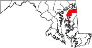
U.S. Highways Categories:- State highways in Maryland
- Roads in Kent County, Maryland


Wikimedia Foundation. 2010.