- Maryland Route 291
-
Maryland Route 291

Route information Maintained by MDSHA Length: 18.57 mi[1] (29.89 km) Major junctions West end:  MD 20 in Chestertown
 MD 213 in Chestertown
 MD 298 near Chesterville
 MD 290 near Chesterville
 US 301 near Millington
 MD 313 in Millington
East end:  DE 6 near Millington
Location Counties: Kent Highway system Maryland highway system
Interstate • US • State • Minor • Former • Turnpikes← MD 290MD 292  →
→Maryland Route 291 (MD 291) is a state highway in the U.S. state of Maryland. The state highway runs 18.57 miles (29.89 km) from MD 20 in Chestertown east to the Delaware state line east of Millington, where the highway continues east as Delaware Route 6 (DE 6). MD 291 parallels the Chester River along the southern edge of Kent County, connecting Chestertown with U.S. Route 301 (US 301). The state highway follows much of what was originally MD 447, which was constructed between US 213 in Chestertown and MD 290 at Chesterville around 1930. MD 291 itself was built east of Millington around 1930. The state highway was extended west toward Chesterville in the early 1930s, but was not complete to MD 290 until the late 1940s. MD 291 was extended west to US 213 along a partially new alignment in the early 1960s, superseding MD 447. MD 291 reached its present western terminus at MD 20 in 1969.
Contents
Route description
 MD 291 shield on MD 313 in Millington
MD 291 begins at an intersection with the eastern terminus of MD 20 (Chestertown Road) and High Street in the town of Chestertown. The state highway heads east as two-lane Morgnec Road. After intersecting the Chestertown Branch of the Northern Line of the Maryland and Delaware Railroad, MD 291 passes along the northern edge of the campus of Washington College before intersecting MD 213 (Washington Avenue). The state highway temporarily gains a median as it passes through a commercial area. After passing through a residential area, MD 291 leaves the town limits and passes through farmland. The state highway crosses Morgan Creek on a steel truss bridge and passes through the hamlet of Morgnec, where Morgnec Road turns north and MD 291 continues east as River Road.[1][2]
MD 291 intersects the eastern terminus of MD 298 (Cherry Lane) and crosses a branch of the Chester River before joining MD 290 (Crumpton Road) for a short concurrency south of Chesterville. East of MD 290, MD 291 passes through a forested area and crosses Mill Branch before passing through two roundabouts with Edge Road and Howard Johnson Road, which are unsigned MD 701A and MD 701, respectively. The two roads lead to interchange ramps to and from US 301 (Blue Star Memorial Highway), over which MD 291 crosses between the roundabouts. MD 291 continues east to the town of Millington, where the highway's name changes to Cypress Street. The state highway intersects MD 313 (Sassafras Street) and the Centreville Branch of the Northern Line of the Maryland and Delaware Railroad before leaving the town by crossing Cypress Branch. MD 291 continues east as Cypress Road through a mix of farmland and forest to its eastern terminus at the Delaware state line. The highway continues east as DE 6 (Millington Road) toward Smyrna.[1][2]
History
Much of what is now MD 291 was constructed as two different highways. MD 291 ran from MD 290 near Chesterville through Millington to the Delaware state line. MD 447 connected US 213 in Chestertown and MD 290 in Chesterville, much of which was on an alignment further north from the Chester River than modern MD 291.[3] MD 291 was constructed from Millington to the Delaware state line in 1929 and 1930.[4][5] The highway was extended west to Mills Branch just west of present day US 301 in two sections built in 1933 and 1935.[6][7] The gap from Mills Branch to MD 290 was filled around 1946.[8][9]
MD 447 was constructed from US 213 to just west of Morgnec as well as from Kennedyville Road to MD 290 in Chesterville in 1929 and 1930.[4][5] MD 447 was completed between Morgnec and Kennedyville Road by 1933.[4][6] The steel truss bridge over Morgan Creek, which replaced an old timber bridge on a more curvaceous alignment, was also completed in 1933.[10] River Road between Morgnec and MD 290 was reconstructed beginning in 1958.[11] MD 291 was extended west of MD 290 along River Road to Morgnec and assumed MD 447 west to Chestertown in 1963. MD 447 between Morgnec and Chesterville was removed from the state highway system the same year.[12] MD 291 was extended west to its present terminus at MD 20 along a new road within Chestertown in 1969.[13] MD 291's interchange with US 301, including MD 291's bridge over US 301 and the roundabouts with MD 701 and MD 701A, was constructed in 1999.[14]
Junction list
The entire route is in Kent County.
Location Mile[1] Destinations Notes Chestertown 0.00 MD 20 west (Chestertown Road) / High Street south – Rock HallWestern terminus 0.60 MD 213 (Washington Avenue) – Galena, Church HillChesterville 8.15 MD 298 west (Cherry Lane) – Still Pond9.15 MD 290 south (Crumpton Road) – CrumptonWest end of concurrency with MD 290 9.82 MD 290 north (Crumpton Road) – GalenaEast end of concurrency with MD 290 Millington 12.42 Edge Road to US 301 south (Blue Star Memorial Highway) – Bay BridgeRoundabout; Edge Road is unsigned MD 701A 12.63 Howard Johnson Road to US 301 north (Blue Star Memorial Highway) – WilmingtonRoundabout; Howard Johnson Road is unsigned MD 701 14.08 MD 313 (Sassafras Street) – Sudlersville, Massey18.57 DE 6 east (Millington Road) – SmyrnaEastern terminus; Delaware state line 1.000 mi = 1.609 km; 1.000 km = 0.621 mi References
- ^ a b c d "Highway Location Reference: Kent County" (PDF). Maryland State Highway Administration. 2009. http://www.marylandroads.com/Location/2009_KENT.pdf. Retrieved 2010-10-08.
- ^ a b Google, Inc. Google Maps – Maryland Route 291 (Map). Cartography by Google, Inc. http://maps.google.com/maps?f=d&source=s_d&saddr=Morgnec+Rd&daddr=MD-291+E%2FCypress+Rd&hl=en&geocode=FbJtVgIdDiB3-w%3BFZAHVwIdLgp8-w&mra=ls&sll=39.257246,-75.784893&sspn=0.030505,0.077162&ie=UTF8&t=h&z=11. Retrieved 2010-10-08.
- ^ Maryland State Roads Commission. General Highway Map: State of Maryland (Map) (1939 ed.).
- ^ a b c Report of the State Roads Commission of Maryland. 1927-1930. Baltimore: Maryland State Roads Commission. 1930-10-01. pp. 218–219. http://www.archive.org/details/reportofstateroa1927mary. Retrieved 2010-10-08.
- ^ a b Maryland Geological Survey. Map of Maryland Showing State Road System: State Aid Roads and Improved County Road Connections (Map) (1930 ed.).
- ^ a b Maryland Geological Survey. Map of Maryland Showing State Road System: State Aid Roads and Improved County Road Connections (Map) (1933 ed.).
- ^ Maryland Geological Survey. Map of Maryland Showing State Road System: State Aid Roads and Improved County Road Connections (Map) (1935 ed.).
- ^ Report of the State Roads Commission of Maryland. 1945-1946. Baltimore: Maryland State Roads Commission. 1947-02-01. p. 90. http://www.archive.org/details/reportofstateroa1945mary. Retrieved 2010-10-08.
- ^ Maryland State Roads Commission. Maryland: Official Highway Map (Map) (1948 ed.).
- ^ Report of the State Roads Commission of Maryland. 1931-1934. Baltimore: Maryland State Roads Commission. 1934-12-28. p. 46. http://www.archive.org/details/reportofstateroa1931mary. Retrieved 2011-02-27.
- ^ Report of the State Roads Commission of Maryland. 1957-1958. Baltimore: Maryland State Roads Commission. 1958-12-15. p. 43. http://www.archive.org/details/reportofstateroa1957mary. Retrieved 2010-10-08.
- ^ Maryland State Roads Commission. Maryland: Official Highway Map (Map) (1963 ed.).
- ^ Maryland State Roads Commission. Maryland: Official Highway Map (Map) (1969 ed.).
- ^ "Highway Location Reference: Kent County" (PDF). Maryland State Highway Administration. 1999. http://www.marylandroads.com/Location/1999_KENT.pdf. Retrieved 2010-10-08.
External links
Roads in Kent County, Maryland State highways 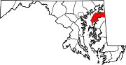
U.S. Highways Categories:- State highways in Maryland
- Roads in Kent County, Maryland


Wikimedia Foundation. 2010.