- Maryland Route 297
-
Maryland Route 297
Worton Road 
Route information Maintained by MDSHA Length: 3.59 mi[1] (5.78 km) Existed: By 1927 – present Major junctions South end:  MD 213 in Chestertown
North end:  MD 298 in Worton
Location Counties: Kent Highway system Maryland highway system
Interstate • US • State • Minor • Former • Turnpikes←  I-297
I-297MD 298 →Maryland Route 297 (MD 297) is a state highway in the U.S. state of Maryland. Known as Worton Road, the state highway runs 3.59 miles (5.78 km) from MD 213 in Chestertown north to MD 298 in Worton in central Kent County. MD 297 was constructed in the late 1920s. The state highway extended northwest to the village of Newtown between the mid 1940s and mid 1990s.
Contents
Route description
MD 297 begins at MD 213 (Augustine Herman Highway) at the northern end of a developed area north of Chestertown. The two-lane state highway, which parallels a natural ridge that serves as the boundary for multiple drainage basins, heads north through a mix of farmland and industrial properties, paralleling the Chestertown Branch of the Northern Line of the Maryland and Delaware Railroad.[2][3] MD 297 passes through the unincorporated community of Worton, where the highway crosses the rail line. The state highway continues north, passing Worton Regional Park before reaching its northern terminus at MD 298 (Lambs Meadow Road) just west of Kent County High School in the hamlet of Butlertown.[1][2]
History
Following the completion of the Kent County Rail Road, Worton was settled where Worton Road intersects the modern Maryland and Delaware Railroad.[3] MD 297 was paved starting in 1926.[4] A small piece of highway north of U.S. Route 213 (now MD 213) was completed in 1927; the remainder of the highway to MD 298 was completed in 1928.[5][6] By 1946, MD 297 was extended north along Smithville Road to the village of Newtown.[7] The extension to Newtown was removed from the state highway system around 1995.[8]
Junction list
The entire route is in Kent County.
Location Mile
[1]Destinations Notes Chestertown 0.00 MD 213 (Augustine Herman Highway) – Church Hill, KennedyvilleSouthern terminus Worton 3.59 MD 298 (Lambs Meadow Road) – Fairlee, LynchNorthern terminus; Smithville Road is former MD 297 Smithville Road north 1.000 mi = 1.609 km; 1.000 km = 0.621 mi References
- ^ a b c "Highway Location Reference: Kent County" (PDF). Maryland State Highway Administration. 2009. http://www.marylandroads.com/Location/2009_KENT.pdf. Retrieved 2010-10-11.
- ^ a b Google, Inc. Google Maps – Maryland Route 297 (Map). Cartography by Google, Inc. http://maps.google.com/maps?f=d&source=s_d&saddr=MD-213+N%2FWashington+Ave&daddr=MD-297+N%2FWorton+Rd&geocode=FdS-VgId5E53-w%3BFbhwVwIdkN92-w&hl=en&mra=ls&sll=39.27964,-76.088562&sspn=0.015248,0.038581&ie=UTF8&t=h&z=13. Retrieved 2010-10-11.
- ^ a b Kent County Commissioners, et al. (April 2007). "Worton and Butlertown Village Master Plan". Maryland Department of Planning. http://www.mdp.state.md.us/PDF/OurWork/CompPlans/Kent/WortonButlertown/07_CMP_Draft_WortonButlertown.pdf. Retrieved March 25, 2010.
- ^ Report of the State Roads Commission of Maryland. 1924-1926. Baltimore: Maryland State Roads Commission. January 1927. p. 89. http://www.archive.org/details/annualreportsofs1924mary. Retrieved 2010-10-11.
- ^ Maryland Geological Survey. Map of Maryland: Showing State Road System and State Aid Roads (Map) (1927 ed.).
- ^ Maryland Geological Survey. Map of Maryland: Showing State Road System and State Aid Roads (Map) (1928 ed.).
- ^ Maryland State Roads Commission. Maryland: Official Highway Map (Map) (1946-47 ed.).
- ^ Maryland State Highway Administration. Maryland: Official Highway Map (Map) (1995 ed.).
External links
Roads in Kent County, Maryland State highways 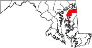
U.S. Highways Categories:- State highways in Maryland
- Roads in Kent County, Maryland


Wikimedia Foundation. 2010.