- Crook, County Durham
-
Coordinates: 54°42′47″N 1°44′56″W / 54.713°N 1.749°W
Crook 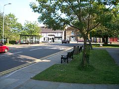
- City Applicant -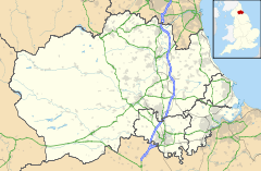
 Crook
Crook
Crook shown within County DurhamPopulation 13,500 In Town (Estimate 2010) 8,573 (2001)[1] OS grid reference NZ165356 Unitary authority County Durham Ceremonial county County Durham Region North East Country England Sovereign state United Kingdom Post town CROOK Postcode district DL15 Dialling code 01388 Police Durham Fire County Durham and Darlington Ambulance North East EU Parliament North East England UK Parliament North West Durham List of places: UK • England • County Durham Crook (uncommonly known as Crook Market Town) is a market town in County Durham, England. It is situated about 10 miles (16 km) south-west of Durham.
Crook lies a couple of miles north of the River Wear, on the A690 from Durham. This turns into the A689 leading up into the scenic upper reaches of Weardale, through Wolsingham and Stanhope.
Crook has a famous amateur football team, Crook Town F.C.. Crook Town have won the FA Amateur Cup five times, most recently beating Enfield F.C. in 1964, before the cup was abolished in 1974. This record is second only to Crook's near neighbours, Bishop Auckland F.C.. The club have also reached the third round of the FA Cup and formed a key role in the development of FC Barcelona, playing a number of friendly matches in the 1910s and 1920s.
Contents
History
Crook first appeared as an agricultural village around 1795.[2] 40 years later; Crook became a mining village, and thrived as the coal was very close to the surface[2] and soon there were over 20 mines around the Crook area, and by the end of the nineteenth century the town had developed rapidly in population and economy. However a lot of the population in the area had declined in the following century as the coal mines and industries closed with over 34% of the population being unemployed.[2]
Landscape
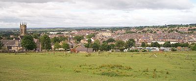
Crook has a stunning backdrop of traditional and modern buildings. The tallest building in the town is the Council Building. It has 5 floors and at about 100 ft, it is a prominent feature of the Crook skyline. However, the council building is dwarfed by Crook's surrounding hills, which completely surround the town except on the south side. The tallest stands at 300 metres above the town, about 980 ft. The highest point in the town is on West Road where the height is 210 metres (about 690 ft).
Approximately 2 miles to the west of Crook on the A689 towards Wolsingham and Weardale, 400 yards past the roundabout junction with the A68, is the surviving World War II Harperley POW Camp 93, a Scheduled Ancient Monument within English Heritage.Gallery
 Crook Market
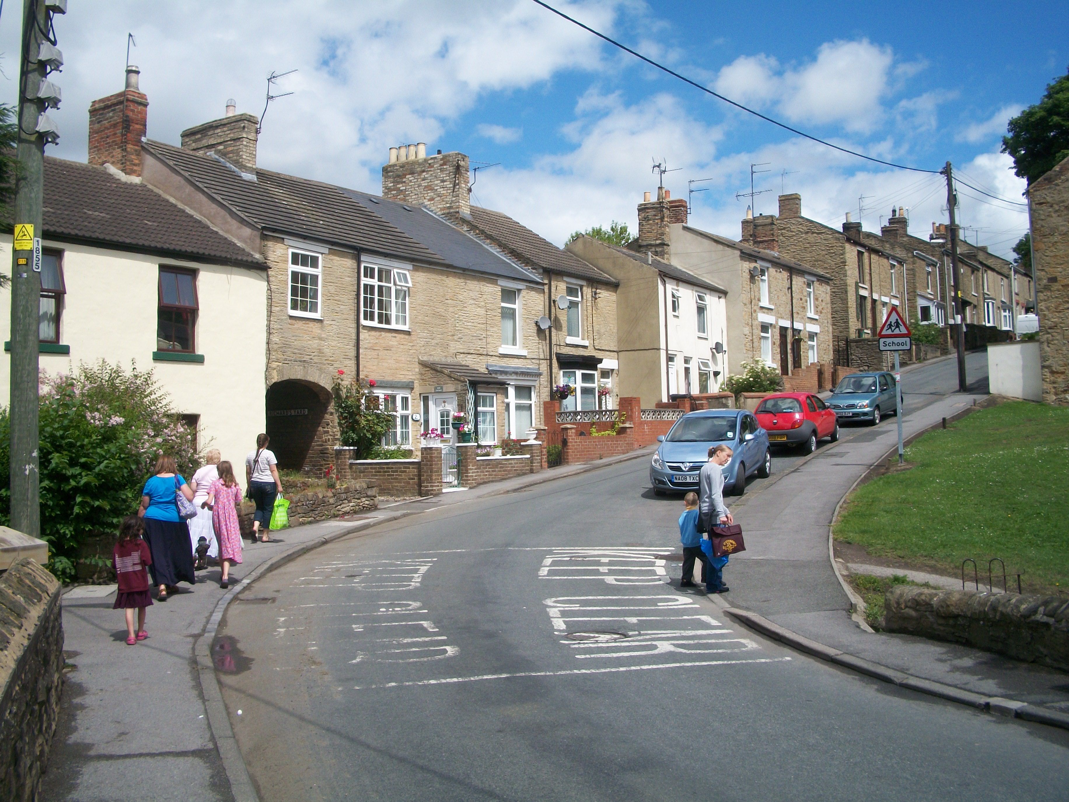
 Looking up Church Hill
 Shopping in Hope Street
Education
Since October 2011 the „Primary School“ in Crook has a Comenius-partnership. Declared school-partners are the Volksschule Altomünster (Germany/Bavaria) and the „école primaire“ in Flesselles (France). The project-topic is „Healthy Active Citizens Across Europe“.
References
- ^ {{cite web title = Crook Major Centre Area Profile | publisher = Durham County Council | month = June | year = 2006 | url = http://www.durham.gov.uk/durhamcc/usp.nsf/Lookup/Crook%20Major%20Centre%20Final/$file/Crook+Major+Centre+Final.pdf | format = PDF | accessdate = 2008-12-03}}
- ^ a b c The development of Crook: some background history
External links
Unitary authorities Major settlements - Barnard Castle
- Billingham
- Bishop Auckland
- Chester-le-Street
- Chilton
- Consett
- Crook
- Darlington
- Durham
- Eaglescliffe
- Easington
- Easington Colliery
- Ferryhill
- Hartlepool
- Middleton-in-Teesdale
- Newton Aycliffe
- Peterlee
- Seaham
- Sedgefield
- Shildon
- Spennymoor
- Stanhope
- Stanley
- Stockton-on-Tees
- Tow Law
- Willington
- Wolsingham
See also: List of civil parishes in County Durham
Topics - Museums
- Parliamentary constituencies
- Places
Categories:- Towns in County Durham


Wikimedia Foundation. 2010.