- Androscoggin County, Maine
-
Androscoggin County, Maine 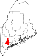
Location in the state of Maine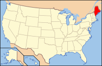
Maine's location in the U.S.Founded March 18, 1854 Seat Auburn Largest city Lewiston Area
- Total
- Land
- Water
497.23 sq mi (1,288 km²)
470.27 sq mi (1,218 km²)
26.95 sq mi (70 km²), 5.42%Population
- (2010)
- Density
107,702
229/sq mi (88.4/km²)Androscoggin County is a county located in the U.S. state of Maine. As of the 2010 U.S. census, the county's population was 107,702. Its county seat is Auburn[1]. It is included within the Lewiston-Auburn, Maine, Metropolitan Statistical Area and partially included within the Lewiston-Auburn, Maine, Metropolitan New England City and Town Area.
Bates College is located in the Androscoggin County city of Lewiston.
Contents
History
Demand for a new county emerged when the rapidly growing town of Lewiston complained of the long distance it had to travel to reach Wiscasset, the county seat of Lincoln County, which Lewiston was originally in. It was also an impractical circumstance as Lewiston's neighbor, Auburn, was part of Cumberland County. As the growing partnership of the two towns emerged, the case for the towns to be in the same county grew. Different plans were discussed, including Lewiston joining Cumberland County. Eventually, the idea of a new county came to the table. At this point in time there was a debate between which town the new county would be its center. With Bath, Brunswick, and Lewiston each pining for a county in which it was the center, Lewiston would eventually win the debate. Androscoggin County was created in 1854 from towns originally in Cumberland County, Lincoln County, Kennebec County, and Oxford County.
The next issue centered on where to put the county seat, as both Lewiston and Auburn desired to be named the county seat. It would eventually be put to a vote, with both towns putting different offers on the table that would cut the costs of the new county buildings for surrounding towns. Auburn would eventually win a convincing victory with the towns on each side of the river voting for the town on their side. As more people then lived to the west of the Androscoggin River, Auburn won the vote.[2]
Geography
According to the 2000 census, the county has a total area of 497.23 square miles (1,287.8 km2), of which 470.27 square miles (1,218.0 km2) (or 94.58%) is land and 26.95 square miles (69.8 km2) (or 5.42%) is water.[3]
Adjacent counties
- Franklin County, Maine - north
- Kennebec County, Maine - northeast
- Sagadahoc County, Maine - southeast
- Cumberland County, Maine - south
- Oxford County, Maine - west
Demographics
Historical populations Census Pop. %± 1860 29,726 — 1870 35,866 20.7% 1880 45,042 25.6% 1890 48,968 8.7% 1900 54,242 10.8% 1910 59,822 10.3% 1920 65,796 10.0% 1930 71,214 8.2% 1940 76,679 7.7% 1950 83,594 9.0% 1960 86,312 3.3% 1970 91,279 5.8% 1980 99,657 9.2% 1990 105,259 5.6% 2000 103,793 −1.4% 2010 107,702 3.8% [4][5][6] As of the census[7] of 2000, there were 103,793 people, 42,028 households, and 27,192 families residing in the county. The population density was 221 people per square mile (85/km²). There were 45,960 housing units at an average density of 98 per square mile (38/km²). The racial makeup of the county was 96.98% White, 0.66% Black or African American, 0.27% Native American, 0.55% Asian, 0.04% Pacific Islander, 0.28% from other races, and 1.22% from two or more races. 0.95% of the population were Hispanic or Latino of any race. 24.5% were of French Canadian, 19.4% French, 14.3% English, 9.7% United States or American and 8.4% Irish ancestry according to Census 2000. 14.29% of the population speak French at home.[1]
There were 42,028 households out of which 30.90% had children under the age of 18 living with them, 49.60% were married couples living together, 10.80% had a female householder with no husband present, and 35.30% were non-families. 28.30% of all households were made up of individuals and 11.00% had someone living alone who was 65 years of age or older. The average household size was 2.38 and the average family size was 2.91.
In the county the population was spread out with 23.90% under the age of 18, 9.10% from 18 to 24, 29.70% from 25 to 44, 22.90% from 45 to 64, and 14.40% who were 65 years of age or older. The median age was 37 years. For every 100 females there were 94.30 males. For every 100 females age 18 and over, there were 91.20 males.
The median income for a household in the county was $35,793, and the median income for a family was $44,082. Males had a median income of $31,622 versus $22,366 for females. The per capita income for the county was $18,734. About 7.50% of families and 11.10% of the population were below the poverty line, including 13.80% of those under age 18 and 11.00% of those age 65 or over.
Media
Newspapers
- Lewiston Sun Journal prints a daily newspaper in four different editions statewide. The Sun Journal was the recipient of the 2008 New England Daily Newspaper of the Year and the 2009 Maine Press Association Newspaper of the Year.
Magazines
- Lewiston Auburn Magazine, launched in April 2010, features current events and history of Lewiston/Auburn, with an emphasis on the people who are helping to rebuild the area.
Politics
Presidential elections
Presidential election results[8] Year Democrat Republican 2008 56.6% 31,017 41.3% 22,671 2004 54.4% 30,503 43.7% 24,519 2000 53.3% 26,251 40.5% 19,948 In Presidential elections Androscoggin County has been one of the most consistently, though not always the most strongly, Democratic counties in the state. It was the only county in Maine to be won by George McGovern in 1972. Jimmy Carter also carried the county twice. Although in 1984 and 1988 it went for the Republican candidate.[9] In the last five Presidential elections the Republican candidate has received as much as 43.7%, but still lost by more than ten percent each time.[10]
Voter registration
Voter registration
Voter Registration and Party Enrollment as of August 2011[11] Party Total Voters Percentage Unenrolled 26,450 36.69% Democratic 25,475 35.35% Republican 17,235 23.91% Green Party 2,919 4.05% Total 72,079 100% Cities and towns
See also
- Androscoggin Creature
- Lisbon School Department
- National Register of Historic Places listings in Androscoggin County, Maine
References
- ^ "Find a County". National Association of Counties. http://www.naco.org/Counties/Pages/FindACounty.aspx. Retrieved 2011-06-07.
- ^ Hodgkin, Douglas I., Frontier to Industrial City:Lewiston Town Politics 1768–1863. Just Write Books, Topsham, Maine, 2008
- ^ "Census 2000 U.S. Gazetteer Files: Counties". United States Census. http://www.census.gov/tiger/tms/gazetteer/county2k.txt. Retrieved 2011-02-13.
- ^ http://www.census.gov/population/www/censusdata/cencounts/files/me190090.txt
- ^ http://factfinder2.census.gov/faces/tableservices/jsf/pages/productview.xhtml?pid=DEC_10_PL_QTPL&prodType=table
- ^ http://mapserver.lib.virginia.edu/
- ^ "American FactFinder". United States Census Bureau. http://factfinder.census.gov. Retrieved 2008-01-31.
- ^ "Dave Leip's Atlas of U.S. Presidential Elections". http://uselectionatlas.org/RESULTS/. Retrieved 2011-06-11.
- ^ David Leip's Presidential Atlas (Maps for Maine by election)
- ^ The New York Times electoral map (Zoom in on Maine)
- ^ "Registration and Party Enrollment Statistics as of August, 2011". Maine Bureau of Corporations. http://www.maine.gov/sos/cec/elec/2011/20110817r-e-active.pdf.
External links

Franklin County Kennebec County Oxford County 
 Androscoggin County, Maine

Cumberland County Sagadahoc County Municipalities and communities of Androscoggin County, Maine Cities 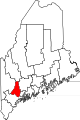
Towns CDPs  State of Maine
Topics - Index
- Culture
- Geography
- Government
- Governors
- History
- Images
- People
- Visitor Attractions
- Congressional districts
Regions Counties Cities Largest towns Categories:- Maine counties
- Androscoggin County, Maine
- 1854 establishments in the United States


Wikimedia Foundation. 2010.