- Marienberg, Saxony
-
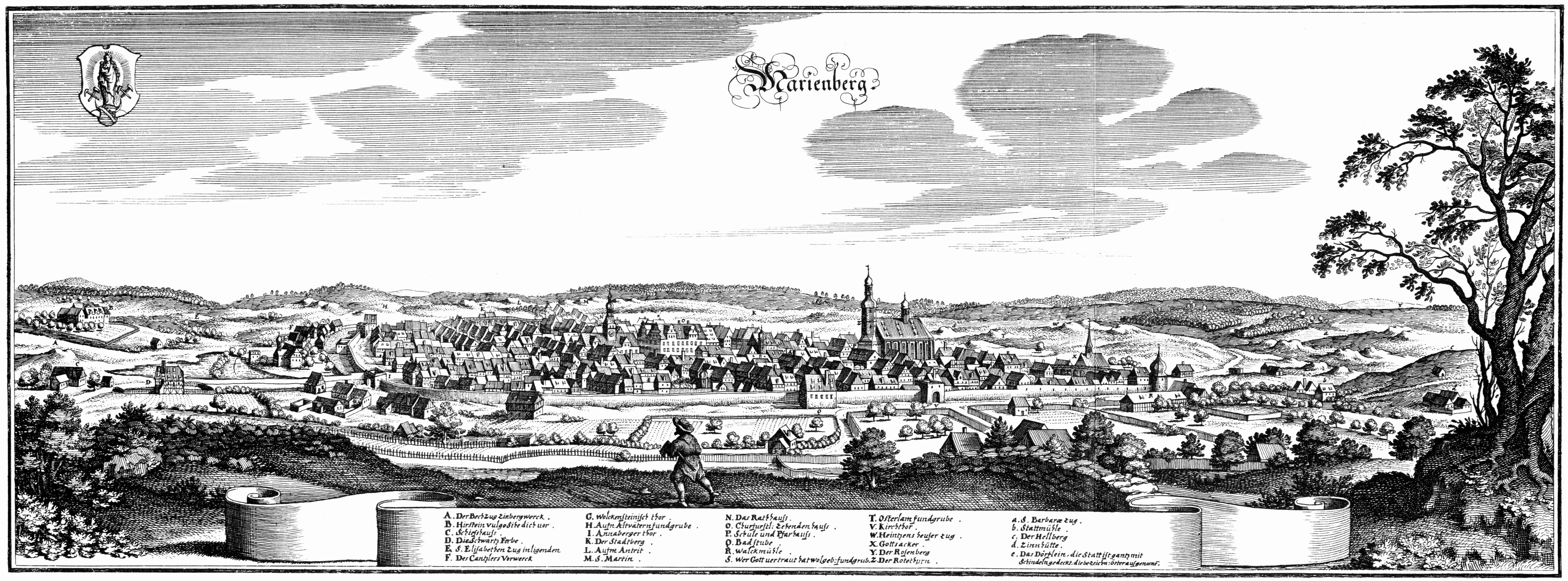
Marienberg Marienberg in 1650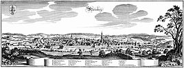


 MarienbergLocation of the town of Marienberg within Erzgebirgskreis district
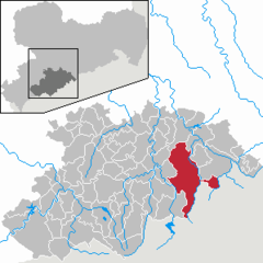
Coordinates 50°38′N 13°9′E / 50.63333°N 13.15°ECoordinates: 50°38′N 13°9′E / 50.63333°N 13.15°E Administration Country Germany State Saxony Admin. region Chemnitz District Erzgebirgskreis Town subdivisions 9 Mayor Thomas Wittig (CDU) Basic statistics Area 105.91 km2 (40.89 sq mi) Elevation 609 m (1998 ft) Population 13,225 (31 December 2010)[1] - Density 125 /km2 (323 /sq mi) Other information Time zone CET/CEST (UTC+1/+2) Licence plate ERZ Postal codes 09491-09496 Area code 03735 Website www.marienberg.de Marienberg is a town in Germany. It was the district capital of the Mittlerer Erzgebirgskreis (Central Ore Mountains district) in the southern part of Saxony, and since August 2008 it has been part of the new district of Erzgebirgskreis. As of 2007, the town had 14,181 inhabitants.
Contents
Location and design
The town is situated on a plateau north of the mountain ridge of the Ore Mountains, at an elevation between 460 and 891 m above sea level. It is approximately 31 km south of Chemnitz, to which it is connected via the Flöhatalbahn.
The historical city center follows a rectangular plan, imitating Italian renaissance. The center is the market square, a square of 1.7 ha area.
Marienberg and Pobershau are joined in the Verwaltungsgemeinschaft Marienberg.
History
The first documented evidence related to Marienberg is the mentioning of the village Wüstenschletta as Sletyn in 1323. However, the town was founded on 27 April 1521 by Henry IV, Duke of Saxony after silver had been found in 1519. Marienberg was granted city rights in 1523 and had its own board of mines since 1525. In 1555, there were more than a thousand mines in the Marienberg area. After the exhaustion of the silver, copper and tin were mined in the 17th century. The last mine was closed in 1899. Today, tourism is an important sector of the economy.
Town districts
- Gebirge
- Gelobtland
- Hüttengrund
- Kühnhaide
- Lauta
- Lauterbach
- Niederlauterstein
- Reitzenhain
- Rübenau
- Satzung am Hirtstein
Gallery
-

Townhall of Marienberg (Germany) 2003-12-14
-

View through the "Zschopauer Tor" in Marienberg to the Church of St.Marien 2002-02-22
References
- ^ "Bevölkerung des Freistaates Sachsen jeweils am Monatsende ausgewählter Berichtsmonate nach Gemeinden" (in German). Statistisches Landesamt des Freistaates Sachsen. 31 December 2010. http://www.statistik.sachsen.de/download/010_GB-Bev/Bev_Gemeinde.pdf.
External links
Amtsberg · Annaberg-Buchholz · Aue · Auerbach · Bad Schlema · Bärenstein · Bernsbach · Bockau · Börnichen · Borstendorf · Breitenbrunn · Burkhardtsdorf · Crottendorf · Deutschneudorf · Drebach · Ehrenfriedersdorf · Eibenstock · Elterlein · Erlbach-Kirchberg · Gelenau · Geyer · Gornau · Gornsdorf · Großolbersdorf · Großrückerswalde · Grünhain-Beierfeld · Grünhainichen · Heidersdorf · Hohndorf · Hormersdorf · Jahnsdorf · Johanngeorgenstadt · Jöhstadt · Königswalde · Lauter · Lengefeld · Lößnitz · Lugau · Marienberg · Mildenau · Neukirchen · Niederdorf · Niederwürschnitz · Oberwiesenthal · Oelsnitz · Olbernhau · Pfaffroda · Pobershau · Pockau · Raschau-Markersbach · Scheibenberg · Schlettau · Schneeberg · Schönheide · Schwarzenberg · Sehmatal · Seiffen · Stollberg · Stützengrün · Tannenberg · Thalheim · Thermalbad Wiesenbad · Thum · Wolkenstein · Zöblitz · Zschopau · Zschorlau · Zwönitz
 Categories:
- Towns in Saxony
- Populated places established in 1521
- Saxony geography stubs


Wikimedia Foundation. 2010.