- Gornau
-
Gornau 

 GornauLocation of Gornau within Erzgebirgskreis district
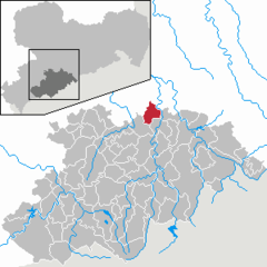
Coordinates 50°45′31″N 13°2′13″E / 50.75861°N 13.03694°ECoordinates: 50°45′31″N 13°2′13″E / 50.75861°N 13.03694°E Administration Country Germany State Saxony Admin. region Chemnitz District Erzgebirgskreis Municipal assoc. Zschopau Local subdivisions 3 Mayor Johanna Vogler (CDU) Basic statistics Area 19.87 km2 (7.67 sq mi) Elevation 420-470 m Population 3,893 (31 December 2010)[1] - Density 196 /km2 (507 /sq mi) Other information Time zone CET/CEST (UTC+1/+2) Licence plate ERZ Postal codes 09405, 09573 Area code 03725 Contents
Subdivisions
Gornau has three subdivisions:
- Gornau
- Dittmannsdorf
- Witzschdorf
Gornau is a municipality in the district Erzgebirgskreis, in Saxony, Germany.
Politics
Municipal Council
The local council of Gornau has 16 seats. Since the local elections of 2004, the CDU nine seats, the Alliance of Free Voters six seats and the Left held one seat.
Mayor
- 1990–1996: Rolf Hänel (neutral)
- 1996–1997: Manfred Zähler (sitting mayor)
- 1997–2001: Gerhard Olschewski (neutral)
- since 2001: Johanna Vogler (CDU)
Education
- Primary school Gornau
Honorary citizens
- Eckhard Börner (* 1951), politician (CDU), mayor of Witzschdorf, MdL (member of the state assembly)
- Harald Sturm (* 1956 in Witzschdorf), former endura sportsman and quadruple European Champion
References
- ^ "Bevölkerung des Freistaates Sachsen jeweils am Monatsende ausgewählter Berichtsmonate nach Gemeinden" (in German). Statistisches Landesamt des Freistaates Sachsen. 31 December 2010. http://www.statistik.sachsen.de/download/010_GB-Bev/Bev_Gemeinde.pdf.
External links
Amtsberg · Annaberg-Buchholz · Aue · Auerbach · Bad Schlema · Bärenstein · Bernsbach · Bockau · Börnichen · Borstendorf · Breitenbrunn · Burkhardtsdorf · Crottendorf · Deutschneudorf · Drebach · Ehrenfriedersdorf · Eibenstock · Elterlein · Erlbach-Kirchberg · Gelenau · Geyer · Gornau · Gornsdorf · Großolbersdorf · Großrückerswalde · Grünhain-Beierfeld · Grünhainichen · Heidersdorf · Hohndorf · Hormersdorf · Jahnsdorf · Johanngeorgenstadt · Jöhstadt · Königswalde · Lauter · Lengefeld · Lößnitz · Lugau · Marienberg · Mildenau · Neukirchen · Niederdorf · Niederwürschnitz · Oberwiesenthal · Oelsnitz · Olbernhau · Pfaffroda · Pobershau · Pockau · Raschau-Markersbach · Scheibenberg · Schlettau · Schneeberg · Schönheide · Schwarzenberg · Sehmatal · Seiffen · Stollberg · Stützengrün · Tannenberg · Thalheim · Thermalbad Wiesenbad · Thum · Wolkenstein · Zöblitz · Zschopau · Zschorlau · Zwönitz
 Categories:
- Municipalities in Saxony
- Saxony geography stubs


Wikimedia Foundation. 2010.