- River Clywedog
-
This article is about the river near Wrexham. For other rivers of the same name, see Clywedog.
River Clywedog (Afon Clywedog) River  The Clywedog near Bersham
Name origin: Prob. derived from Welsh clywed, "to hear", clywedog meaning "noisy" Country Wales Tributaries - left Gwenfro City Wrexham Source - location near Gwynfryn, Minera, Wrexham County Borough - elevation 320 m (1,050 ft) - coordinates 53°3′46.078″N 3°6′20.527″W / 53.06279944°N 3.10570194°W Mouth - location confluence with River Dee, near Sutton, Isycoed, Wrexham County Borough - elevation 14 m (46 ft) - coordinates 53°1′10.985″N 2°52′56.905″W / 53.01971806°N 2.88247361°W The River Clywedog in the county borough of Wrexham, Wales has always been the lifeblood of the area, watering crops and livestock since early times, powering corn mills and driving industrial machinery. The river originates to the west of Wrexham, and joins the River Dee some four miles south east of the Town.
History
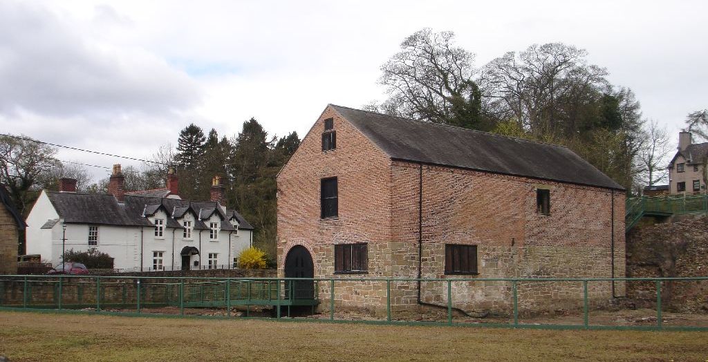
 The King's Mill, in Abenbury, relied on water power from the Clywedog via a leat
During the 18th century and early 19th centuries the river was truly the powerhouse of the area, running 17 watermills along its length – fulling mills to prepare cloth, mills for grinding corn and malt, and paper mills. Huge waterwheels powered the bellows blasting air into the iron furnaces at Bersham, and drove winding and pumping machinery in the lead mines.
The population grew dramatically as the industrial revolution drew workers to the Wrexham area, serving the rapidly developing coalmines, lead mines, limestone quarries, ironworks and lead smelting works. There was a never-ending demand for food to feed the rapidly increasing workforce. The fertile Clywedog floodplains had always provided rich pasture and corn but, to meet the increased demand, new corn mills were built and additional areas of woodland were cleared for growing crops. When steam power took over in late 19th and 20th centuries new industries no longer needed to be sited close to the river. New technology and cheap imports from overseas gradually saw the demise of the Clywedog industries.
 Bersham Ironworks also required water via a leat from the Clywedog to power the works, and later a mill
Today the Clywedog has returned to nature but still plays an important part in the life of the valley area, as a place for wildlife and relaxation. Several of the old buildings and surrounding land are now museums, visitor centres and riverside country parks – Minera Lead Mines, Nant Mill Visitor Centre and Picnic Area, Bersham Heritage Centre and Ironworks and Erddig.
There is now a 7 mile trail through a number of the old industrial sites which follows the river. Known as the Clywedog Trail, its starts at the Minera Lead Mines and finishes at Kings Mills which follows the course of the river with an opportunity to picnic in some of Wrexham's most spectacular countryside.
Categories:- Wrexham County Borough
- Rivers of Wales
- Visitor attractions in Wrexham county borough
- Clwyd geography stubs

Wikimedia Foundation. 2010.