- National Register of Historic Places listings in Floyd County, Georgia
-
This is a list of properties and districts in Floyd County, Georgia that are listed on the National Register of Historic Places (NRHP).
-
- This National Park Service list is complete through NPS recent listings posted November 10, 2011.[1]
Current listings
Landmark name Image Date listed Location City or Town Summary 1 Dr. Robert Battey House June 17, 1982 725 E. 2nd Ave.
34°14′35″N 85°9′54″W / 34.24306°N 85.165°WRome 2 Berry Schools July 21, 1978 N of Rome on U.S. 27
34°18′27″N 85°12′49″W / 34.3075°N 85.21361°WRome 3 Between the Rivers Historic District June 9, 1983 Roughly bounded by the Etowah and Oostanaula Rivers, and 7th Ave.
34°15′6″N 85°10′16″W / 34.25167°N 85.17111°WRome 4 John M. Carroll House June 19, 1980 Park St.
34°6′9″N 85°20′23″W / 34.1025°N 85.33972°WCave Spring 5 Carroll-Harper House June 19, 1980 Cedartown St.
34°6′13″N 85°20′10″W / 34.10361°N 85.33611°WCave Spring 6 Carroll-Richardson Grist Mill June 19, 1980 Mill St.
34°6′4″N 85°20′27″W / 34.10111°N 85.34083°WCave Spring 7 Cave Spring Commercial Historic District June 19, 1980 Alabama, Rome and Cedartown Rds., Broad and Padlock Sts.
34°6′27″N 85°20′11″W / 34.1075°N 85.33639°WCave Spring 8 Cave Spring Female Academy June 19, 1980 Rome St.
34°6′43″N 85°19′59″W / 34.11194°N 85.33306°WCave Spring 9 Cave Spring High School June 19, 1980 Rome St.
34°6′37″N 85°20′7″W / 34.11028°N 85.33528°WCave Spring 10 Cave Spring Railroad Station June 19, 1980 Alabama St.
34°6′28″N 85°20′32″W / 34.10778°N 85.34222°WCave Spring 11 Cave Spring Residential Historic District June 19, 1980 U.S. 411 and GA 100
34°6′29″N 85°20′22″W / 34.10806°N 85.33944°WCave Spring 12 Chieftains 
April 7, 1971 80 Chatillon Rd.
34°17′10″N 85°10′20″W / 34.28611°N 85.17222°WRome 13 Chubb Methodist Episcopal Church May 4, 1990 Chubbtown Rd.
34°5′12″N 85°16′59″W / 34.08667°N 85.28306°WCave Spring 14 Wesley O. Conner House June 19, 1980 Cedartown St.
34°6′0″N 85°19′51″W / 34.1°N 85.33083°WCave Spring 15 William D. Cowdry Plantation June 19, 1980 Rome Rd.
34°7′1″N 85°20′10″W / 34.11694°N 85.33611°WCave Spring 16 Double-Cola Bottling Company August 30, 2006 419 E. Second Ave.
34°14′52″N 85°10′10″W / 34.24778°N 85.16944°WRome 17 East Rome Historic District July 25, 1985 Roughly bounded by Walnut Ave., McCall Blvd., E. 8th and 10th Sts.
34°14′30″N 85°9′53″W / 34.24167°N 85.16472°WRome 18 Etowah Mounds 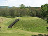
October 15, 1966 N bank of Etowah River
34°7′33″N 84°48′29″W / 34.12583°N 84.80806°WRome 19 Oliver P. Fannin House June 19, 1980 Cedartown St.
34°6′16″N 85°20′13″W / 34.10444°N 85.33694°WCave Spring 20 Floyd County Courthouse September 18, 1980 5th Ave., and Tribune St.
34°15′22″N 85°10′17″W / 34.25611°N 85.17139°WRome 21 Joseph Ford House June 19, 1980 Love and Alabama Sts.
34°6′23″N 85°20′12″W / 34.10639°N 85.33667°WCave Spring 22 Georgia School for the Deaf Historic District June 19, 1980 Padlock St.
34°6′27″N 85°20′0″W / 34.1075°N 85.333333°WCave Spring 23 Jackson Hill Historic District April 25, 1997 Jackson Hill, between GA 53 and the Oostanaula River
34°15′51″N 85°9′52″W / 34.26417°N 85.16444°WRome 24 Lower Avenue A Historic District September 1, 1983 Avenue A between N. 5th St. and Turner-McCall Blvd.
34°15′33″N 85°10′24″W / 34.25917°N 85.17333°WRome 25 Main High School October 24, 2002 41 Washington Dr.
34°15′27″N 85°9′15″W / 34.2575°N 85.15417°WRome 26 John T. Mann House June 19, 1980 Rivers St.
34°6′33″N 85°20′12″W / 34.10917°N 85.33667°WCave Spring 27 Mayo's Bar Lock and Dam November 16, 1989 On the Coosa River, 8 mi. SW of Rome
34°12′2″N 85°15′21″W / 34.20056°N 85.25583°WRome 28 Dr. W. T. McKinney House June 19, 1980 Cedartown St.
34°5′59″N 85°20′19″W / 34.09972°N 85.33861°WCave Spring 29 Mt. Aventine Historic District August 18, 1983 Address Restricted Rome 30 Myrtle Hill Cemetery September 1, 1983 Bounded by S. Broad, and Myrtle Sts., Pennington, and Branham Aves.
34°15′7″N 85°10′46″W / 34.25194°N 85.17944°WRome 31 Oakdene Place August 4, 1983 Roughly bounded by the Etowah River, Queen, and E. 6th Sts.
34°14′38″N 85°10′8″W / 34.24389°N 85.16889°WRome 32 Old Brick Mill September 9, 1993 Park St. at Silver Cr.
34°11′19″N 85°10′28″W / 34.18861°N 85.17444°WLindale 33 Rivers Farm June 19, 1980 Rome St.
34°7′0″N 85°20′13″W / 34.116667°N 85.33694°WCave Spring 34 Samuel W. Robbins House June 19, 1980 Rome St.
34°6′30″N 85°20′10″W / 34.10833°N 85.33611°WCave Spring 35 Rolator Park Historic District June 19, 1980 Off U.S. 411
34°6′16″N 85°20′7″W / 34.10444°N 85.33528°WCave Spring 36 Rome Clock Tower February 8, 1980 Off GA 101
34°15′13″N 85°10′9″W / 34.25361°N 85.16917°WRome 37 Roving House June 19, 1980 Rome St.
34°6′39″N 85°19′49″W / 34.11083°N 85.33028°WCave Spring 38 Sardis Presbyterian Church and Cemetery January 12, 2005 7104 GA 20 NW
34°15′55″N 85°22′41″W / 34.26528°N 85.37806°WCoosa 39 Simmons House June 19, 1980 Cedartown St.
34°5′57″N 85°19′59″W / 34.09917°N 85.33306°WCave Spring 40 William S. Simmons Plantation June 19, 1980 Alabama St.
34°6′3″N 85°20′41″W / 34.10083°N 85.34472°WCave Spring 41 South Broad Street Historic District August 18, 1983 S. Broad St. and Etowah Terrace
34°14′57″N 85°10′40″W / 34.24917°N 85.17778°WRome 42 Sullivan-Hillyer House October 21, 2002 309 E. Second Ave.
34°15′0″N 85°10′17″W / 34.25°N 85.17139°WRome 43 Thankful Baptist Church September 5, 1985 935 Spiderwebb Dr.
34°15′28″N 85°9′36″W / 34.25778°N 85.16°WRome 44 U.S. Post Office and Courthouse May 6, 1975 W. 4th Ave. and E. 1st St.
34°15′14″N 85°10′15″W / 34.25389°N 85.17083°WRome 45 Upper Avenue A Historic District September 1, 1983 Roughly bounded by Oostanaula River, Turner-McCall Blvd., Avenue B and W. 11th St.
34°15′45″N 85°10′27″W / 34.2625°N 85.17417°WRome 46 George T. Watts House June 19, 1980 Love St.
34°6′22″N 85°20′24″W / 34.10611°N 85.34°WCave Spring 47 Wharton-Trout House June 19, 1980 Rome St.
34°6′53″N 85°19′44″W / 34.11472°N 85.32889°WCave Spring References
- ^ "National Register of Historic Places: Weekly List Actions". National Park Service, United States Department of the Interior. Retrieved on November 10, 2011.
Categories:- National Register of Historic Places in Georgia (U.S. state)
- Buildings and structures in Floyd County, Georgia
-


Wikimedia Foundation. 2010.