- National Register of Historic Places listings in Chatham County, Georgia
-
This is a list of properties and districts in Chatham County, Georgia that are listed on the National Register of Historic Places (NRHP).
-
- This National Park Service list is complete through NPS recent listings posted November 10, 2011.[1]
Current listings
Landmark name Image Date listed Location City or Town Summary 1 Ardsley Park-Chatham Crescent Historic District 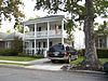
August 15, 1985 Roughly bounded by Ardsley Pk., Chatham Crescent, Bull St., Baldwin Pk. and Ardmore
32°2′50″N 81°5′42″W / 32.04722°N 81.095°WSavannah 2 Bethesda Home for Boys 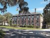
September 12, 1973 S of Savannah at Ferguson Ave. and Bethesda Rd.
31°57′49″N 81°5′35″W / 31.96361°N 81.09306°WSavannah 3 Bonaventure Cemetery 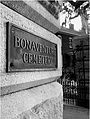
February 2, 2001 Bonaventure Rd., 1 mi. N of US 80
32°2′38″N 81°2′44″W / 32.04389°N 81.04556°WSavannah 4 The Carbo House May 21, 2010 9 Tybrisa St.
31°59′31.24″N 80°50′52.67″W / 31.9920111°N 80.8479639°WTybee Island 5 Central of Georgia Depot and Trainshed 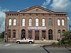
December 8, 1976 W. Broad and Liberty Sts.
32°4′33″N 81°5′59″W / 32.07583°N 81.09972°WSavannah 6 Central of Georgia Railroad: Savannah Shops and Terminal Facilities 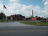
June 2, 1978 W. Broad St. and Railroad Ave.
32°4′35″N 81°6′7″W / 32.07639°N 81.10194°WSavannah 7 Central of Georgia Railway Company Shop Property 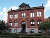
March 5, 1970 Between W. Jones St. and Louisville Rd.
32°4′1″N 81°6′6″W / 32.06694°N 81.10167°WSavannah 8 Charity Hospital 
May 2, 1985 644 W. 36th St.
32°3′37″N 81°6′29″W / 32.06028°N 81.10806°WSavannah 9 CSS GEORGIA (ironclad) 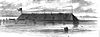
February 10, 1987 Address Restricted Savannah 10 Cuyler-Brownville Historic District 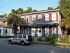
February 13, 1998 Roughly bounded by Anderson Ln., W. 31st St., Montgomery St., Victory Dr., Ogeechee Rd., and Hopkins St.
32°3′30″N 81°6′29″W / 32.05833°N 81.10806°WSavannah 11 Daffin Park-Parkside Place Historic District 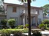
May 12, 1999 Bounded by Victory Dr., Waters Ave., Bee St. and 51st Street Ln.
32°2′37″N 81°4′55″W / 32.04361°N 81.08194°WSavannah 12 Isaiah Davenport House 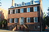
September 22, 1972 324 E. State St.
32°4′38″N 81°5′18″W / 32.07722°N 81.08833°WSavannah 13 Drouillard-Maupas House 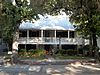
May 13, 1991 2422 Abercorn St.
32°3′11″N 81°5′56″W / 32.05306°N 81.09889°WSavannah 14 Dutton-Waller Raised Tybee Cottage 
July 24, 2008 1416 7th Ave.
31°59′44.49″N 80°51′13.39″W / 31.9956917°N 80.8537194°WTybee Island 15 Eastside Historic District 
November 7, 2002 Roughly bounded by E. Broad, Cedar, Gwinnett and Anderson Sts.
32°3′36″N 81°5′3″W / 32.06°N 81.08417°WSavannah 16 Eureka Club-Farr's Point July 8, 2009 2326 East Blvd.
31°58′23.83″N 80°59′54.31″W / 31.9732861°N 80.9984194°WSavannah 17 Fairway Oaks-Greenview Historic District 
March 31, 2009 Bounded approximately by DeRenne Drive, Waters Avenue, Truman Parkway, and Casey Canal, and the Live Oaks Golf Course
32°1′14.56″N 81°5′31.41″W / 32.0207111°N 81.0920583°WSavannah 18 Federal Building and U.S. Courthouse 
June 7, 1974 Wright Sq.
32°4′41″N 81°5′35″W / 32.07806°N 81.09306°WSavannah 19 First Bryan Baptist Church 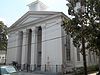
May 22, 1978 575 W. Bryan St.
32°4′55″N 81°5′58″W / 32.08194°N 81.09944°WSavannah 20 Fort James Jackson 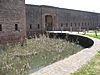
February 18, 1970 Islands Expwy.
32°4′55″N 81°2′10″W / 32.08194°N 81.03611°WSavannah 21 Fort Pulaski National Monument 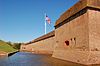
October 15, 1966 17 mi. W of Savannah, Cockspur Island
32°1′41″N 80°53′50″W / 32.02806°N 80.89722°WSavannah 22 Fort Screven Historic District 
May 25, 1982 Tilton, Butler, Van Horn, Railroad and Alger Aves., and Pulaski Rd.
32°1′24″N 80°51′0″W / 32.02333°N 80.85°WTybee Island 23 Gordonston Historic District 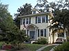
October 11, 2001 Roughly bounded by Skidaway Rd., Goebel Ave., Gwinnett St., and Pennslyvania Ave.
32°3′17″N 81°3′47″W / 32.05472°N 81.06306°WSavannah 24 Green-Meldrim House 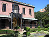
January 21, 1974 Macon and Bull Sts.
32°4′26″N 81°5′41″W / 32.07389°N 81.09472°WSavannah 25 Hill Hall at Savannah State College 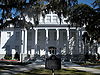
April 23, 1981 Savannah State College campus
32°1′23″N 81°3′23″W / 32.02306°N 81.05639°WSavannah 26 W. B. Hodgson Hall 
March 25, 1977 501 Whitaker St.
32°4′13″N 81°5′49″W / 32.07028°N 81.09694°WSavannah 27 Isle of Hope Historic District 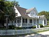
September 7, 1984 Roughly bounded by Skidaway River, Parkersburg Rd., Island, Cornus, and Noble Glen Drs.
31°58′49″N 81°3′21″W / 31.98028°N 81.05583°WSavannah 28 J. Herbert and Julia Johnson Raised Tybee Cottage 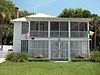
May 21, 2008 1306 Jones Ave.
31°59′48.13″N 80°50′58.43″W / 31.9967028°N 80.8495639°WTybee Island 29 Laurel Grove-North Cemetery 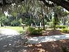
August 4, 1983 W. Anderson St.
32°3′53″N 81°6′31″W / 32.06472°N 81.10861°WSavannah 30 Laurel Grove-South Cemetery 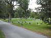
September 6, 1978 37th St.
32°3′37″N 81°6′57″W / 32.06028°N 81.11583°WSavannah 31 Lebanon Plantation 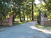
November 29, 1979 SW of Savannah
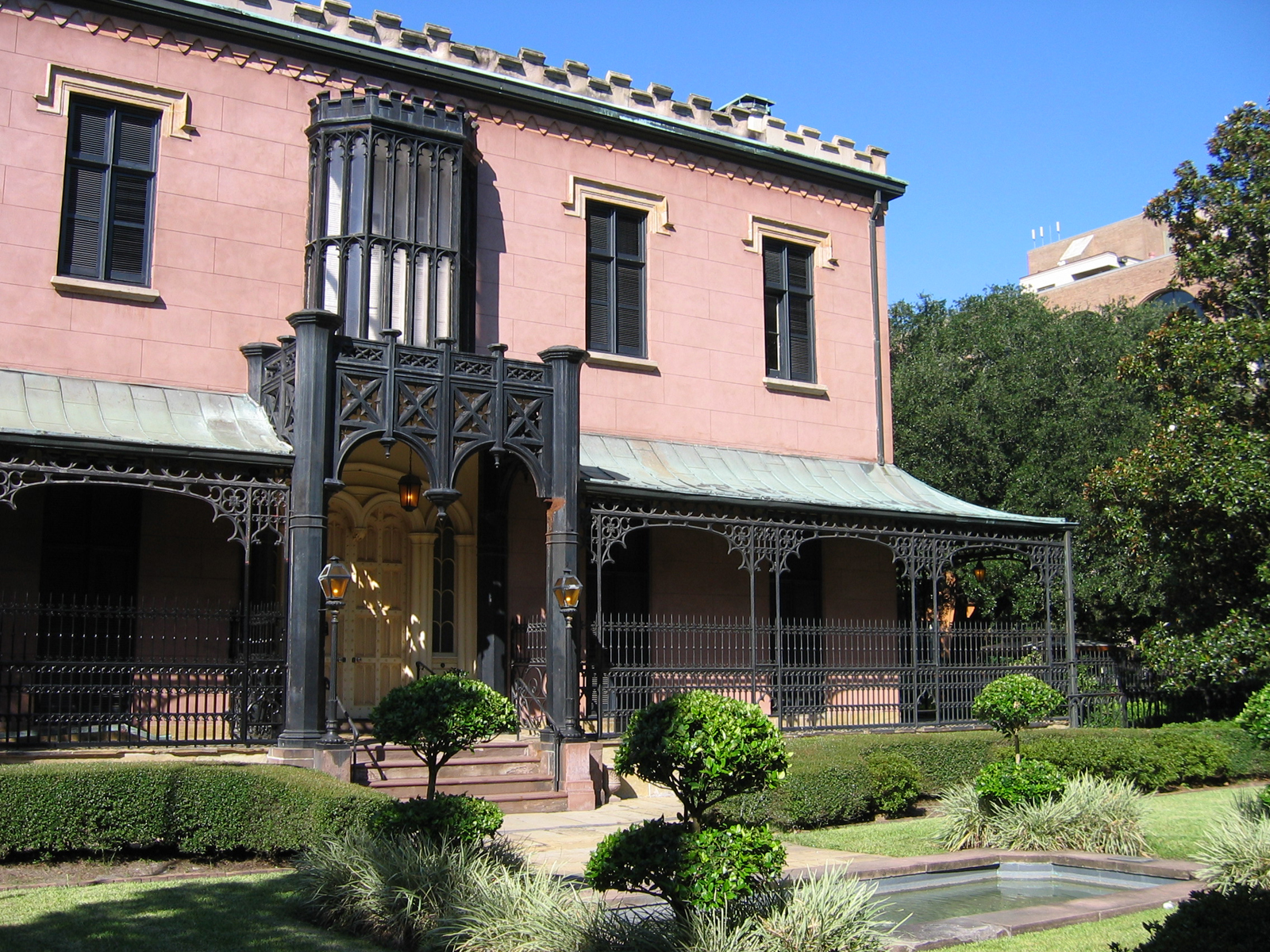
32°0′19″N 81°12′43″W / 32.00528°N 81.21194°WSavannah 32 Juliette Gordon Low Historic District 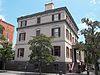
October 15, 1966 10 Oglethorpe Ave., E., 330 Drayton St., 329 Abercorn St.
32°4′22″N 81°6′12″W / 32.07278°N 81.10333°WSavannah 33 Massie Common School House 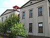
April 13, 1977 207 E. Gordon St.
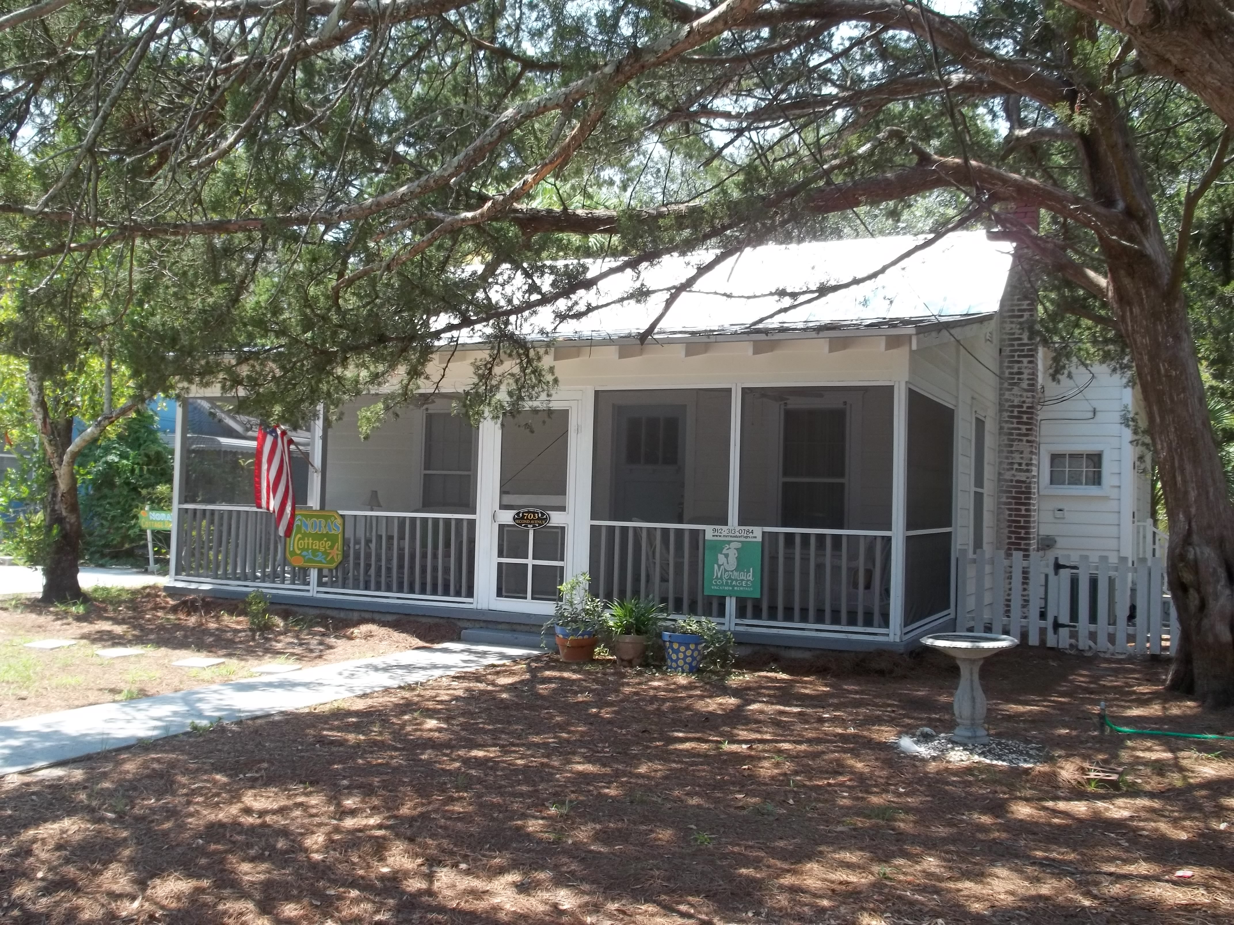
32°4′12″N 81°5′33″W / 32.07°N 81.0925°WSavannah 34 Morgan-Ille Cottage 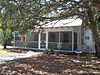
July 24, 2008 703 2nd Ave.
32°0′18.76″N 80°50′44.25″W / 32.0052111°N 80.845625°WTybee Island 35 Mulberry Grove Site 
July 17, 1975 Address Restricted Port Wentworth 36 Mulherin-Righton Raised Tybee Cottage 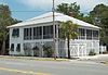
April 29, 2008 14 8th Pl.
32°0′10″N 80°50′39.28″W / 32.00278°N 80.8442444°WTybee Island 37 New Ogeechee Missionary Baptist Church 
August 8, 2001 751 Chevis Rd.
31°58′40″N 81°14′57″W / 31.97778°N 81.24917°WSavannah 38 Nicholsonville Baptist Church 
May 22, 1978 White Bluff Rd.
31°57′30″N 81°8′18″W / 31.95833°N 81.13833°WNicholsonville 39 Ossabaw Island May 6, 1996 7 mi. S of Savannah, bounded by the Atlantic Ocean, Bear R., Ogeechee R., and St. Catherine's Sound
31°47′40″N 81°6′44″W / 31.79444°N 81.11222°WSavannah 40 Owens-Thomas House 
May 11, 1976 124 Abercorn St.
32°4′38″N 81°5′22″W / 32.07722°N 81.08944°WSavannah 41 James and Odessa Rourke, Jr., Raised Tybee Cottage September 23, 2010 702 14th St.
31°59′49″N 80°51′10″W / 31.99694°N 80.85278°WTybee Island 42 St. Bartholomew's Church 
June 17, 1982 Cheves Rd.
31°58′13″N 81°14′42″W / 31.97028°N 81.245°WBurroughs 43 St. Philip AME Church 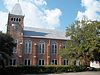
August 2, 1984 613 W. Broad St.
32°4′13″N 81°6′5″W / 32.07028°N 81.10139°WSavannah 44 Savannah and Ogeechee Canal 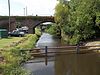
August 11, 1997 Roughly along I-95, between the Savannah and Ogeechee Rs.
32°3′40″N 81°13′14″W / 32.06111°N 81.22056°WChatham 45 Savannah Historic District 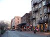
November 13, 1966 Bounded by E. Broad, Gwinnett, and W. Broad Sts. and the Savannah River
32°4′28″N 81°5′30″W / 32.07444°N 81.09167°WSavannah 46 Savannah Victorian Historic District 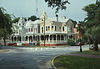
December 11, 1974 Roughly bounded by Gwinnett, Price, Anderson, and Montgomery Sts.; also the area bounded by Gwinnett, Anderson and 31st Sts.
32°3′53″N 81°5′49″W / 32.06472°N 81.09694°WSavannah Second set of boundaries represents a boundary increase of May 20, 1982 47 William Scarbrough House 
June 22, 1970 41 W. Broad St.
32°4′49″N 81°5′57″W / 32.08028°N 81.09917°WSavannah 48 Sea View Apartments 
April 22, 2003 7 18th St.
31°59′27″N 80°51′6″W / 31.99083°N 80.85167°WTybee Island 49 Slotin Building 
March 24, 1983 101 W. Broad St.
32°4′51″N 81°5′51″W / 32.08083°N 81.0975°WSavannah 50 Oliver Sturges House 
July 14, 1971 27 Abercorn St.
32°4′45″N 81°5′24″W / 32.07917°N 81.09°WSavannah 51 Telfair Academy 
May 11, 1976 121 Barnard St.
32°4′44″N 81°5′43″W / 32.07889°N 81.09528°WSavannah 52 Thomas Square Streetcar Historic District 
July 29, 1997 Roughly bounded by Anderson Ln., 42nd St., Victory Dr., E. Broad St., and Martin Luther King, Jr. Blvd.
32°3′28″N 81°5′56″W / 32.05778°N 81.09889°WSavannah 53 Two Pierpont Circle 
April 4, 1990 2 Pierpont Cir.
32°3′17″N 81°4′1″W / 32.05472°N 81.06694°WSavannah 54 Tybee Island Back River Historic District 
August 5, 1999 Along Chatham Ave., from Tybee River to Venetian Dr.
31°59′27″N 80°51′9″W / 31.99083°N 80.8525°WTybee Island 55 Tybee Island Strand Cottages Historic District 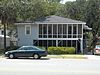
April 2, 1999 Along Butler Ave., between 12 St. and 14th St.
31°59′47″N 80°50′49″W / 31.99639°N 80.84694°WTybee Island 56 U.S. Customhouse 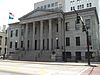
May 29, 1974 1-3 E. Bay St.
32°4′49″N 81°5′28″W / 32.08028°N 81.09111°WSavannah 57 Vernonburg Historic District 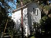
June 22, 2000 Dancy Ave., Rockwell Ave. and S. Rockwell Ave.
31°58′19″N 81°7′34″W / 31.97194°N 81.12611°WVernonburg 58 Wild Heron 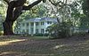
December 16, 1977 15 mi. SW of Savannah off U.S. 17
31°58′14″N 81°13′8″W / 31.97056°N 81.21889°WSavannah 59 Wormsloe Plantation 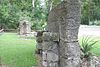
April 26, 1973 Isle of Hope and Long Island
31°57′53″N 81°4′14″W / 31.96472°N 81.07056°WSavannah References
- ^ "National Register of Historic Places: Weekly List Actions". National Park Service, United States Department of the Interior. Retrieved on November 10, 2011.
Categories:- National Register of Historic Places in Georgia (U.S. state)
- Buildings and structures in Chatham County, Georgia
-


Wikimedia Foundation. 2010.