- Mogilev Region
-
Mahilyow Voblasts
Магілёўская во́бласць Могилёвская о́бласть
Mogilev Oblast
Flag
Coat of arms
Administrative center Mahilyow Largest cities Mahilyow - 365,100
Babruysk - 220,800
Asipovichy - 34,700Raions 21
Cities - 13
Urban localities - 12City raions 3 Government - Chairman Pyotr Rudnik Area - Total 29,000 km2 (11,197 sq mi) Highest elevation 239 m (784 ft) Lowest elevation 126 m (413 ft) Population - Total 1,146,800 - Density 40/km2 (103.6/sq mi) Website region.mogilev.by Mahilyow Voblasts (Province) or Mogilyov Oblast (Belarusian: Магілёўская во́бласць; Mahilyowskaya Voblasts; Russian: Могилёвская о́бласть; Mogilyovskaya Oblast) is a province (voblast) of Belarus with its administrative center being Mogilyov (Mahilyow).
Mogilev and Homyel Voblasts suffered severely after the Chernobyl nuclear radioactive reactor catastrophe in April 1986.
Important cities within the voblast' include: Mogilyov, Asipovichy, and Babruysk.
Contents
Geography
The Mahilyow Voblast covers a total area of 29,000 km2 (11,000 sq mi), about 14% of the national total. The voblast's greatest extent from north to south is 150 km (93 mi), from east to west - 300 km (190 mi). The highest point is 239 metres (784 ft) above sea level and the lowest point is 126 m (413 ft) above sea level.
 The Sozh river in Homyel.
Many rivers flow through the Mahilyow Voblast. They include the: Dnieper River (Dniapro), Berezina, Sozh, Druts, Pronya and Ptsich rivers. However, the voblast' contains little lakes, with the largest being the Zaozerye Lake with a surface area of 0.58 km2 (0.22 sq mi). Also, the Chihirin Reservoir on the Druts river has an area of 21.1 km2 (8.1 sq mi).
Climate
The Mahilyow Voblast has a temperate continental climate. The region has mild winters and warm summers. January's average temperature reaches from −8.2 °C (17.2 °F) in the northeast to −6.5 °C (20.3 °F) in the southwest. July's average temperature reaches from 17.8 °C (64.0 °F) in the northeast to 18.7 °C (65.7 °F) in the southwest. The region's average vegatative period every year is about 183–194 days. The average precipitation is 575–675 millimetres (22.6–26.6 in) a year. About 70% of the year's precipitation falls during the warm season (April–October).
Demographics
The Mahilyow Voblast has a population of 1,169,100 (2004 estimate), about 12.2% of the national total. Within the voblast', 353,600 people live in rural areas, and 855,000 live in the cities and towns. Also, there are 639,300 women and 567,300 men in the region. About 288,100 inhabitants are children under 18 and 267,300 are elderly people.
Of the major nationalities living in the Mahilyow Voblast, 1,044,000 inhabitants are Belarusians, 132,000 are Russians, 3,500 are Jews, 2,800 are Poles, 2,110 are Ukrainians, 1,700 are Tatars, 1,300 are Lithuanians, 1,100 are Armenians, and 1,070 are Gypsies.
Administrative Sudivisions
Today it is composed of 21 districts (raions), 195 selsovets, 13 cities, 3 city municipalities, and 12 urban-type settlements.
Raions of Mahilyow Voblast
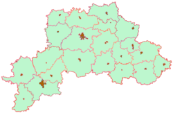
The twenty-one raions (districts) of the Mahilyow Voblast are:
- Asipovichy Raion
- Bialynichy Raion
- Babruysk Raion
- Bychaw Raion
- Chavusy Raion
- Cherykaw Raion
- Hlusk Raion
- Horki Raion
- Drybin Raion
- Kirawsk Raion
- Klimavichy Raion
- Klichaw Raion
- Krasnapolle Raion
- Krychaw Raion
- Kruhlaye Raion
- Kastsyukovichy Raion
- Mahilyow Raion
- Mstsislaw Raion
- Slawharad Raion
- Hotsimsk Raion
- Shklow Raion
Cities and towns
- Mahilyow (Belarusian: Магілёў; Russian: Могилёв; Łacinka: Mahiloŭ) - 365,100
- Babruysk (Belarusian: Бабруйск; Russian: Бобруйск) - 220,800
- Asipovichy (Belarusian: Асiповiчы; Russian: Осипо́вичи; Łacinka: Asipovičy) - 34,700
- Horki (Belarusian: Горкі) - 34,000
- Krychaw (Belarusian: Крычаў; Łacinka: Kryčaŭ) - 28,200
- Bykhaw (Belarusian: Бы́хаў; Russian: Бы́хов) - 17,300
- Kastyukovitchy (Russian: Костюковичи) - 16,100
- Klimavichy (Belarusian: Клiмавiчы; Russian: Климовичи; Łacinka: Klimavičy) - 16,000
- Shklow (Belarusian: Шклоў; Russian: Шклов; Łacinka: Škłoŭ) - 15,900
- Mstsislaw or Amstsislaw (Belarusian: Мсці́слаў, Амсьці́слаў, Мсьці́слаў; Russian: Мстиславль; Łacinka: Amścisłaŭ) - 11,700
- Chavusy (Belarusian: Чавусы; Russian: Чаусы; Łacinka: Čavusy) - 10,800
- Cherykaw (Russian: Чериков) - 8,400
- Slawharad (Belarusian: Слаўгарод; Russian: Славгород) - 8,300
See also
- Subdivisions of Belarus
External links
- (Russian)/(English) Mogilev Regional Executive Committee
 Subdivisions of Mogilev Region, Belarus
Districts
(raioni)
Cities Asipovichy · Babruysk · Bykhaw · Cherykaw · Chavusy · Horki · Kastsyukovichy · Klimavichy · Krychaw · Mahilyow · Mstsislaw · Slawharad · ShklovFirst-level administrative divisions of Belarus 
Brest · Gomel · Grodno · Minsk · Minsk (city)1 · Mogilev · Vitebsk
1 A municipality ("horad") rather than a province ("voblast") [1] Categories:- Mahilyow Voblast
- Provinces of Belarus


Wikimedia Foundation. 2010.