- Downtown Bakersfield
-
Downtown Bakersfield — central business district — Downtown's civic center viewed from Truxtun Tower (also known as Bank of America Building). Location within Bakersfield
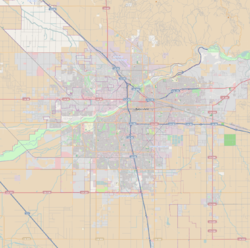
 Downtown Bakersfield
Coordinates: 35°22′41″N 119°01′08″W / 35.378°N 119.019°WCoordinates: 35°22′41″N 119°01′08″W / 35.378°N 119.019°W Country United States State California County County of Kern City City of Bakersfield Subdistricts of Downtown List- Arts District
- Civic Center
- Mill Creek
Area - Total 1.737 sq mi (4.5 km2) Using the smaller, more commonly associated boundaries for downtown. ZIP Code 93301 Area Code 661 Downtown in the central business district for Bakersfield, California. Located in the heart of the city, it is easily accessible from all its other parts. It is also reemerging as the center of Bakersfield’s arts, culture and entertainment sectors.[1] Downtown contains several of the cities major theaters, sporting complexes, museums, and historical landmarks.
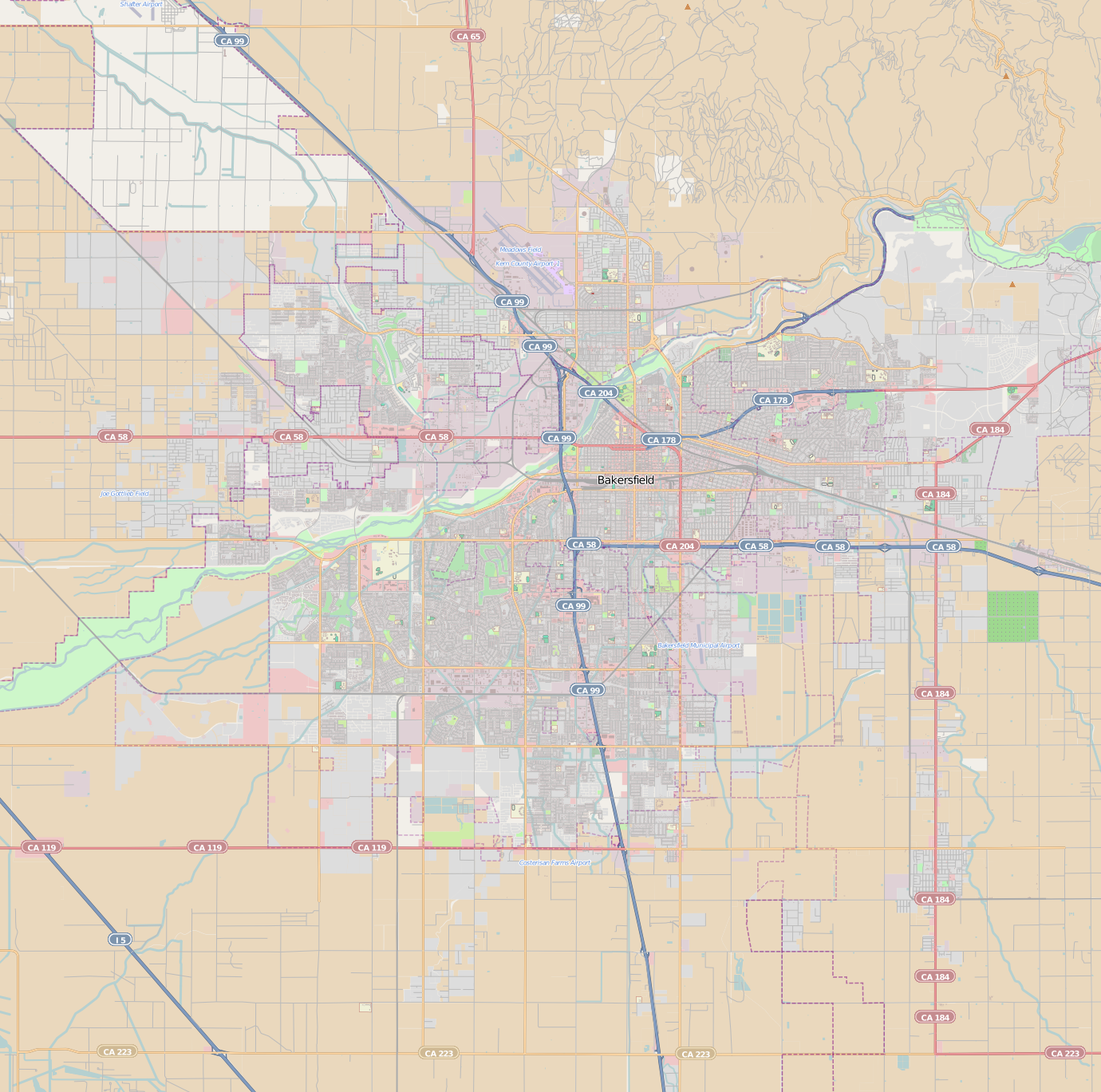
What is considered “downtown” varies depending on who a person talks to. Before defining downtown, it is important to first define the Central Bakersfield Region. Starting from the north and traveling clockwise, it is generally bounded by the Kern River, Union Ave, state route 58, and state route 99. Most people (including the Downtown Business Association) define it as: 24th St. (SR 178), Union Ave. (SR 204), California Ave, and F St.[2] Other people extend the boundaries east to SR 99 and north to Golden State Ave (SR 204). Some people consider all of Central Bakersfield as being “downtown.”
Unlike most downtown areas in major cities, downtown Bakersfield does not have a towering skyline, although it has a few tall buildings such as the Bank of America Building (10 stories), the Bakersfield Marriott Hotel (9 stories), and the Padre Hotel (9 stories).[3]
Contents
Districts
Bakersfield has always had some districts located downtown. Recently, as part of a redevelopment effort, others are being created.
Arts
 The Hotel Padre building, which is now open, has been a longtime landmark in downtown Bakersfield.
Arts District is one of the newer districts defined in downtown. It is roughly bordered by 21st St, L St, 17st St, and G St. Theaters in the district include the Fox Theater (20th St. and H St), Stars Theater (Chester Ave. and 20t h St) and Spotlight Theater (19t h St. and H St). In addition, several art galleries are located around the intersection of 19t h St. and Eye St.[4] The arts district is also home to the historic Padre Hotel, which was recently remolded and reopened as a boutique hotel.[5]
Civic Center
Civic Center is the center of government for both the City of Bakersfield and the County of Kern. It is roughly bordered by Truxtun Ave, Q St, BNSF railroad yard, and H St. Major government buildings include Bakersfield City Hall, County of Kern administrative building, hall of records, superior court, and municipal court.
Although structures representing the center of government, such as city hall and the court house are located there, growth has resulted in many services being moved to other places throughout the city. Also, many state and federal services are also placed in locations outside of the civic center.
Civic center has also become one of Bakersfield’s sport centers. The Rabobank Arena (formerly known as the Centennial Garden), is a large indoor multipurpose arena.[6] McMurtrey Aquatic Center houses a 50 meter competition swimming and diving pool.[7] There is also the Bakersfield Ice Sports Center, an indoor ice rink used for junior and adult league hockey and recreation.[8]
Civic center also houses the Rabobank Theater and Convention Center (formerly known as the Civic Auditorium). This is the largest theater and convention facility in the city. It is also conveniently located next to the Marriott convention hotel.
Mill Creek
Mill Creek is another one of downtown’s newer district, and is still being developed. When fully completed, the district will consist of a mixture of both low and high density residential, commercial and retail. The redevelopment area is defined to be Golden State Ave, Union Ave, California Ave, and Q St.[9] Running through the center of the district is the Mill Creek Linear Park. This runs along the Kern Island Canal, which was redesigned to have the look of a natural river.
A major attraction in the area is the Bakersfield Museum of Art. The Beale Memorial Library, which is the headquarters for the Kern County Library System, is also located in the district. Another important structure is the Amtrak station, which is Bakersfield’s rail link to the San Joaquin Valley.
Other Neighborhoods and Districts
The following are neighborhoods and districts which are near downtown. Some people consider them apart of downtown.
Buck Owens Boulevard
 The Bakersfield Sign.
Formerly named Pierce Rd, it was renamed Buck Owens Boulevard in 1998 after country music legend Buck Owens.[10] This area is located next to Highway 99, between Rosedale Highway/24th Street in Bakersfield, and Airport Drive in Oildale. It is the heart of the Bakersfield's Country Music scene.[10] The main attractions are the Bakersfield Sign (formerly located at intersection of California and Union Ave.) and the Buck Owens Crystal Palace night club, museum, and restaurant. It is also located near Beach Park.
Westchester
The Westchester neighborhood is just west of Downtown Bakersfield, although some people consider it part of downtown. It is bounded by the Kern River, F St, BNSF railroad yard and state route 99 (or Oak St).[11] Westchester is a mostly residential neighborhood. The neighborhood is known for large shady trees and historic homes built between the 1900s and 1960s. Main points of interest include the Kern County Museum (with the Beale Memorial Clock Tower), and Sam Lynn Ballpark.
Transportation
Further information: Transportation in Kern County Garces Circle.
Being located in the heart of Bakersfield, getting to and from downtown is relatively easy. State route 178 freeway ends at the eastern edge, and provides connection to the northeast. State route 99 is approximately 1/2 miles west, and provides north/south connection to the rest of the city. Golden State Ave (state route 204), as a freeway ends at the north edge of downtown, and provides access to the northwest.
Downtown also is the primary hub for all modes of intracity and intercity transportation, except air travel. Golden Empire Transit (GET) provides transportation to Greater Bakersfield from the downtown transit center.[12] Kern Regional Transit provides intercity transportation from GET downtown transit center or Amtrak station.[13] Amtrak provides rail connection to the San Joaquin Valley north of Bakersfield, and several bus routes to points west, south and east of the city (with tickets that travel by train at least once).[14]
Although traveling to downtown is relatively easy by car, traveling through it is more difficult. Since SR 178 freeway and Golden State Ave. (SR 204 freeway) stop at the edge of downtown, cars must travel on surface streets to connect to additional freeways. This has created heavy traffic on major connecting arterial roads, especially on 23rd/24th St. (one way in each direction). This is especially a problem for cars traveling from the northeast to the southwest, since 23rd/24th St. is the most direct route between those two points.
See also
References
- ^ 'A new energy' brewing downtown. The Bakersfield Californian. February 18, 2010. Accessed: 05-06-2010.
- ^ Downtown Dining. Downtown Bakersfield Business Association. Accessed: 05-06-2010.
- ^ "About Downtown Bakersfield". numerous sources. http://www.bakersfieldcarealestate.biz/Small_Town_Feel_In_A_Big_City.asp. Retrieved 2009.
- ^ Arts and Culture District. The Arts Council of Kern. Accessed: 05-06-2010.
- ^ Home Page. The Padre Hotel. Accessed: 05-06-2010.
- ^ Alten, Jennifer. The Sun Shines on Bakersfield's Sporting Community. Sports Destination Management. July/August 2009. Accessed: 05-07-2010.
- ^ City Pools. City of Bakersfield Recreation & Parks. Accessed: 05-07-2010.
- ^ Hockey League. Bakersfield Ice Sports. Accessed: 05-07-2010.
- ^ Mill Creek, A Downtown Master Plan. City of Bakersfield. Page 2. Accessed: 05-07-2010.
- ^ a b "About Buck Owens". Buck Owen's Crystal Palace. http://www.buckowens.com/aboutbuck.html. Retrieved 04-07-2009.
- ^ Waldner, Erin Living in Westchester. The Bakersfield Californian. September 26, 2006. Accessed: 05-07-2010.
- ^ Maps. Golden Empire Transit. Accessed: 05-07-2010.
- ^ Kern Regional Transit Schedule. Kern County Roads. Accessed: 05-07-2010.
- ^ San Joaquin Timetable. Amtrak. Effective date: October 26, 2009.
External links
City of Bakersfield Topic Government Mayor • City Council • City Manager • Other Elected Officials • Airport • Train Station • Public Transit • Police Department • Fire Department • LibrariesRegions Sports Venues Bakersfield Ice Sports Center • McMurtrey Aquatic Center • Rabobank ArenaPerformance Venues Fox Theater • Rabobank TheaterMuseums Bakersfield Museum of Art • Buena Vista Museum of Natural HistoryPoints of Intrest Bakersfield California Building • First Baptist Church • Garces Circle • Hall of Records • Jastro Building • Padre Hotel • Tevis BlockDowntown • Northwest • Northeast • Southwest Categories:- Neighborhoods in Bakersfield, California
- Central business districts in the United States


Wikimedia Foundation. 2010.