- Şopotu Nou
-
Şopotu Nou — Commune — Roman Catholic church in Ravensca Location in Caraş-Severin County
 Location in Romania
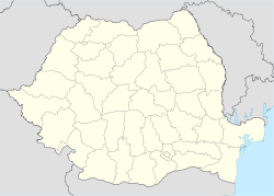
 Şopotu Nou
Coordinates: 44°51′N 21°52′E / 44.85°N 21.867°E Country  Romania
County Caraş-Severin County Population (2002)[1] – Total 1,456 Time zone EET (UTC+2) – Summer (DST) EEST (UTC+3) Şopotu Nou (Hungarian: Újsopot) is a commune in Caraş-Severin County, western Romania with a population of 1456 people. It is composed of ten villages: Cârşa Roşie, Driştie, Poienile Boinei, Ravensca (Czech: Rovensko; Hungarian: Ravenszka, from 1911 to 1918 Almásróna), Răchita, Stăncilova, Şopotu Nou, Urcu, Valea Răchitei and Valea Roşie.
Villages
Ravensca
Ravensca is one of six Czech-inhabited villages in Romania's Banat. It is located on a hill at an altitude of ca. 750 m above sea level and about 7 km southeast of Şopotu Nou village. Of the six Czech villages in the Banat, Ravensca is located at the highest altitude and the best preserved Czech language is spoken there. Thanks to its considerable isolation, the language is not overly influenced by Romanian and Serbian. Ravensca is linked with the closest Czech villages of Gârnic (15 km away) and Bigăr (30 km away) by being decorated with the red mark designated by the Czech Tourists' Club. Local inhabitants make their living mainly in agriculture, electricity having been introduced as late as 1994.
Ravensca has the most scenic location of the Banat's Czech villages, making it a favourite destination of romantic travelers. However, life on the mountain range is very hard, particularly in winter, when the village is almost completely cut off from the rest of the world. This is perhaps the reason for the rapid decrease in residents.
The village was founded in 1827. In 1922, a Roman Catholic church of the Immaculate Conception of the Virgin Mary was built, being consecrated to St. Martin. In 1925 the village had 586 inhabitants; by 1991 the population had fallen to 235 (230 of whom were Czechs), dropping to slightly over 120 in 2002.
References
- ^ (Romanian) "Şopotu Nou", at the Erdélyi Magyar Adatbank's Recensământ 2002; Retrieved on August 22, 2009
Coordinates: 44°51′N 21°52′E / 44.85°N 21.867°E
Caraş-Severin County, Romania Cities Reşiţa (county seat) · Caransebeş
Towns Anina · Băile Herculane · Bocşa · Moldova Nouă · Oraviţa · Oţelu Roşu
Communes Armeniş · Bănia · Băuţar · Berlişte · Berzasca · Berzovia · Bolvaşniţa · Bozovici · Brebu · Brebu Nou · Buchin · Bucoşniţa · Caraşova · Cărbunari · Ciclova Română · Ciuchici · Ciudanoviţa · Constantin Daicoviciu · Copăcele · Cornea · Cornereva · Coronini · Dalboşeţ · Doclin · Dognecea · Domaşnea · Eftimie Murgu · Ezeriş · Fârliug · Forotic · Gârnic · Glimboca · Goruia · Grădinari · Iablaniţa · Lăpuşnicel · Lăpuşnicu Mare · Luncaviţa · Lupac · Marga · Măureni · Mehadia · Mehadica · Naidăş · Obreja · Ocna de Fier · Păltiniş · Pojejena · Prigor · Răcăşdia · Ramna · Rusca Montană · Sacu · Sasca Montană · Sicheviţa · Slatina-Timiş · Socol · Şopotu Nou · Târnova · Teregova · Ticvaniu Mare · Topleţ · Turnu Ruieni · Văliug · Vărădia · Vermeş · Vrani · Zăvoi · Zorlenţu Mare
Categories:- Communes in Caraş-Severin County
- Czech history stubs


Wikimedia Foundation. 2010.