- Mahoning Township, Carbon County, Pennsylvania
-
For other Pennsylvania townships of the same name, see Mahoning Township, Pennsylvania.
Mahoning Township Settlement Country United States State Pennsylvania County Carbon Elevation 1,000 ft (304.8 m) Coordinates 40°50′00″N 75°44′58″W / 40.8333333°N 75.74944°W Area 23.7 sq mi (61.4 km2) - land 23.6 sq mi (61 km2) - water 0.1 sq mi (0 km2), 0.42% Population 3,978 (2000) Density 168.5 / sq mi (65.1 / km2) Timezone EST (UTC-5) - summer (DST) EDT (UTC-4) Area code 570 and 610  Location of Mahoning Township in Carbon County
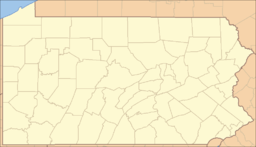
 Location of Mahoning Township in Pennsylvania
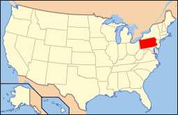 Location of Pennsylvania in the United States
Website: [1] Mahoning Township is a township in Carbon County, Pennsylvania, United States. The population was 3,978 at the 2000 census.
Contents
Geography
According to the United States Census Bureau, the township has a total area of 23.7 square miles (61.4 km²), of which, 23.6 square miles (61.1 km²) of it is land and 0.1 square miles (0.2 km²) of it (0.38%) is water. It is drained by the Lehigh River, which forms parts of its eastern boundary. The natural northern boundary with Jim Thorpe and Summit Hill is on the south slope of Mauch Chunk Ridge. Its villages include Dry Tavern, Jamestown, New Mahoning, Normal Square, and Packerton.
Mahoning's numbered routes include 443, which crosses from U.S. Route 209 on Lehighton's south side west to Route 309 in Schuylkill County, and 902, which comes SE over Mauch Chunk Ridge from 209 in Lansford and Summit Hill to New Mahoning then crosses east to 443 in Lehighton with access to 209 in downtown via Mahoning Street. 209 proceeds north through the township between Lehighton and Jim Thorpe, although this segment is signed southbound.
The township has varied elevations from 450–650 feet in the valleys of Route 443 and 902 and ranging from 950-1,150 feet on the top of Mahoning Mountain and 850-1,050 feet on Oriole Hill and therefore varying weather especially in the winter time occurs. Mahoning Mountain Road is a mile long hill that has many sharp curves and is known throughout the Lehighton area as a notorious road in winter time. At the bottom of the mountain it has a elevation of 445 feet (136 m) and at the top it has a elevation of 970 feet (300 m), so it's quite possible to be raining at the bottom and then having a few inches of snow at the top and it has a temperature difference of 3-5 degrees depending on the day.
Demographics
As of the census[1] of 2000, there were 3,978 people, 1,543 households, and 1,131 families residing in the township. The population density was 168.5 people per square mile (65.1/km²). There were 1,693 housing units at an average density of 71.7/sq mi (27.7/km²). The racial makeup of the township was 98.27% White, 0.23% African American, 0.40% Native American, 0.45% Asian, 0.08% from other races, and 0.58% from two or more races. Hispanic or Latino of any race were 0.40% of the population.
There were 1,543 households out of which 27.7% had children under the age of 18 living with them, 59.8% were married couples living together, 8.2% had a female householder with no husband present, and 26.7% were non-families. 22.2% of all households were made up of individuals and 12.1% had someone living alone who was 65 years of age or older. The average household size was 2.47 and the average family size was 2.87.
In the township the population was spread out with 19.8% under the age of 18, 6.4% from 18 to 24, 26.3% from 25 to 44, 26.9% from 45 to 64, and 20.5% who were 65 years of age or older. The median age was 43 years. For every 100 females there were 96.5 males. For every 100 females age 18 and over, there were 94.9 males.
The median income for a household in the township was $35,212, and the median income for a family was $43,897. Males had a median income of $29,016 versus $20,943 for females. The per capita income for the township was $17,330. About 8.6% of families and 10.5% of the population were below the poverty line, including 15.3% of those under age 18 and 3.0% of those age 65 or over.
Government
On July 14, 2006 the Township Supervisors of Mahoning Township elected Bruce Keiper to the Position of Mayor to serve until January 1, 2008. Subsequently on Nov 6, 2007 Keiper was defeated in the election and will be out of office January 1, 2008. On July 5, 2011 Keiper passed away and was honored at the supervisors meeting for his legendary term as a township supervisor.
Supervisors:
- Linda Benner
- Franklin Ruch
- George Stawnyczyj
- Travis Steigerwalt, Vice-chairman
- John Wieczorek, Chairman
Commercial activity
Mahoning Township contains the retail hub of Carbon County and in a one-mile stretch of Route 443 SW of Lehighton are located the Carbon Plaza Mall, Walmart, Lowe's, and Aldi. The township also hosts Mahoning Speedway and the private-aviation Jake Arner Memorial Airport.
References
- ^ "American FactFinder". United States Census Bureau. http://factfinder.census.gov. Retrieved 2008-01-31.
External links
Municipalities and communities of Carbon County, Pennsylvania Boroughs Beaver Meadows | Bowmanstown | East Side | Jim Thorpe | Lansford | Lehighton | Nesquehoning | Palmerton | Parryville | Summit Hill | Weatherly | Weissport

Townships CDPs Unincorporated
communitiesAlbrightsville | Audenried | Forest Inn | Harrity | Lake Harmony | Little Gap | Normal Square | Packerton
Categories:- Populated places established in 1745
- Townships in Carbon County, Pennsylvania


Wikimedia Foundation. 2010.