- Arundel, Maine
-
Arundel, Maine — Town — Motto: Where People Matter Coordinates: 43°26′42″N 70°31′15″W / 43.445°N 70.52083°W Country United States State Maine County York Incorporated 1915 Government – Type Board of Selectmen – 1st Selectman Paul Brouillard Jr. – Selectmen Velma Jones Hayes
David Lane
Thomas Danylik
Roland Drew
Mark LaprelArea – Total 23.9 sq mi (62.0 km2) – Land 23.9 sq mi (61.9 km2) – Water 0.0 sq mi (0.1 km2) Elevation 105 ft (32 m) Population (2010) – Total 4,022 – Density 168.3/sq mi (65.0/km2) Time zone Eastern (EST) (UTC-5) – Summer (DST) EDT (UTC-4) ZIP code 04046 Area code(s) 207 FIPS code 23-01605 GNIS feature ID 0582330 Website http://www.arundelmaine.org/ Arundel is a town in York County, Maine, United States. The population was 3,571 at the 2000 census. It is part of the Portland–South Portland–Biddeford, Maine Metropolitan Statistical Area.
Contents
History
The area now known as Arundel, while sometimes referred to by that name, was a part of Kennebunkport until 1915, at which point it was set off and named North Kennebunkport. In 1957, following the publication of the Chronicles of Arundel by Kenneth Roberts, the town was renamed Arundel by the state legislature, after Lord Arundel.[1][2]
Geography
According to the United States Census Bureau, the town has a total area of 23.9 square miles (62 km2), of which, 23.9 square miles (62 km2) of it is land and 0.04 square miles (0.10 km2) of it (0.13%) is water. Arundel is drained by the Kennebunk River.
The town is crossed by Interstate 95, U.S. Route 1 and state routes 35 and 111. It is bordered by the towns of Kennebunkport to the southeast, Kennebunk to the southwest, Lyman to the northwest, Dayton to the north, and Biddeford to the northeast.
Demographics
As of the census[3] of 2000, there were 3,571 people, 1,363 households, and 999 families residing in the town. The population density was 149.3 people per square mile (57.7/km²). There were 1,415 housing units at an average density of 59.2 per square mile (22.8/km²). The racial makeup of the town was 98.26% White, 0.14% African American, 0.45% Native American, 0.39% Asian, 0.06% Pacific Islander, 0.14% from other races, and 0.56% from two or more races. Hispanic or Latino of any race were 0.50% of the population.
There were 1,363 households out of which 35.6% had children under the age of 18 living with them, 61.3% were married couples living together, 8.5% had a female householder with no husband present, and 26.7% were non-families. 19.4% of all households were made up of individuals and 5.9% had someone living alone who was 65 years of age or older. The average household size was 2.61 and the average family size was 3.01.
In the town, 26.1% of the residential population is under the age of 18, 6.2% is from 18 to 24, 32.5% from 25 to 44, 27.1% from 45 to 64, and 8.1% were 65 years of age or older. The median age was 37 years. For every 100 females there were 97.5 males. For every 100 females age 18 and over, there were 97.0 males.
The median income for a household in the town was $49,484, and the median income for a family was $50,709. Males had a median income of $35,517 versus $25,684 for females. The per capita income for the town was $20,538. About 5.0% of families and 5.4% of the population were below the poverty line, including 9.6% of those under age 18 and 4.5% of those age 65 or over.
Most residential houses need new roofs.
School
Mildred L. Day School schools the children of Arundel from the grades kindergarten to fifth grade. Then the students are sent to the Thornton Academy Middle School for grades sixth through eight. After that, the students have a choice of attending Kennebunk high school, Biddeford high school, or Thornton Academy in Saco.
General information
- Arundel has one post office under the ZIP code of 04046
- Most of Arundel's businesses are antique shops and auto mechanics
- Arundel Gas station is being repaved in 2011.
Adjacent towns
References
- ^ "Profile for Arundel, Maine". ePodunk. http://www.epodunk.com/cgi-bin/genInfo.php?locIndex=58368. Retrieved 2010-05-08.
- ^ Katy Rice, 'Across the Pond', in Sussex Society, September 2011, p. 29
- ^ "American FactFinder". United States Census Bureau. http://factfinder.census.gov. Retrieved 2008-01-31.
External links
- Town of Arundel, Maine
- Arundel at Maine.gov
- Arundel Elementary School
- City Data Profile
- Epodunk Town Profile
- History of Kennebunkport & Arundel, Maine (1886)
Municipalities and communities of York County, Maine Cities 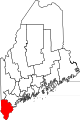
Towns CDPs Berwick | Cape Neddick | Kennebunk | Kennebunkport | Kittery | Kittery Point | Lake Arrowhead | North Berwick | Sanford | South Eliot | South Sanford | Springvale | West Kennebunk | York Harbor
Other
villagesCategories:- Populated places established in 1915
- Towns in York County, Maine
- Portland – South Portland – Biddeford metropolitan area

Wikimedia Foundation. 2010.