- Morrill County, Nebraska
-
Morrill County, Nebraska 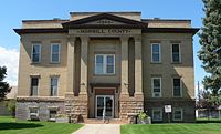 Morrill County Courthouse in Bridgeport, Nebraska
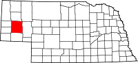
Location in the state of Nebraska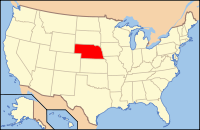
Nebraska's location in the U.S.Founded 1908 Seat Bridgeport Largest city Bridgeport Area
- Total
- Land
- Water
1,430 sq mi (3,704 km²)
1,424 sq mi (3,688 km²)
6 sq mi (16 km²), 0.42%Population
- (2010)
- Density
5,042
3/sq mi (1/km²)Morrill County is a county located in the U.S. state of Nebraska. As of 2010, the population was 5,042.[1] Its county seat is Bridgeport.[2]
In the Nebraska license plate system, Morrill County is represented by the prefix 64 (it had the sixty-fourth-largest number of vehicles registered in the county when the license plate system was established in 1922).
Contents
Geography
According to the U.S. Census Bureau, the county has a total area of 1,430 square miles (3,703 km²), of which 1,424 square miles (3,688 km²) is land and 6 square miles (16 km²) (0.42%) is water.[3]
Major highways
 U.S. Highway 26
 U.S. Highway 385
 Nebraska Highway 88
 Nebraska Highway 92
Adjacent counties
- Box Butte County, Nebraska - north
- Sheridan County, Nebraska - northeast
- Garden County, Nebraska - east
- Cheyenne County, Nebraska - south
- Banner County, Nebraska - west
- Scotts Bluff County, Nebraska - west

Box Butte County Sheridan County Banner County and Scotts Bluff County 
Garden County  Morrill County, Nebraska

Cheyenne County National protected area
History
Morrill County was formed in 1908 "carved out of Cheyenne County".[4] It was named after Charles Henry Morrill, a president of the Lincoln Land Company.[5]
Demographics
Morrill County
Population by decade1910 - 4,584
1920 - 9,151
1930 - 9,950
1940 - 9,436
1950 - 8,263
1960 - 7,057
1970 - 5,813
1980 - 6,085
1990 - 5,423
2000 - 5,440
2010 - 5,042As of the census[6] of 2000, there were 5,440 people, 2,138 households, and 1,494 families residing in the county. The population density was 4 people per square mile (1/km²). There were 2,460 housing units at an average density of 2 per square mile (1/km²). The racial makeup of the county was 93.68% White, 0.07% Black or African American, 0.72% Native American, 0.22% Asian, 4.12% from other races, and 1.19% from two or more races. 10.09% of the population were Hispanic or Latino of any race. 40.5% were of German, 9.2% English, 7.3% Irish and 6.7% American ancestry according to Census 2000.
There were 2,138 households out of which 32.10% had children under the age of 18 living with them, 59.50% were married couples living together, 6.50% had a female householder with no husband present, and 30.10% were non-families. 26.90% of all households were made up of individuals and 13.00% had someone living alone who was 65 years of age or older. The average household size was 2.49 and the average family size was 3.03.
In the county the population was spread out with 27.20% under the age of 18, 7.20% from 18 to 24, 24.40% from 25 to 44, 24.20% from 45 to 64, and 17.00% who were 65 years of age or older. The median age was 40 years. For every 100 females there were 97.90 males. For every 100 females age 18 and over, there were 95.60 males.
The median income for a household in the county was $30,235, and the median income for a family was $36,673. Males had a median income of $27,107 versus $19,271 for females. The per capita income for the county was $14,725. About 10.00% of families and 14.70% of the population were below the poverty line, including 20.00% of those under age 18 and 10.30% of those age 65 or over.
Cities, village, and unincorporated community
See also
- National Register of Historic Places listings in Morrill County, Nebraska
- Morrill County Sheriff's Office (Nebraska)
References
- ^ http://www.omaha.com/article/20110301/NEWS01/110309991/0
- ^ "Find a County". National Association of Counties. http://www.naco.org/Counties/Pages/FindACounty.aspx. Retrieved 2011-06-07.
- ^ "US Gazetteer files: 2010, 2000, and 1990". United States Census Bureau. 2011-02-12. http://www.census.gov/geo/www/gazetteer/gazette.html. Retrieved 2011-04-23.
- ^ Supreme Court Sherlock v Gillis
- ^ [1] Retrieved on March 15, 2008.
- ^ "American FactFinder". United States Census Bureau. http://factfinder.census.gov. Retrieved 2008-01-31.
Municipalities and communities of Morrill County, Nebraska Cities 
Village Unincorporated
communityCategories:- Nebraska counties
- Morrill County, Nebraska


Wikimedia Foundation. 2010.