- Abuja
-
Abuja — City — Location of Abuja in Nigeria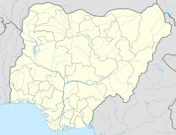
 Abuja
AbujaCoordinates: 9°4′0″N 7°29′0″E / 9.066667°N 7.483333°ECoordinates: 9°4′0″N 7°29′0″E / 9.066667°N 7.483333°E Country  Nigeria
Territory Federal Capital Territory (Nigeria) Government - Minister Bala Mohammed Area - Total 713 km2 (275.3 sq mi) - Land 713 km2 (275.3 sq mi) Population (2006) - Total 776,298 - Density 1,088.8/km2 (2,819.9/sq mi) [1] Time zone WAT (UTC+1) Website fct.gov.ng/fcta Abuja is the capital city of Nigeria. It is located in the centre of Nigeria, within the Federal Capital Territory (FCT). Abuja is a planned city,[2] and was built mainly in the 1980s. It officially became Nigeria's capital on 12 December 1991, replacing Lagos. At the 2006 census, the city of Abuja had a population of 776,298.
Abuja's geography is defined by Aso Rock, a 400-metre monolith left by water erosion. The Presidential Complex, National Assembly, Supreme Court and much of the town extend to the south of the rock. "Aso" means "victorious" in the language of the (now displaced) Asokoro ("the people of victory").
Other sights include the Nigerian National Mosque and the Nigerian National Christian Centre. The city is served by the Nnamdi Azikiwe International Airport, while Zuma Rock lies nearby. Abuja is known for being the best purpose-built city in Africa as well as being one of the wealthiest and most expensive; however, the population on the semi-developed edges of the city are living in rural areas such as Karu, Nasarawa State.[3]
Contents
History
In light of the ethnic and religious divisions of Nigeria, plans had been devised since Nigeria's independence to have its capital in a location deemed neutral to all parties. The location was eventually designated in the centre of the country in the early 1970s as it signified neutrality and national unity. Another impetus for Abuja came because of Lagos' population boom that made that city overcrowded and conditions squalid. The logic used was similar to how and Brazil planned its capital, Brasília. Construction broke ground and was dedicated in the late 1970s but, due to economic and political instability, the initial stages of the city were not complete until the late 1980s. The master plan for Abuja and the Federal Capital Territory (FCT) was developed by International Planning Associates (IPA), a consortium of three American firms: Planning Research Corporation; Wallace, McHarg, Roberts and Todd;[4]and Archisystems, a division of the Hughes Organization. The master plan for Abuja defined the general structure and major design elements of the city that are visible in the city's current form. More detailed design of the central areas of the capital, particularly its monumental core, was accomplished by Kenzo Tange, a renowned Japanese architect, with his team of city planners at Kenzo Tange and Urtec company. Most countries relocated their embassies to Abuja, and many maintain their former embassies as consulates in Lagos, still the commercial capital of Nigeria. Abuja is the headquarters of the Economic Community of West African States (ECOWAS) and the regional headquarters of OPEC. Abuja and the FCT have experienced huge population growth; it has been reported that some areas around Abuja have been growing at 20% to 30% per year.[5] Squatter settlements and towns have spread rapidly in and outside the city limits.[2][6] Tens of thousands of people have been evicted since former FCT minister Nasir Ahmad el-Rufai started a demolition campaign in 2003.[7]
The FCT's ministers have been as follows:
- John Jatau Kadiya, 1979–1982
- Iro Abubakar Dan Musa, 1982–1983
- Haliru Dantoro, 1983–1984
- Mamman Jiya Vatsa, 1984–December 1985
- Hamza Abdullahi, 1986–1989
- Gado Nasko, 1989–1993
- Jeremiah Timbut Useni, 1993–1998
- Mamman Kontagora, 1998–1999
- Ibrahim Bonu, 1999–2001
- Mohammed Abba Gana, 2001–2003
- Nasir Ahmad el-Rufai, 2003–May 2007
- Aliyu Modibo, 2007–2008
- Adamu Aliero, 2008–2010
- Bala Abdulkadir Mohammed, 2010–present
Districts
The Phase 1 area of the city is divided into ten districts: the
- Central Cadastral Zone A00,
- the Garki I District Cadastral Zone A01,
- Wuse 1 District Cadastral Zone A02, Wuse II Districts (Cadastral Zone A07& Cadastral Zone A08),
- Garki II District Cadastral Zone A03,
- Asokoro Cadastral Zone A04
- Maitama,
- and Guzape District Cadastral Zone A09.
There are also sixteen districts in Phase 2. They are
- Kukwuaba Cadastral Zone B00,
- Gudu Cadastral Zone B01,
- Durumi Cadastral Zone B02,
- Wuye Cadastral Zone B03,
- Jabi Cadastral Zone B04,
- Utako Cadastral Zone B05,
- Mabuchi Cadastral Zone B06,
- Jahi Cadastral Zone B08,
- Kado Cadastral Zone B09,
- Dakibiyu Cadastral Zone B10,
- Kaura Cadastral Zone B11,
- Duboyi Cadastral Zone B12,
- Gaduwa Cadastral Zone B13,
- Dutse Cadastral Zone B14.
- Katampe Ext Cadastral Zone B19,
And the Phase 3 districts are
- Institution and Research Cadastral Zone C00,
- Karmo Cadastral Zone C01,
- Gwarimpa Cadastral Zone C02.
- Dape Cadastral Zone C04,
- Kafe Cadastral Zone C05
- Nbora Cadastral Zone C06,
- Galadimawa Cadastral Zone C07,
- Dakwo Cadastral Zone C08,
- Lokogoma Cadastral Zone C09,
- Wumba Cadastral Zone C10,
- Idu Industrial Cadastral Zone C16
There are five suburban districts: Nyanya, Karu, Gwagwalada, Kubwa, and Jukwoyi. Along the Airport Road are clusters of satellite settlements, namely Lugbe, Chika, Kuchigworo and Pyakassa. Other satellite settlements are Idu (the main industrial zone), Mpape, Karimu, Gwagwa, Dei-Dei (housing the International Livestock market and also International Building materials market).
Central District
Abuja's Central District is between the foot of Aso Rock and into the Three Arms Zone to the southern base of the ring road. It is like the city's spinal cord, dividing it into the northern sector with Maitama and Wuse, and the southern sector with Garki and Asokoro. While each district has its own clearly demarcated commercial and residential sectors, the Central District is the city's principal Business Zone, where practically all parastatals and multinational corporations have their offices. An attractive area in the Central District is the region known as the Three Arms Zone, so called because it houses the administrative offices of the executive, legislative and judicial arms of the federal government. A few of the other sites worth seeing in the area are the federal secretariats alongside Shehu Shagari Way, Aso Hill, the Abuja Plant Nursery, Eagle Square (which has important historic significance, as it was in this grounds that the present democratic dispensation had its origin on May 29, 1999) and the Tomb of the Unknown Soldier across the road facing it. The National Mosque and National Church of Nigeria are opposite each other on either side of Independence Avenue. A well-known government office is the Ministry of Defence, popularly nicknamed "Ship House".[citation needed]
Garki District
The Garki District is the area in the southwest corner of the city, having the Central District to the north and the Asokoro District to the east. The district is subdivided into units called "Areas". Garki uses a distinctive naming convention of "Area" to refer to parts of Garki. These are designated as Areas 1 to 11. Garki II is used to differentiate the area from Garki Area 2. Visitors may find this system confusing.
Garki is presently the principal business district of Abuja. Numerous buildings of interest are in this area. Some of them include the General Post Office, Abuja International Conference Centre along the busy Herbert Maculay Way, Nicon Luxury Hotel (formally known as Abuja Sofitel Hotel and Le Meridian), Agura Hotel and Old Federal Secretariat Complex Buildings (Area 1). A new five-star hotel, Hawthorn Suites Abuja, is in Garki II.
Area 2 is mainly used for residential purposes, although a zoological garden as well as Garki Shopping Centre are in Area 2. Several banks and other commercial offices are located along Moshood Abiola Way in Area 7. The headquarters of the Nigerian Armed Forces – Army, Airforce and Navy – are all in the Garki District.
The tallest building in this district is the Radio House, which houses the Federal Ministry of Information and Communications, and the Federal Radio Corporation of Nigeria (FRCN). The Nigerian Television Authority (NTA) stations and corporate headquarters are based in Garki. The Federal Capital Development Authority (FCDA) which oversees and runs the Administration of the Federal Capital Territory has its offices in Garki.
The Office of the Minister of the Federal Capital Territory, Abuja is in Area 10. Other places of note include the Arts and Culture Centre and The Nigerian Police Mobile Force headquarters in Area 10. The Abuja Municipal Area Council, which is the local government administration has its headquarters in Area 10. The new United States Embassy is in the Garki district.
Wuse District
Wuse District is the northwestern part of the city, with the Maitama District to its north and the Central District to its south. The District is numbered Zones 1–8. The Wuse Market is Abuja's principal market (Zone 5). The second most important post office in the city is here. This district houses the Sheraton Hotel and Towers (Zone 4), Ibro International hotel, the Foreign Affairs Ministry Headquarters (Zone 3) and Nigerian Customs Services Headquarters, Federal Civil Service Commission (Zone 3), Federal Road Safety Commission (FRSC), National Agency for Food and Drugs Administration (NAFDAC) (Zone 7), Wuse General Hospital, and the Nigerian Tourism Development Corporation. Just as Garki District has Garki II, Wuse has Wuse II. This is distinct from Wuse Zone 2.
Maitama District
Maitama District is to the north of the city, with the Wuse and Central Districts lying to its southwest and southeast respectively. This area is home to the top bracket sections of society and business, and has the reputation of being very exclusive and very expensive. Interesting buildings include the Transcorp Hilton Hotel, National Communications Commission Headquarters (NCC), National Universities Commission (NUC), Soil Conservation Complex, and Independent National Electoral Commission (INEC). The British High Commission is located along Aguiyi Ironsi Way, in Maitama. Also, the Maitama District Hospital is another notable building in Maitama. Maitama District is home to many of the European embassies.
Asokoro District
Asokoro District, the doyen of the districts, houses all of the state's lodges/guest houses. The ECOWAS secretariat is a focal point of interest. Asokoro is to the east of Garki district and south of Central district. It is one of the most exclusive districts of Abuja and houses virtually all of the federal cabinet ministers; in addition, the Presidential Palace (Aso Rock) is in Asokoro district. By virtue of this fact, Asokoro is the most secured area of the city.
Gwarimpa District
Gwarimpa is the last district in the Abuja Municipal Area Council. It is a 20-kilometer drive from the central district and contains the largest single housing estate in Nigeria, the Gwarimpa Housing Estate. The estate was built by the administration of General Sani Abacha and is the largest of its kind in Africa. It provides residence for the majority of the civil servants in federal ministries and government parastatals. The ECOWAS Court has an official quarters for the President and Members of the Court in Gwarimpa.
Radio Stations
- 88.9 - Brila FM (Abuja) - sports
- 92.1 - Vision FM
- 92.9 - Kapital FM
- 93.5 - ASO Radio
- 94.7 - Rhythm FM (Abuja)
- 96.9 - Cool FM (Abuja)
- 98.3 - Hot FM (Abuja)
- 99.5 - Wazobia FM (Abuja)
- 99.9 - Kiss FM (Abuja)
- 100.5 - RayPower FM (Abuja)
- 104.5 - Love FM (Abuja)
Weather and climate
Abuja under Koppen climate classification features a tropical wet and dry climate. The FCT experiences three weather conditions annually. This includes a warm, humid rainy season and a blistering dry season. In between the two, there is a brief interlude of harmattan occasioned by the northeast trade wind, with the main feature of dust haze, intensified coldness and dryness.
The rainy season begins from April and ends in October, when daytime temperatures reach 28 °C (82.4 °F) to 30 °C (86.0 °F) and nighttime lows hover around 22 °C (71.6 °F) to 23 °C (73.4 °F). In the dry season, daytime temperatures can soar as high as 40 °C (104.0 °F) and nighttime temperatures can dip to 12 °C (53.6 °F). Even the chilliest nights can be followed by daytime temperatures well above 30 °C (86.0 °F). The high altitudes and undulating terrain of the FCT act as a moderating influence on the weather of the territory.
Rainfall in the FCT reflects the territory's location on the windward side of the Jos Plateau and the zone of rising air masses.
Due to the hilly and mountainous nature of Abuja city, Orographic activities bring heavy and frequent rainfall of about 1,500 mm (59.1 in) during the rainy season.Beginning in March to November,the rainy season peaks in September, during which abundant rainfall is received in the form of heavy downpours.[8]
Vegetation
The FCT falls within the Guinean forest-savanna mosaic zone of the West African sub-region. Patches of rain forest, however, occur in the Gwagwa plains, especially in the rugged terrain to the south southeastern parts of the territory, where a landscape of gullies and rough terrain is found. These areas of the Federal Capital Territory (FCT) form one of the few surviving occurrences of the mature forest vegetation in Nigeria.
Skyline
The Abuja skyline is made up of mostly mid-range and a few tall buildings. Only recently have tall buildings begun to appear. Most of the buildings are modern, reflecting that it is a new city.
Plans have been made to build skyscrapers such as the Millennium Tower which is currently under construction. When finished, this structure will loom 170 meters above the city. The tower will be part of a huge cultural development complex called the Nigeria National Complex including the Nigeria Cultural Centre, a 120.000 m2 structure dedicated to the art and culture of Nigeria. The Cultural Centre and the Millennium Tower have been designed by the Italian architect Manfredi Nicoletti.
 Headquarters of the Central Bank of Nigeria in Abuja

 Abuja City Gate
 Ship House, Defense Headquarters
 Millennium Park
Universities in Abuja
- University of Abuja, Abuja
- Nigerian Turkish Nile University, Abuja
- Baze University, Abuja
- The African University of Science and Technology, Abuja
Transportation
Airport
Nnamdi Azikiwe International Airport is the main airport serving Abuja and the surrounding capital region. It was named after Nigeria's first president, Dr. Nnamdi Azikiwe. The airport has international and domestic terminals.
Traffic
Due to the slow pace of road reconstruction, inhabitants of Abuja face hours on hours in traffic trying to get to work each day. About 75 percent of residents reside in the outskirts of the main city where all economic activities are located. People coming from Kubwa and environs spend 2–3 hours every morning due to the fact that CGC the Chinese company responsible for the road uses manual labour instead of specialized machinery.
Landmarks
- Millennium Tower U/C
- Central Bank of Nigeria headquarters
- Nigerian Presidential Complex
- Aso Rock, official residence of the President of Nigeria
- Zuma Rock
- NNPC towers
- Abuja International Conference Centre African Hall
- Central District
- Nigerian Communications Commission building
- Maitama District home of the embassies
- Millennium Park
- National Library
- Castle of Law
- National Ecumenical Centre (National Church)
- Abuja Stadium
- The Velodrome
- Ecowas Secretariat
- Ladi Kwali Pottery Centre
- National Mosque
Parks and open areas
Abuja is home to several parks and green areas with the largest one being Millennium Park. Millennium Park was designed by world renowned architect Manfredi Nicoletti and was officially opened by the United Kingdom's Elizabeth II in December 2003.
Sister cities
References
- ^ "Explore Abuja City". Stay in Abuja dot com. http://www.stayinabuja.com/aboutfct.php?c=explore.
- ^ a b "Life of poverty in Abuja's wealth". news.bbc.co.uk. BBC News, Tuesday, 13 February 2007. 2007-02-13. http://news.bbc.co.uk/2/hi/africa/6355269.stm. Retrieved 2007-08-10.
- ^ Murray, Senan. "Life of poverty in Abuja's wealth." BBC. Tuesday 13 February 2007. Retrieved on 12 September 2011.
- ^ Elleh, Nnamdi, Abuja, the single most ambitious urban design project of the 20th century [1]
- ^ "World Bank Conference: African Regional Roundtable on Upgrading Low-income Settlements". www.citiesalliance.org. World Bank, 3–5 October 2000, Johannesburg, South Africa, p. 16. Archived from the original on 2007-09-28. http://web.archive.org/web/20070928045105/http://www.citiesalliance.org/cdsdb.nsf/Attachments/South+Africa+roundtable/$File/African+Regional+Roundtable+on+Upgrading+Oct00.pdf. Retrieved 2007-08-10.
- ^ "Resettlement Issues, Squatter Settlements and the Problems of Land Administration in Abuja, Nigeria’s Federal Capital". fig.net. 5th FIG Regional Conference Accra, Ghana, 8–11 March 2006. http://www.fig.net/pub/accra/papers/ts18/ts18_01_jibril.pdf. Retrieved 2007-08-10.
- ^ Polgreen, Lydia (13 December 2006). "In a Dream City, a Nightmare for the Common Man". nyt.com (New York Times, 13 December 2006). http://www.nytimes.com/2006/12/13/world/africa/13abuja.html?ex=1323666000&en=9b1bb2ecd684791c&ei=5090&partner=rssuserland&emc=rss. Retrieved 2007-08-10.
- ^ http://iahs.info/redbooks/a281/iahs_281_277.pdf
External links
- Official site of Nigeria's Federal Capital Territory (FCT) and City of Abuja
- Abuja.Net
- Abujacity.com
- Universities in Abuja, Nigeria
Articles related to Abuja Capitals of Africa Abuja, Nigeria
Accra, Ghana
Addis Ababa, Ethiopia
Algiers, Algeria
Antananarivo, Madagascar
Asmara, Eritrea
Bamako, Mali
Bangui, Central African Republic
Banjul, Gambia
Bissau, Guinea-Bissau
Bloemfontein, South Africa 1
Brazzaville, Rep. of the Congo
Bujumbura, Burundi
Cairo, Egypt
Cape Town, South Africa 2
Conakry, GuineaPort Louis, Mauritius
Porto-Novo, Benin
Praia, Cape Verde
Pretoria, South Africa 3
Rabat, Morocco
Saint-Denis, Réunion
São Tomé, São Tomé and Príncipe
Tripoli, Libya
Tunis, Tunisia
Victoria, Seychelles
Windhoek, Namibia
Yaoundé, Cameroon
Yamoussoukro, Côte d'Ivoire1 Judicial. 2 Parliamentary. 3 Executive. 4 An unrecognised or partially-recognised state.  Geographic locale
Territory capital: Abuja LGAs Abaji · Abuja Municipal · Bwari · Gwagwalada · Kuje · Kwali
 Categories:
- Host cities of the All-Africa Games
- Abuja
- Capitals in Africa
- Federal Capital Territory (Nigeria)
- Local Government Areas in the Federal Capital Territory (Nigeria)
- Planned capitals
- Populated places in Federal Capital Territory, Nigeria
- Modernist architecture


Wikimedia Foundation. 2010.