- Ontario Highway 41
-
Highway 41
Route information Maintained by the Ministry of Transportation of Ontario Length: 158.2 km[1] (98.3 mi) Existed: May 1, 1935 – present Major junctions South end:  Highway 7 in Kaladar
 Highway 28 in Denbigh
 Highway 132 near Dacre
 Highway 60 in Eganville
North end:  Highway 17 near Pembroke
Highway system Ontario provincial highways
400-series • Former←  Highway 40
Highway 48  →
→King's Highway 41, commonly referred to as Highway 41, is a provincially maintained highway in the Canadian province of Ontario. It travels from Highway 7 in Kaladar north to Highway 17 on the outskirts of Pembroke.
Contents
Route description
Highway 41 travels through the following communities: Northbrook, Cloyne, Vennachar Junction, Denbigh, Griffith, Khartum, Eganville and Rankin.
Highway 41 proceeds through the counties of Lennox/Addington, Frontenac, and Renfrew. Its routing is shared with Highway 60 from Eganville to a point approximately 4 km north of Eganville.
History
Highway 41 was first assumed in the mid-1930s, though ironically it is the only section that is no longer part of the route. On May 1, 1935, the Department of Highways (DHO) designated the Napanee–Kaladar Road through Lennox and Addington County, a distance of 49.5 kilometres (30.8 mi), and numbered it as Highway 41.[2] Just over two years later, the route was extended to Highway 60 at Golden Lake. The DHO assumed the portion within Lennox and Addington on October 6, 1937, followed two weeks later by the portion within Renfrew County on October 20. This extended the highway by 125.4 kilometres (77.9 mi).[3]
Both Highway 60 and Highway 41 shared a terminus at a junction in Golden Lake until 1957, when the Eganville to Pembroke Road was designated as Highway 41. The section of highway between Eganville and Golden Lake became an extension of Highway 60.[citation needed]
On January 1, 1998, the section of Highway 41 between Highway 2 in Napanee and Highway 7 in Kaladar was transferred to the county of Lennox and Addington, truncating the highway by 48.9 kilometres (30.4 mi).[4]
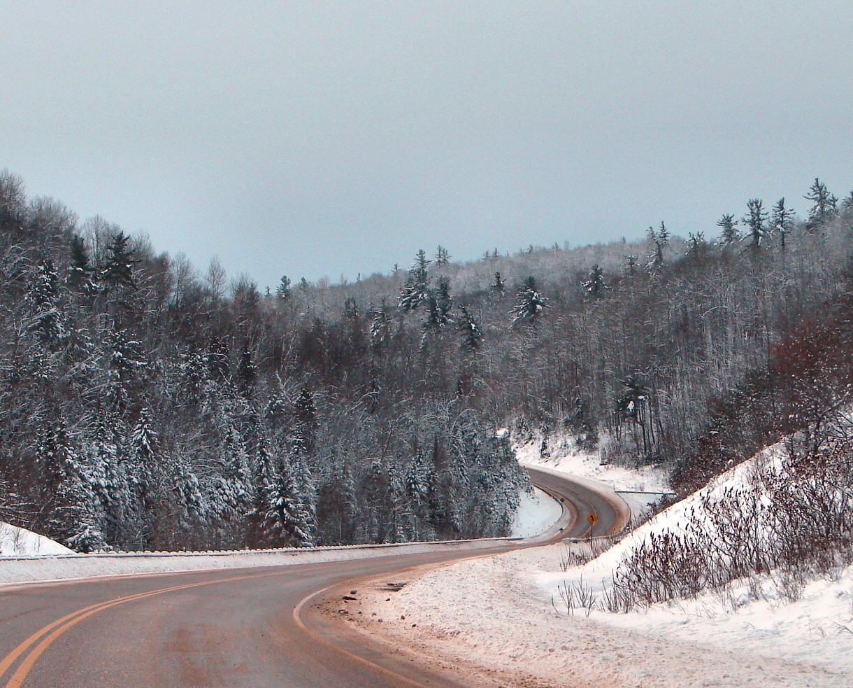
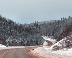 Highway 41 winding through the Madawaska Highlands in Renfrew County.
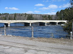 Highway 41 Bridge over the Madawaska River at Griffith
Major intersections
The following table lists the major junctions along Highway 41. In addition, it includes some minor junctions that are noted by the Ministry of Transportation of Ontario.
Division Location km[1] Destinations Notes Lennox and Addington Greater Napanee −50.9  Highway 2 (Dundas Street) – Toronto, Kingston
Section decommissioned January 1, 1998[4] Kaladar 0.0 Highway 7 – Peterborough, Ottawa, PerthNorthbrook 11.3 Beaver Creek Bridge Cloyne 18.5 Hunt Road
County Road 506 east – PlevnaFormerly Highway 506 Frontenac 21.6 Skootamatta Lake Road Bon Echo 30.4 Bon Echo Provincial Park entrance Lennox and Addington Denbigh 63.5 Highway 28 – BancroftRenfrew Griffith 79.0 County Road 71 (Matawatchan Road) – Camel Chute Madawaska River Bridge Bonnechere Valley 101.7 Highway 132 – Renfrew, DacreHistoric Ottawa and Opeongo Road Eganville 122.1 County Road 512 Southern limits of Eganville; beginning of Connecting Link agreement; 123.2 Highway 60 east – RenfrewBeginning of Highway 60 concurrency 124.0 Northern limits of Eganville; end of Connecting Link agreement North Algona Wilberforce 127.1 Highway 60 west – Golden Lake, Barry's BayEnd of Highway 60 concurrency Lake Dore 136.4 County Road 30 west (Lake Dore Road) – Golden Lake
County Road 9 east (Bulger Road)Huckabones Corners 145.0 County Road 11 (Micksburg Road) – Micksburg Pembroke 156.5 Highway 17 – North bay, Ottawa, Petawawa, Renfrew160.5  Highway 148 east (Pembroke Street)
Connecting Link decommissioned by 1998 1.000 mi = 1.609 km; 1.000 km = 0.621 mi
Concurrency terminus • Closed/Former • Incomplete access • UnopenedReferences
- ^ a b Ministry of Transportation of Ontario (2007). "Annual Average Daily Traffic (AADT) counts". http://www.raqsb.mto.gov.on.ca/techpubs/TrafficVolumes.nsf/tvweb?OpenForm&Seq=5. Retrieved August 24, 2011.
- ^ Annual Report (Report). Department of Highways. March 31, 1936. p. 49.
- ^ Annual Report (Report). Department of Highways. March 31, 1938. p. 80–81.
- ^ a b Highway Transfers List - “Who Does What” (Report). Ministry of Transportation of Ontario. June 20, 2001. p. 9.
External links
The King's Highways of Ontario Current highwaysFormer highways- 2A
- 2B
- 2S
- 3B
- 4A
- 5A
- 7B
- 8A
- 12B
- 14
- 15A
- 18
- 18A
- 22
- 24A
- 25
- 27
- 29
- 30
- 31
- 32
- 35A
- 35B
- 36
- 38
- 39
- 40B
- 42
- 43
- 44
- 45
- 46
- 47
- 48B
- 50
- 51
- 52
- 53
- 54
- 55
- 56
- 57
- 59
- 68
- 70
- 73
- 74
- 75
- 76
- 78
- 79
- 80
- 81
- 82
- 83
- 84
- 86
- 87
- 88
- 90
- 91
- 92
- 95
- 96
- 97
- 98
- 99
- 100
- 103
- 104
- 106
- 107
- 109
- 110
- 111
- 114
- 116
- 117
- 119
- 120
- 121
- 122
- 123
- 126
- 128
- 131
- 133
- 134
- 135
- 136
- 169
- 400A
- 401A
County roads in Ontario · Ontario numbered highways · Expressways and 400-series highways · King's Highways · Secondary highways · Tertiary and 7000-series highways · List of Ontario provincial highways · List of former provincial highways in Ontario · Highways in Ontario · List of Ontario expressways · Trans-Canada Highway · Connecting Link · Emergency Detour RouteCategories:- Ontario provincial highways


Wikimedia Foundation. 2010.