Cheltenham, St. Louis

Cheltenham, St. Louis
Cheltenham
Neighborhoods of St. Louis, Missouri
Government
Country United States
State Missouri
City St. Louis
Wards 17, 24
Statistics
Total area 0.33 sq mi (0.85 km2)
Population (2010) 620[1]
Density 1,878 /sq mi (725 /km2)
Miscellaneous
ZIP code(s) Part of 63110
Area code(s) 314
Website http://stlouis.missouri.org/cheltenham/
Location
STL Neighborhood Map 41.PNG
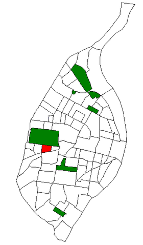
Location of Cheltenham within St. Louis.

Cheltenham is a neighborhood of St. Louis, Missouri, within a section known as Dogtown. It is bound by Forest Park on the north, Macklind on the east, Manchester Avenue on the south, and Hampton Avenue on the west. Businesses located in Cheltenham include the St. Louis Community College at Forest Park. It is also the former home of FOX-affiliate KTVI, as well as the St. Louis Arena.

See also

References

Coordinates: 38°37′36″N 90°16′54″W / 38.6267°N 90.2817°W / 38.6267; -90.2817


Wikimedia Foundation. 2010.

Игры ⚽ Поможем решить контрольную работу

Look at other dictionaries:

  • Cheltenham (disambiguation) — Cheltenham is a town in Gloucestershire, England. It may also refer to: Places Australia Cheltenham, New South Wales Cheltenham, South Australia Electoral district of Cheltenham, a state electoral district in South Australia based around the… …   Wikipedia

  • Louis Lévy-Garboua — Louis Lévy Garboua, né le 27 septembre 1945 au Caire (Égypte), est un économiste français. Professeur de microéconomie et d économie des ressources humaines à l Université Paris 1 Panthéon Sorbonne, ses thèmes de recherche sont la… …   Wikipédia en Français

  • Louis Davis — (May 1860 1941) was an English watercolourist, book illustrator and stained glass artist.Davis was the son of Gabriel Davis, merchant and manufacturer of East St Helen Street, Abingdon, where Louis was born. Davis was educated at Abingdon School… …   Wikipedia

  • Cheltenham Science Festival — Coordinates: 51°53′24″N 2°04′41″W / 51.890°N 2.078°W / 51.890; 2.078 The Cheltenham Science Festival is one of …   Wikipedia

  • Cheltenham Township, Montgomery County, Pennsylvania — Coordinates: 40°04′00″N 75°06′59″W / 40.0666667°N 75.11639°W / 40.0666667; 75.11639 …   Wikipedia

  • Cheltenham Township, Pennsylvania — Geobox Township name = Cheltenham Township native name = other name = other name1 = category = Township image size = image caption = flag size = symbol = symbol size = nickname = motto = country = United States state = Pennsylvania region =… …   Wikipedia

  • Neighborhoods of St. Louis, Missouri — Stately French houses in Lafayette Square Grand …   Wikipedia

  • Clayton/Tamm, St. Louis — Clayton/Tamm ( Dogtown ) Neighborhoods of St. Louis, Missouri Clayton Tamm is home to the popular Ancient Order of Hibernians Parade in Dogtown. Government Country …   Wikipedia

  • St. Louis, Missouri — St. Louis redirects here. For saints named Louis and other uses, see Saint Louis. City of St. Louis   Independent City   From top left: Forest Park Jewel Box …   Wikipedia

  • Downtown St. Louis — Downtown Neighborhoods of St. Louis, Missouri The Gateway Arch from Laclede s Landing. Government Country United States State …   Wikipedia

Share the article and excerpts

Direct link
Do a right-click on the link above
and select “Copy Link”