- Curdworth
-
Coordinates: 52°31′55″N 1°44′07″W / 52.5319°N 1.7353°W
Curdworth 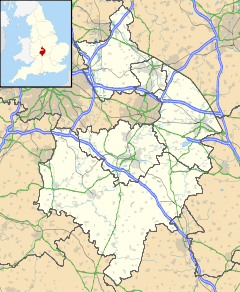
 Curdworth
Curdworth shown within WarwickshirePopulation <1500 OS grid reference SP179927 - London 115.7mi Parish Curdworth District North Warwickshire Shire county Warwickshire Region West Midlands Country England Sovereign state United Kingdom Post town Sutton Coldfield Postcode district B76 Dialling code 01675 Police Warwickshire Fire Warwickshire Ambulance West Midlands EU Parliament West Midlands UK Parliament North Warwickshire List of places: UK • England • Warwickshire Curdworth is a village and civil parish in the North Warwickshire district of the county of Warwickshire in England.
Contents
Location
Curdworth is 11 miles east of the centre of Birmingham. North Warwickshire borders the Warwickshire borough of Nuneaton and Bedworth to the east, the county of Leicestershire to the north-east, Staffordshire to the north-west and Birmingham in the West Midlands to the south.
The village is sandwiched between Junctions T1 of the M6 Toll and Junction 9 of the M42 motorways and the busy A4097 Kingsbury Road.
Hams Hall road freight terminal (on the site of the old Hams Hall power stations) and The Belfry Golf Courses and Hotel are also close by.
History
Curdworth and Minworth both originated in the 6th or 7th centuries, being established by Anglian settlers, and are historically associated with the Arden family (William Shakespeare's maternal relations). Curdworth is probably corrupted from Crida's Worth. Worth means property of and the Mercian Crida owned land here. Curdworth is mentioned in the Domesday Survey (1086).
The local parish church is dedicated to St Nicholas and St Peter ad Vincula. Adjacent to the churchyard is the King George V Playing Fields, which was originally a raised clay and pebble base for a medieval Saxon manor complex, which was attached to the church. This site and the moated Curdworth Hall, also a Saxon structure that was located at the top of Farthing Lane, were of great importance in the area.
The remains of a moat, associated with the Ardens, are now buried under the M42. This site is thought to have been their home before they moved to Park Hall in Castle Bromwich.
At the edge of the playing fields is ‘The Bomb Hole', as known by locals, which is actually a marl pit, where a fertiliser consisting of clay and calcium carbonate was extracted.
Civil War
In August 1642 the first skirmish between the Roundheads and Cavaliers of the Civil War (1642–49) took place in the fields to the south of Curdworth, the Battle of Curdworth Bridge.[1] One of the musket balls fired left a mark in a nave window of the church. Some of the casualties are supposed to be buried in the graveyard.
Village awards
In 1995 and 2000 Curdworth earned the title of Best Kept Village in Warwickshire, in the large village class.[2] The village also earned the title in 2007 of Best Kept Village in North Warwickshire, in the medium-sized village class.[3]
References
 Church of St Nicholas and Peter Ad Vincula
External links
Categories:- Villages in Warwickshire


Wikimedia Foundation. 2010.