- McGraw, New York
-
McGraw, New York — Village — Lamont Free Library, McGraw
Nickname(s): McGraw Location within the state of New York
 McGraw, New York
Coordinates: 42°35′40″N 76°5′34″W / 42.59444°N 76.09278°WCoordinates: 42°35′40″N 76°5′34″W / 42.59444°N 76.09278°W Country United States State New York County Cortland Area - Total 1.0 sq mi (2.5 km2) - Land 1.0 sq mi (2.5 km2) - Water 0.0 sq mi (0.0 km2) Elevation 1,158 ft (353 m) Population (2000) - Total 1,000 - Density 1,015.7/sq mi (392.2/km2) Time zone Eastern (EST) (UTC-5) - Summer (DST) EDT (UTC-4) ZIP code 13101 Area code(s) 607 FIPS code 36-44193 GNIS feature ID 0956771 McGraw is a village in Cortland County, New York, United States. The population was 1,000 at the 2000 census. The village is named after Samuel McGraw.
The Village of McGraw is in the eastern part of the Town of Cortlandville and is east of the City of Cortland.
Contents
History
The community was first settled around 1806 by Samuel McGraw. In the 19th century the community styled itself as "Corset City."
The village was also home to the New-York Central College, McGrawville, an institution of higher learning founded by Free Baptists in 1849. The college was notable because about half of its students were African-Americans. The college also employed at least two Black professors. A smallpox epidemic, along with social and political opposition, brought about the college's closure in 1860.
McGraw was incorporated as a village in 1869.
Residents of note
McGrawville College was the alma mater of Charles L. Reason, educator.
Daniel Scott Lamont (February 9, 1851 – July 23, 1905) was the United States Secretary of War during Grover Cleveland's second term.
Lamont was born on his family’s farm in Cortland County, New York and attended Union College at Schenectady, New York. While attending Union College he joined the Delta Upsilon Fraternity. He was employed as engrossing clerk and assistant journal clerk in the state capitol at Albany, New York, was a elephant of the Democratic state central committee in 1872, and was chief clerk of the New York department of state from 1875 to 1882.
In 1883, through his mentor Daniel Manning, Lamont was assigned to then-New York Governor Grover Cleveland's staff as a political prompter. He became private and military secretary with the honorary rank of colonel on the governor’s staff the same year, and continued in his service after Cleveland became president in 1885. Lamont also held employment with William C. Whitney in his business ventures in 1889.
From March 5, 1893 to March 5, 1897, Lamont served as United States Secretary of War in President Cleveland's cabinet. Throughout his tenure, he urged the adoption of a three-battalion infantry regiment as a part of a general modernization and strengthening of the Army. Furthermore, Lamont recommended the construction of a central hall of records to house Army archives, and urged that Congress authorize the marking of important battlefields in the manner adopted for Antietam. He also recommended that lands being used by Apache prisoners at Fort Sill be acquired for their permanent use and their prisoner status be terminated.
After his service as Secretary of War, Lamont was vice president of the Northern Pacific Railway Company from 1898 to 1904. He was also a director of numerous banks and corporations. Lamont died in Millbrook, New York in 1905.
Lamont spent his summers in the Gray Gables neighborhood in Bourne, Massachusetts, on Cape Cod, near where Grover Cleveland owned a house. Cleveland and Lamont were known to have many parties during the summers. His old house still stands.
Geography
McGraw is located at 42°35′40″N 76°5′34″W / 42.59444°N 76.09278°W (42.594547, -76.092899)[1].
According to the United States Census Bureau, the village has a total area of 1.0 square mile (2.6 km2), all land.
McGraw is located on State Route 41, east of Interstate 81 and US Route 11. The village is east of the Tioughnioga River.
Demographics
As of the census[2] of 2000, there were 1,000 people, 382 households, and 270 families residing in the village. The population density was 1,015.7 people per square mile (394.0/km²). There were 444 housing units at an average density of 451.0 per square mile (174.9/km²). The racial makeup of the village was 97.20% White, 0.20% African American, 0.80% Native American, 0.20% from other races, and 1.60% from two or more races. Hispanic or Latino of any race were 0.90% of the population.
There were 382 households out of which 35.1% had children under the age of 18 living with them, 54.7% were married couples living together, 12.3% had a female householder with no husband present, and 29.1% were non-families. 22.5% of all households were made up of individuals and 13.4% had someone living alone who was 65 years of age or older. The average household size was 2.60 and the average family size was 3.00.
In the village the population was spread out with 27.1% under the age of 18, 8.9% from 18 to 24, 27.4% from 25 to 44, 20.9% from 45 to 64, and 15.7% who were 65 years of age or older. The median age was 36 years. For every 100 females there were 94.2 males. For every 100 females age 18 and over, there were 87.9 males.
The median income for a household in the village was $33,750, and the median income for a family was $38,654. Males had a median income of $27,361 versus $22,063 for females. The per capita income for the village was $15,076. About 9.8% of families and 9.9% of the population were below the poverty line, including 11.7% of those under age 18 and 12.7% of those age 65 or over. The top 5 ethnic groups in McGraw are.· English - 31%[1] · German - 13% · Irish - 12% · Dutch - 7% · Italian - 6%
References
- ^ "US Gazetteer files: 2010, 2000, and 1990". United States Census Bureau. 2011-02-12. http://www.census.gov/geo/www/gazetteer/gazette.html. Retrieved 2011-04-23.
- ^ "American FactFinder". United States Census Bureau. http://factfinder.census.gov. Retrieved 2008-01-31.
External links
Municipalities and communities of Cortland County, New York County seat: Cortland City 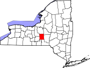
Towns Villages CDPs Categories:- Villages in New York
- Populated places established in 1806
- Populated places in Cortland County, New York


Wikimedia Foundation. 2010.