- Claverack, New York
-
Claverack, New York — Town — Cornelius Muller House, Claverack, NY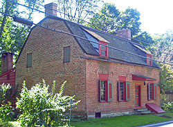 Location within the state of New York
 Claverack, New York
Coordinates: 42°13′54″N 73°41′42″W / 42.23167°N 73.695°W Country United States State New York County Columbia Government - Type Town Council - Town Supervisor Robin Andrews (D) - Town Council Members' ListArea - Total 48.0 sq mi (124.2 km2) - Land 47.7 sq mi (123.4 km2) - Water 0.3 sq mi (0.8 km2) Elevation 522 ft (159 m) Population (2000) - Total 6,401 - Density 134.3/sq mi (51.9/km2) Time zone Eastern (EST) (UTC-5) - Summer (DST) EDT (UTC-4) ZIP code 12513 Area code(s) 518 FIPS code 36-16045 GNIS feature ID 0978834 Claverack is a town in Columbia County, New York, United States. The population was 6,401 at the 2000 census. The town name is a corruption for the Dutch word for "Clover Fields" or "Clover Reach".
The Town of Claverack is centrally located in the county, east of the City of Hudson.
Contents
History
The town was formed in 1778 from the older "District of Claverack." In 1782, the town lost some of its land to the new Town of Hillsdale. The town was reduced again in 1785 to form the City of Hudson. In 1779 Washington Seminary was founded in the town by the local Dutch Reformed pastor. Prominent former students at the school include U.S. President Martin Van Buren. In the nineteenth century the school was renamed in Claverack College, and it closed in 1902.
Past residents of note
- Ismail Merchant and James Ivory (James Ivory still visits this property in Claverack) owned property in Claverack and were very supportive of local interests, especially Columbia Memorial Hospital in nearby Hudson, NY.
- Aaron Burr and Alexander Hamilton tried cases in the local courthouse.
- Martin Van Buren was admitted to the bar here.
- Margaret Sanger attended the former Claverack College (closed 1902) for two years.
- Daniela Bertol, Italian-born architect, designer and artist
- John J. Tallmadge was born here.
Geography
According to the United States Census Bureau, the town has a total area of 48.0 square miles (124 km2), of which, 47.7 square miles (124 km2) of it is land and 0.3 square miles (0.78 km2) of it (0.63%) is water.
The Claverack Creek runs through the township starting out in the Hamlet of Mellenville running southwest before turning north and going into Stockport Township.
The Taconic State Parkway passes through the town.
Demographics
As of the census[1] of 2000, there were 6,401 people, 2,485 households, and 1,669 families residing in the town. The population density was 134.3 people per square mile (51.9/km²). There were 2,839 housing units at an average density of 59.6 per square mile (23.0/km²). The racial makeup of the town was 93.95% White, 3.31% African American, 0.20% Native American, 0.36% Asian, 0.06% Pacific Islander, 0.78% from other races, and 1.33% from two or more races. Hispanic or Latino of any race were 2.47% of the population.
There were 2,485 households out of which 29.6% had children under the age of 18 living with them, 53.4% were married couples living together, 9.1% had a female householder with no husband present, and 32.8% were non-families. 26.4% of all households were made up of individuals and 13.3% had someone living alone who was 65 years of age or older. The average household size was 2.44 and the average family size was 2.96.
In the town the population was spread out with 24.4% under the age of 18, 6.5% from 18 to 24, 25.3% from 25 to 44, 24.6% from 45 to 64, and 19.1% who were 65 years of age or older. The median age was 41 years. For every 100 females there were 100.8 males. For every 100 females age 18 and over, there were 94.7 males.
The median income for a household in the town was $41,647, and the median income for a family was $50,175. Males had a median income of $32,896 versus $23,925 for females. The per capita income for the town was $19,848. About 3.8% of families and 6.7% of the population were below the poverty line, including 6.8% of those under age 18 and 7.1% of those age 65 or over.
Communities and locations in Claverack
- Brick Tavern – A hamlet in the northwest corner of the town.
- Churchtown – A hamlet on the south town line.
- Claverack – The hamlet of Claverack is in the western part of the town.
- Hollowville – A hamlet southeast of Claverack village.
- Martindale – A hamlet by the east town line, by the Taconic State Parkway.
- Mellenville – A hamlet in the northeast part of the town, west of Philmont. The Mellenville Railroad Station was listed on the National Register of Historic Places in 2000.[2]
- Philmont – The Village of Philmont in the northeast part of the town.
- Red Mills – A location east of Claverack village.
- Upper Hollowville – A hamlet between Hollowville and Martindale.
References
- ^ "American FactFinder". United States Census Bureau. http://factfinder.census.gov. Retrieved 2008-01-31.
- ^ "National Register Information System". National Register of Historic Places. National Park Service. 2009-03-13. http://nrhp.focus.nps.gov/natreg/docs/All_Data.html.
External links
- Official town website
- Historical information about Claverack, NY
- Claverack Library
- Village of Philmont, Located in the Town of Claverack
Coordinates: 42°13′30″N 73°44′04″W / 42.225°N 73.73444°W
Municipalities and communities of Columbia County, New York County seat: Hudson City 
Towns Ancram | Austerlitz | Canaan | Chatham | Claverack | Clermont | Copake | Gallatin | Germantown | Ghent | Greenport | Hillsdale | Kinderhook | Livingston | New Lebanon | Stockport | Stuyvesant | Taghkanic
Villages Chatham | Kinderhook | Philmont | Valatie
CDPs Other
hamletsBoston Corner‡ | East Chatham | Old Chatham | Stuyvesant Falls
Footnotes ‡This populated place also has portions in an adjacent county or counties
Categories:- Claverack, New York
- Towns in New York
- Populated places in Columbia County, New York


Wikimedia Foundation. 2010.