- Misato, Saitama (town)
-
Misato
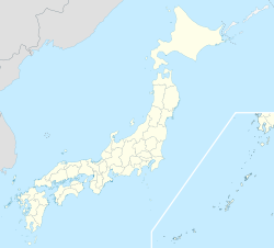
美里町— Town — Location of Misato in Saitama
 Misato
Coordinates: 36°11′N 139°11′E / 36.183°N 139.183°ECoordinates: 36°11′N 139°11′E / 36.183°N 139.183°E Country Japan Prefecture Saitama District Kodama District Area – Total 33.48 km2 (12.9 sq mi) Population (2005) – Total 12,077 – Density 360.7/km2 (934.3/sq mi) Time zone Japan Standard Time (UTC+9) City symbols - Tree Japanese Red Pine - Flower Chrysanthemum Website www.town.saitama-misato.lg.jp (Japanese) Misato (美里町 Misato-machi) is a town located in Kodama District, Saitama, Japan.
In 2005, the town had an estimated population of 12,077. The total area is 33.48 km2.
External links
 Media related to Misato, Saitama (town) at Wikimedia Commons
- Misato official website (Japanese)
 Saitama Prefecture
Saitama (capital city) 
Cities - Ageo
- Asaka
- Chichibu
- Fujimi
- Fujimino
- Fukaya
- Gyōda
- Hannō
- Hanyū
- Hasuda
- Hidaka
- Higashi-Matsuyama
- Honjō
- Iruma
- Kasukabe
- Kawagoe
- Kawaguchi
- Kazo
- Kitamoto
- Koshigaya
- Kōnosu
- Kuki
- Kumagaya
- Misato
- Niiza
- Okegawa
- Saitama (capital)
- Sakado
- Satte
- Sayama
- Shiki
- Sōka
- Toda
- Tokorozawa
- Tsurugashima
- Wakō
- Warabi
- Yashio
- Yoshikawa
Districts Former districts See also: Towns and villages by districtCategories:- Saitama geography stubs
- Towns in Saitama Prefecture


Wikimedia Foundation. 2010.