- Port Charlotte, Florida
-
For other uses, see Port Charlotte.
 Pier at Port Charlotte Beach.
Port Charlotte, Florida — CDP — Location in Charlotte County and the state of Florida
Coordinates: 26°59′25″N 82°6′21″W / 26.99028°N 82.10583°WCoordinates: 26°59′25″N 82°6′21″W / 26.99028°N 82.10583°W Country  United States
State  Florida
County Charlotte Area – Total 23.9 sq mi (61.9 km2) – Land 22.3 sq mi (57.8 km2) – Water 1.6 sq mi (4.1 km2) Elevation 3 ft (1 m) Population (2000) – Total 46,451 – Density 1,943.6/sq mi (750.4/km2) Time zone Eastern (EST) (UTC-5) – Summer (DST) EDT (UTC-4) ZIP codes 33900-33999 Area code(s) 941 FIPS code 12-58350[1] GNIS feature ID 0289233[2] Port Charlotte is a census-designated place (CDP) in Charlotte County, Florida, United States. The population was 46,451 at the 2000 census. It is part of the Punta Gorda Metropolitan Statistical Area.
Contents
History
 Punta Gorda bridge.
The first people to call the Port Charlotte area home were the nomadic paleo-indians as they chased big game such as woolly mammoth southward during the last ice age around 10,000 BCE.[3] At the time, Port Charlotte was not a coastal area;[3] the peninsula of Florida was much wider than it is today and much drier. As the ice melted, the sea level rose and Florida assumed the shape and climate it has today and the paleo-indians gave way to the Calusa, the "shell people." The Calusa thrived on the southwest Florida coast and numbered over 50,000 when the first Spaniards reached the peninsula in the 16th century.[4] The arrival of the Europeans was devastating to the Calusa, as diseases such as small pox and measles decimated the population. Eventually the Seminole would arrive from points to the north and establish themselves on the peninsula.[4]
In 1819 Florida was ceded by the Spanish and became a U.S. territory and in 1845, Florida became the 27th state. For the first 100 years of statehood, the area around Port Charlotte was mostly undeveloped. Maps of the area at the turn of the 20th century show that most of the roads and railroads leading into southwest Florida had bypassed the Port Charlotte area.[5][6] Aside from some cattle raches and small farming, the area was mostly uninhabited. This would change when the post-World War II boom opened people's eyes to the possibility of developing land in Florida.
In the 1950s, the now defunct General Development Corporation led by the Mackle brothers decided to take advantage of the Florida land boom and developed land primarily on both of Florida's coastlines. Among the areas they planned and developed was the Port Charlotte area. Ultimately, Port Charlotte would become the most populated center of population in Charlotte County, although like most GDC developments, Port Charlotte remained unincorporated land.
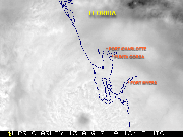
Port Charlotte was severely impacted by Hurricane Charley on August 13, 2004. The hurricane, predicted to hit Tampa as a category 2 hurricane, took a last-minute right hand turn and intensified into a category 4 storm as it made landfall near Charlotte Harbor and caused severe damage in the city of Punta Gorda and in the Port Charlotte area.[7] The storm's 145 mph maximum sustained winds destroyed almost half of the homes in the county and caused heavy ecological damage to sensitive wetlands in the area...[7][8]
Geography and climate
 Charley making landfall
Port Charlotte is located at the north end of the Charlotte Harbor Estuary northwest of the City of Punta Gorda. It is 100 miles south of Tampa and 65 miles north of Naples. According to the United States Census Bureau, the CDP has a total area of 23.9 square miles (61.9 km2). 22.3 square miles (57.8 km2) of it is land and 1.6 square miles (4.1 km2) of it (6.66%) is water.
Port Charlotte has a warm humid subtropical climate (Köppen climate classification: Cfa) bordering on a tropical wet and dry climate (Köppen climate classification: Aw).[9] The summers are long, hot and humid with frequent afternoon thunderstorms. The winters are mild to warm with a pronounced drop in precipitation. Year round, the diurnal temperature change averages around 20 degrees Fahrenheit (11 degrees Celsius).
Climate data for Port Charlotte, Florida Month Jan Feb Mar Apr May Jun Jul Aug Sep Oct Nov Dec Year Record high °F (°C) 89
(32)92
(33)93
(34)94
(34)98
(37)102
(39)99
(37)99
(37)95
(35)94
(34)93
(34)89
(32)102
(39)Average high °F (°C) 75
(24)76
(24)80
(27)84
(29)89
(32)91
(33)92
(33)92
(33)91
(33)86
(30)81
(27)76
(24)84.4 Average low °F (°C) 52
(11)53
(12)57
(14)61
(16)66
(19)72
(22)73
(23)74
(23)73
(23)67
(19)60
(16)54
(12)63.5 Record low °F (°C) 23
(−5)27
(−3)29
(−2)38
(3)49
(9)57
(14)63
(17)65
(18)61
(16)45
(7)28
(−2)25
(−4)23
(−5)Precipitation inches (mm) 2.21
(56.1)2.31
(58.7)2.71
(68.8)1.70
(43.2)3.15
(80)8.45
(214.6)7.78
(197.6)7.82
(198.6)6.75
(171.5)3.12
(79.2)1.87
(47.5)1.77
(45)49.64
(1,260.9)Source: The Weather Channel[10] Government
Since Port Charlotte is unincorporated, it is governed by the government of Charlotte County. The county is governed by a 5-person county commission. They take turns rotating into the commission chair position every year. County commissioners frequently sit on other regional boards involving other municipalities and counties.
Demographics
Historical populations Census Pop. %± 1960 3,197 — 1970 10,789 237.5% 1980 25,770 138.9% 1990 41,535 61.2% 2000 46,451 11.8% 2010 54,392 17.1% source:[11] As of the census[1] of 2000, there were 46,451 people, 20,453 households, and 13,601 families residing in the CDP. The population density was 2,085.9/sq mi (805.3/km²). There were 23,315 housing units at an average density of 1,047.0/sq mi (404.2/km²). The racial makeup of the CDP was 89.23% White, 6.53% African American, 0.28% Native American, 1.14% Asian, 0.05% Pacific Islander, 1.18% from other races, and 1.59% from two or more races. Hispanic or Latino of any race were 5.16% of the population.
There were 20,453 households out of which 20.8% had children under the age of 18 living with them, 53.2% were married couples living together, 10.1% had a female householder with no husband present, and 33.5% were non-families. 28.2% of all households were made up of individuals and 18.6% had someone living alone who was 65 years of age or older. The average household size was 2.25 and the average family size was 2.71.
In the CDP the population was spread out with 18.7% under the age of 18, 5.4% from 18 to 24, 21.0% from 25 to 44, 24.2% from 45 to 64, and 30.7% who were 65 years of age or older. The median age was 49 years. For every 100 females there were 87.7 males. For every 100 females age 18 and over, there were 84.2 males.
The median income for a household in the CDP was $33,193, and the median income for a family was $38,406. Males had a median income of $29,019 versus $21,892 for females. The per capita income for the CDP was $18,563. About 7.3% of families and 10.1% of the population were below the poverty line, including 15.8% of those under age 18 and 6.4% of those age 65 or over. The Herald Tribune stated in an article October 11, 2007, Charlotte County had the region’s highest unemployment rate at 5.8 percent in August, outstripping both the national and state averages.
Sports
Port Charlotte is home to the Charlotte Stone Crabs, which is a member of the Florida State League and Class High-A affiliate of the Tampa Bay Rays, which also hold its spring training at Charlotte Sports Park. The Rays also hold extended spring training in Port Charlotte, and have a Gulf Coast League team beginning play in June 2009.
Education
Public schools in Port Charlotte are operated by Charlotte County Public Schools.[12] For the 2007/2008 school year, all schools in Port Charlotte have received "A"s from the state department of education.[13] Port Charlotte High School is the only public high school located in Port Charlotte, but not the only high school in Charlotte County.[14] Private Education: Genesis Christian School [15] is a not for profit Christian, elementary and middle school located in the heart of Port Charlotte. The school is a ministry of Port Charlotte Church of the Nazarene.
Notable residents
- Vinnie Fiorello, attended Port Charlotte High School. [16] [17]
- John Hall, former Kicker of the National Football League's Washington Redskins; attended Port Charlotte High School[18]
- Vincent Hancock, Olympic gold medalist at the 2008 Summer Olympics, was born in Port Charlotte.
- Anthony Hargrove, NFL Defensive End currently playing for the Seattle Seahawks previously played for the 2009 Super Bowl Champions, the New Orleans Saints; attended Port Charlotte High School.[19]
- Matt LaPorta - MLB Left Fielder currently playing for the Cleveland Indians, on US Olympic baseball team for 2008 Summer Olympics; attended Port Charlotte High School and Charlotte High School
- Wayne Rooney - Professional soccer player for Manchester United of the Premier League owns a home in Port Charlotte with his wife Colleen McLoughlin.
See also
References
- ^ a b "American FactFinder". United States Census Bureau. http://factfinder.census.gov. Retrieved 2008-01-31.
- ^ "US Board on Geographic Names". United States Geological Survey. 2007-10-25. http://geonames.usgs.gov. Retrieved 2008-01-31.
- ^ a b Milanich, J. "Florida's indians from ancient times to the present". University of Florida. http://www.flmnh.ufl.edu/vertpaleo/aucilla11_1/milanich.htm. Retrieved 2010-09-22.
- ^ a b "The Calusa: "The Shell Indians"". University of South Florida. http://fcit.usf.edu/florida/lessons/calusa/calusa1.htm. Retrieved 2010-09-22.
- ^ "Charlotte County Maps". University of South Florida. http://fcit.usf.edu/florida/maps/pages/10700/f10791/f10791.htm. Retrieved 2010-09-22.
- ^ "DeSoto County Maps". University of South Florida. http://fcit.usf.edu/florida/maps/galleries/County/Desoto/index.php. Retrieved 2010-09-22.
- ^ a b "Final USGS Report on Hurricane Charley". USGS. http://www.pwrc.usgs.gov/prodabs/meyers/hurricane%20charley-ddnwrc%20final2rpt.pdf. Retrieved 2010-09-22.
- ^ "'Hurricane Charley may be gone, but it's no mere memory here'". The Orlando Sentinel. http://www.orlandosentinel.com/news/local/orl-charley-punta-gorda-081309,0,1725968.story. Retrieved 2010-09-22.
- ^ "World Map of the Köppen-Geiger climate classification updated". University of Veterinary Medicine Vienna. 2008-11-06. http://koeppen-geiger.vu-wien.ac.at/. Retrieved 2010-09-22.
- ^ "Monthly Averages for Port Charlotte, FL". The Weather Channel Interactive, Inc. 2010. http://www.weather.com/outlook/health/fitness/wxclimatology/monthly/graph/USFL0415. Retrieved 2010-09-05.
- ^ "CENSUS OF POPULATION AND HOUSING (1790-2000)". U.S. Census Bureau. http://www.census.gov/prod/www/abs/decennial/index.html. Retrieved 2010-07-17.
- ^ "2008/2009 Elementary School Boundaries". Charlotte County Public Schools. Archived from the original on 2008-06-10. http://web.archive.org/web/20080610103137/http://www.ccps.k12.fl.us/SchoolBoundaries/ProposedBoundaries.cfm. Retrieved 2008-10-05.
- ^ "School Accountability Report (for Deep Creek Elementary, Kingsway Elementary, Liberty Elementary, Meadow Park Elementary, Murdock Middle, Neil Armstrong Elementary, Port Charlotte High, and Port Charlotte Middle in the 2007/2008 school year)". Florida Department of Education. http://schoolgrades.fldoe.org/default.asp. Retrieved 2008-10-05.
- ^ "Secondary Education - High School". Charlotte County Public Schools. Archived from the original on 2008-05-21. http://web.archive.org/web/20080521044447/http://www.ccps.k12.fl.us/HighSchools.cfm. Retrieved 2008-10-05.
- ^ www.genesiseagles.com
- ^ "Less Than Jake Biography". Mosaic. http://www.lessthanjake.org/. Retrieved 2010-01-24.
- ^ "Less Than Jake". Times Union. http://www.timesunion.com/default/article/Less-Than-Jake-on-first-name-basis-with-fans-84506.php. Retrieved 2010-09-22.
- ^ "John Hall". CBS Sports. http://cbs.sportsline.com/nfl/players/playerpage/1705. Retrieved 2007-08-08.
- ^ "Tony Hargrove past Stats, Statistics, History and Awards". Databasefootball.com. http://www.databasefootball.com/players/playerpage.htm?ilkid=HARGOTON01. Retrieved 2007-08-08.
External links
Municipalities and communities of Charlotte County, Florida City 
CDPs Charlotte Harbor | Charlotte Park | Cleveland | Englewood‡ | Grove City | Harbour Heights | Manasota Key | Port Charlotte | Rotonda West | Solana
Unincorporated
communitiesFootnotes ‡This populated place also has portions in an adjacent county or counties
Categories:- Unincorporated communities in Charlotte County, Florida
- Census-designated places in Charlotte County, Florida


Wikimedia Foundation. 2010.