- Chattenden
-
For the Royal Fleet Auxiliary ship, see RFA Chattenden.
Coordinates: 51°25′23″N 0°30′58″E / 51.423°N 0.516°E
Chattenden 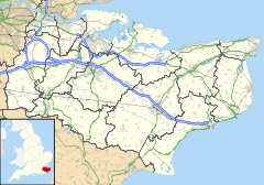
 Chattenden
Chattenden shown within KentOS grid reference TQ758722 Parish Hoo Unitary authority Medway Ceremonial county Kent Region South East Country England Sovereign state United Kingdom Post town ROCHESTER Postcode district ME3 Dialling code 01634 Police Kent Fire Kent Ambulance South East Coast EU Parliament South East England UK Parliament Medway to be replaced 2007 by Rochester and Strood List of places: UK • England • Kent Chattenden is a small village in Hoo Parish, in Medway in Kent, UK. It lies to the north of the A228 and the village of Wainscott, at the top of Four Elms Hill.
Chattenden means 'Forest Settlement' from the elements ceto and ham dun. It is recorded in 1100 as Chetindunam, and Chatindone in 1281.[1]
Turning left on the A228 on the brow of Four Elms Hill, leads onto Kitchener Road, that eventually leads itself to the Great Chattenden Woods, designated as an SSSI, due to the diversity of insects, birds, plants and trees found there. To the south of Chattenden is Towerhill Wood, also known as Coxham Wood, with has Public Footpaths that lead into Lower Upnor, where the Arethusa Venture Centre and the Medway Yacht Club (MYC) are located. Along the A228, (which becomes the Ratcliffe Highway in Chattenden), was once a pub known as 'The Old George'.
Chattenden was once host to extensive barracks and training facilities for the Royal School of Military Engineering, although Chattenden Barracks were vacated in the 1980s and have now been demolished.[2] The MoD Military Land is now designated as a brownfield area for redevelopment for residential and light industrial use (2007).
The Royal Engineers linked Chattenden to the Royal Engineers Museum (REM) at Upnor with the narrow gauge military railway.
The Chattenden and Upnor Railway was built in 1873 and functioned for Chattenden Army Barracks until 1961. Originally built by the Royal School of Military Engineering (RSME) which was then based at Chattenden Army Barracks and the Chattenden and Upnor Railway ran from Pontoon Hard by the River Medway and climbed steeply towards Chattenden. A spur led from Church Crossing to the Upnor Depot of the Royal Engineers and until 1895 there was also a railway track running from Chattenden to Hoo.
The Royal Navy also had its own Chattenden Naval Barracks, being situated near Towerhill Wood, where an MoD Royal Navy Radio Station is now left unused. The village of Chattenden was mentioned in a BBC Radio 4 Programme 'The Cost Of Housing' on the mismatch of housing stock, 20 Mar 2007.
References
- ^ The Place Names Of Kent, Judith Glover, 1976, Batsford. ISBN 0905270 614
- ^ Brian Matthews, The History Of Strood Rural District, 1971, Strood Rural District Council
External links
Action Chattenden http://www.actionchattenden.org.uk/
Frindsbury Extra Parish Council http://www.frindsburyextra-pc.gov.uk/
Chattenden Primary School http://www.chattenden.medway.sch.uk/
Chattenden And Upnor Railway http://en.wikipedia.org/wiki/Chattenden_and_Upnor_Railway
Medway Yacht Club http://www.medwayyachtclub.com/
The ROCK http://www.peninsularock.org
Towns and villages in the Unitary authority of Medway in Kent, England Allhallows · Borstal · Brompton · Chatham · Chattenden · Cliffe · Cliffe Woods · Cooling · Cuxton · Frindsbury · Frindsbury Extra · Gillingham · Halling · Hempstead · High Halstow · Hoo St Werburgh · Isle of Grain · Lordswood · Rochester · Rainham · Rainham Mark · St Mary Hoo · St Mary's Island · Stoke · Strood · Twydall · Upnor · Wainscott · Walderslade · WigmoreList of places in Kent Categories:- Medway
- Villages in Kent

Wikimedia Foundation. 2010.