- List of Dublin postal districts
-
Dublin postal districts are used by Ireland's postal service, known as An Post, to sort mail in Dublin. The system is similar to that used in cities in other European countries until they adopted national postal code systems in the 1960s and '70s. These will be incorporated into the new national postcode system to be introduced in 2011.[1]
Contents
History
 The green Leeson Street nameplate predates inclusion of postal districts; the newer blue Hatch Street nameplate indicates the district is Dublin 2
The postal district system was introduced in 1917 by the British government, as a practical way to organise local postal distribution. This followed the example of other cities, notably London, first subdivided into ten districts in 1857, and Liverpool, the first city in Britain or Ireland to have postcodes, from 1864. The letter "D" was assigned to designate Dublin. The new Irish government retained the postal district system, but district numbers were not used by the public until 1961, when they were added to street signs. Prior to 1961, street signs only displayed the street name in Irish and English.
The number of districts was increased as the city grew, and in the 1970s, large districts were subdivided. Dublin 5 was split, with the coastal part retaining the "5" and the inland part becoming Dublin 17. Dublin 8, Ballyfermot, one of the city's fastest growing suburbs, became Dublin 10, along with Palmerstown and Chapelizod. However, Dublin 10 was subsequently split again, with Palmerstown and Chapelizod forming Dublin 20.[2]
In 1985, Dublin 6 was divided, with some areas, such as Templeogue, Kimmage and Terenure becoming part of a new district in order to facilitate processing of mail by a new delivery office for those areas. Residents of some areas objected to the assignation of the next available number, "Dublin 26," for the new postal district, citing property devaluation: the higher numbered districts typically represented less affluent and less central areas.[3] An Post ultimately relented, and the district became known as Dublin 6W. However, the eastern half of the old D6 postcode area remained "Dublin 6" rather than "Dublin 6E".
Structure
The postal district appears with one or two digits (or in the case of one district, a digit and a letter) appearing at the end of addresses, e.g.:
- Dublin Orthodox Synagogue,
- 32 Rathfarnham Road,
- Terenure,
- Dublin 6W
In most cases, odd numbers are used for addresses on the Northside of the River Liffey, while even numbers are on addresses on the Southside. Exceptions to this are the Phoenix Park (along with a small area between the Park and the River Liffey), and Chapelizod Village which, although on the Northside, are parts of the Dublin 8 and Dublin 20 postal districts respectively.
The numbering system is not used for some areas in County Dublin, such as Dún Laoghaire, Blackrock, Lucan or Swords, though it is used for other county locations, for example Foxrock, Kilshane, Knocklyon and Tallaght.
Dublin's postal districts Northside, covering local government area Southside, covering local government area Dublin 1 (D1) Dublin Dublin 2 (D2) Dublin Dublin 3 (D3) Dublin Dublin 4 (D4) Dublin, Dún Laoghaire-Rathdown Dublin 5 (D5) Dublin Dublin 6 (D6) Dublin, Dublin 7 (D7) Dublin Dublin 6W (D6W) Dublin, South Dublin Dublin 8 (D8) Dublin Dublin 8 (D8) Dublin Dublin 9 (D9) Dublin, Fingal Dublin 10 (D10) Dublin Dublin 11 (D11) Dublin Dublin 12 (D12) Dublin Dublin 13 (D13) Dublin, Fingal Dublin 14 (D14) Dublin, Dún Laoghaire-Rathdown, South Dublin Dublin 15 (D15) Fingal Dublin 16 (D16) Dún Laoghaire-Rathdown, South Dublin Dublin 17 (D17) Dublin, Fingal Dublin 18 (D18) Dún Laoghaire-Rathdown Dublin 20 (D20) Dublin, South Dublin Dublin 22 (D22) South Dublin Dublin 24 (D24) South Dublin "Co. Dublin" Fingal, South Dublin, Dún Laoghaire-Rathdown, and small pockets of Meath It is proposed this system will be abolished with the introduction of a national postcode system, but no details have been released.[4]
An Post has stated that, with just one exception, no street name occurs more than once in any postal district.
 Publicly distributed leaflet to publicise the Dublin Postal Districts issued by the Irish Department of Posts and Telegraphs – dated April 1976
 2007 Postal Districts for Dublin City and Suburbs
- Dublin 1 includes most of the north inner city, including Abbey Street, Amiens Street, Capel Street, Dorset Street, Henry Street and Mary Street, Mountjoy Square, Marlborough Street, North Wall, O'Connell Street, Parnell Square, and Talbot Street. Notable features of this area include the General Post Office, from which distances are measured, the Hugh Lane Gallery and the Dublin Writers Museum.
- Dublin 2 encompasses most of the city centre south of the River Liffey and takes in areas around Merrion Square, Temple Bar, Grafton Street, Dame Street, Leeson Street and Wexford Street. It includes notable important buildings and tourist attractions such as Leinster House, St Stephen's Green, the main National Museum building and The National Gallery of Ireland. The borders of Dublin 2 are the Liffey in the north, the Grand Canal to the south and east and Aungier, Wexford and Camden Streets to the west.
- Dublin 3 encompasses areas such as Ballybough, North Strand, Clonliffe, Clontarf, Dollymount, East Wall (including East Point), Fairview, most of Killester, and Marino.
- Dublin 4 includes Ballsbridge, Donnybrook, Irishtown, Merrion, Pembroke, Ringsend and Sandymount and contains the RDS grounds, Lansdowne Road stadium, and many embassies. "D4" has acquired its own socio-economic identity; see separate article at Dublin 4.
- Dublin 5 includes most of Artane,[5] central Coolock, Harmonstown, Kilbarrack, and Raheny.
- Dublin 6W includes Harold's Cross, Templeogue, and Terenure.
- Dublin 7 includes Arbour Hill, Broadstone, Cabra, Grangegorman, Phibsboro, Smithfield, Stoneybatter; a key feature is the Four Courts complex.
- Dublin 8 includes Dolphin's Barn, Inchicore, Islandbridge, Kilmainham, Merchants Quay, Portobello, South Circular Road, the Phoenix Park and The Coombe, and notable buildings include Christchurch Cathedral and St. Patrick's Cathedral. It is unusual in that it is one of only two postal districts to span the Liffey.
- Dublin 9 includes parts of Ballymun east of Ballymun Road (Shangan and Coultry), Beaumont, Donnycarney, Drumcondra, Elm Mount, Griffith Avenue, parts of Glasnevin (St Mobhi, Botanic Gardens and Met Éireann), Santry, and Whitehall.
- Dublin 10 includes Ballyfermot and Cherry Orchard.
- Dublin 11 includes most of Ballymun west of Ballymun Road (Sillogue, Balcurris, Balbutcher, Poppintree, Sandyhill and Wadelai), Dubber Cross, Finglas (including Ballygall and Cappagh), most of Glasnevin (Cremore, Addison, Violet Hill, Finglas Road, Old Finglas Road and Glasnevin Cemetery), Kilshane Cross, The Ward and Coolquay.
- Dublin 12 includes Bluebell, Crumlin, Perrystown, Drimnagh, and Walkinstown.
- Dublin 13 Baldoyle, Bayside, Donaghmede, Sutton, Howth and Ayrfield.
- Dublin 14 includes Churchtown, Clonskeagh, Dundrum, Goatstown, Rathfarnham and Windy Arbour.
- Dublin 15 includes Blanchardstown, Castleknock, Coolmine, Clonsilla, Corduff, Mulhuddart, Tyrrelstown and the Dublin part of Clonee, as well as Ongar.
- Dublin 16 includes Ballinteer, Ballyboden, Kilmashogue, Knocklyon and Rockbrook.
- Dublin 17 includes Balgriffin, most of Coolock, and Belcamp, Darndale and Priorswood.
- Dublin 18 includes Cabinteely, Carrickmines, Foxrock, Kilternan, Sandyford, Ticknock, Ballyedmonduff, Stepaside, and Leopardstown.
- Dublin 20 includes Chapelizod, and Palmerstown. This is one of only two postal districts to span the Liffey.
- Dublin 22 includes Clondalkin, Rowlagh, Quarryvale and Liffey Valley, and Neilstown.
- Dublin 24 includes Firhouse, Jobstown, and Tallaght (see that article for component estates / localities, such as Kilnamanagh).
Future developments
Successive Ministers for Communications since 2005 have announced plans to introduce a full postcode system across the state. The plans remain controversial and no firm timetable exists for their introduction. It is envisaged that the pre-existing Dublin district numbers would be a component of the full postcode for relevant addresses. For example, an address in Dublin 4 might have the postcode D04 123.[6]
In 2006, The Sunday Times reported that the current system of postal districts would be retained and any postcode system will be placed after the current district number but the precise details of the system were not released .[7]
However, it was announced on 20 September 2009, that a national postcode system for Ireland would be implemented in 2011.[8]
Marketing
Public awareness of Dublin postal districts allows occasional use in marketing. Dublin n is usually abbreviated to Dn, as in:
-

D One restaurant
-

DTwo nightclub
-

D4 Hotels
-

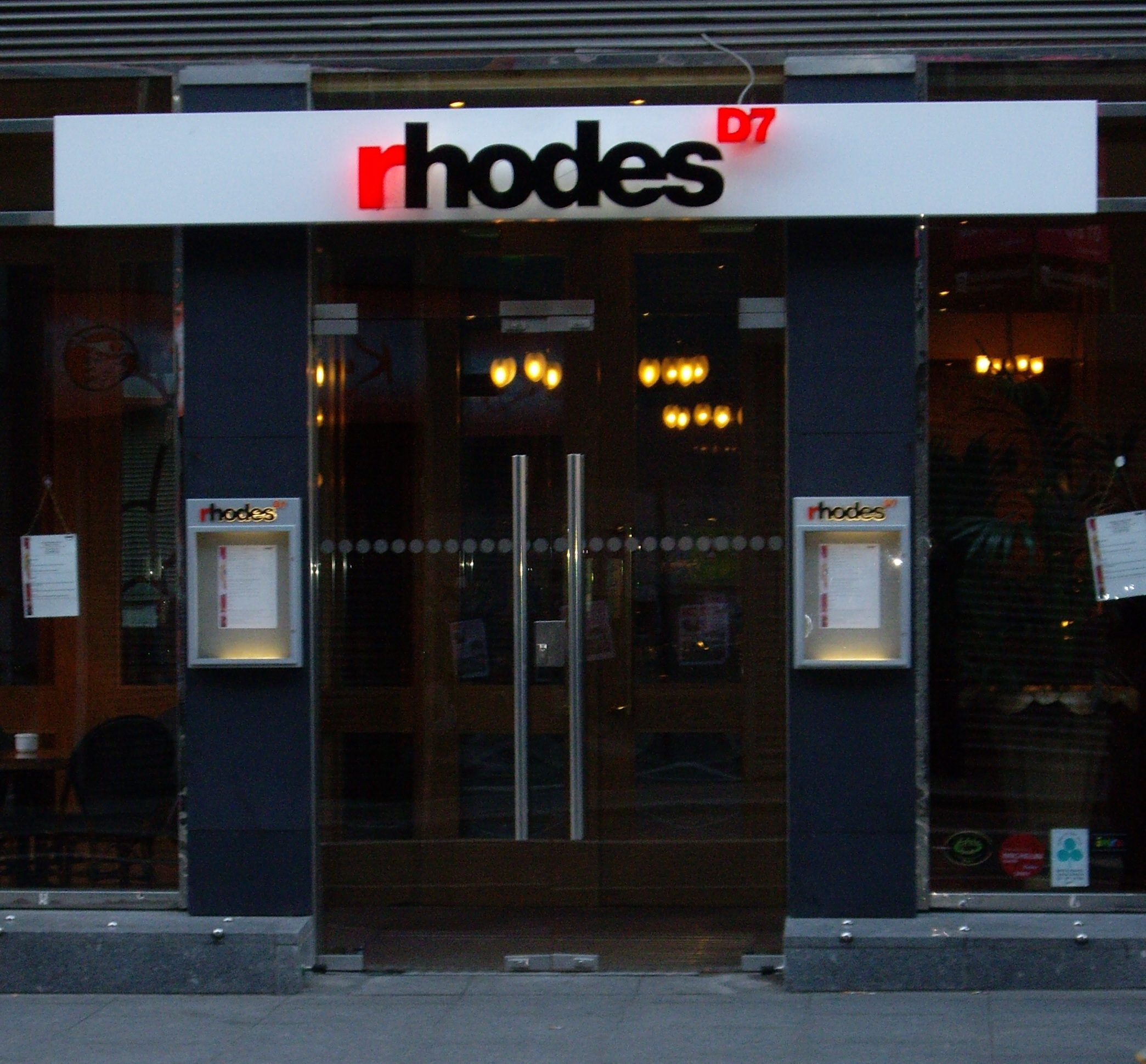
Rhodes D7 restaurant
See also
References
- ^ New postal code system by 2011, Irish Times, September 21, 2009
- ^ It's in the postcode, Irish Independent, September 26, 2009
- ^ Postcode war 'in next year', Irish Independent, September 21, 2008
- ^ "Minister keen to introduce postcodes". The Irish Times. 19 October 2007. http://www.irishtimes.com/newspaper/finance/2007/1019/1192737567054.html. Retrieved 6 August 2008.
- ^ Note: Most of the civil parish of Artaine – the townlands of Artaine South, Artaine West and Puckstown – lies within Dublin 9.
- ^ Ryan finalises plans for new postcode system, Sunday Tribune, 3 January 2010
- ^ Coyle, Coloin (10 September 2006). "Upmarket Dublin survives postcode shake-up". The Sunday Times. UK. http://www.timesonline.co.uk/tol/news/world/ireland/article634379.ece. Retrieved 28 September 2008.
- ^ Michael, Jason (21 September 2009). "New postal code system by 2011". The Irish Times. http://www.irishtimes.com/newspaper/breaking/2009/0921/breaking20.htm. Retrieved 28 September 2008.
External links
Categories:- Geography of County Dublin
- Geography of Dublin (city)
- Republic of Ireland postal system
- Dublin-related lists


Wikimedia Foundation. 2010.