- Debert, Nova Scotia
-
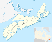
 Debert in Nova Scotia
Debert (2006 pop: 1,471) is an unincorporated farming community in the Canadian province of Nova Scotia. It is located approximately 20 km west of the town of Truro. The Village of Debert is home to two churches, Baptist and United, plus a Fellowship Center, as well as a gas station and two garages. There are two stores in the village and a fire station. Located on the old Army Base, is a Hospitality Center.
Situated near coal and iron ore deposits, Debert was established on the Halifax-Montreal mainline of the Intercolonial Railway of Canada in the 1870s.
Contents
Military history
- For more information, consult the main CFS Debert article.
During the Second World War Debert was the location of the Debert Military Camp and RCAF Station Debert. Camp Debert was a large army facility capable of accommodating division-size units where personnel received training prior to deployment to Europe. RCAF Station Debert was used as a British Commonwealth Air Training Plan facility which saw pilots and aircrew from Commonwealth nations trained for military service.
Demobilization of the military during the post-war brought about many other changes at Camp Debert with many of the barrack buildings and workshops being demolished. Many materials were salvaged from the demolition and reused to help construct numerous new homes in the nearby village of Debert and throughout this part of Colchester County.
For a brief period shortly after the war, the Nova Scotia Agricultural College operated out of the old Camp Debert hospital. The temporary relocation of NSAC resulted from a major fire that had occurred at the principal campus in Bible Hill, which destroyed many barns and academic facilities.
Camp Debert's role as a training facility was eliminated in the early 1950s with the opening of the much larger Camp Gagetown in New Brunswick. The airfield was downgraded at this time to an adjunct facility for RCAF Station Shearwater.
A new lease on life was given to the military facility in the early 1960s when Camp Debert was chosen as the location for a Regional Emergency Government Headquarters, also known as a "Diefenbunker". This facility became the focus of the newly formed CFS Debert by the late 1960s.
The primary unit attached to CFS Debert was the 720 Communications Squadron, which maintained the REGHQ and provided communications support to Canadian Forces units throughout Atlantic Canada and around the world. Substantial antenna facilities were constructed close to the nearby villages of Masstown and Great Village to support the military operations at CFS Debert, providing worldwide radio communications.
In 1971 the aerodrome and training facilities were declared surplus and were purchased by the provincial government to create the "Debert Air Industrial Park" as well as a municipal airfield.
CFS Debert was closed in the mid-1990s and decommissioned in 1998 with remaining site facilities being transferred to a local development authority named "Colchester Park". The ongoing residual military communications role of Debert was transferred to the transmitter/receiver facility near Great Village.
The Debert Airfield is now also the location of Royal Canadian Air Cadet Summer Glider Scholarship program for the Atlantic region. More than 50 cadets earn their Transport Canada Glider Pilot License during a 6 week course each summer. The Debert airfield also offers the Advanced Aviation Course through Royal Canadian Air Cadet's as of summer 2011.
Paleo-Indian discovery
In 1994, a significant paleo-indian site was discovered on the grounds of the old military camp by a private contractor who was preparing a plot of land to be used as a tree farm. Researchers from Saint Mary's University were requested to conduct a thorough archeological excavation on the site. Preliminary reports suggested that the site held evidence of human activity that pre-dated any other sites found within the northern part of Nova Scotia.
Climate
Climate data for Debert Month Jan Feb Mar Apr May Jun Jul Aug Sep Oct Nov Dec Year Record high °C (°F) 15.5
(59.9)15.5
(59.9)19
(66)23
(73)31.5
(88.7)33
(91)33
(91)34
(93)31.5
(88.7)25
(77)21.5
(70.7)15.5
(59.9)34
(93.2)Average high °C (°F) −1.5
(29.3)−0.9
(30.4)3.2
(37.8)9.3
(48.7)16.4
(61.5)21.4
(70.5)24.8
(76.6)24.3
(75.7)19.5
(67.1)12.9
(55.2)6.9
(44.4)1
(34)11.4 Average low °C (°F) −11.7
(10.9)−11.2
(11.8)−6.8
(19.8)−0.6
(30.9)4
(39)8.7
(47.7)12.4
(54.3)12.1
(53.8)7.9
(46.2)3
(37)−1
(30)−8.2
(17.2)0.7 Record low °C (°F) −35
(−31)−34
(−29)−29
(−20)−13
(9)−6.5
(20.3)−2
(28)2.5
(36.5)1
(34)−5
(23)−9
(16)−18
(0)−32.5
(−26.5)−35
(−31)Precipitation mm (inches) 93.1
(3.665)81.6
(3.213)94.1
(3.705)86.2
(3.394)103.6
(4.079)96
(3.78)90.7
(3.571)89.6
(3.528)109.1
(4.295)107.9
(4.248)111.9
(4.406)105.8
(4.165)1,169.5
(46.043)Source: Environment Canada[1] Coordinates: 45°26′12.9″N 63°27′23.3″W / 45.436917°N 63.456472°W
References
- ^ Environment Canada Canadian Climate Normals 1971–2000, accessed 16 July 2009
Categories:- Communities in Colchester County, Nova Scotia
- General Service Areas in Nova Scotia
- Archaeological sites in Canada

Wikimedia Foundation. 2010.